Αποστολή από: thailandgr στις Απριλίου 21, 2010, 13:41:00 μμ
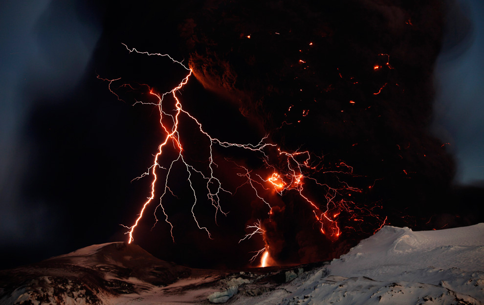
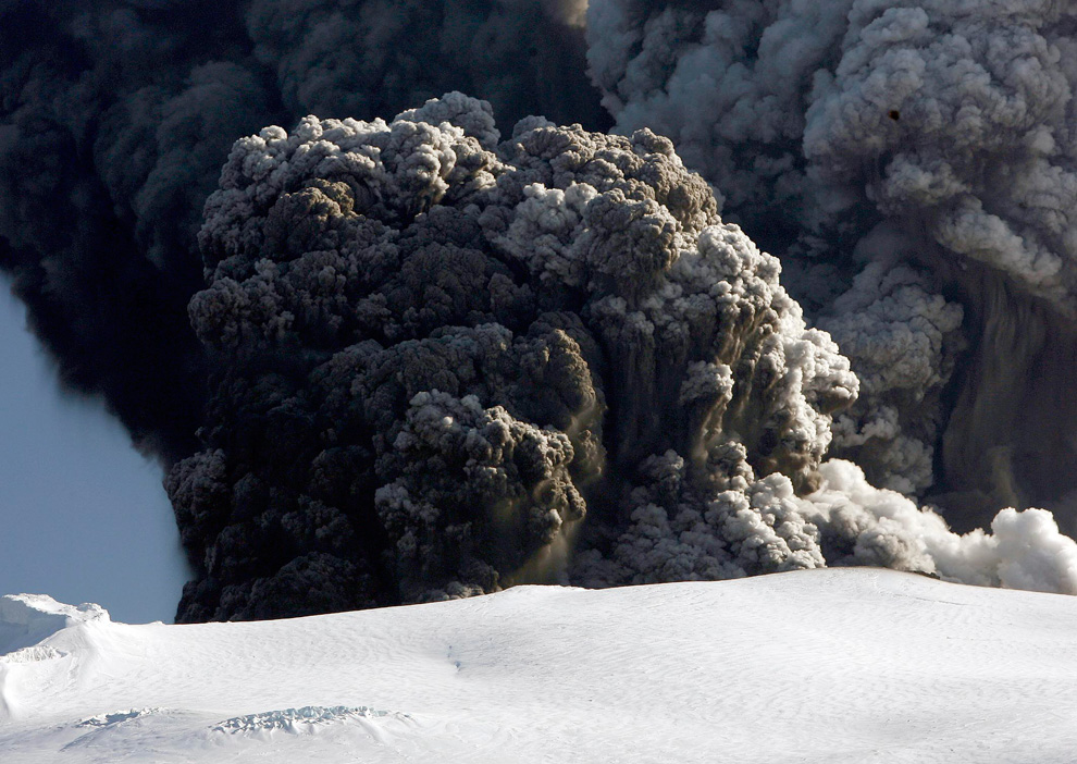
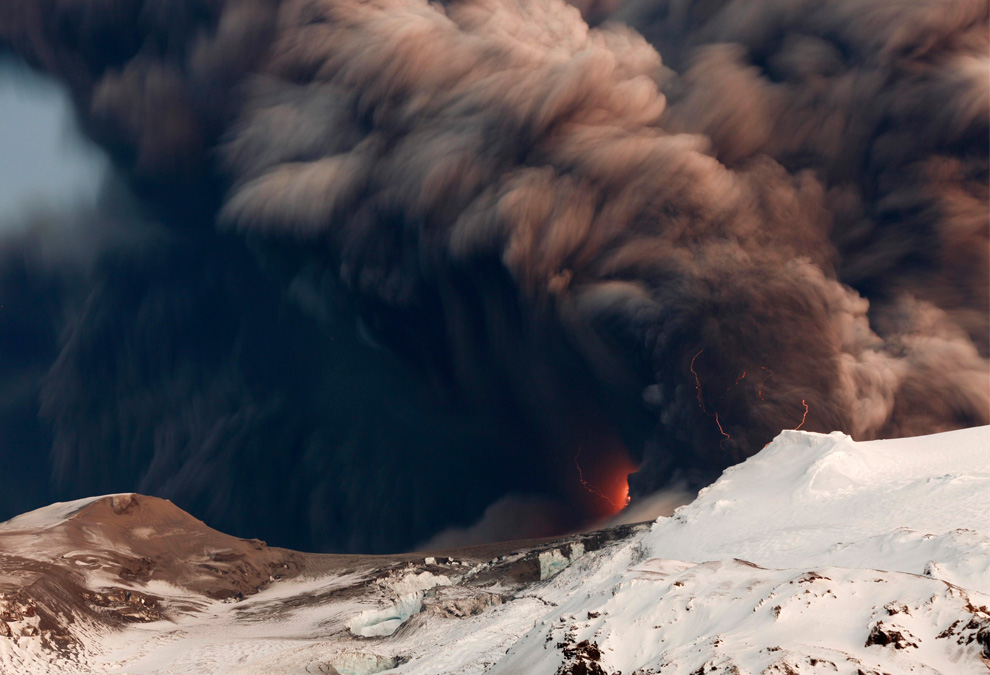
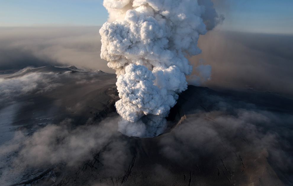
Lightning streaks across the sky as lava flows from a volcano in Eyjafjallajokul April 17, 2010. (REUTERS/Lucas Jackson)
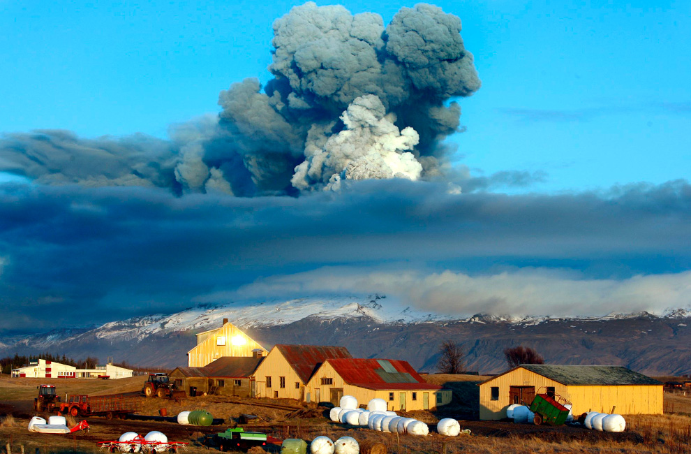
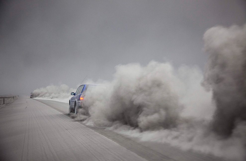
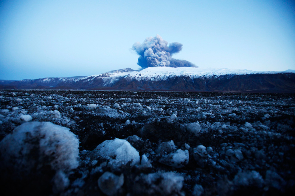
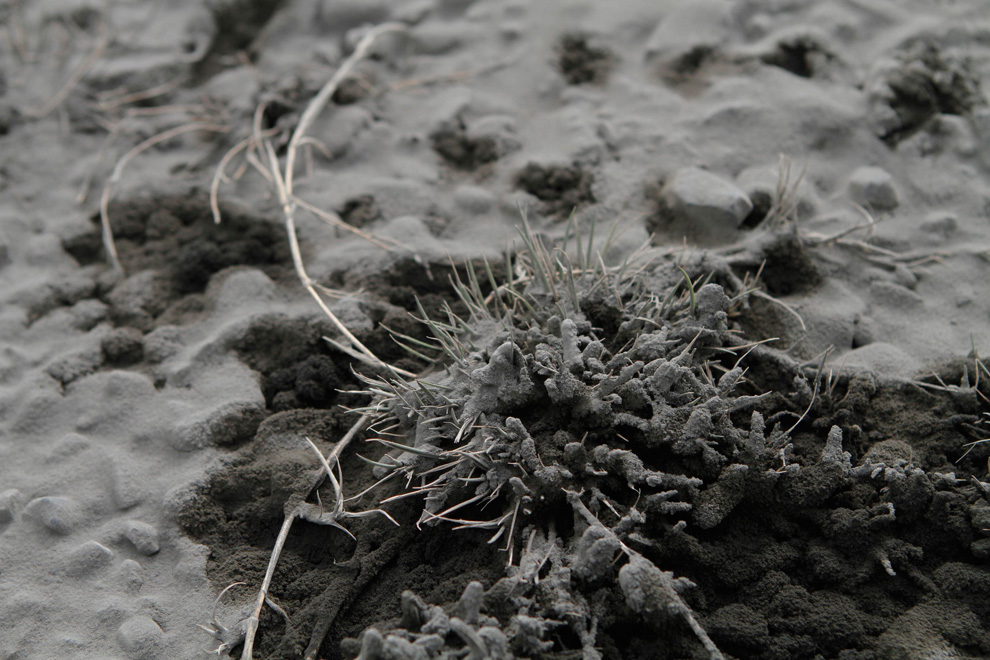
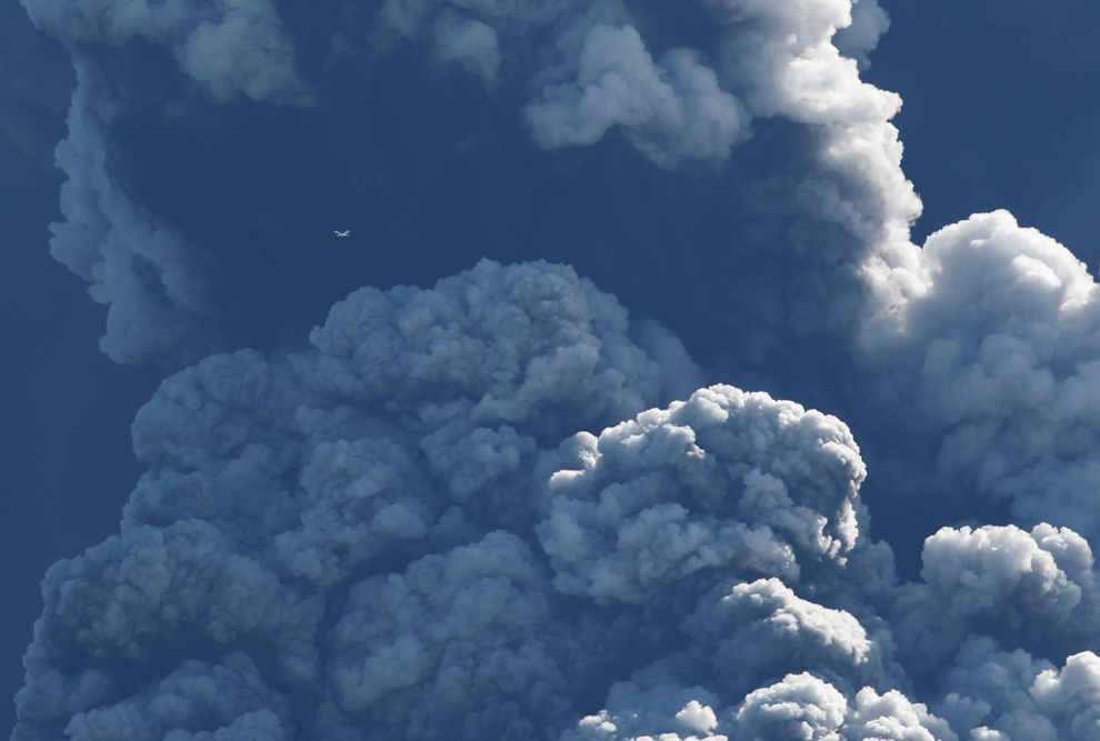
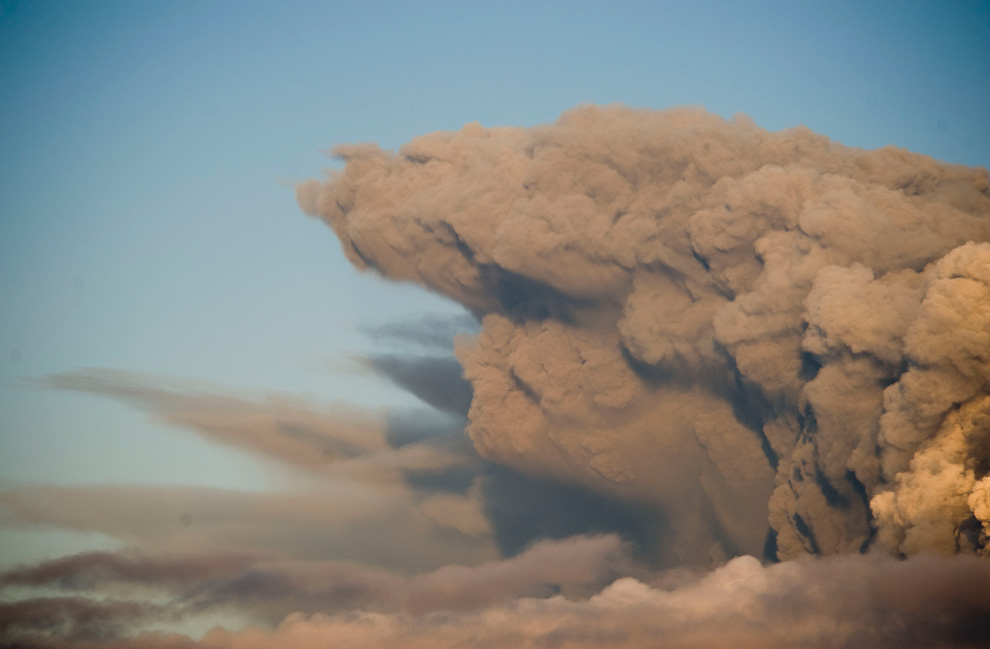
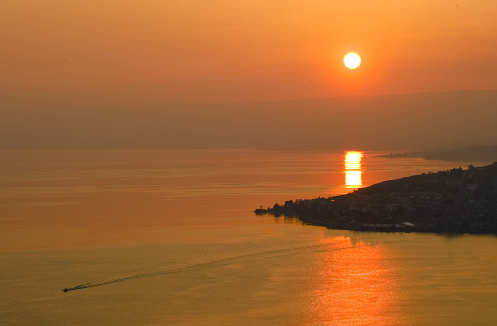
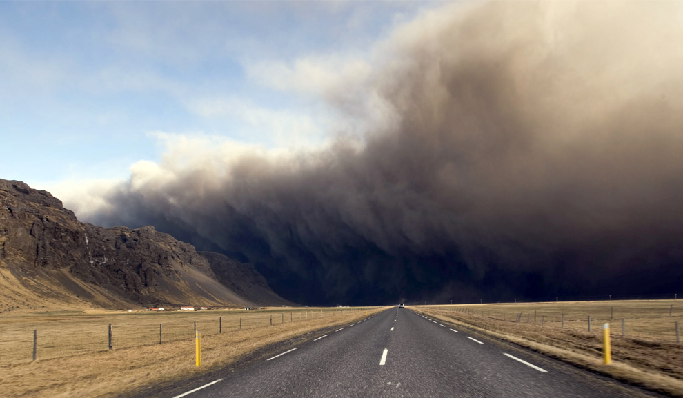
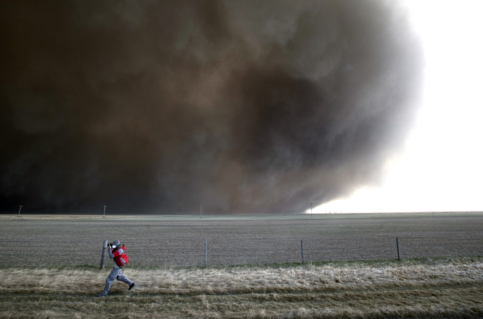
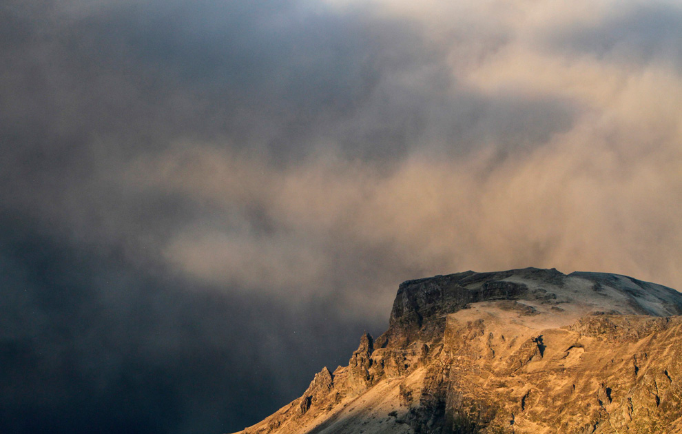
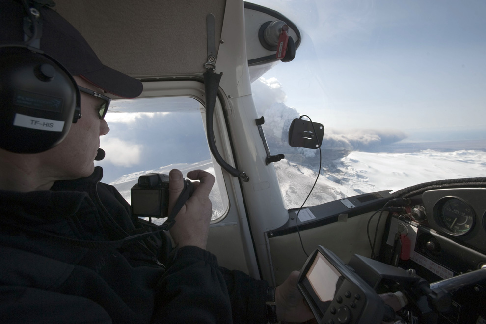
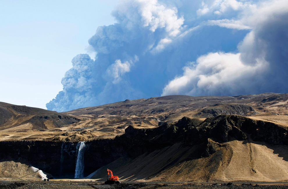
The volcano in southern Iceland's Eyjafjallajokull glacier sends ash into the air just prior to sunset ON Friday, April 16, 2010. Thick drifts of volcanic ash blanketed parts of rural Iceland on Friday as a vast, invisible plume of grit drifted over Europe, emptying the skies of planes and sending hundreds of thousands in search of hotel rooms, train tickets or rental cars. (AP Photo/Brynjar Gauti) #
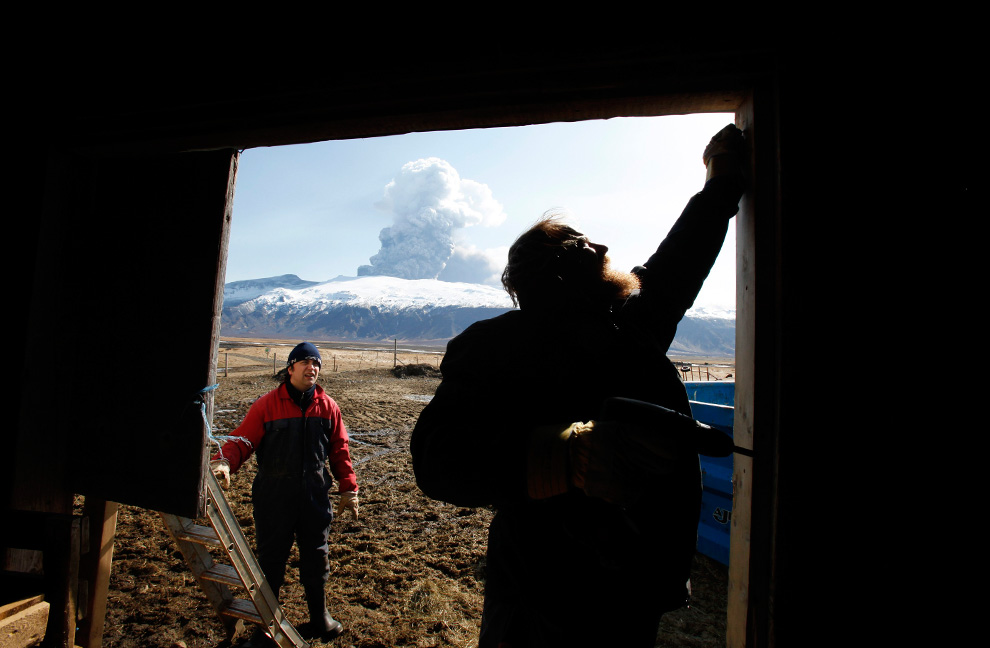
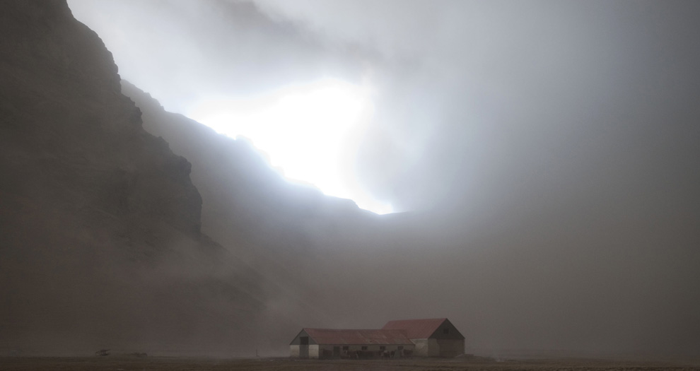
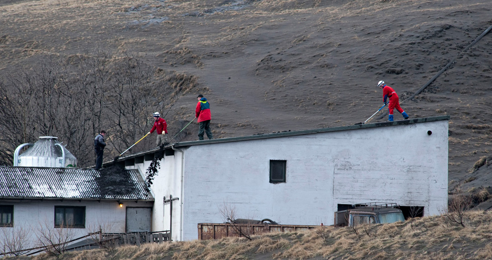
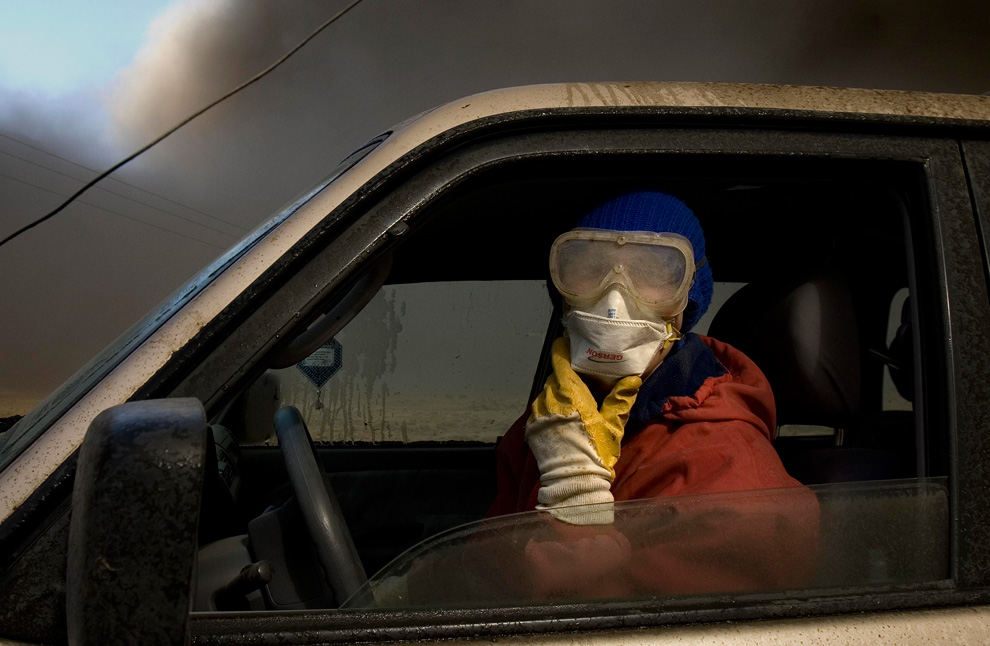
Sheep farmer Thorkell Eiriksson (R) and his brother-in-law Petur Runottsson work to seal a sheep barn, in case winds shift and ash from a volcano erupting across the valley lands on their farm, in Eyjafjallajokull April 17, 2010. The current season is when the spring lambs are born and such young animals are especially susceptible to volcanic ash in their lungs so they must be stored inside. (REUTERS/Lucas Jackson) #
Αποστολή από: thailandgr στις Απριλίου 21, 2010, 13:41:17 μμ
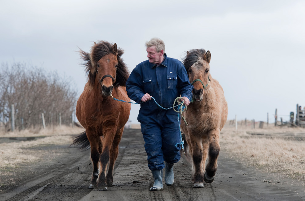
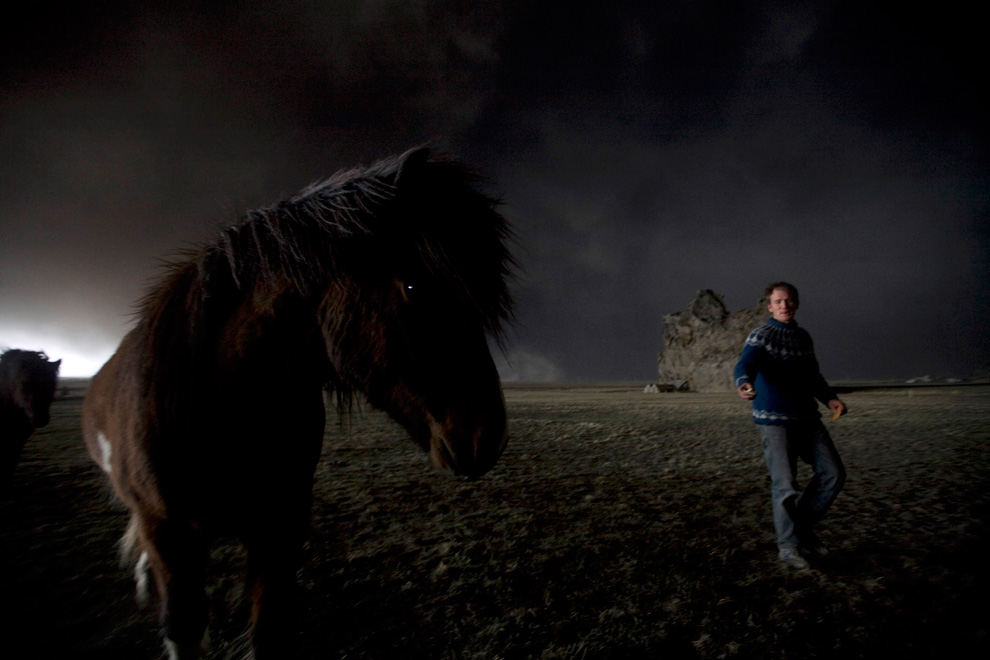
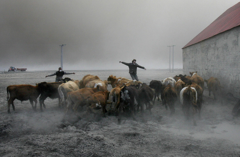
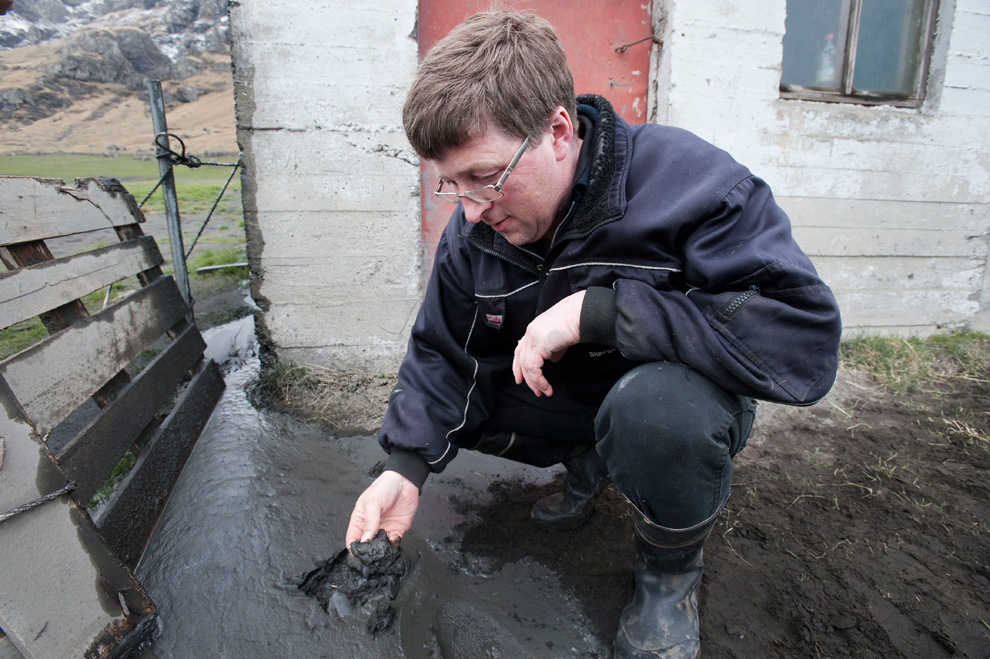
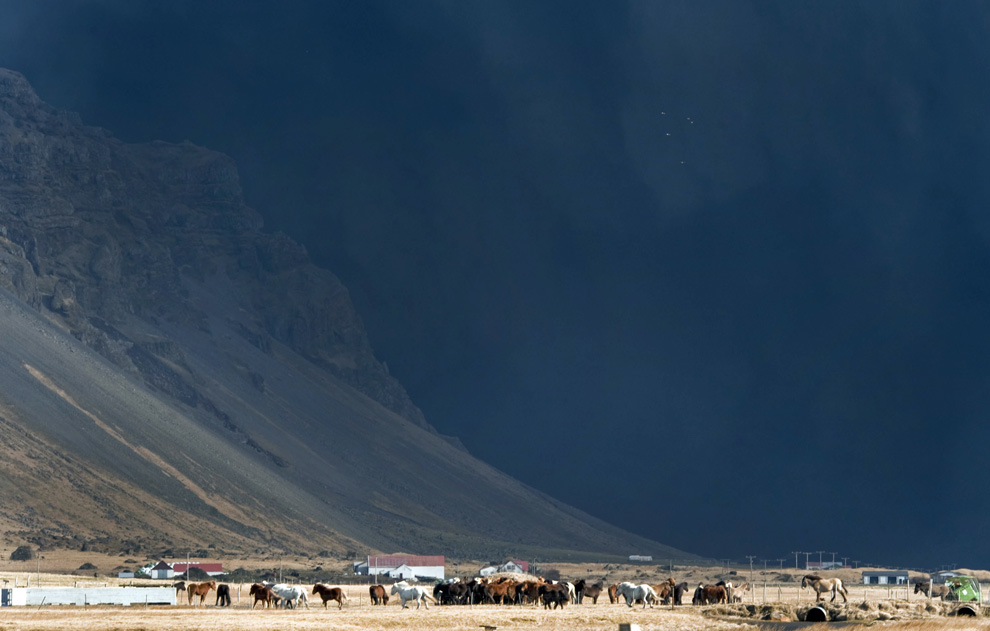
Ingi Sveinbjoernsso leads his horses on a road covered volcanic ash back to his barn in Yzta-baeli, Iceland on April 18, 2010. They come galloping out of the volcanic storm, hooves muffled in the ash, manes flying. 24 hours earlier he had lost the shaggy Icelandic horses in an ash cloud that turned day into night, blanketing the landscape in sticky gray mud. (HALLDOR KOLBEINS/AFP/Getty Images) #

The ash plume of southwestern Iceland's Eyjafjallajokull volcano streams southwards over the Northern Atlantic Ocean in a satellite photograph made April 17, 2010. The erupting volcano in Iceland sent new tremors on April 19, but the ash plume which has caused air traffic chaos across Europe has dropped to a height of about 2 km (1.2 mi), the Meteorological Office said. (REUTERS/NERC Satellite Receiving Station, Dundee University, Scotland) #
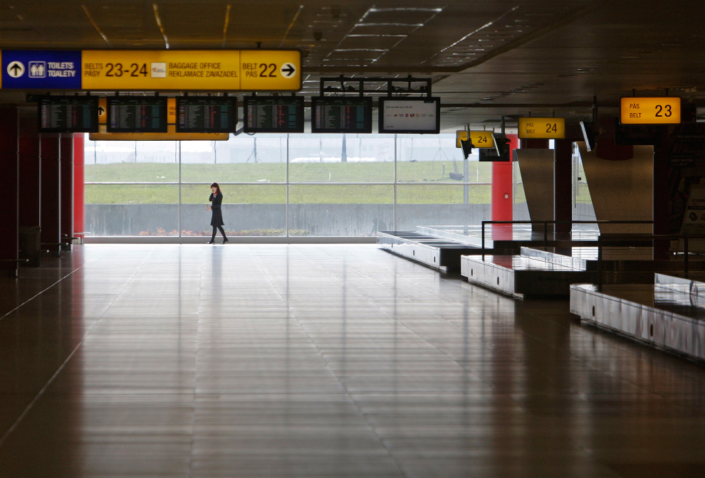
A woman makes a phone call in the empty arrival hall of Prague's Ruzyne Airport after all flights were grounded due to volcanic ash in the skies coming from Iceland April 18, 2010. Air travel across much of Europe was paralyzed for a fourth day on Sunday by a huge cloud of volcanic ash, but Dutch and German test flights carried out without apparent damage seemed to offer hope of respite. (REUTERS/David W Cerny) #
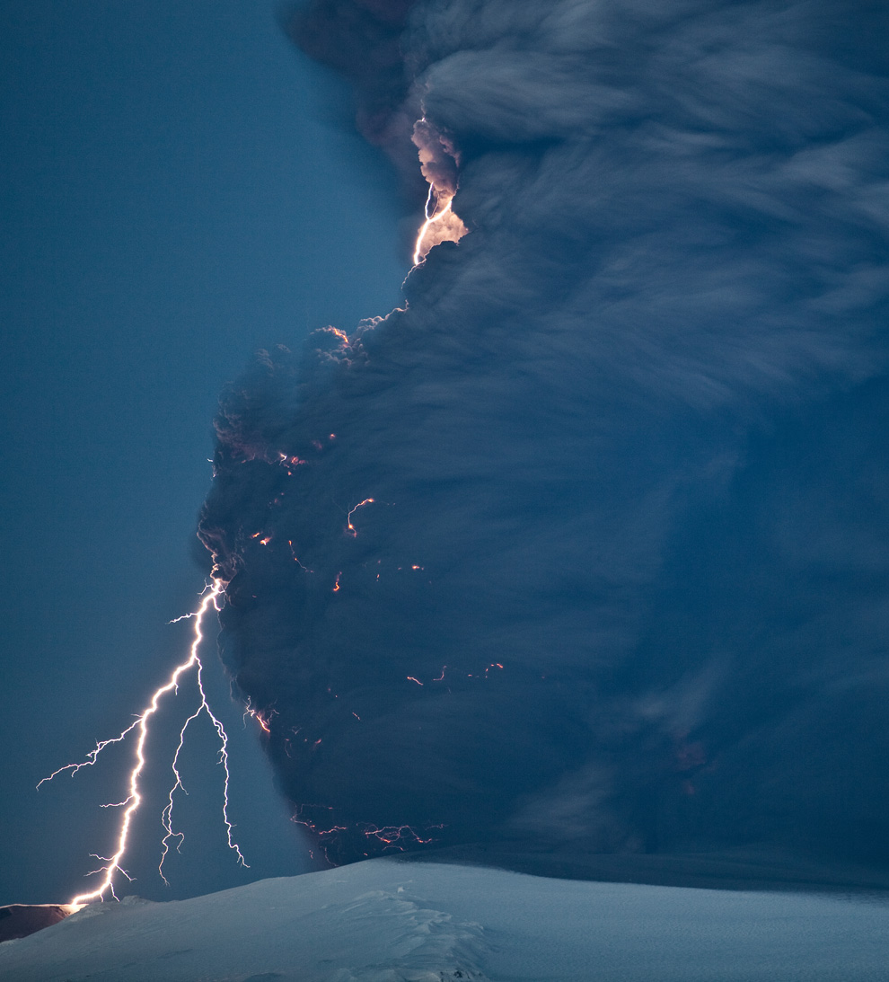
The first of 3 photos by Olivier Vandeginste, taken 10 km east of Hvolsvollur at a distance 25 km from the Eyjafjallajokull craters on April 18th, 2010. Lightning and motion-blurred ash appear in this 15-second exposure. (© Olivier Vandeginste) #
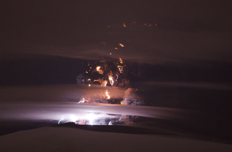
The second of 3 photos by Olivier Vandeginste, taken 25 km from the Eyjafjallajokull craters on April 18th, 2010. The ash plume is lit from within by multiple flashes of lightning in this 168 second exposure. (© Olivier Vandeginste) #
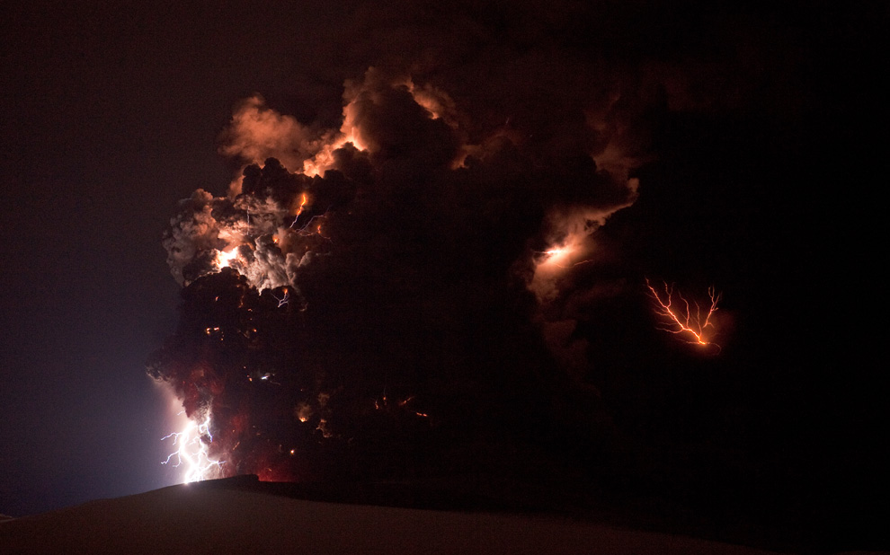
The third of 3 photos by Olivier Vandeginste, taken 10 km east of Hvolsvollur Iceland on April 18th, 2010. Lightning flashes and glowing lava illuminate parts of Eyjafjallajokull's massive ash plume in this 30-second exposure. (© Olivier Vandeginste) #
Αποστολή από: Ivan στις Ιουλίου 03, 2010, 12:08:20 μμ
(http://img139.imageshack.us/img139/2615/dsci0512.jpg)
(http://img215.imageshack.us/img215/5999/dsci0211.jpg)
(http://img59.imageshack.us/img59/6592/dsci0194a.jpg)
(http://img697.imageshack.us/img697/6681/dsci0337.jpg)
(http://img139.imageshack.us/img139/4319/dsci0361l.jpg)
(http://img412.imageshack.us/img412/9057/dsci0390w.jpg)
(http://img291.imageshack.us/img291/5874/dsci0222i.jpg)
(http://img715.imageshack.us/img715/4079/dsci0358.jpg)
(http://img412.imageshack.us/img412/9602/dsci0373.jpg)
(http://img819.imageshack.us/img819/1492/dsci0165o.jpg)
Αποστολή από: Taxidiwtis στις Ιουλίου 03, 2010, 13:46:17 μμ
Αποστολή από: Ivan στις Ιουλίου 04, 2010, 00:18:10 πμ
Αποστολή από: thailandgr στις Ιουλίου 24, 2010, 13:43:26 μμ
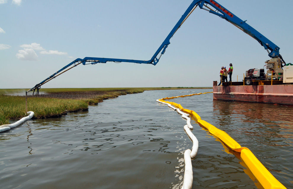
In the past several months, powerful storms have wreaked havoc in many places, torrential rains in central Europe and parts of China, tornadoes in Australia, Montana and the American Midwest, and strong thunderstorms across the northeast. Now, as Tropical Storm Bonnie makes landfall in Florida and heads into the Gulf of Mexico, oil cleanup is being suspended, and the final "kill" operation is delayed for at least one more week. These storms have been destructive and deadly, but beautiful and awe-inspiring at the same time. Collected here are a handful of photographs of stormy skies, lightning strikes and storm damage from the past several months. (37 photos total)

Chris Dickey of Commerce city police department holds golf-ball-sized hailstones on Wednesday, May 26, 2010 in Commerce City, Colorado. Thunderstorms swept along the Front Range and eastern Colorado plains on Wednesday with several reports of tornadoes and strong winds that demolished a barn. (AP Photo/The Denver Post, Hyoung Chang) #

Debris flies through the air as a freak tornado tears through the coastal town of Lennox Head, Australia on June 3, 2010. The storm leveled 12 homes and damaged another 30, with twisting winds carving out a 300 meter-wide path of destruction, injuring six people and leaving thousands without power. (ROSS TUCKERMAN/AFP/Getty Images) #

Debris lies scattered along Main Street in Millbury, Ohio, Sunday, June 6, 2010. Authorities say tornadoes and thunderstorms that swept through the Midwest overnight killed a number of people in Ohio, destroyed 50 homes and damaged a high school gymnasium where graduation was to be held Sunday. (AP Photo/Paul Sancya) #

Lightning strikes in Poyang county in Jiujiang, Jiangxi province on July 20, 2010. Much of China has been suffering flooding and landslides after weeks of torrential downpours. At least 146 people have died since the start of this month, as a result of the rains, and another 40 are missing. (REUTERS/Aly Song) #

Main Street Casino staff members watch a second thunderstorm approach after they just survived a tornado in Billings, Montana on Sunday, June 20, 2010. Buildings were heavily damaged after a tornado touched down near the corner of Main Street and Lake Elmo Drive. (AP Photo/Billings Gazette, Larry Mayer) #
Αποστολή από: thailandgr στις Ιουλίου 24, 2010, 13:43:48 μμ

Multiple lightning strikes above New York City during a storm on on May 2nd, 2010. Photo taken from West New York, New Jersey, looking across the Hudson River. (© Alain Aguilar) #

Paul Verheyen looks over the damage to his house caused by a severe storm and possible tornado in Leamington, Ontario on Sunday, June 6, 2010. Verheyen and his family were luckily not home during the storm. The tree that crashed through the house landed on his son's bed. (AP Photo/Dave Chidley, The Canadian Press) #

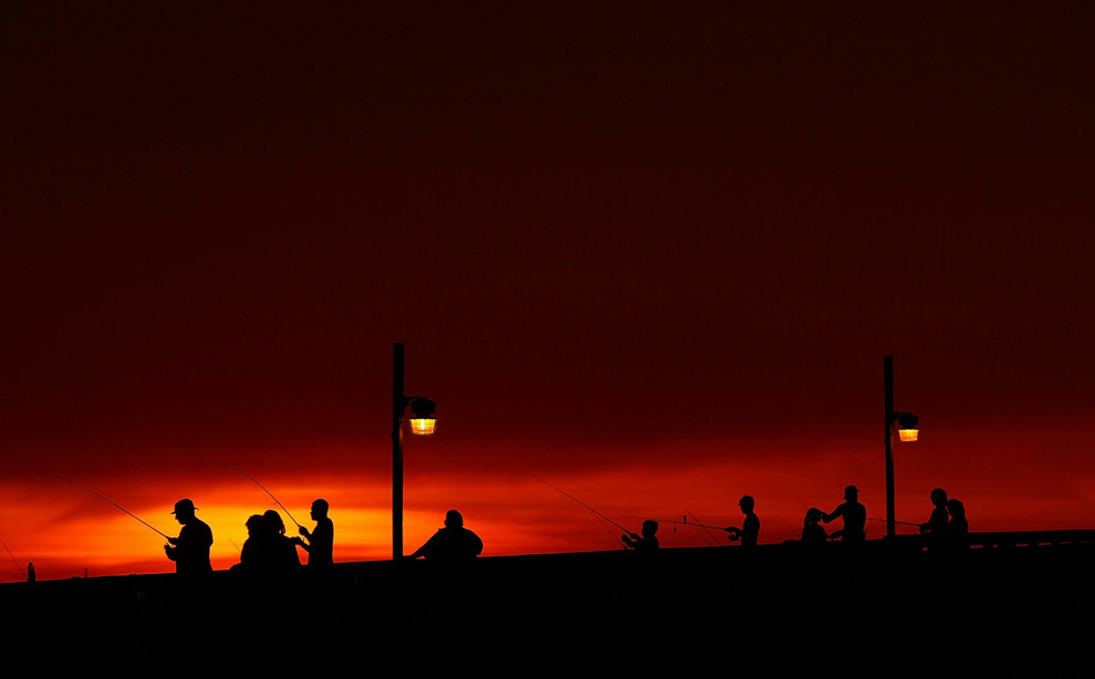
Beneath a lightning storm to the north, Robert Morgan fishes along the banks of a marsh near Lake Boudreaux May 28, 2010 near Cocodrie, Louisiana. (Win McNamee/Getty Images) #
-
Τίτλος: Απ: Ηφαιστεια - τυφωνες και φυσικες καταστροφες
Αποστολή από: thailandgr στις Αυγούστου 06, 2010, 09:00:59 πμ
-
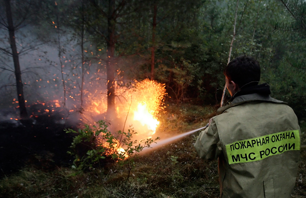
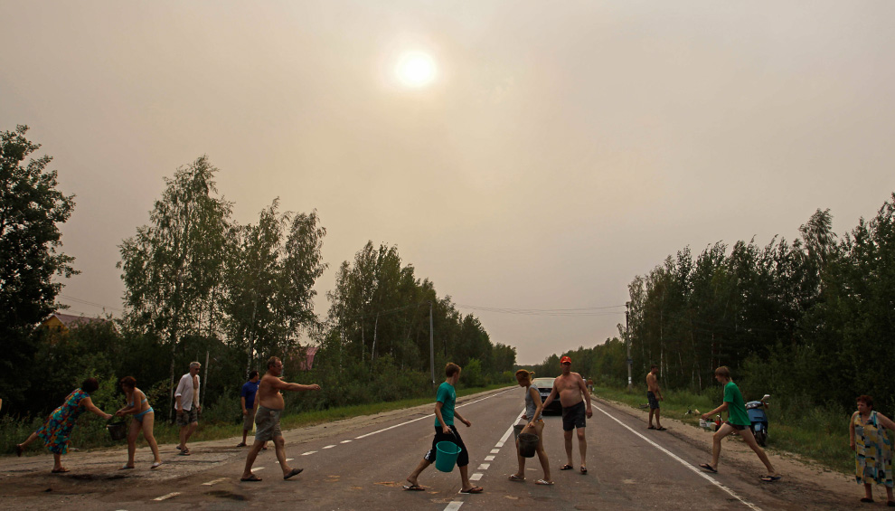
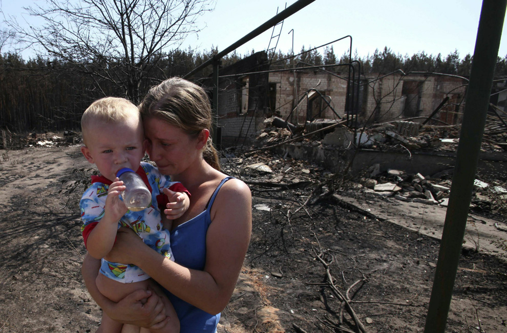
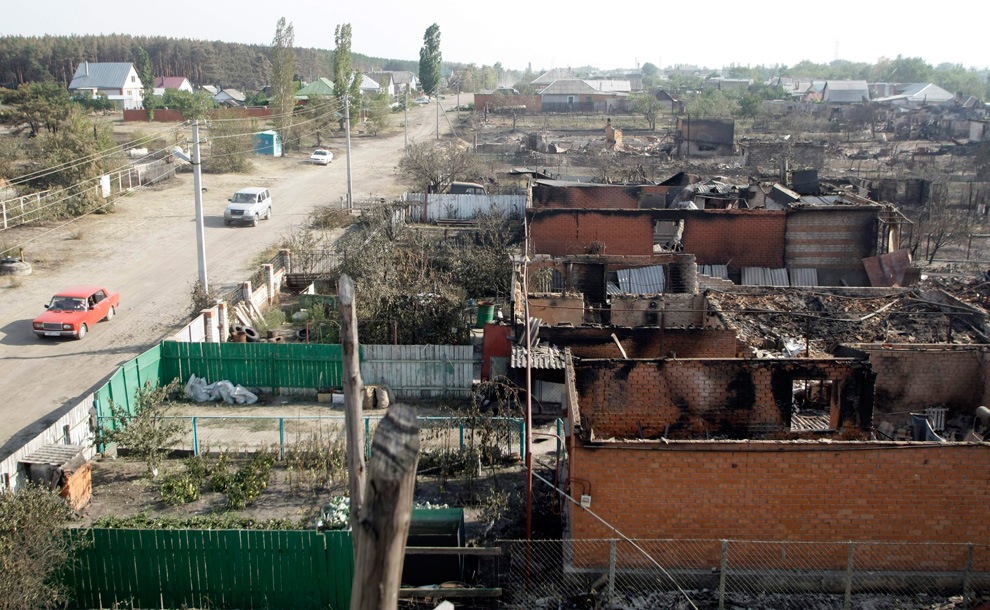
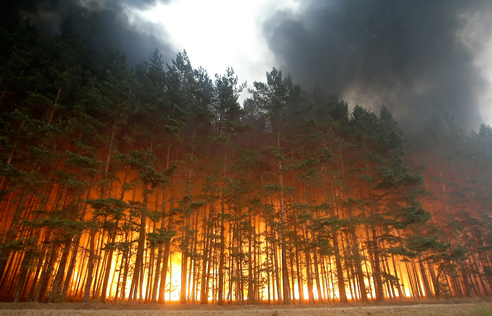
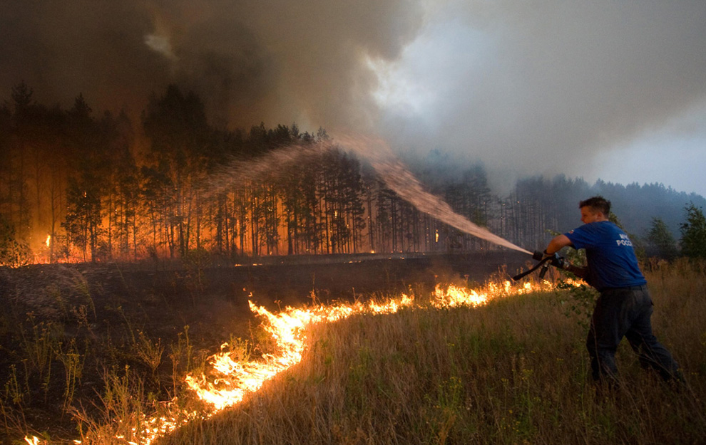
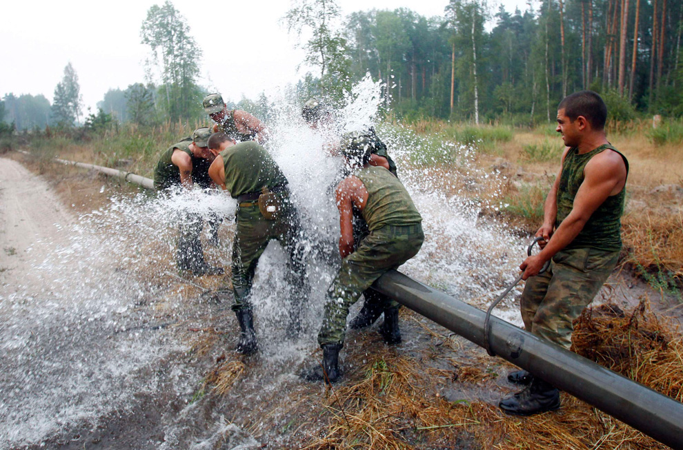
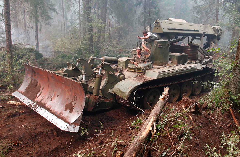
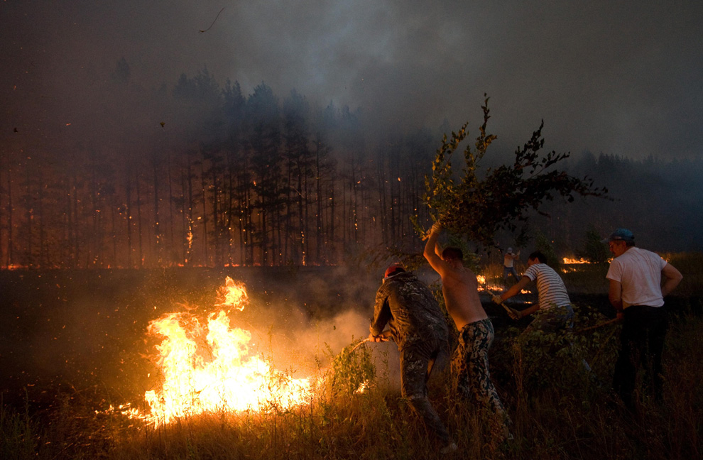
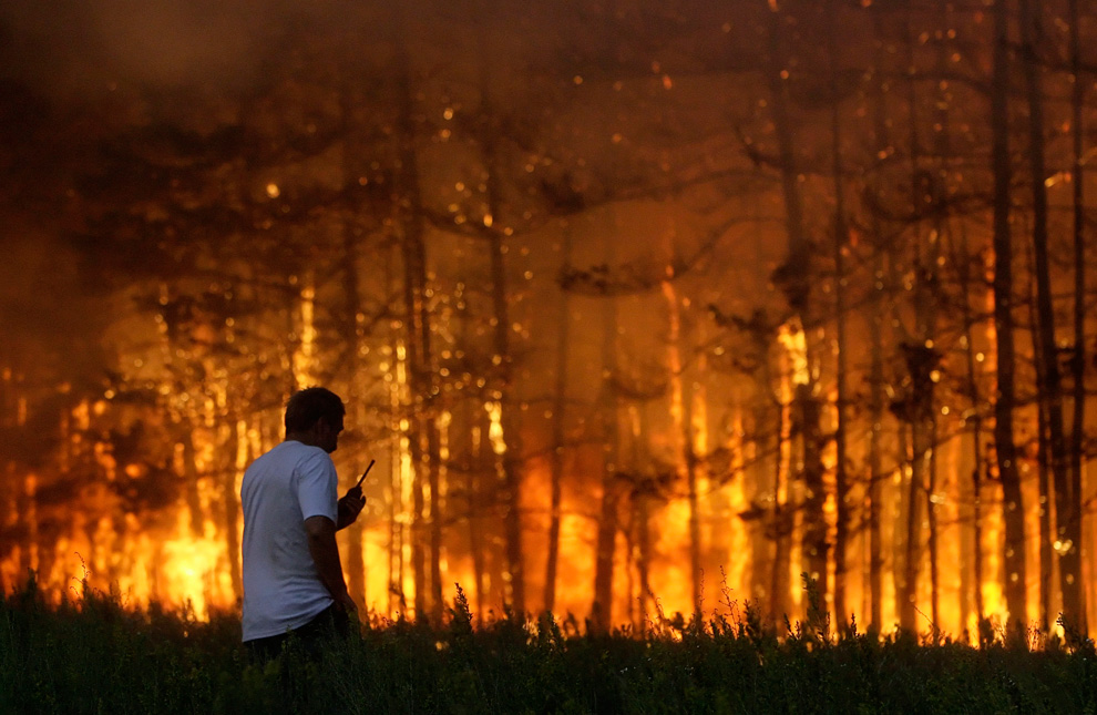
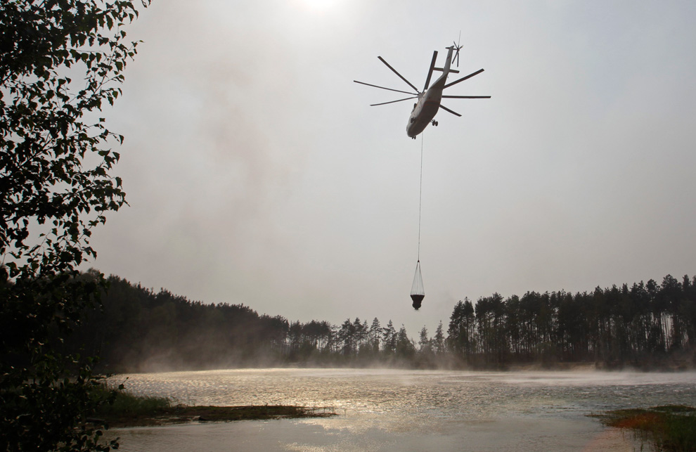
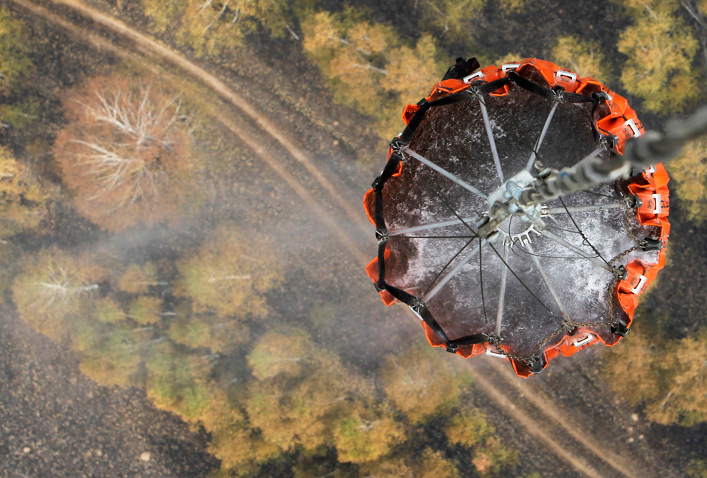
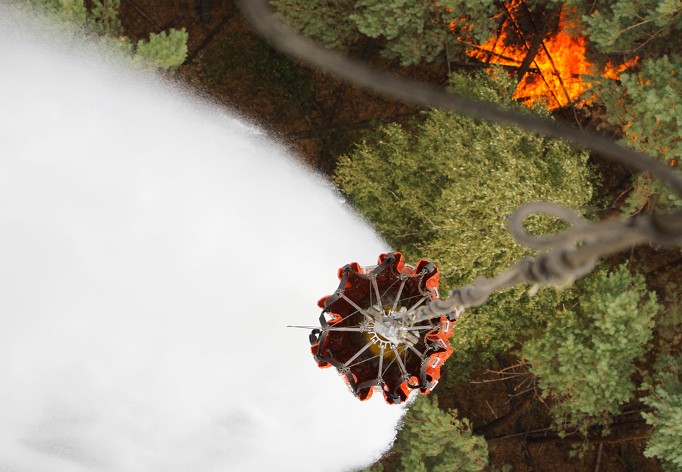
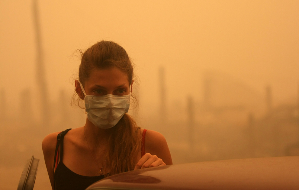
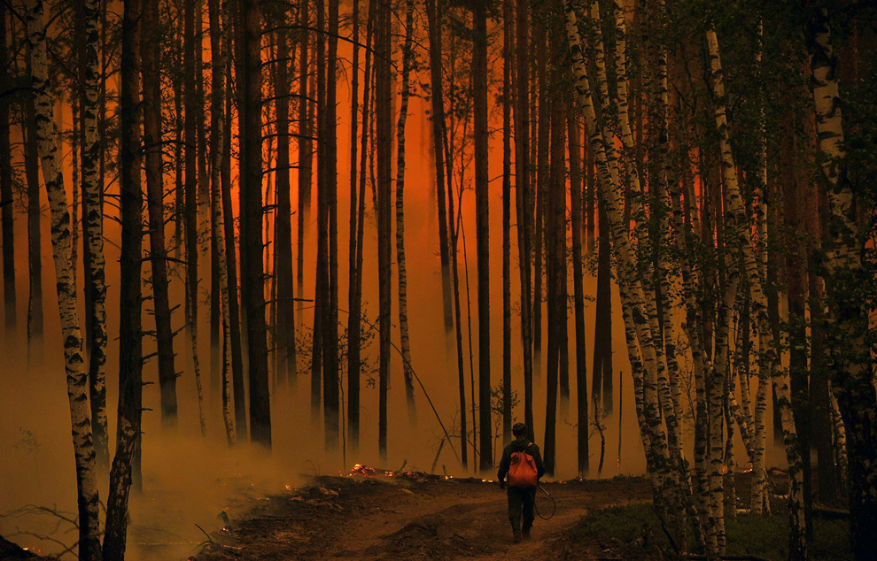
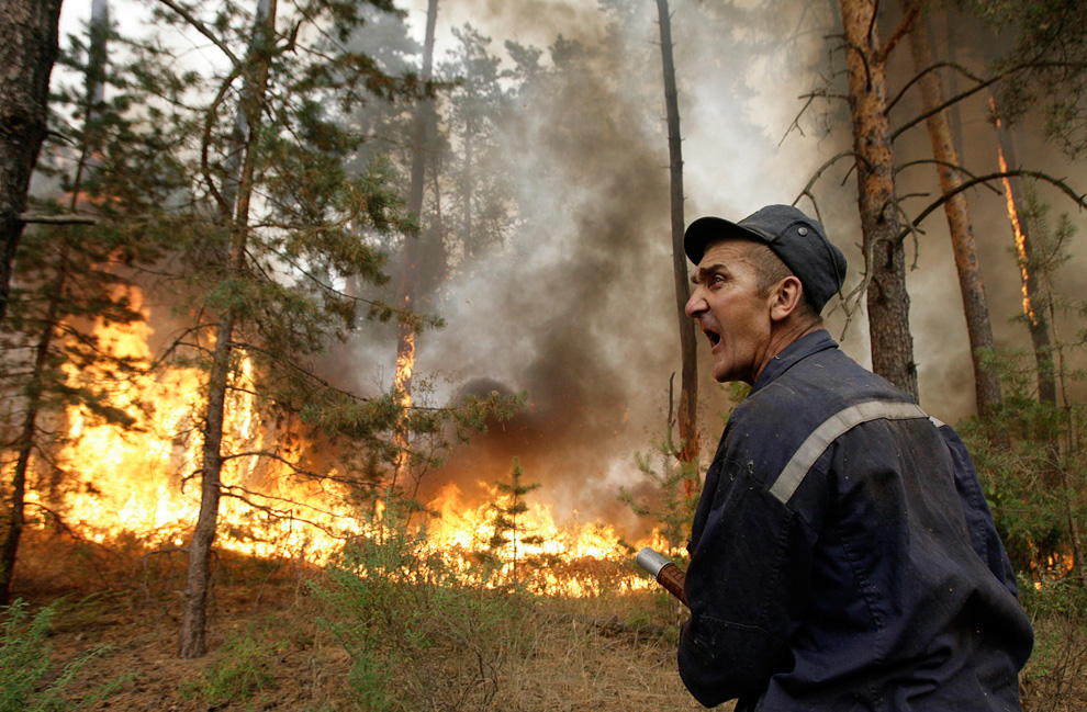
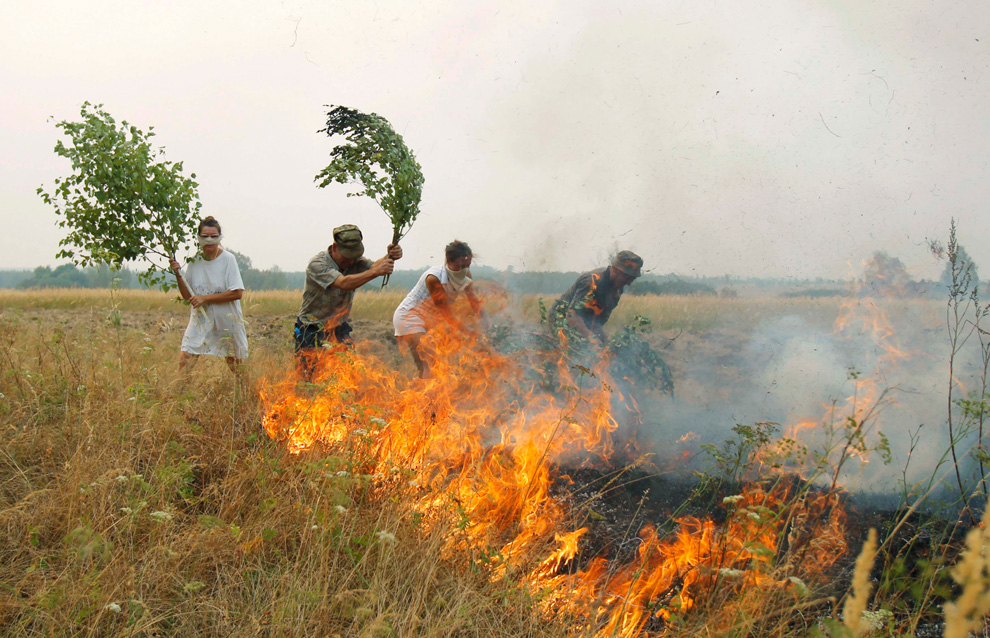
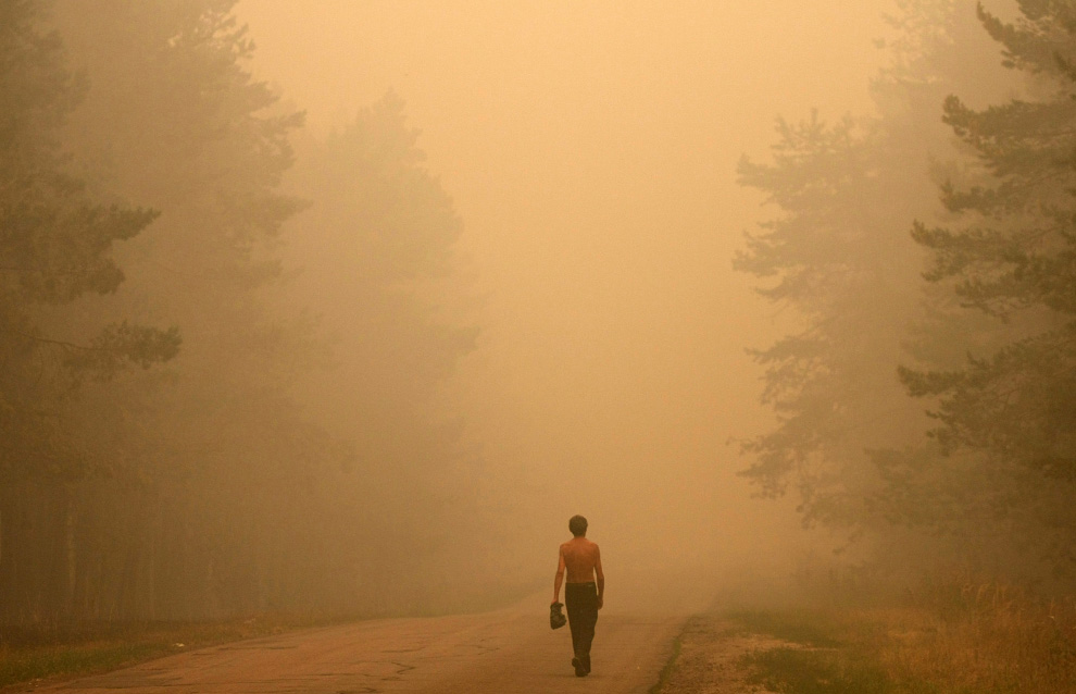
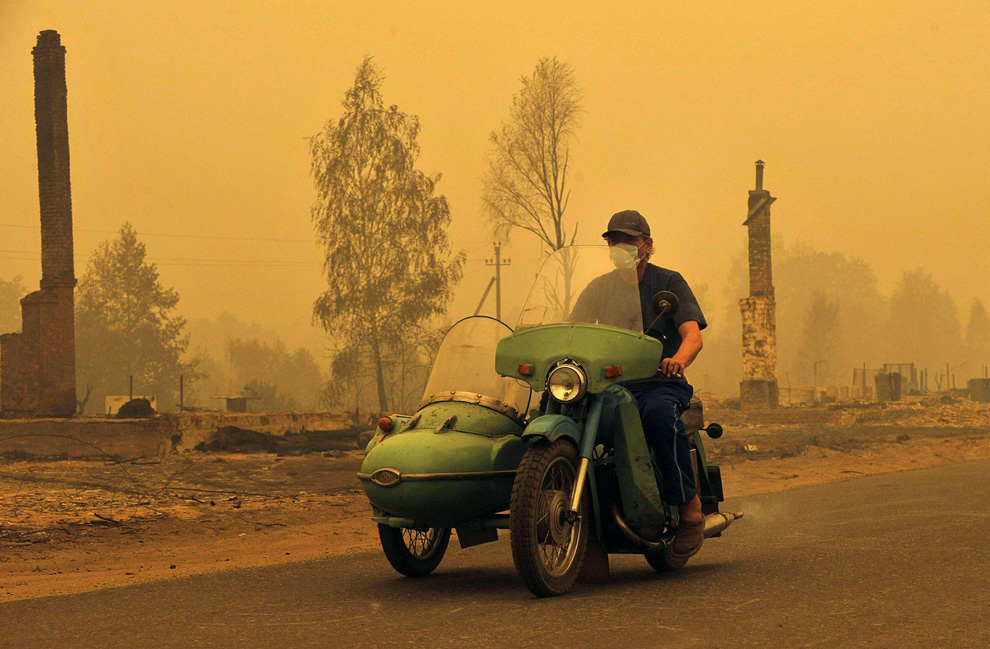
H Ρωσια στις φλόγες
-
Τίτλος: Απ: Ηφαιστεια - τυφωνες και φυσικες καταστροφες
Αποστολή από: thailandgr στις Αυγούστου 06, 2010, 09:01:31 πμ
-

Αποστολή από: thailandgr στις Αυγούστου 06, 2010, 09:00:59 πμ

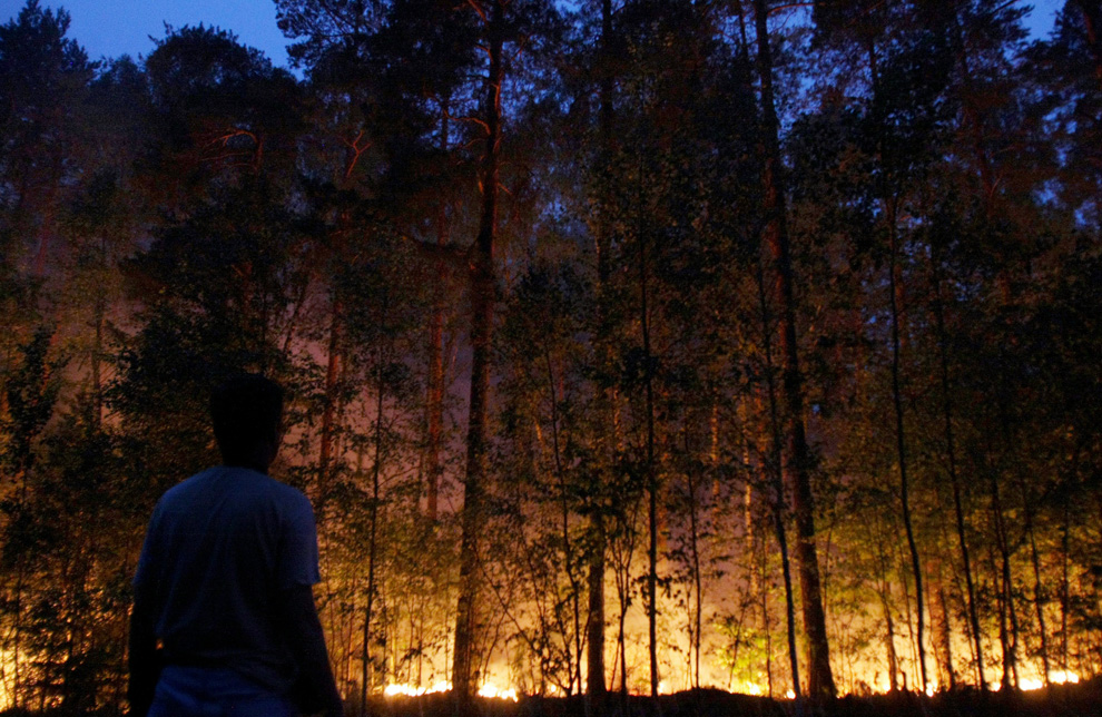
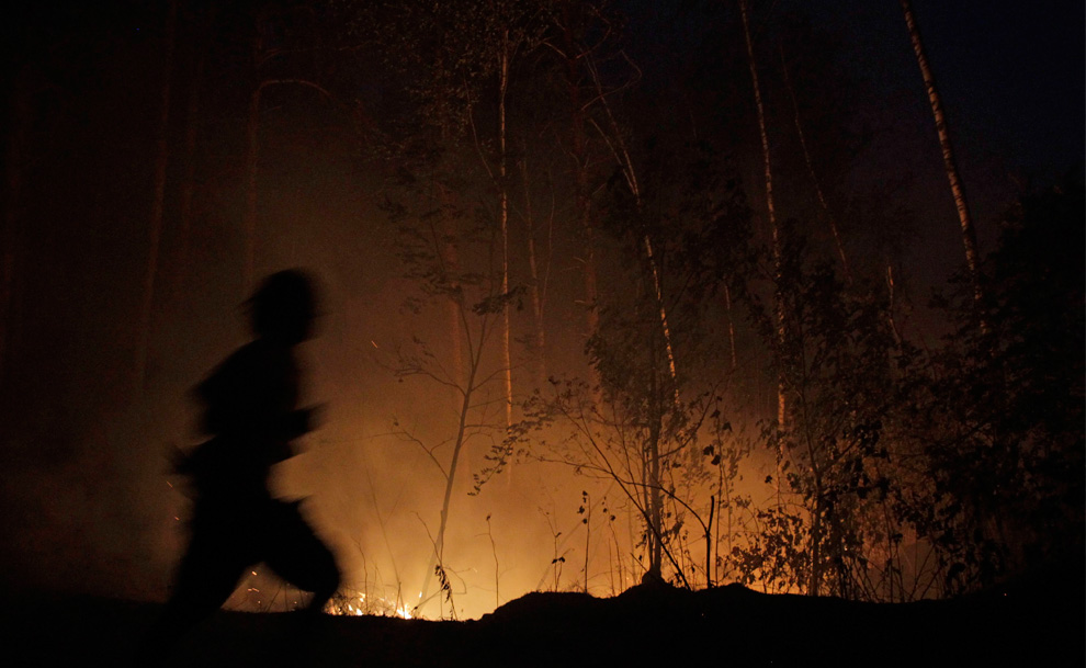
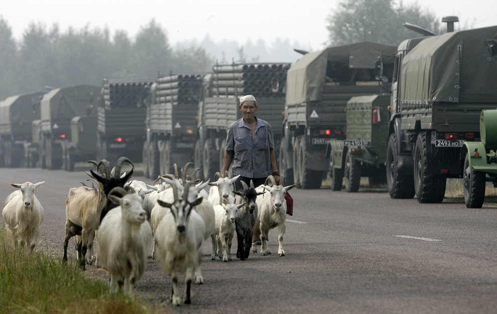
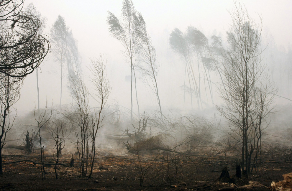
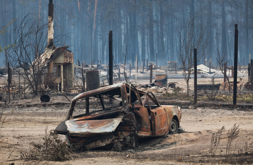
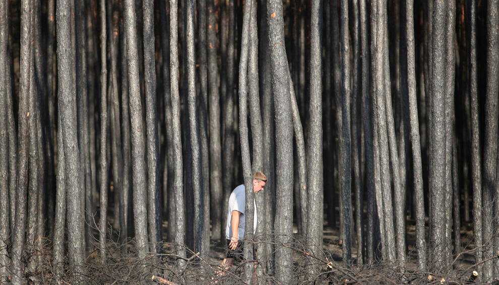
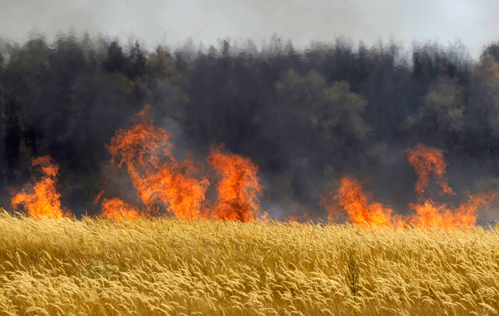
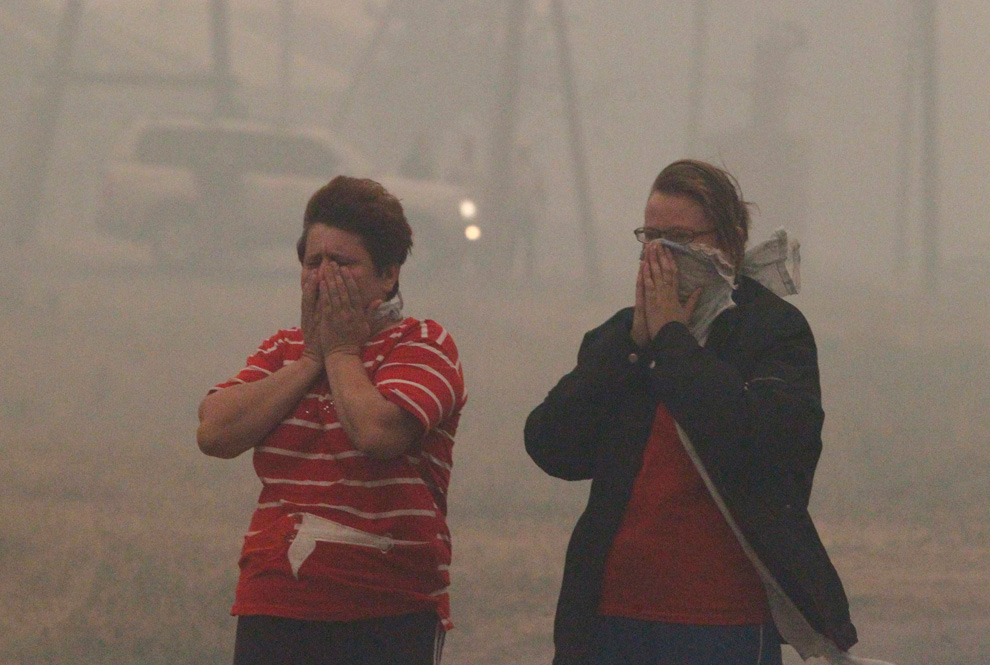
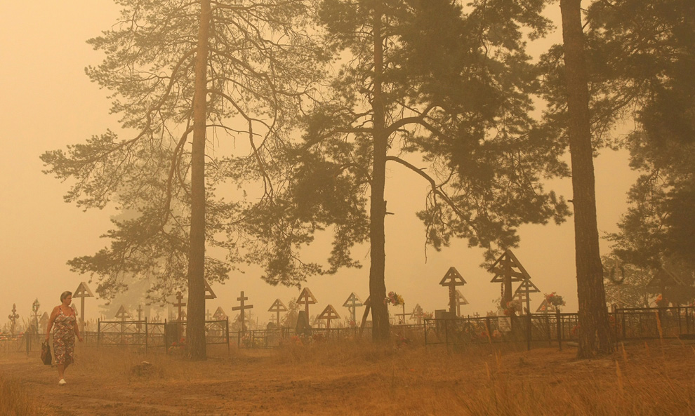
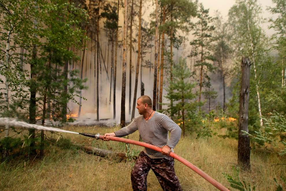
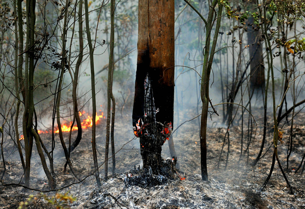
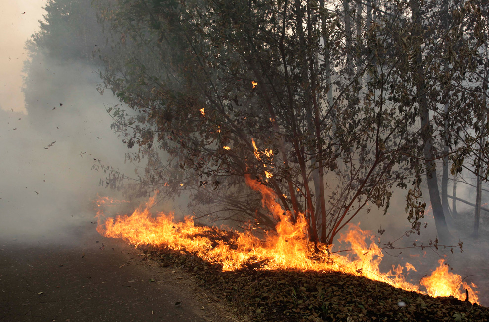
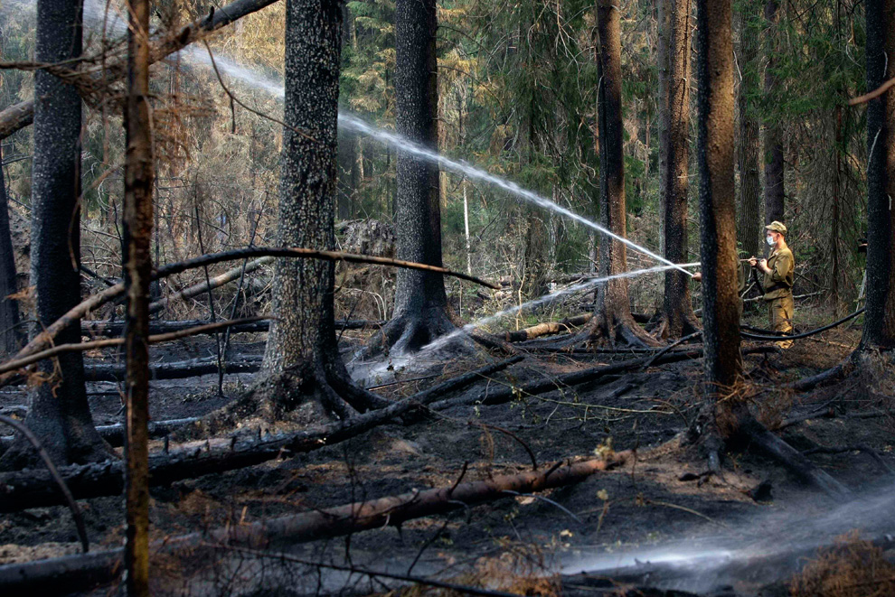
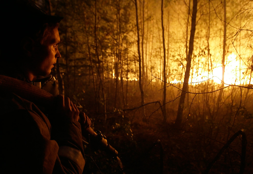
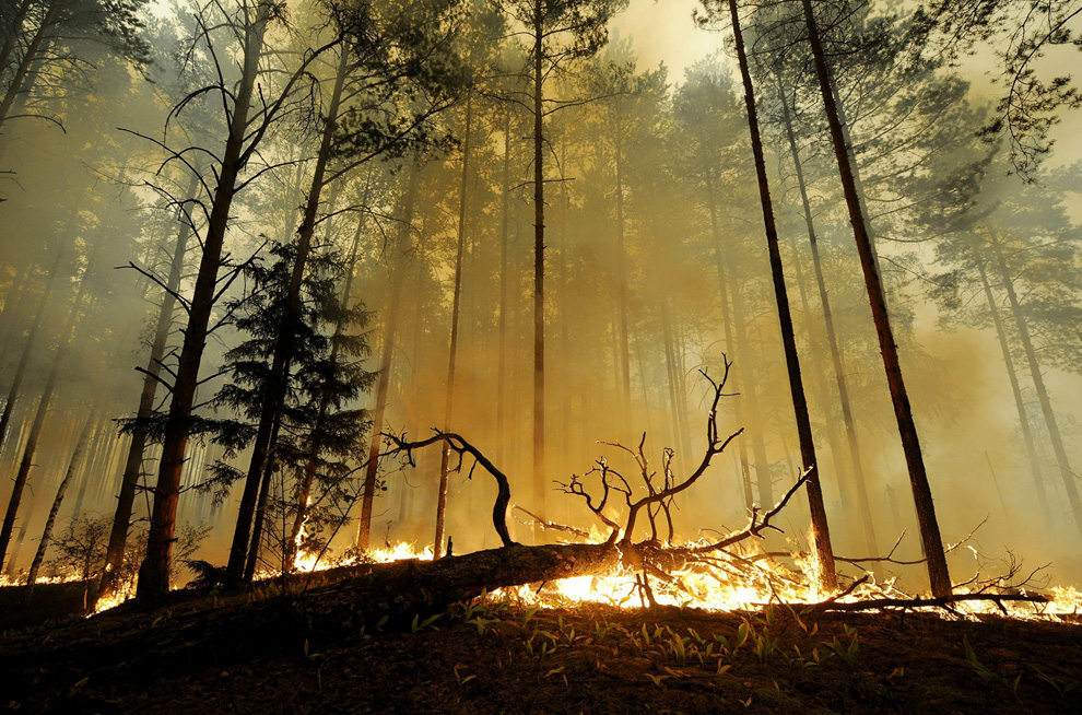
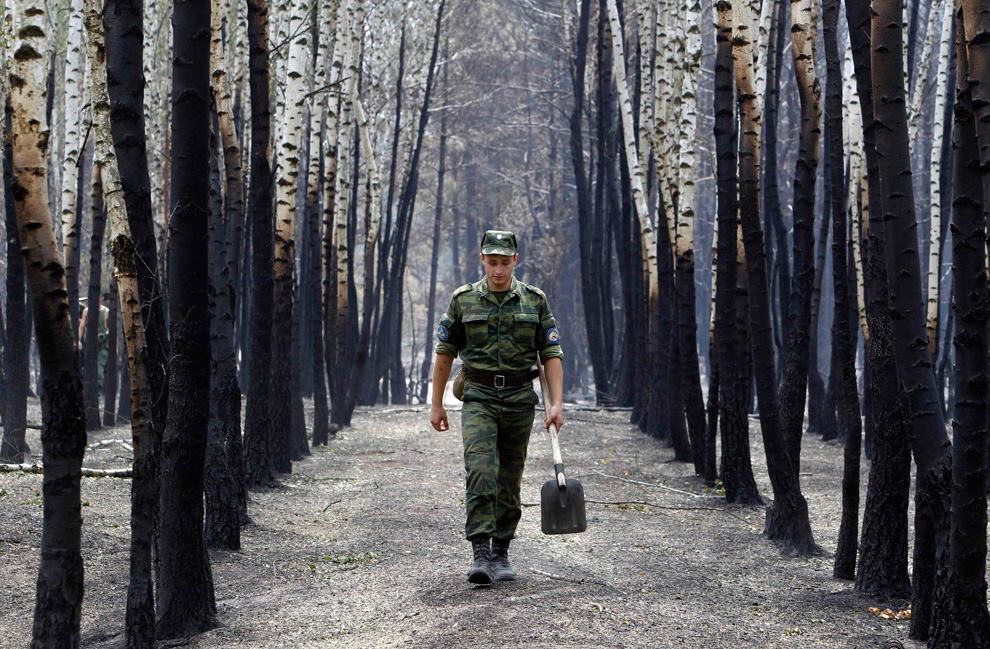
A soldier walks past birches, which are charred, damaged by fire on the outskirts of the Russian city of Voronezh on July 30, 2010. (REUTERS/Sergei Karpukhin)
Αποστολή από: thailandgr στις Αυγούστου 06, 2010, 09:01:31 πμ

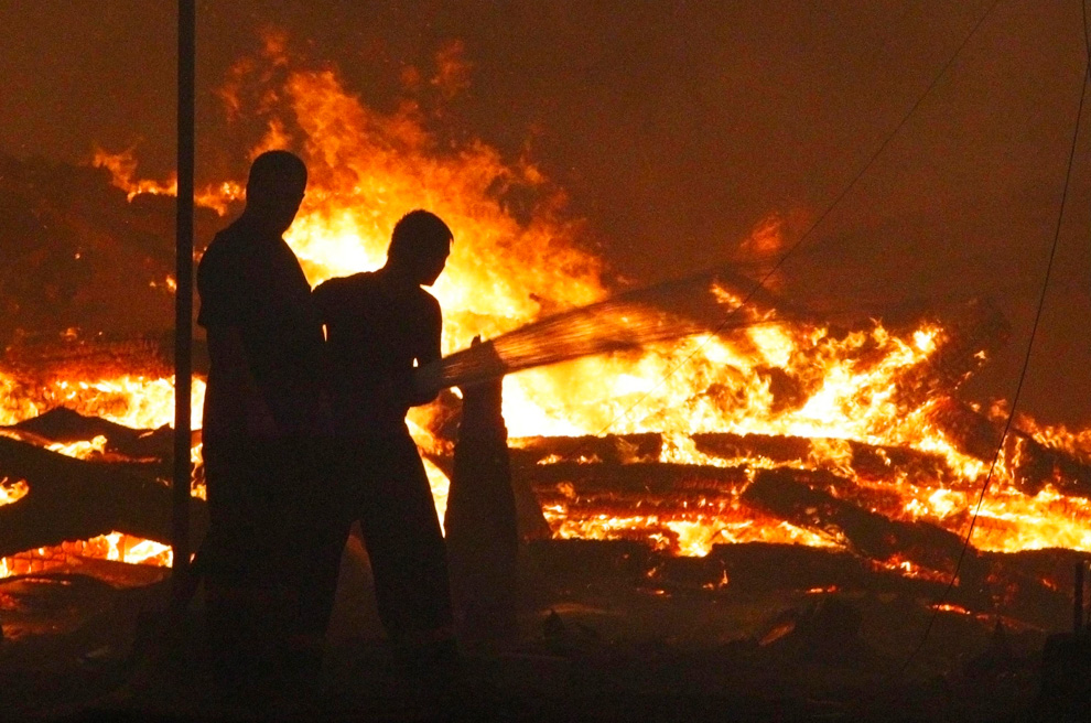
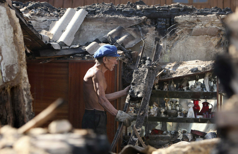
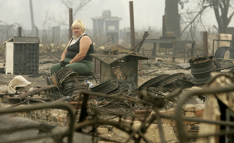
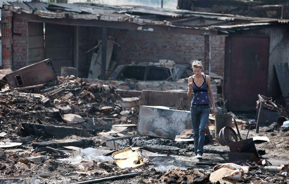
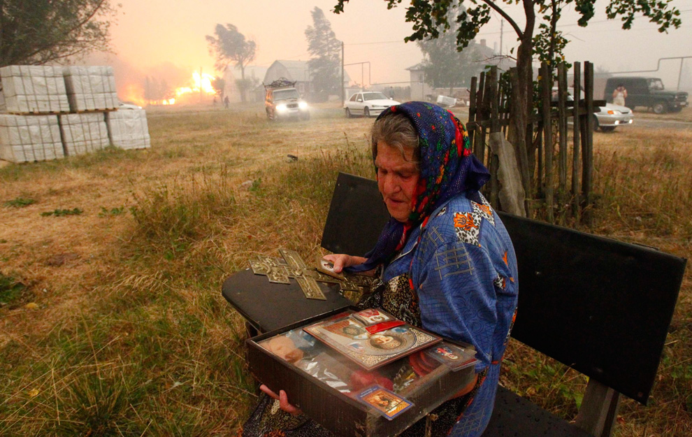
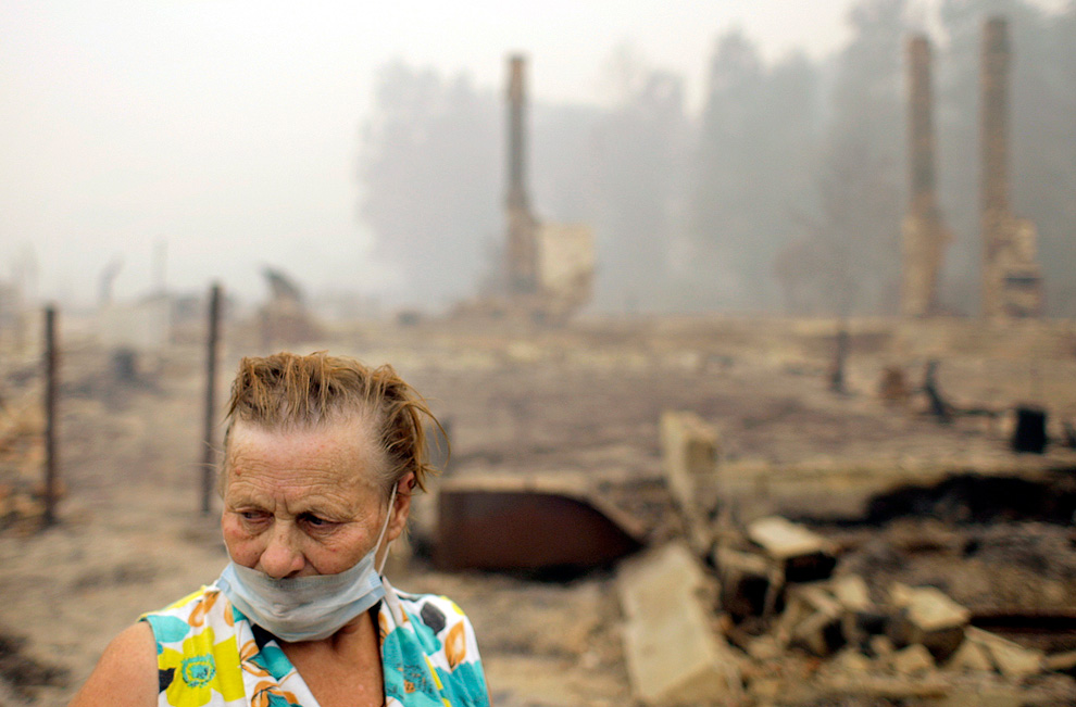
Russian women remove jars of preserved food from the cellar of their burnt home 15km from Moscow in Ostafyevo on August 2, 2010. (BORIS YELENIN/AFP/Getty Images) #
-
Τίτλος: Απ: Ηφαιστεια - τυφωνες και φυσικες καταστροφες
Αποστολή από: thailandgr στις Αυγούστου 07, 2010, 18:45:10 μμ
-
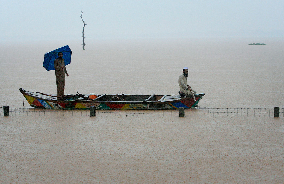
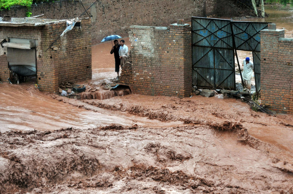
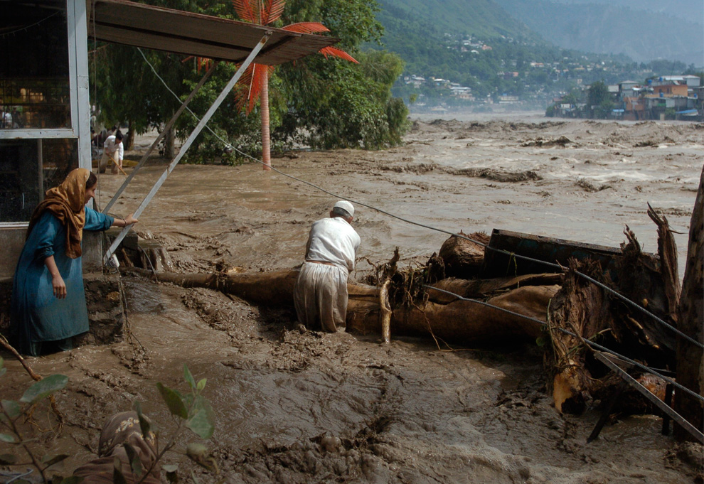
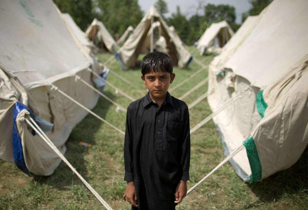
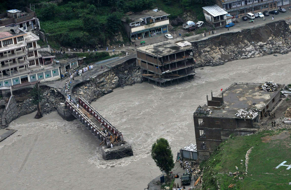
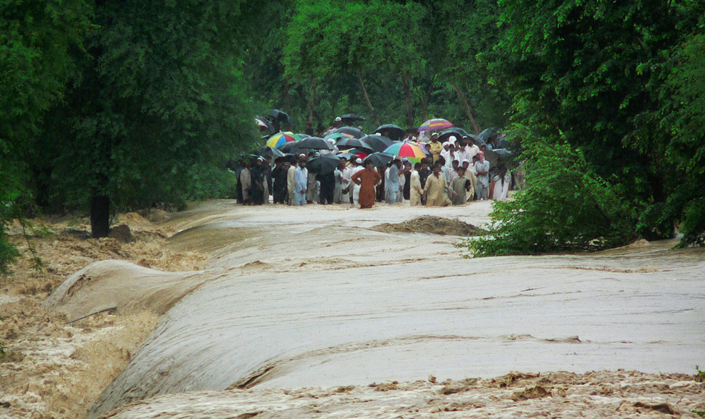
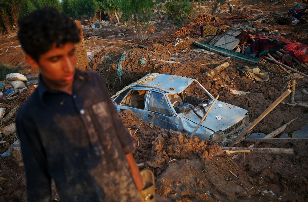
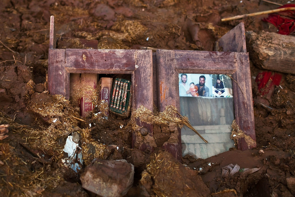
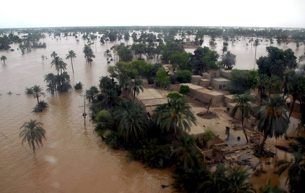
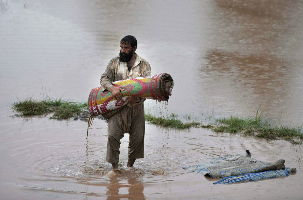
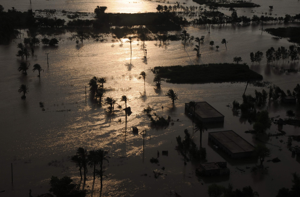
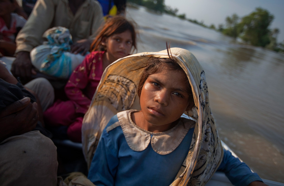
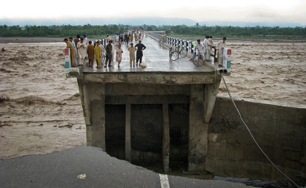
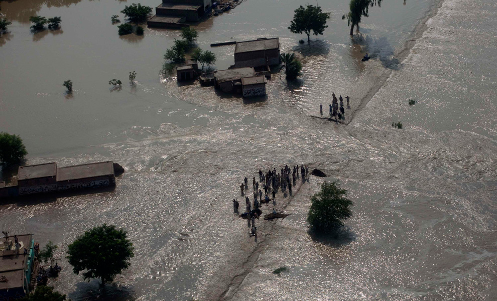
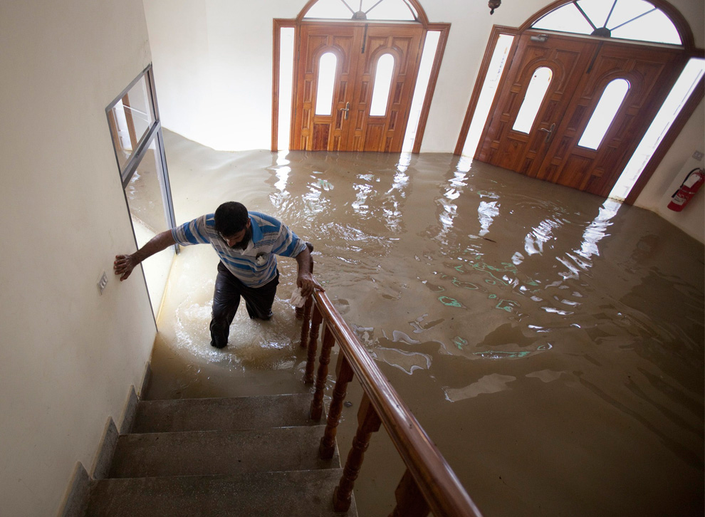
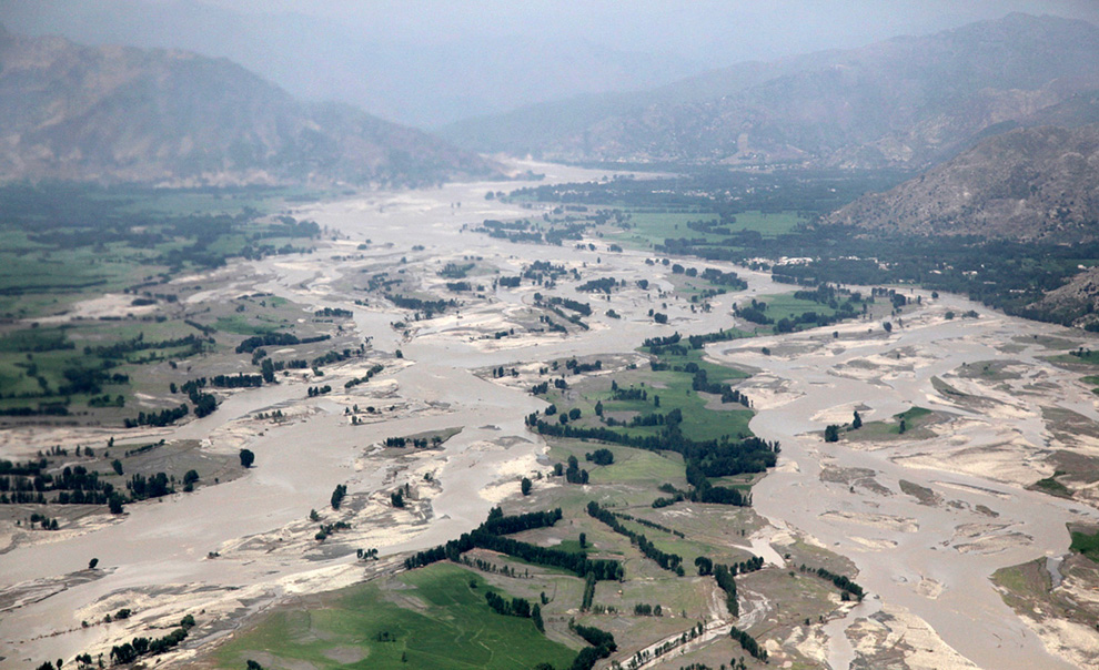
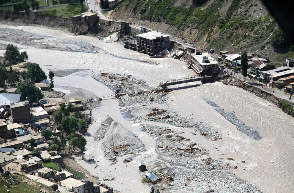
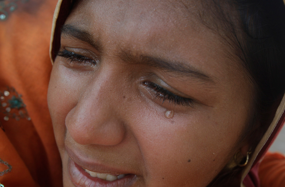
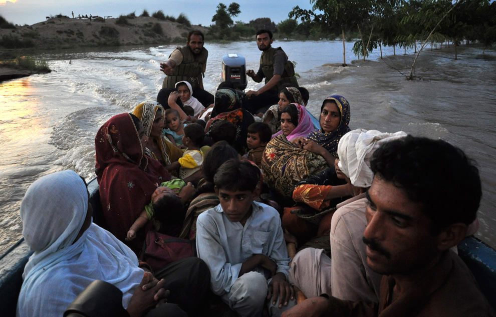
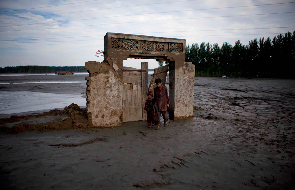
Η ζωή περίπου 12 εκατομμυρίων ανθρώπων έχει αλλάξει ριζικά μετά τις πρόσφατες πλημμύρες στο Πακιστάν, τις χειρότερες τα τελευταία 80 έτη, σύμφωνα με επίσημη ανακοίνωση από την κυβερνητική Υπηρεσία Εκτάκτων Αναγκών.
Από την ίδια Υπηρεσία ανακοινώθηκε ότι «το πρόβλημα της διανομής ανθρωπιστικής βοήθειας και του κινδύνου εκδήλωσης επιδημιών εστιάζεται γεωγραφικά στο βορειοδυτικό Πακιστάν και συγκεκριμένα στην επαρχία Χίμπερ-Παχτούνκουα, αλλά και στο κεντρικό Πακιστάν, επακριβώς στις επαρχίες του Πεντζάμπ».
Οδυνηρή λεπτομέρεια; Στα 12 εκατομμύρια πλημμυροπαθείς δεν συμπεριλαμβάνονται εκείνοι που ζουν στην επαρχία Σιντχ στο νότιο Πακιστάν, όπως συνάγεται από τις τελευταίες κυβερνητικές ανακοινώσεις στο θέμα των πλημμυρών.
-
Τίτλος: Απ: Ηφαιστεια - τυφωνες και φυσικες καταστροφες
Αποστολή από: thailandgr στις Αυγούστου 07, 2010, 18:45:51 μμ
-
-
Τίτλος: Απ: Ηφαιστεια - τυφωνες και φυσικες καταστροφες
Αποστολή από: thailandgr στις Αυγούστου 07, 2010, 19:33:28 μμ
-
-
Τίτλος: Απ: Ηφαιστεια - τυφωνες και φυσικες καταστροφες
Αποστολή από: Ivan στις Αυγούστου 07, 2010, 20:24:32 μμ
-
βιβλίκη καταστροφή. Τι θα απογίνουν άραγε όλοι αυτοί οι άνθρωποι?? όπου φτωχός και η μοίρα του
-
Τίτλος: Απ: Ηφαιστεια - τυφωνες και φυσικες καταστροφες
Αποστολή από: thailandgr στις Αυγούστου 12, 2010, 20:39:36 μμ
-
Πακισταν η καταστροφη συνεχίζετε
-
Τίτλος: Απ: Ηφαιστεια - τυφωνες και φυσικες καταστροφες
Αποστολή από: thailandgr στις Αυγούστου 12, 2010, 20:40:28 μμ
-

Αποστολή από: thailandgr στις Αυγούστου 07, 2010, 18:45:10 μμ
Από την ίδια Υπηρεσία ανακοινώθηκε ότι «το πρόβλημα της διανομής ανθρωπιστικής βοήθειας και του κινδύνου εκδήλωσης επιδημιών εστιάζεται γεωγραφικά στο βορειοδυτικό Πακιστάν και συγκεκριμένα στην επαρχία Χίμπερ-Παχτούνκουα, αλλά και στο κεντρικό Πακιστάν, επακριβώς στις επαρχίες του Πεντζάμπ».
Οδυνηρή λεπτομέρεια; Στα 12 εκατομμύρια πλημμυροπαθείς δεν συμπεριλαμβάνονται εκείνοι που ζουν στην επαρχία Σιντχ στο νότιο Πακιστάν, όπως συνάγεται από τις τελευταίες κυβερνητικές ανακοινώσεις στο θέμα των πλημμυρών.

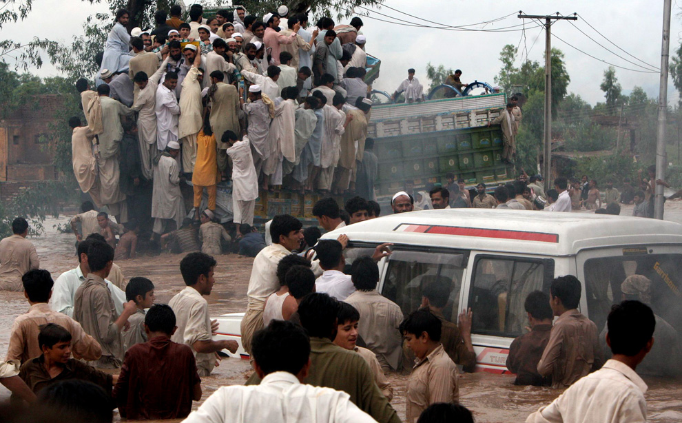
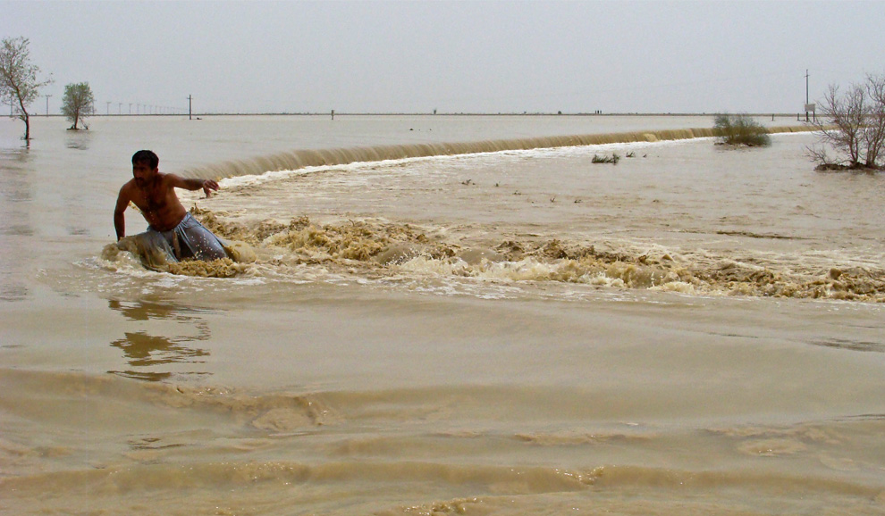
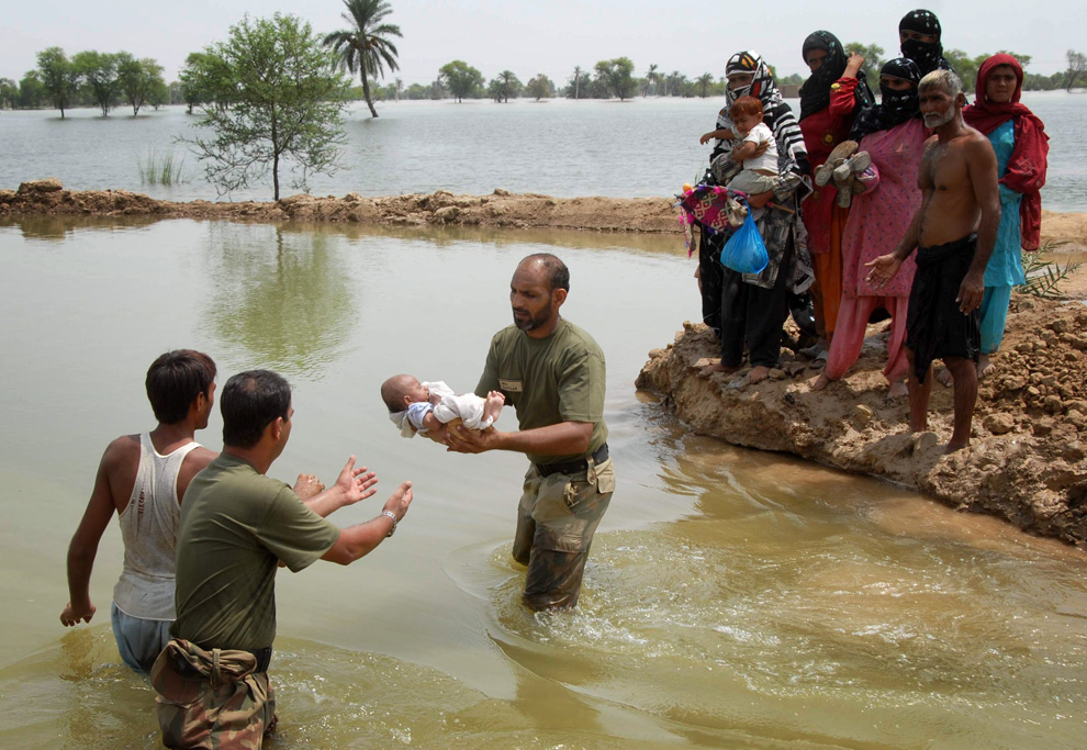
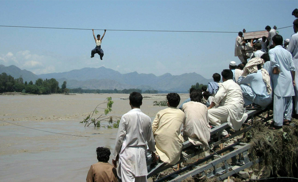
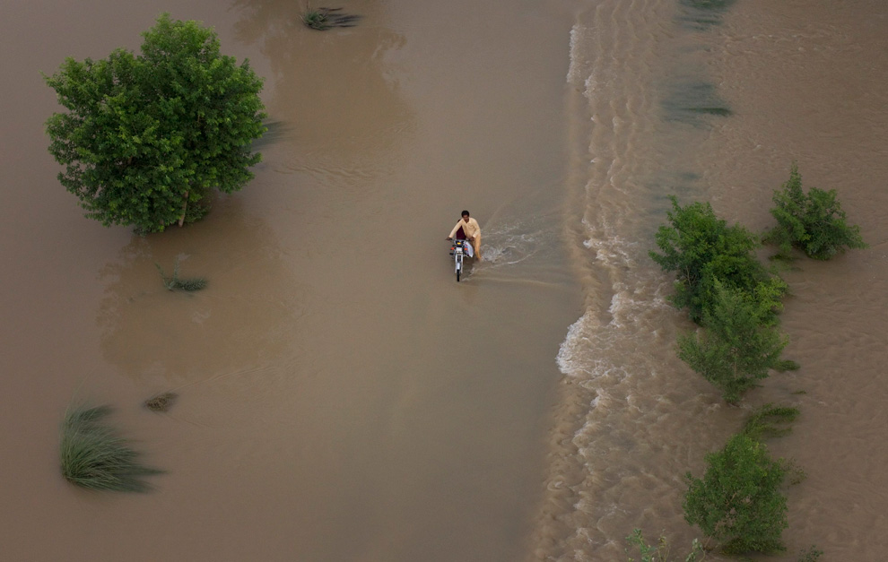
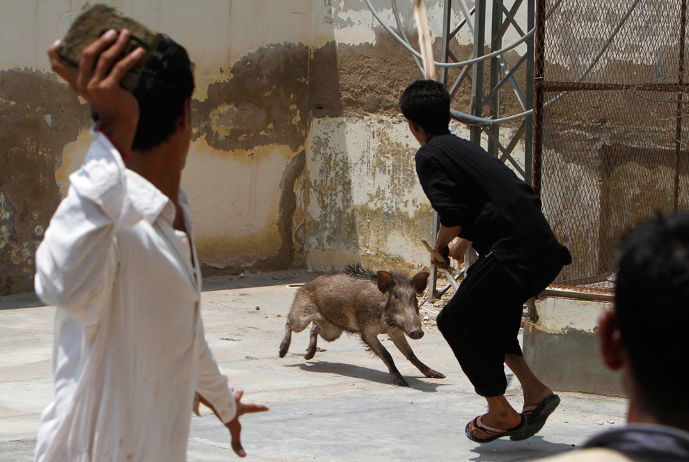
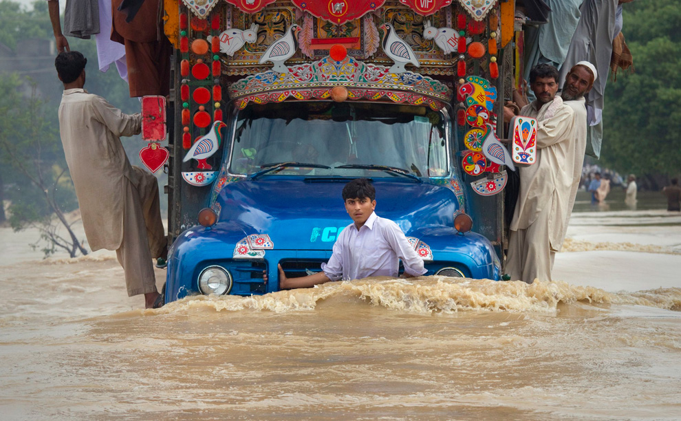
A boy hangs on to the front of a cargo truck while passing through a flooded road in Risalpur, located in Nowshera District in Pakistan's Northwest Frontier Province July 30, 2010. (REUTERS/Adrees Latif)

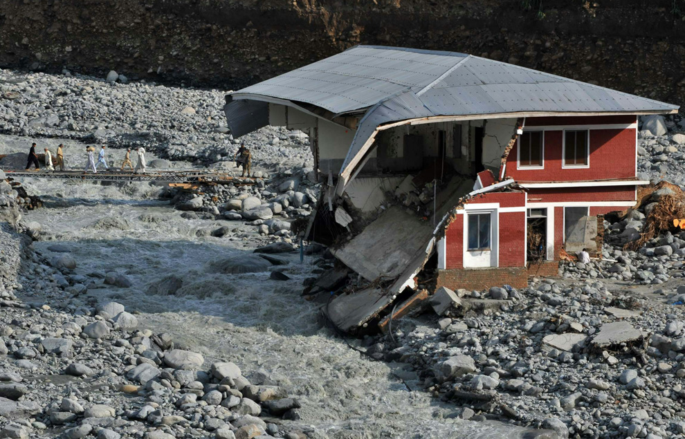
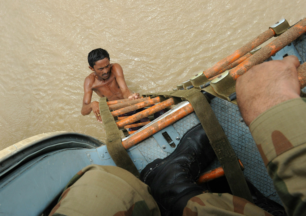
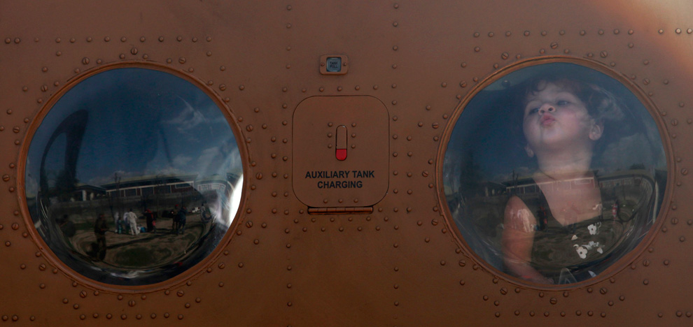
Nimra, a three-year-old girl, who was rescued along with her family from Kaalam in the northern area, kisses the window glass of an army helicopter after their arrival at Khuazakhela in Swat district located in Pakistan's northwest Khyber-Pakhtunkhwa Province on August 1, 2010. (REUTERS/Faisal Mahmood) #
Αποστολή από: thailandgr στις Αυγούστου 07, 2010, 18:45:51 μμ

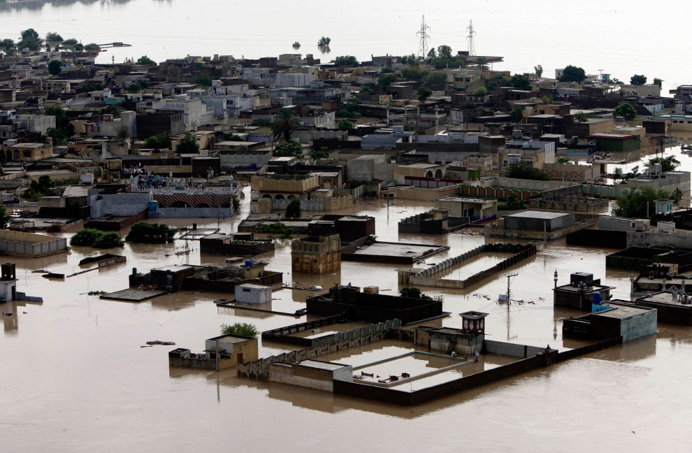
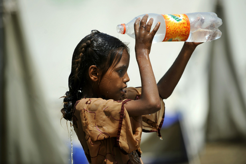
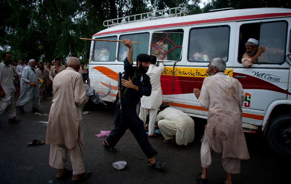
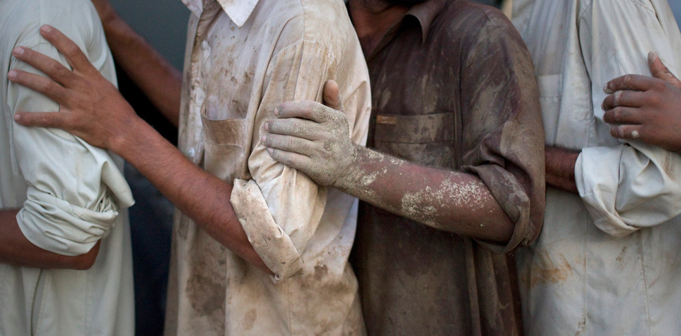
Flood victims line up to collect relief supplies from the Army in Nowshera, Pakistan on August 2, 2010. Islamist charities, some with suspected ties to militants, stepped in on Monday to provide aid for Pakistanis hit by the worst flooding in memory, piling pressure on a government criticized for its response to the disaster that has so far killed more than 1,000 people. (REUTERS/Adrees Latif) #

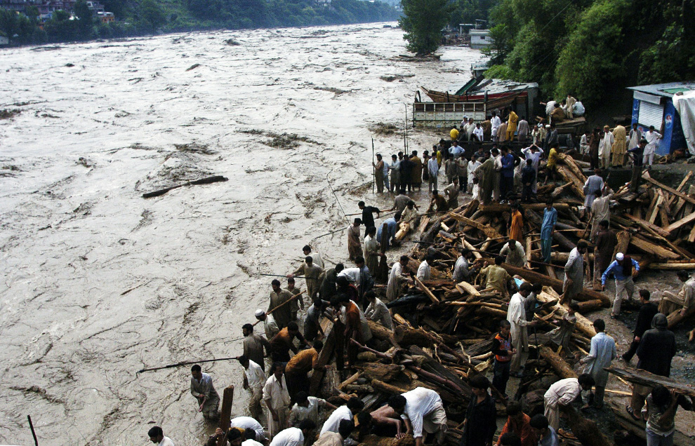
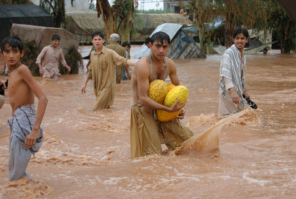
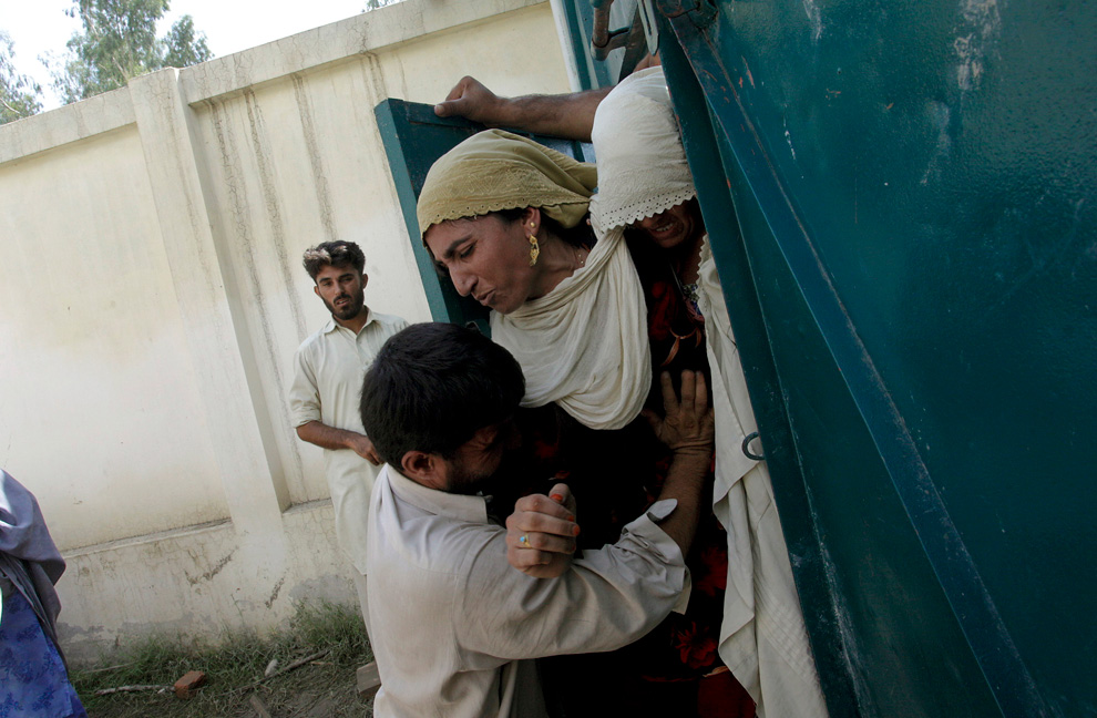
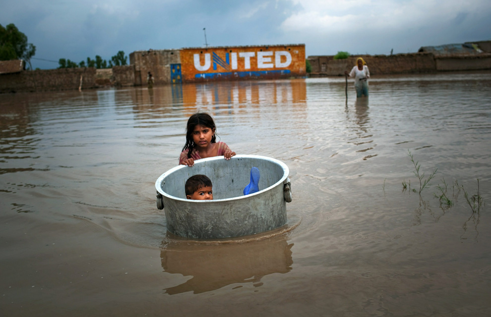
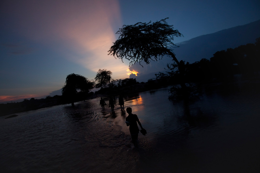
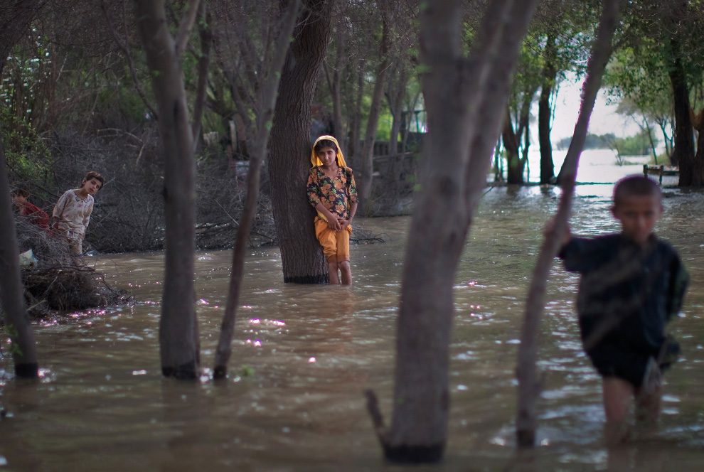
Children, whose families have declined to be rescued, wade in rising flood waters on August 6, 2010 in the village of Panu Akil, near Sukkur, Pakistan. Rescue workers and armed forces continued rescue operations evacuating thousands in Pakistan's heartland province of Sindh. (Daniel Berehulak/Getty Images) #
Αποστολή από: thailandgr στις Αυγούστου 07, 2010, 19:33:28 μμ
Αποστολή από: Ivan στις Αυγούστου 07, 2010, 20:24:32 μμ
Αποστολή από: thailandgr στις Αυγούστου 12, 2010, 20:39:36 μμ

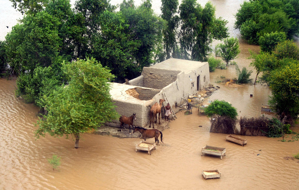
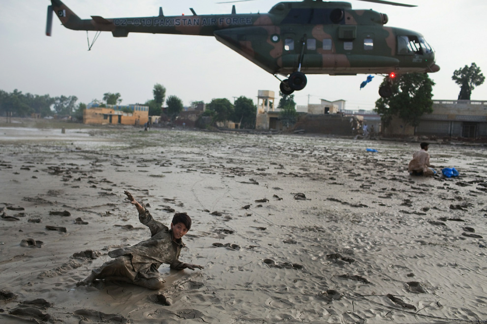
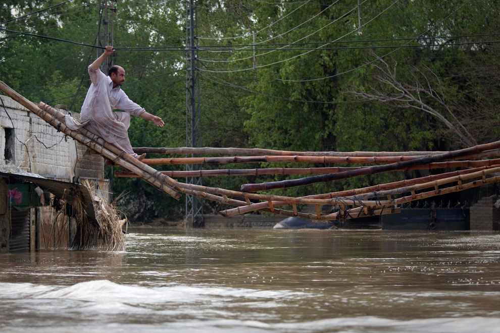
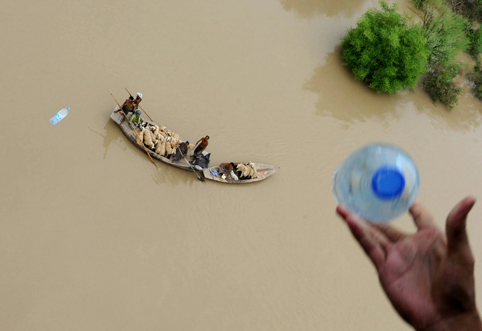
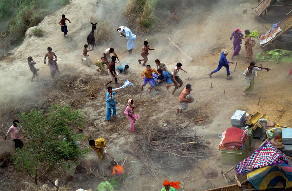
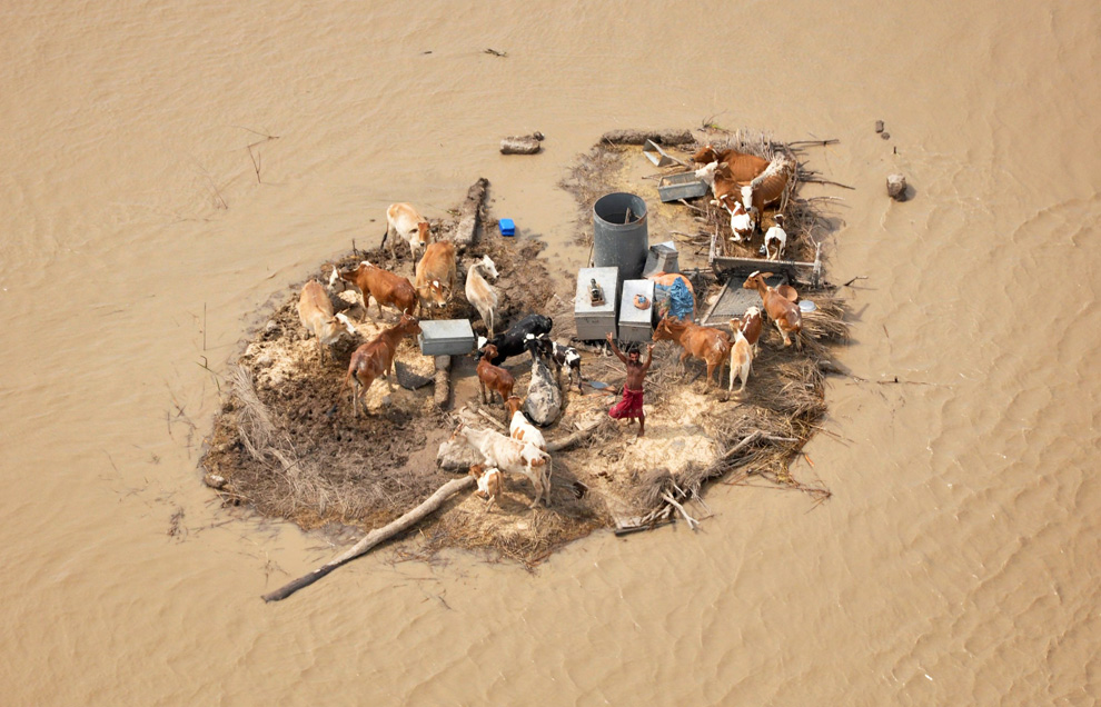
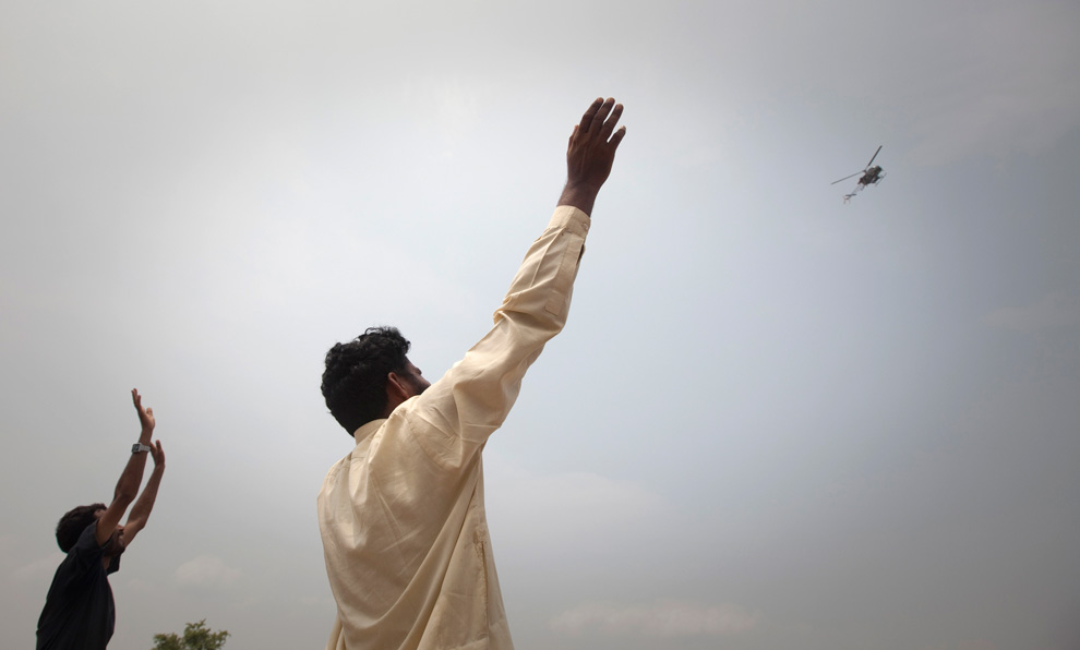
A man marooned by flood waters, alongside his livestock, waves towards an Army helicopter for relief handouts in the Rajanpur district of Pakistan's Punjab province on August 9, 2010. (REUTERS/Stringer)

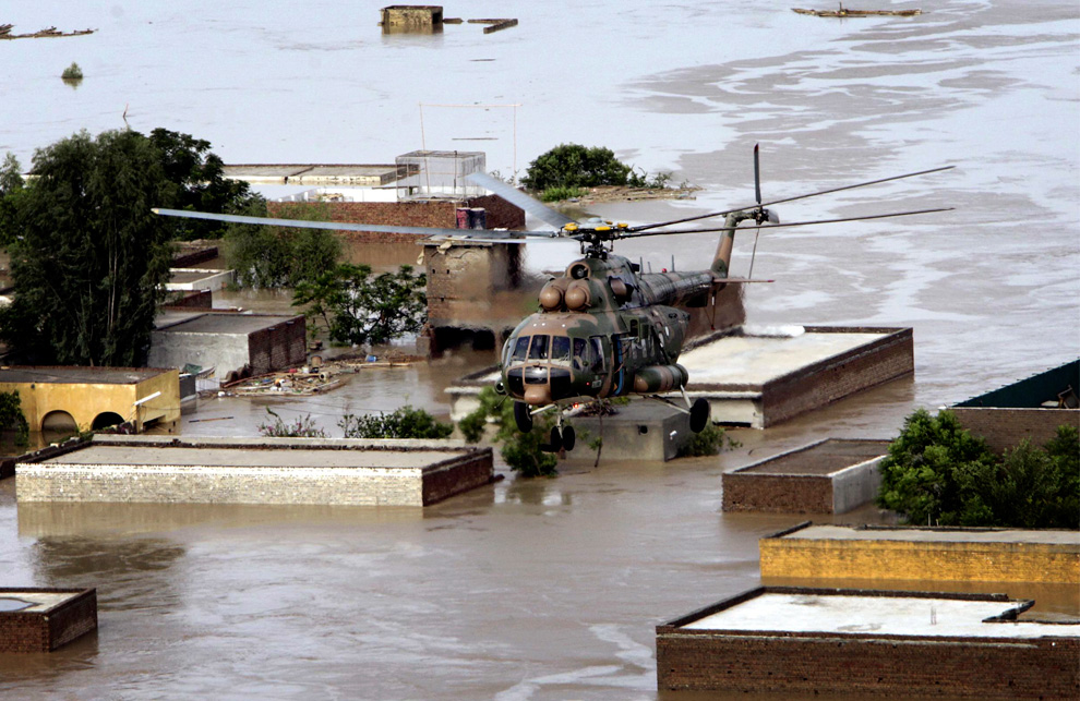
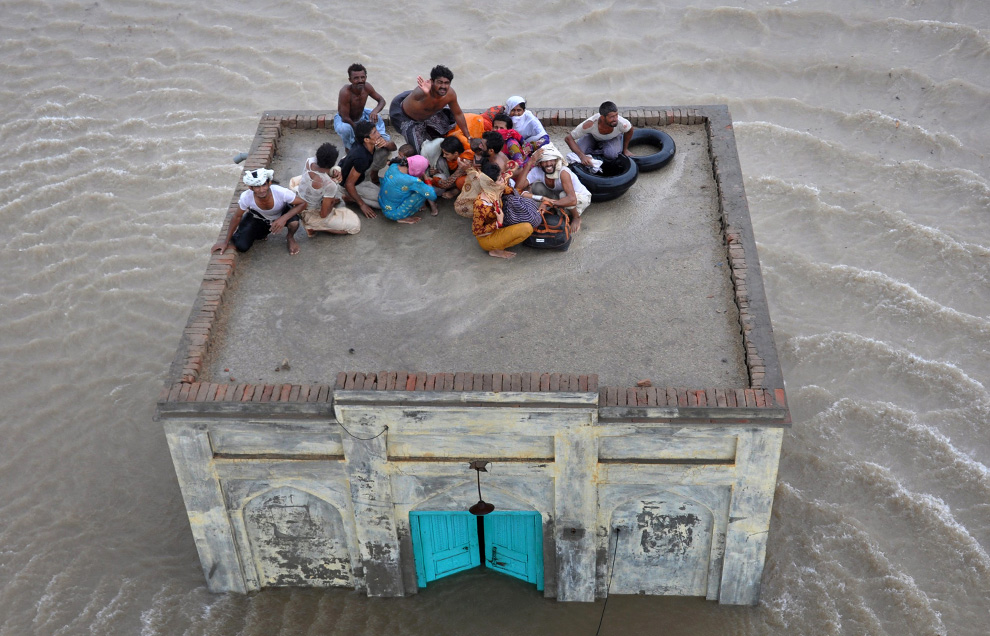
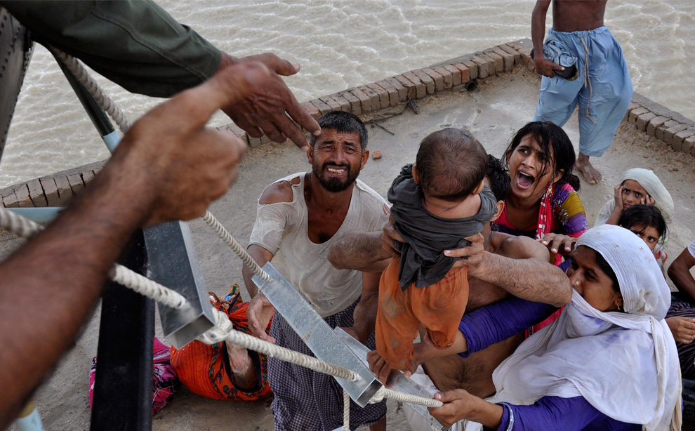
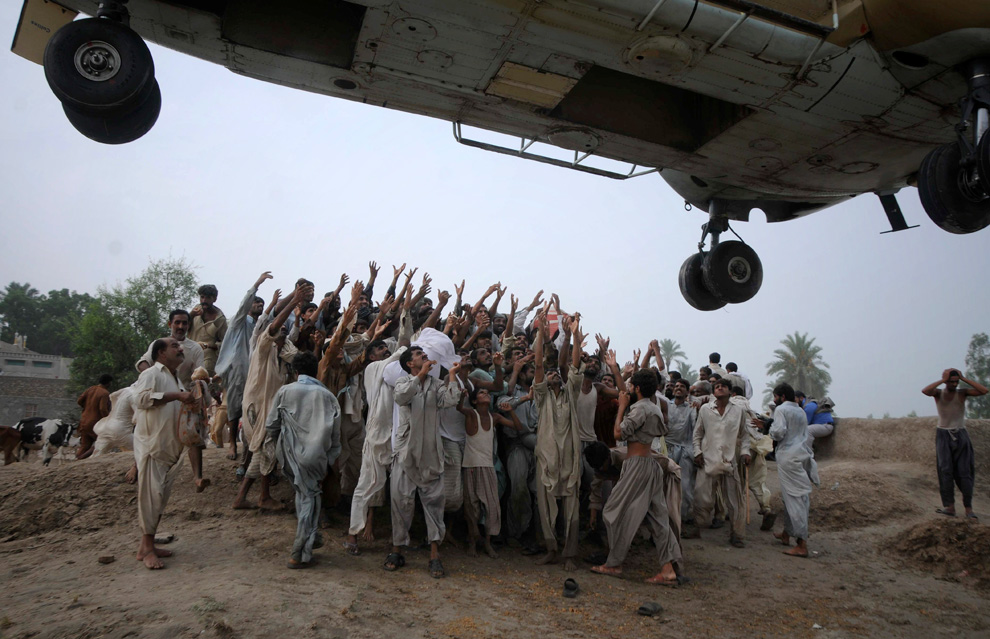
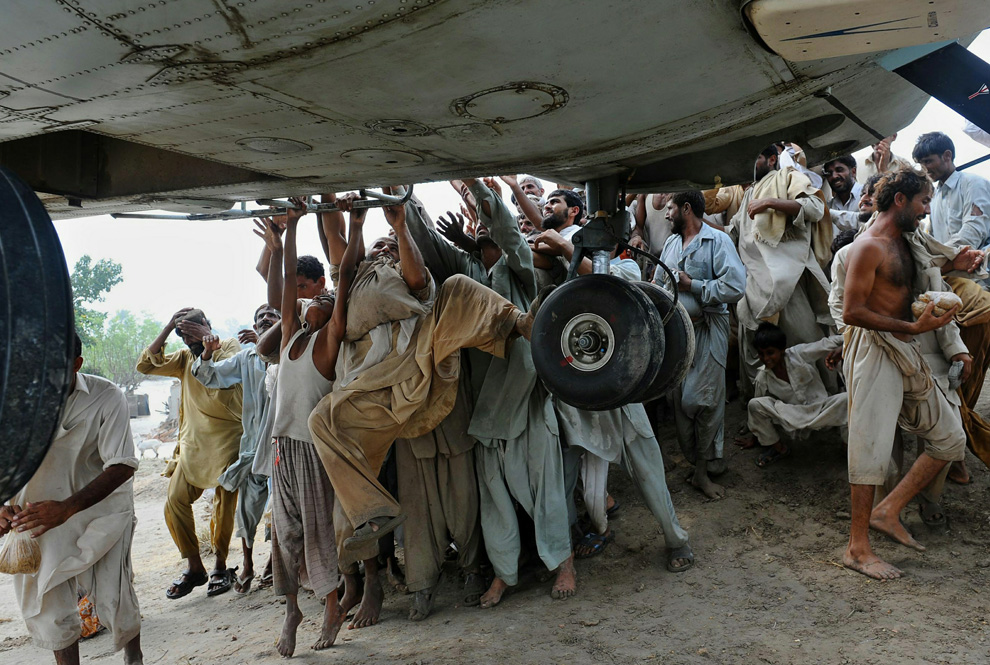
Flood victims awaiting rescue wave down a helicopter from a top a roof in Muzaffargarh district of Pakistan's Punjab province August 7, 2010. Pakistanis desperate to get out of flooded villages threw themselves at helicopters on Saturday as more heavy rain was expected to intensify both suffering and anger with the government. The disaster killed more than 1,600 people and disrupted the lives of 12 million. (REUTERS/Adrees Latif) #

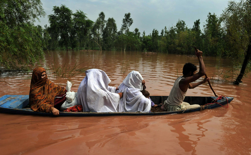
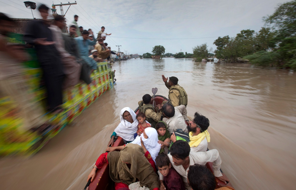
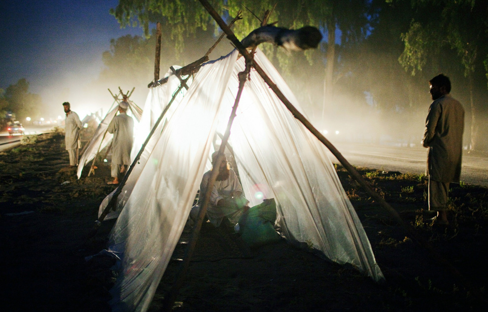
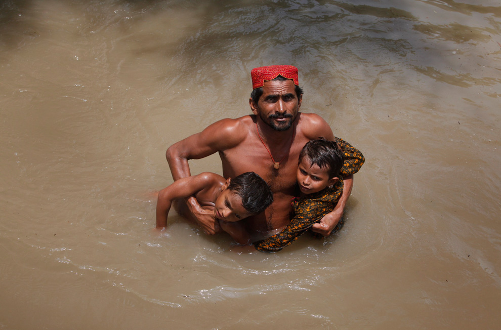
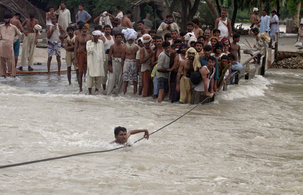
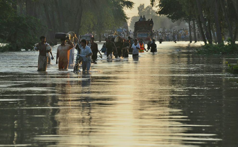
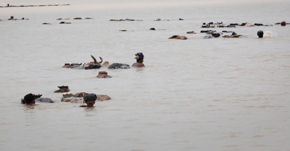
Villagers wade through flood waters with their livestock while looking for higher grounds in Sukkur, Pakistan on August 8, 2010. Pakistani navy boats sped across miles of flood waters on Sunday as the military took a lead role in rescuing survivors from a devastating disaster that has killed 1,600 people and left two million homeless. (REUTERS/Akhtar Soomro) #

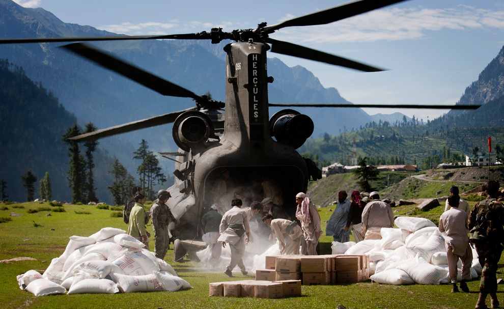
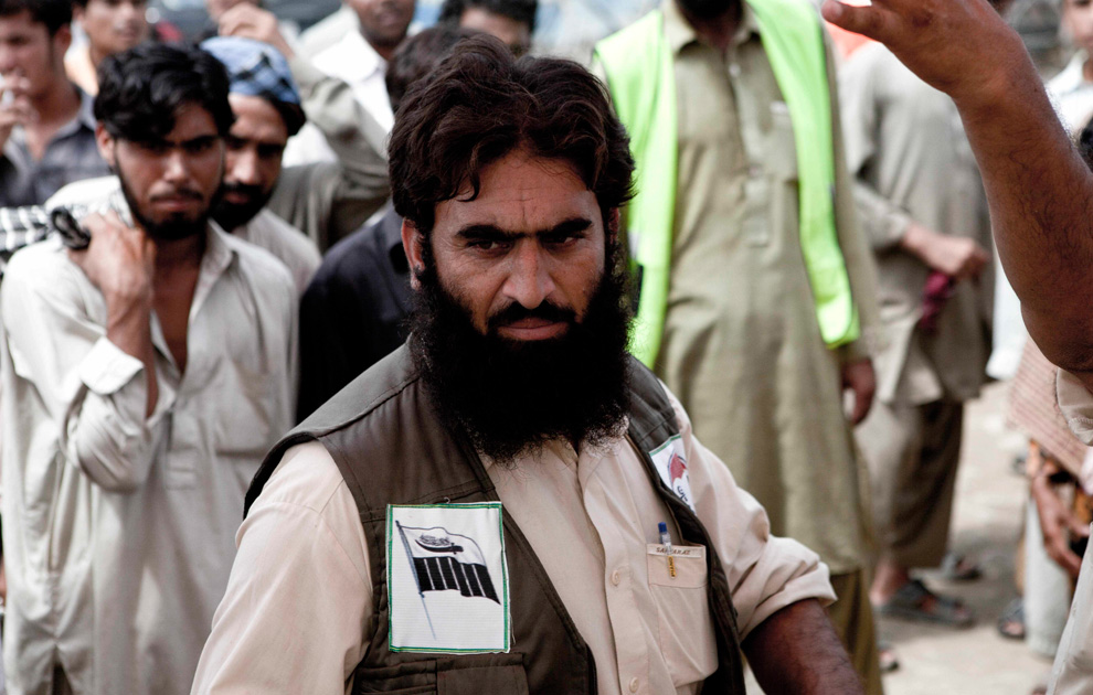
Volunteers of the Falah-e-Insaniyat foundation, the charity wing of Pakistan's anti-American militant group Jamaat-ud-Dawa, run a relief camp for flood-affected people in Nowshera, northwest Pakistan on Aug. 9, 2010. U.S. army choppers flew up the formerly Taliban-controlled valley laden with flour, biscuits and water. They returned loaded with hungry Pakistani flood survivors. (AP Photo/B.K.Bangash) #

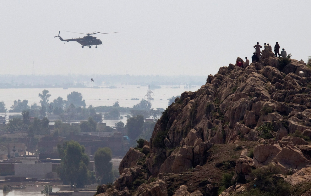
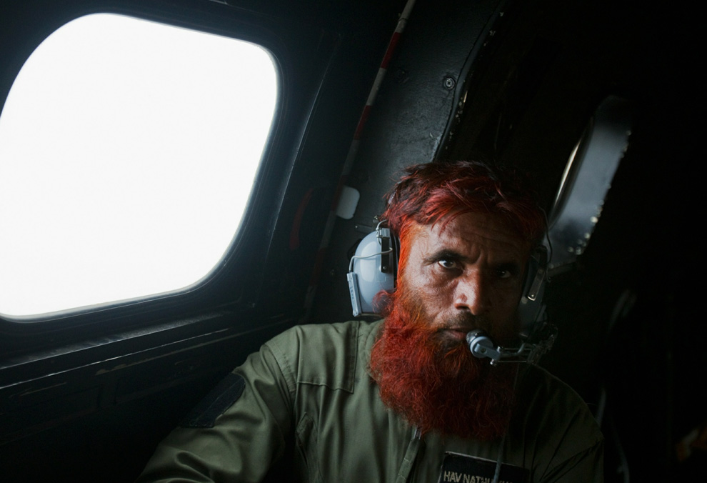
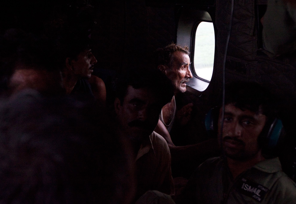
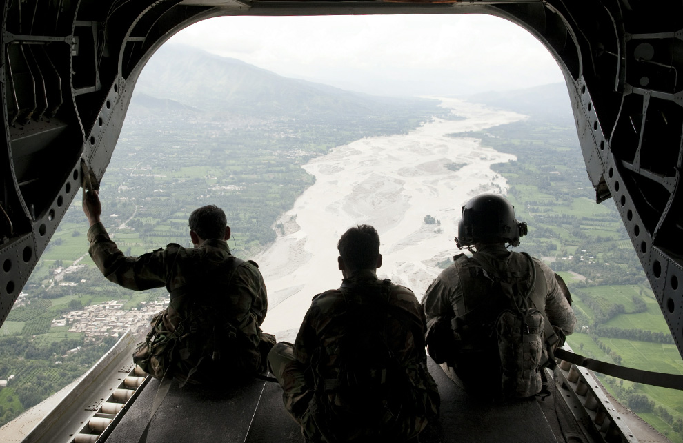
US Army Staff Sargeant Matthew Kingsbury (right) from Bravo Company 2/3 Aviation and Pakistani soldiers sit on the cargo bay ramp of a CH-47 heavy-lift helicopter while looking down at a flooded area while in flight over Pakistan's Swat Valley on August 10, 2010. (BEHROUZ MEHRI/AFP/Getty Images) #
Αποστολή από: thailandgr στις Αυγούστου 12, 2010, 20:40:28 μμ

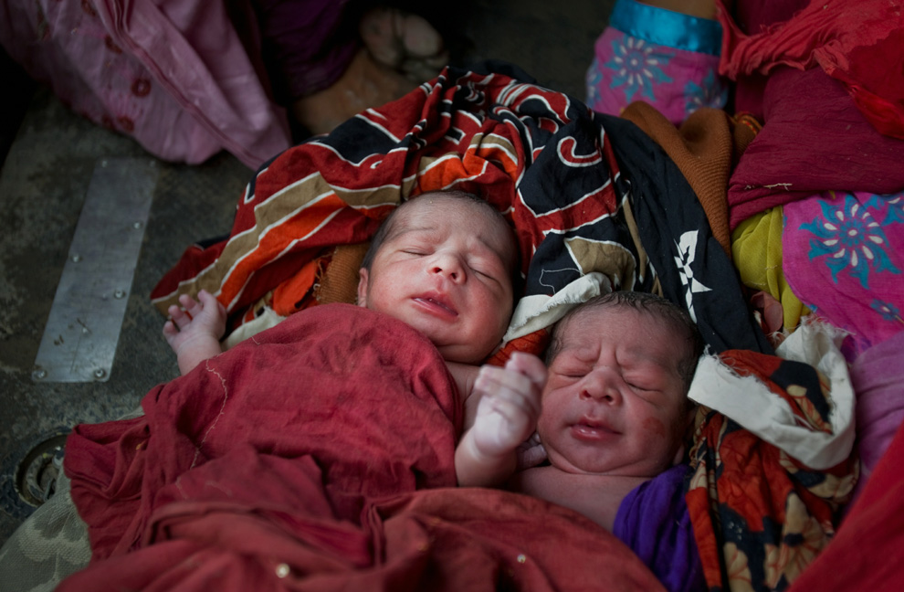
Newborn twin boys lay covered up in a blanket on the floor of a Pakistani Army helicopter, as mother Zada Perveen (unseen) rests after being rescued by Pakistan Army soldiers during air rescue operations on August 9, 2010 over the village of Sanawan in the Muzaffargarh district of Pakistan. Of the twin boys, un-named at the time, the first was born 15 minutes before mid day and the other twin was born as the Army rescue helicopter was circling above to find a safe landing position on a road surrounded by flood waters. The mother was then carried on a makeshift bed through chest deep flood waters to the awaiting Pakistan Army helicopter. (Daniel Berehulak/Getty Images) #

Pakistani flood victim Mohammed Nawaz hangs onto a moving raft as he is rescued by the Pakistan Navy August 10, 2010 in Sukkur, Pakistan. (Paula Bronstein/Getty Images) #
-
Τίτλος: Απ: Ηφαιστεια - τυφωνες και φυσικες καταστροφες
Αποστολή από: thailandgr στις Αυγούστου 12, 2010, 20:42:29 μμ
-
Οι φωτιες συνεχιζονται στην Ρωσία
-
Τίτλος: Απ: Ηφαιστεια - τυφωνες και φυσικες καταστροφες
Αποστολή από: thailandgr στις Αυγούστου 12, 2010, 20:43:04 μμ
-
-
Τίτλος: Απ: Ηφαιστεια - τυφωνες και φυσικες καταστροφες
Αποστολή από: Ivan στις Αυγούστου 12, 2010, 23:33:51 μμ
-
thailandgr συνέχισε τις ανταποκρίσεις.... μας αρέσουν πολύ.....
-
Τίτλος: Απ: Ηφαιστεια - τυφωνες και φυσικες καταστροφες
Αποστολή από: stelkon στις Αυγούστου 13, 2010, 13:04:47 μμ
-
Tο «αυθεντικό» μέτρον άριστον μου φαίνεται κουτσό· το «λανθασμένο» παν μέτρον άριστον ;)μου φαίνεται πολύ πιο ρυθμικό.... :D :)
-
Τίτλος: Απ: Ηφαιστεια - τυφωνες και φυσικες καταστροφες
Αποστολή από: Ivan στις Αυγούστου 13, 2010, 23:24:30 μμ
-
-
Τίτλος: Απ: Ηφαιστεια - τυφωνες και φυσικες καταστροφες
Αποστολή από: thailandgr στις Αυγούστου 14, 2010, 11:55:41 πμ
-
Κίνα: Κατολισθήσεις στην πόλη Ζουτσού της επαρχίας Γκανσού
Νέες κατολισθήσεις έσπειραν και πάλι τον τρόμο στη Νοτιοδυτική Κίνα. Ήδη αγνοούνται 32 άνθρωποι, ενώ από το έντονο φαινόμενο καταστράφηκαν νοσοκομεία στην περιοχή Βεντσουάν, επίκεντρο του σεισμού που προκάλεσε τον θάνατο 87.000 ανθρώπων τον Μάιο του 2008 στην επαρχία Σιτσουάν.
Η σημερινή θα είναι ημέρα πένθους για τα 1.156 θύματα των κατολισθήσεων στην πόλη Ζουτσού της επαρχίας Γκανσού, όπου οι αγνοούμενοι ανέρχονται σε 588.
-
Τίτλος: Απ: Ηφαιστεια - τυφωνες και φυσικες καταστροφες
Αποστολή από: thailandgr στις Αυγούστου 14, 2010, 11:58:04 πμ
-
Πόλη Ζουτσού της Kινας.
Αποστολή από: thailandgr στις Αυγούστου 12, 2010, 20:42:29 μμ

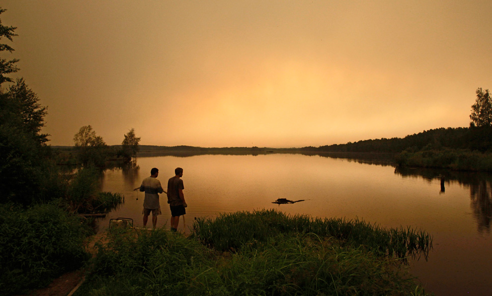
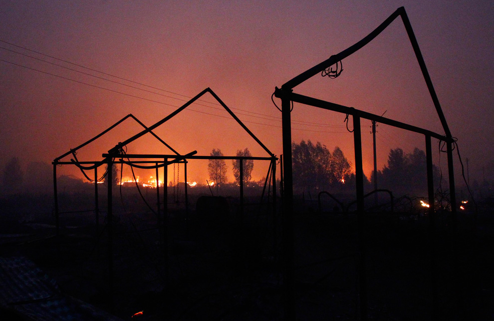
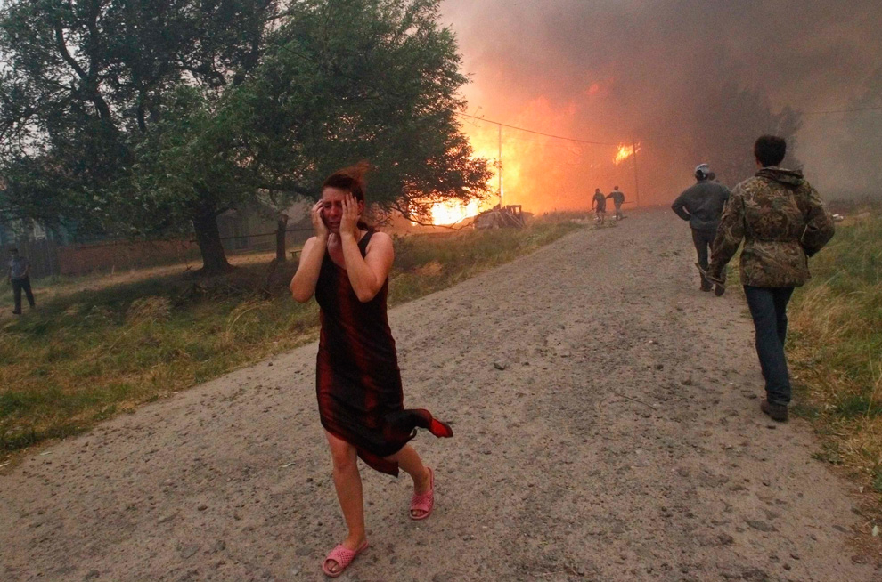
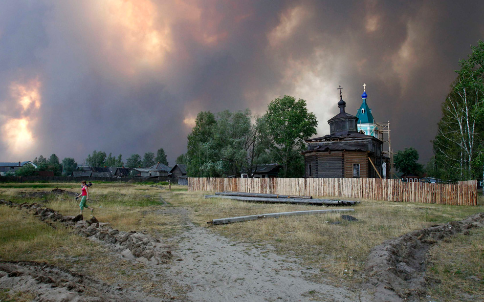
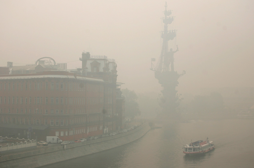
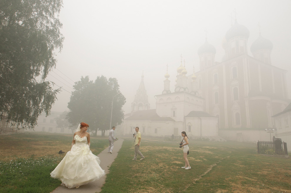
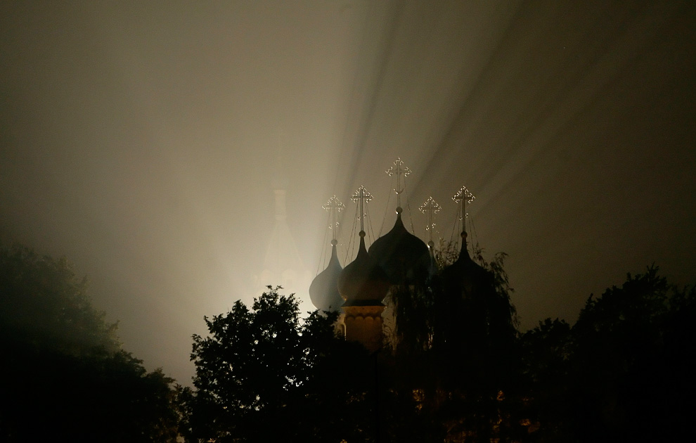
Light shines through forest fire smoke near a Russian Orthodox church 30km from Moscow in Zelenaya Sloboda late on August 3, 2010. (ARTYOM KOROTAYEV/AFP/Getty Images)

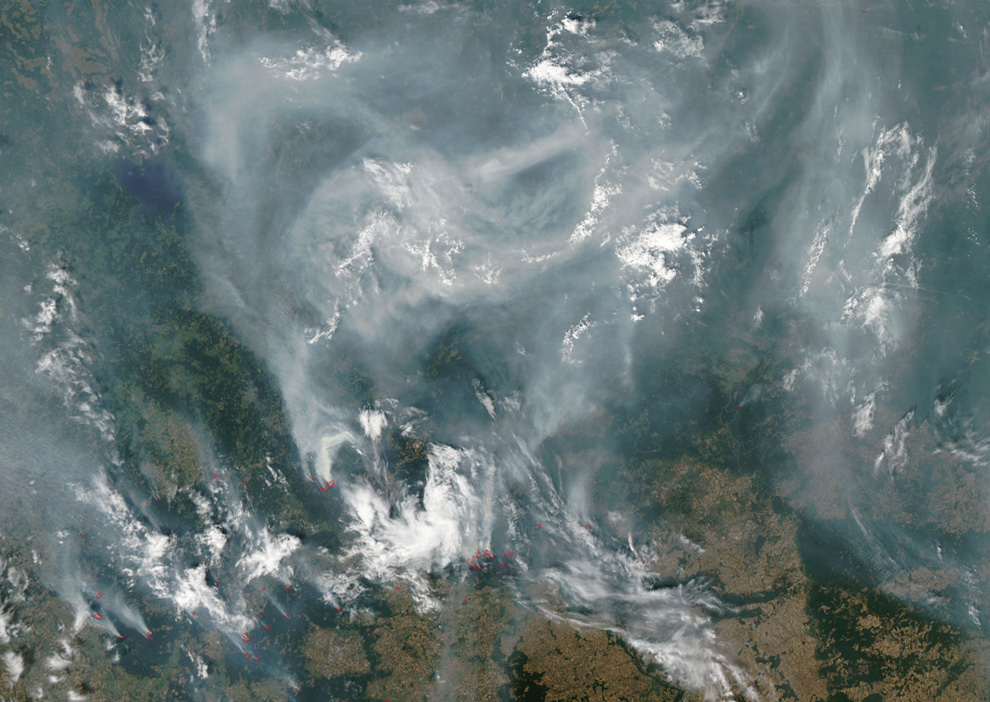
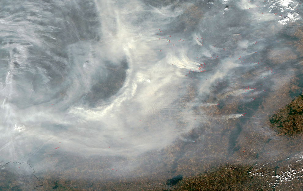
An image released by NASA on August 8, 2010 and taken by the Moderate Resolution Imaging Spectroradiometer (MODIS) on NASA's Aqua satellite on August 7 shows fires burning around Moscow. Red outlines indicate actively burning fires, and multiple fires cluster east of Moscow, many of them sending their smoke right over the city. Smoke almost completely hides the land surface throughout this scene. (AFP/Getty Images/NASA Earth Observatory) #

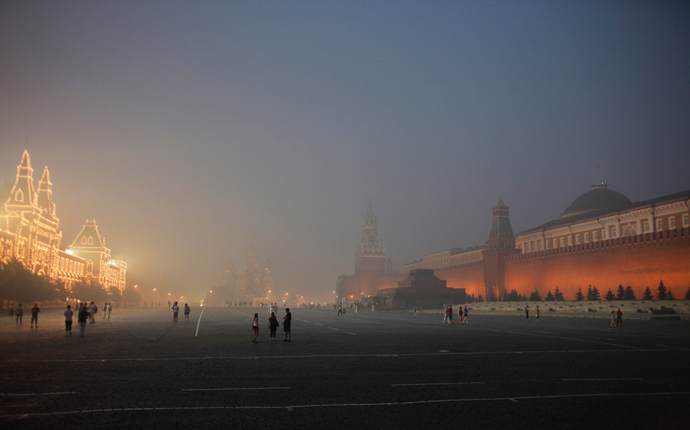
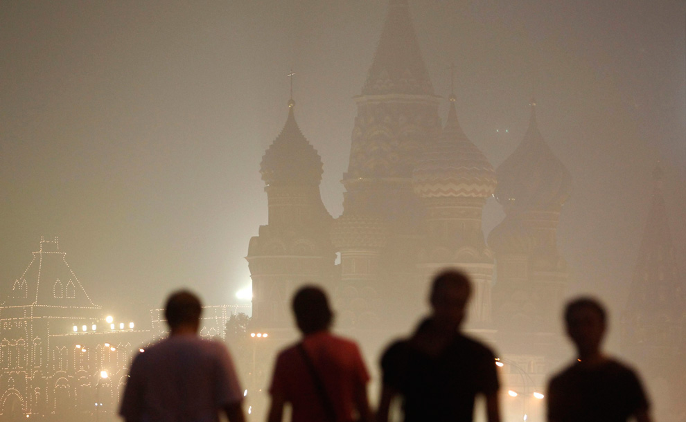
People walk in front of St. Basil's Cathedral shrouded in smog in Moscow, August 4, 2010. Air quality levels in Moscow tumbled to an eight-year low on Wednesday as the Russian capital was blanketed in thick smoke from forest and peat fires, said Moscow's state agency for monitoring air pollution. (REUTERS/Sergei Karpukhin) #

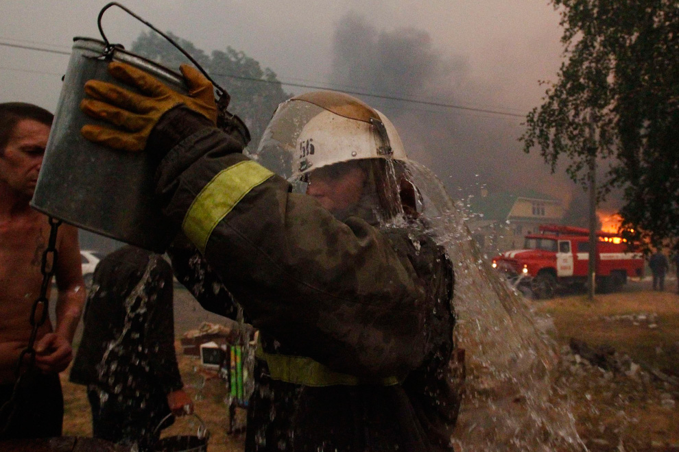
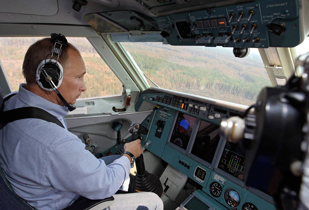
Russia's Prime Minister Vladimir Putin, wearing headphones, sits in the cockpit of a firefighting plane in Ryazan region August 10, 2010. Putin, who has sought to burnish his action-man image and minimize political fallout from wildfires and drought, flew in a firefighting plane that dropped water on a blaze southeast of Moscow, state media reported. (REUTERS/Ria Novosti/Pool/Alexei Nikolsky) #
Αποστολή από: thailandgr στις Αυγούστου 12, 2010, 20:43:04 μμ

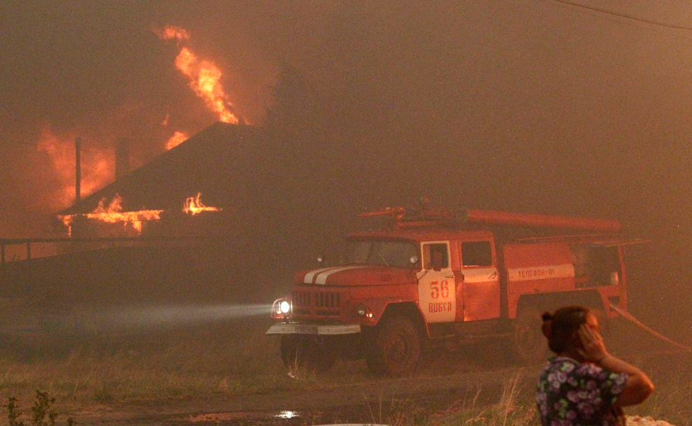
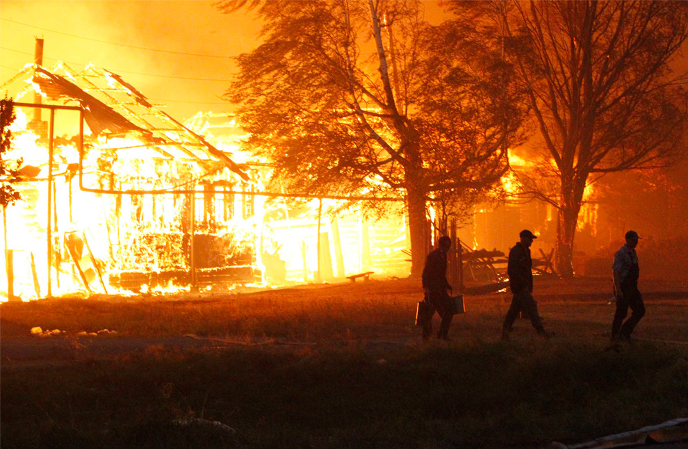
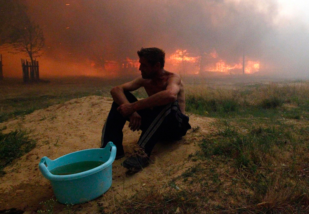
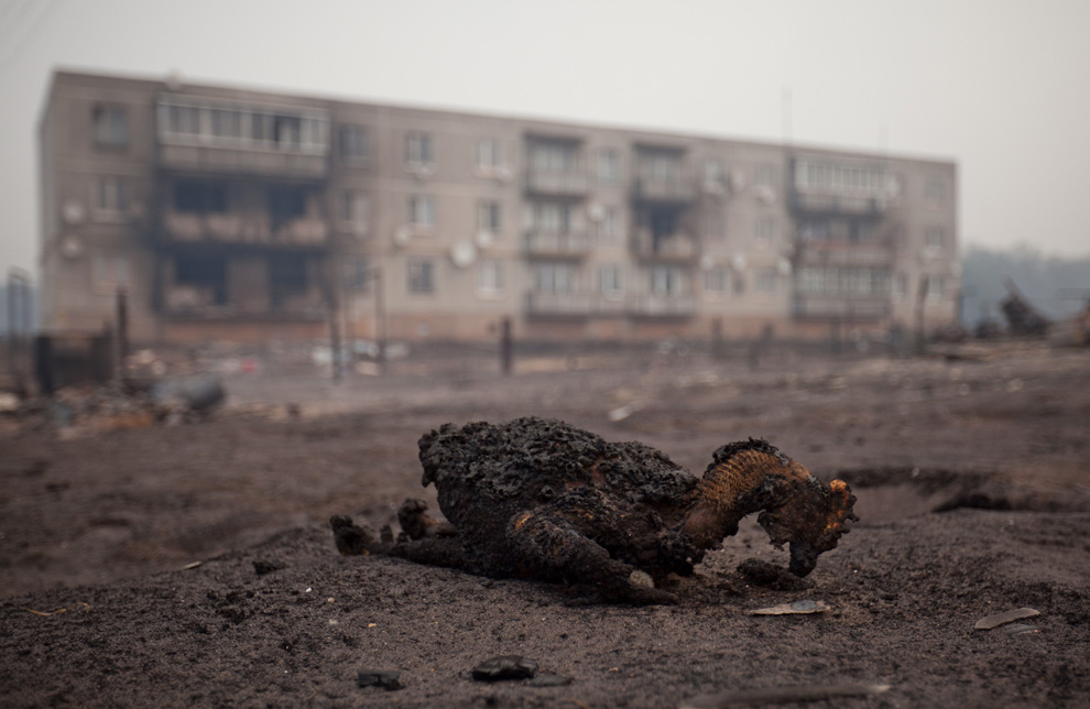
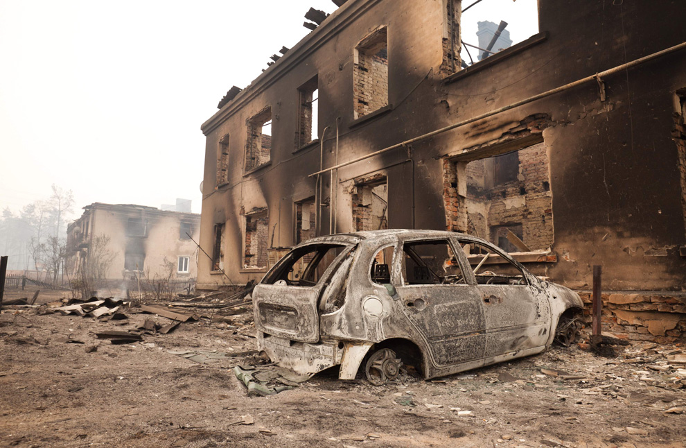
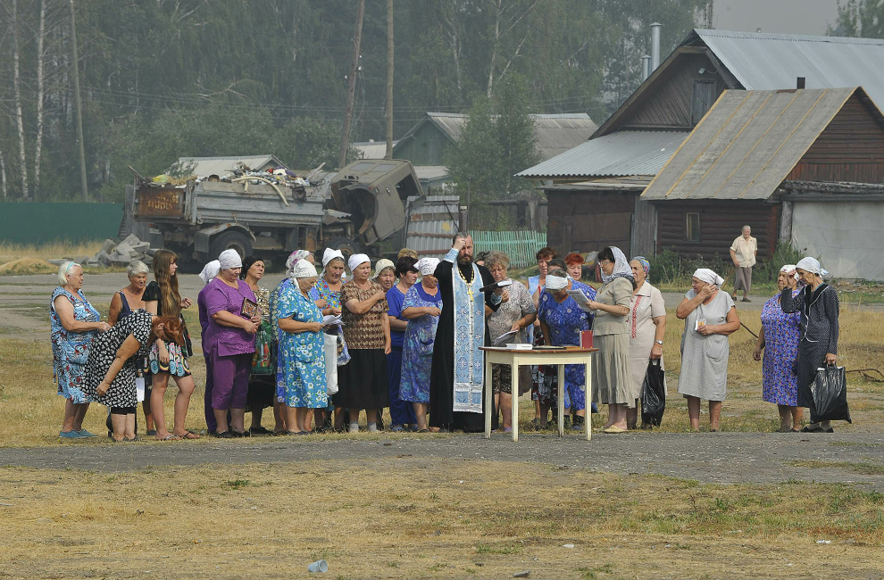
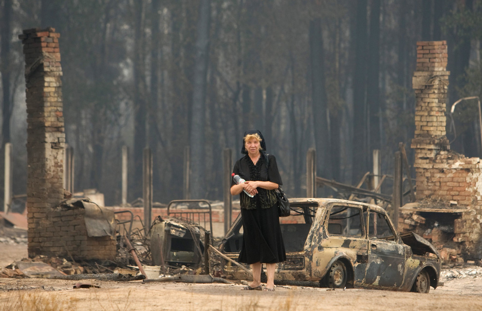
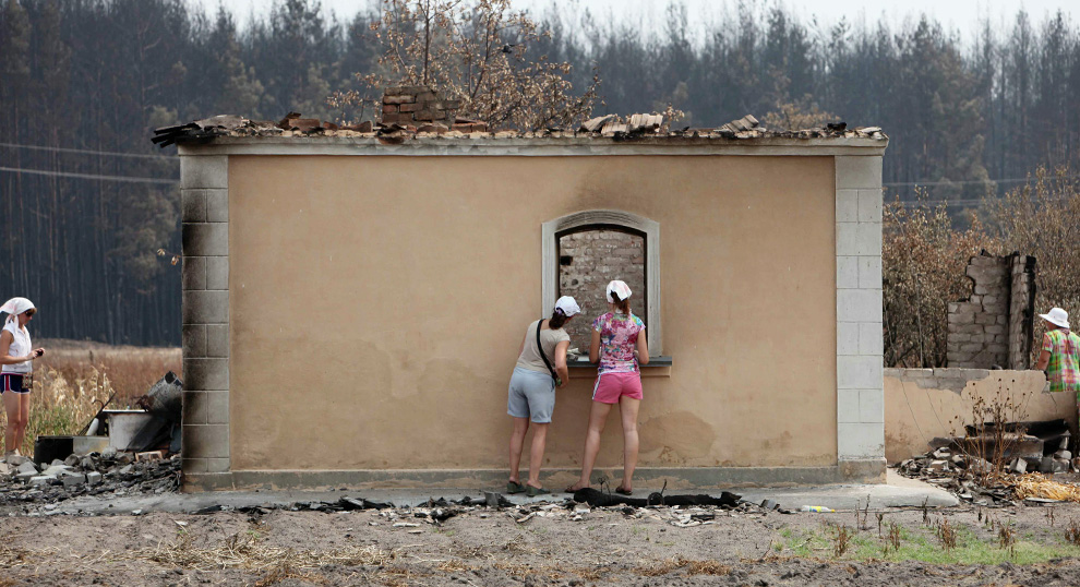
Russian women look inside the charred carcass of a building 450km south of Moscow in Izlegoshche on August 6, 2010. The village of Izlegoshche was completely destroyed by Russia's worst ever wildfires and will not be rebuilt according to an administrative decision. (Alexey SAZONOV/AFP/Getty Images) #
Αποστολή από: Ivan στις Αυγούστου 12, 2010, 23:33:51 μμ
Αποστολή από: stelkon στις Αυγούστου 13, 2010, 13:04:47 μμ
Αποστολή από: Ivan στις Αυγούστου 13, 2010, 23:24:30 μμ
Tο «αυθεντικό» μέτρον άριστον μου φαίνεται κουτσό· το «λανθασμένο» παν μέτρον άριστον ;)μου φαίνεται πολύ πιο ρυθμικό.... :D :)stelkon σε τι αναφέρεσαι???
Αποστολή από: thailandgr στις Αυγούστου 14, 2010, 11:55:41 πμ
Νέες κατολισθήσεις έσπειραν και πάλι τον τρόμο στη Νοτιοδυτική Κίνα. Ήδη αγνοούνται 32 άνθρωποι, ενώ από το έντονο φαινόμενο καταστράφηκαν νοσοκομεία στην περιοχή Βεντσουάν, επίκεντρο του σεισμού που προκάλεσε τον θάνατο 87.000 ανθρώπων τον Μάιο του 2008 στην επαρχία Σιτσουάν.
Η σημερινή θα είναι ημέρα πένθους για τα 1.156 θύματα των κατολισθήσεων στην πόλη Ζουτσού της επαρχίας Γκανσού, όπου οι αγνοούμενοι ανέρχονται σε 588.

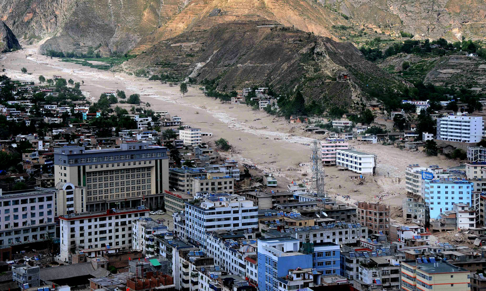
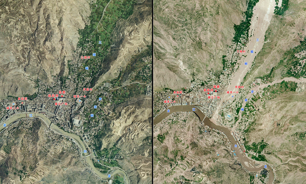
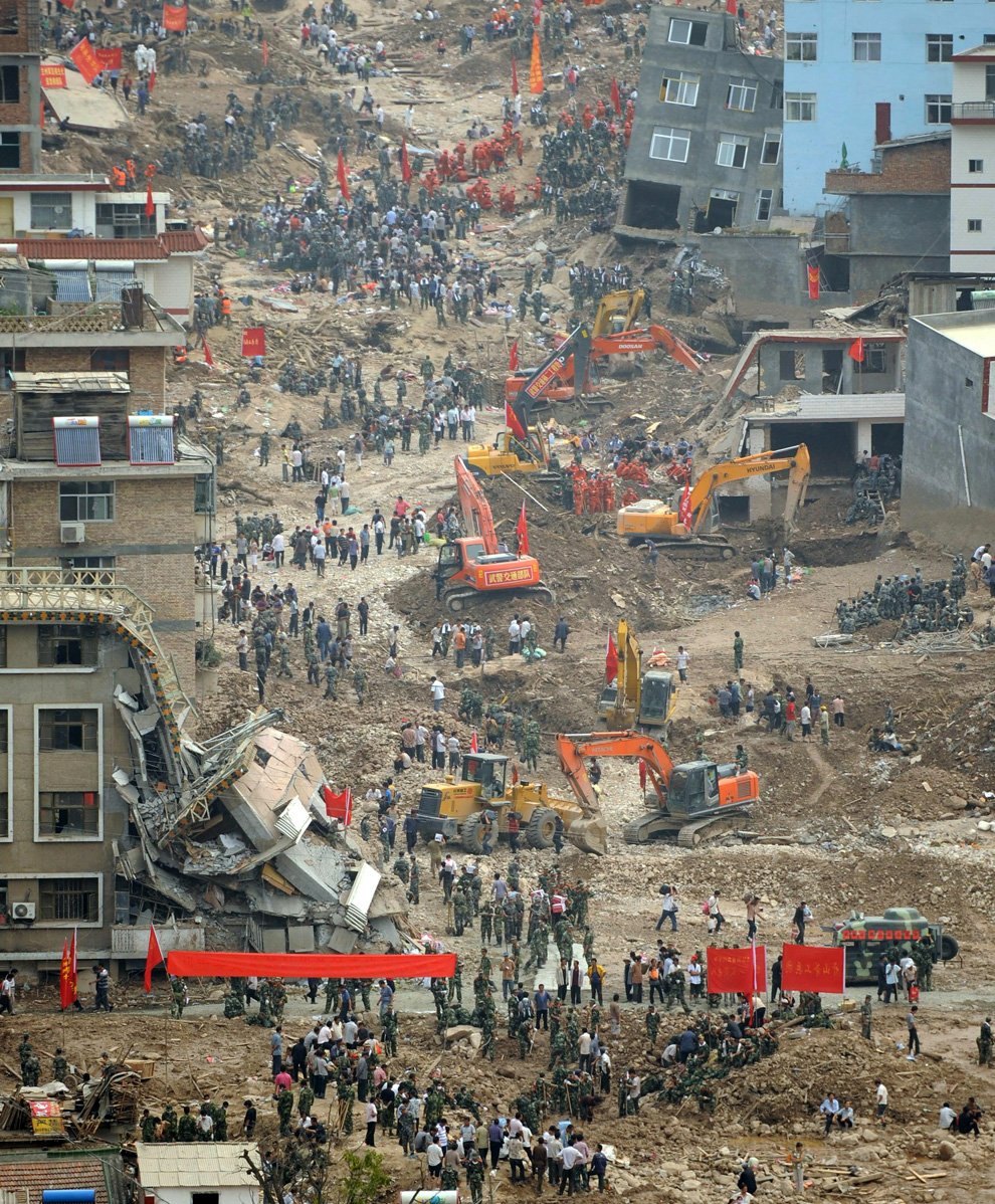
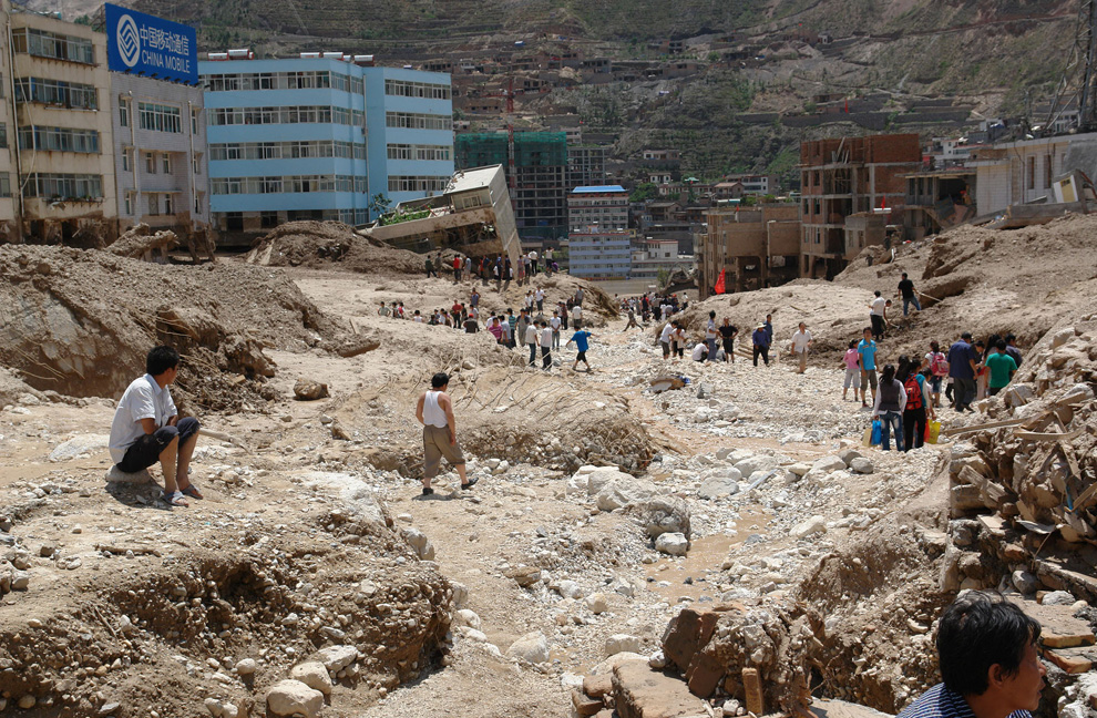
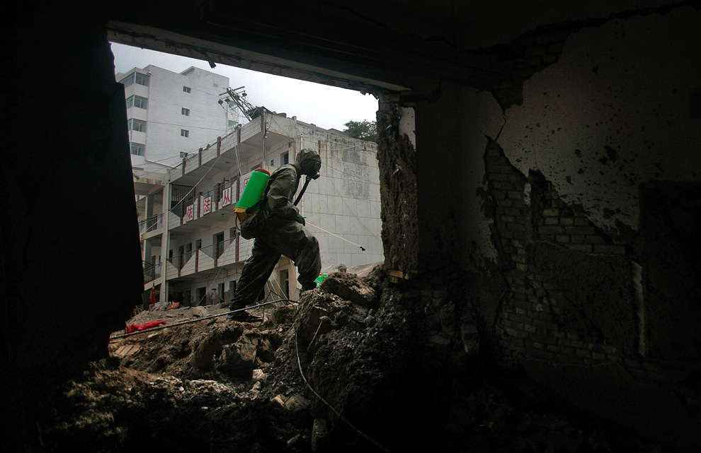
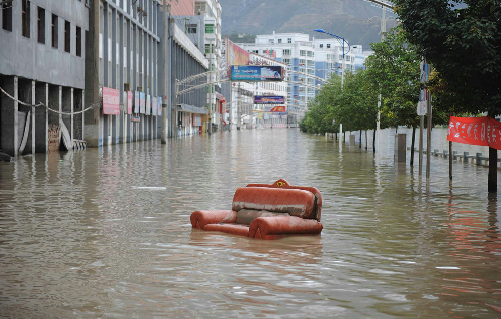
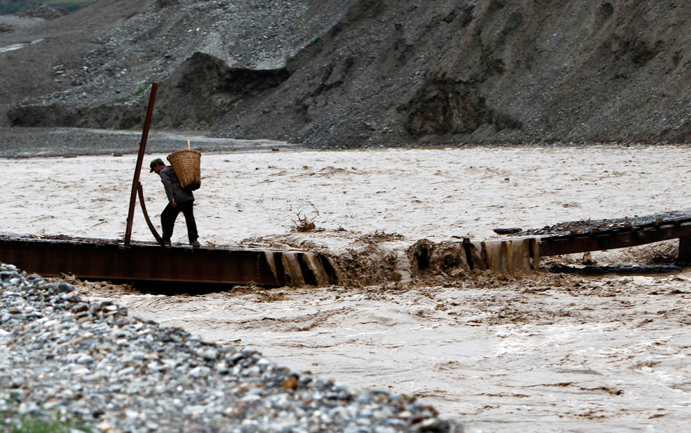
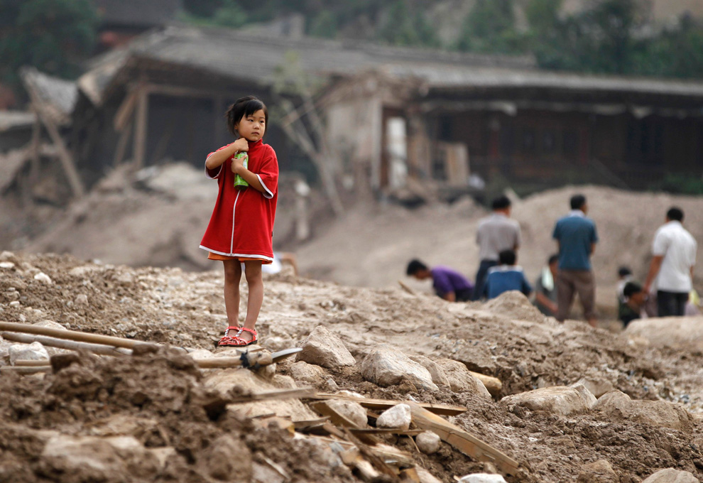
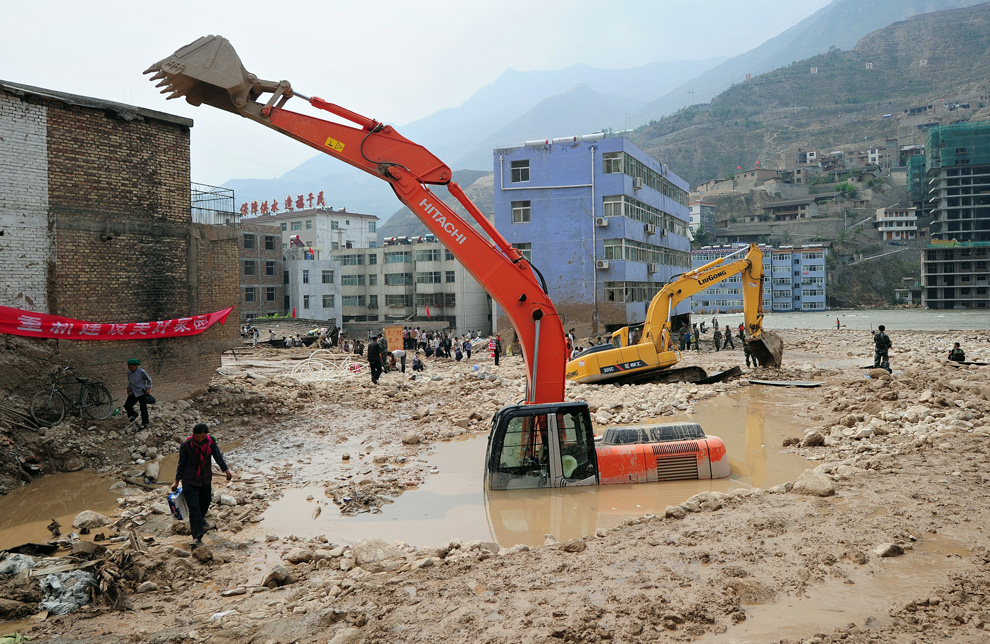
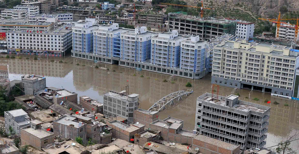
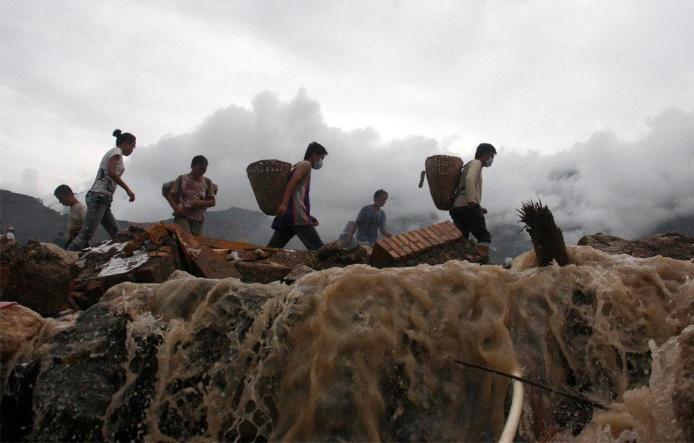
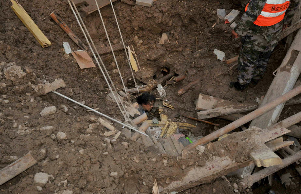
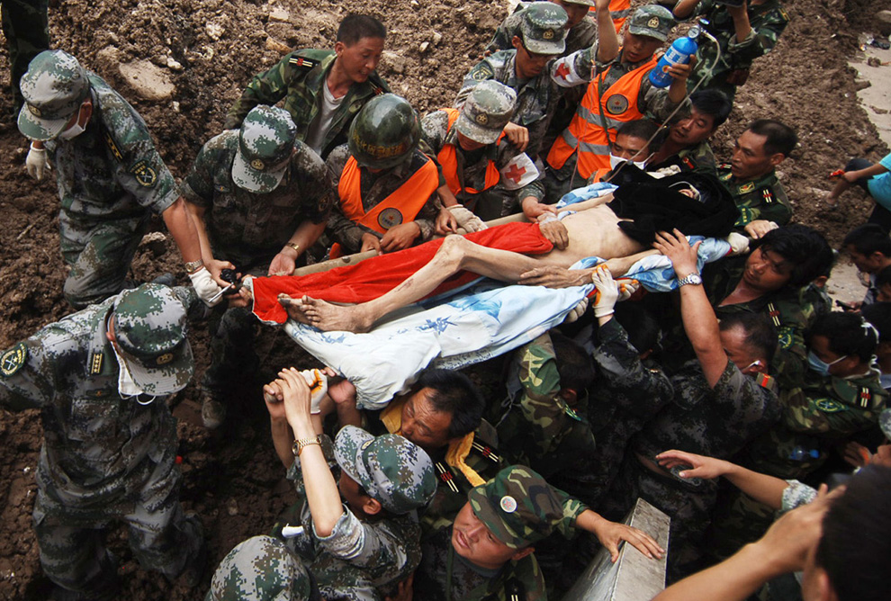
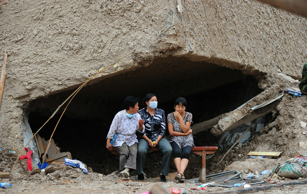
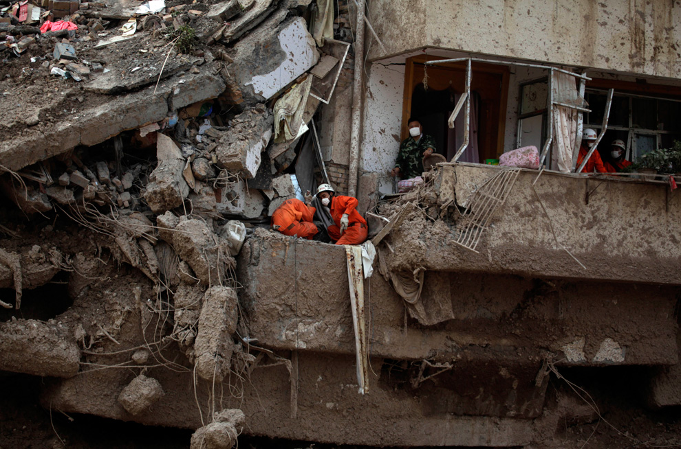
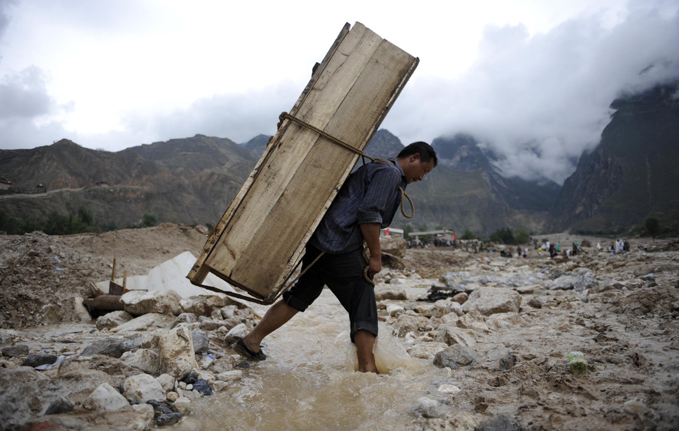
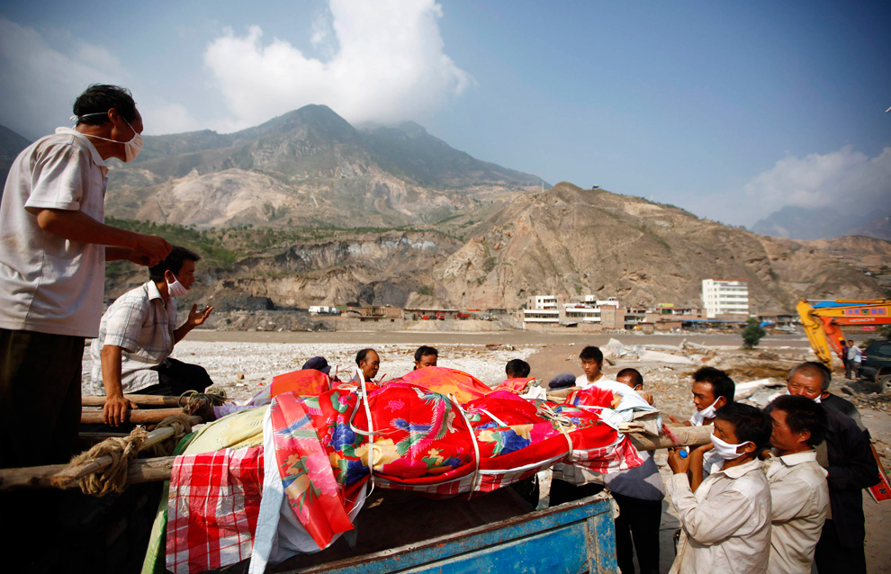
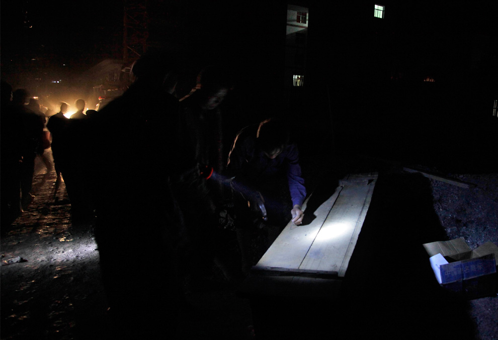
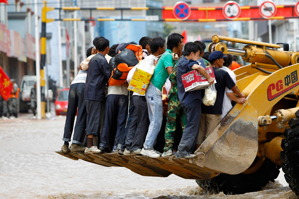
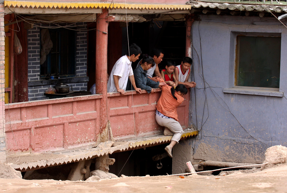
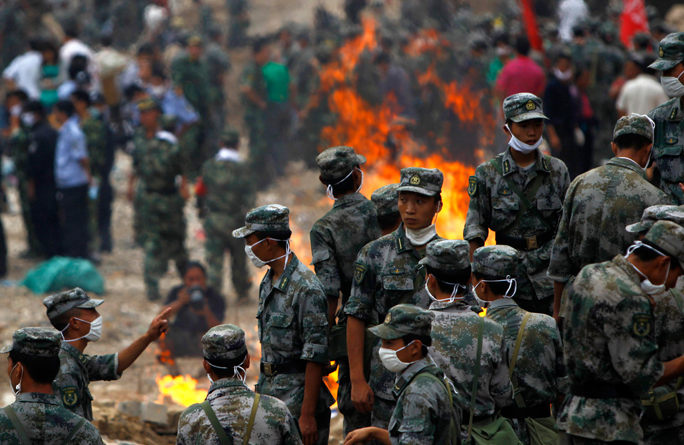
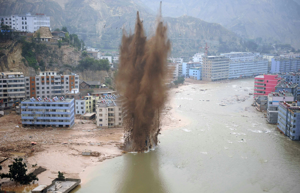
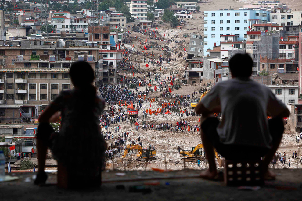
The landslide-hit town of Zhouqu in Gannan Tibetan Autonomous Prefecture, Gansu Province, China on August 9, 2010. Chinese rescuers armed with little more than shovels and hoes hunted for survivors of a huge mudslide, as relatives of the missing trekked into the disaster zone to look for their loved ones. (REUTERS/Aly Song)
Αποστολή από: thailandgr στις Αυγούστου 14, 2010, 11:58:04 πμ

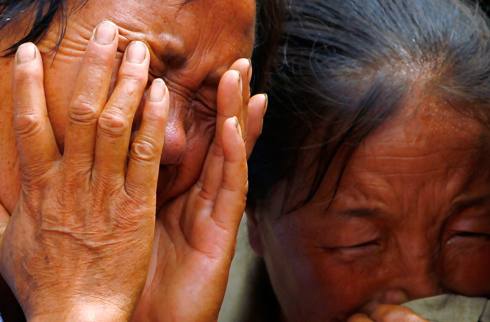
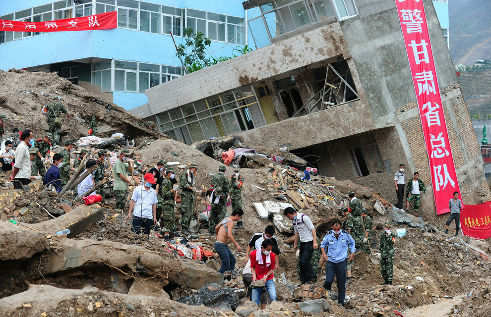
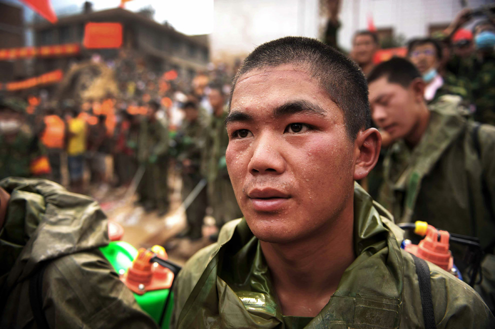
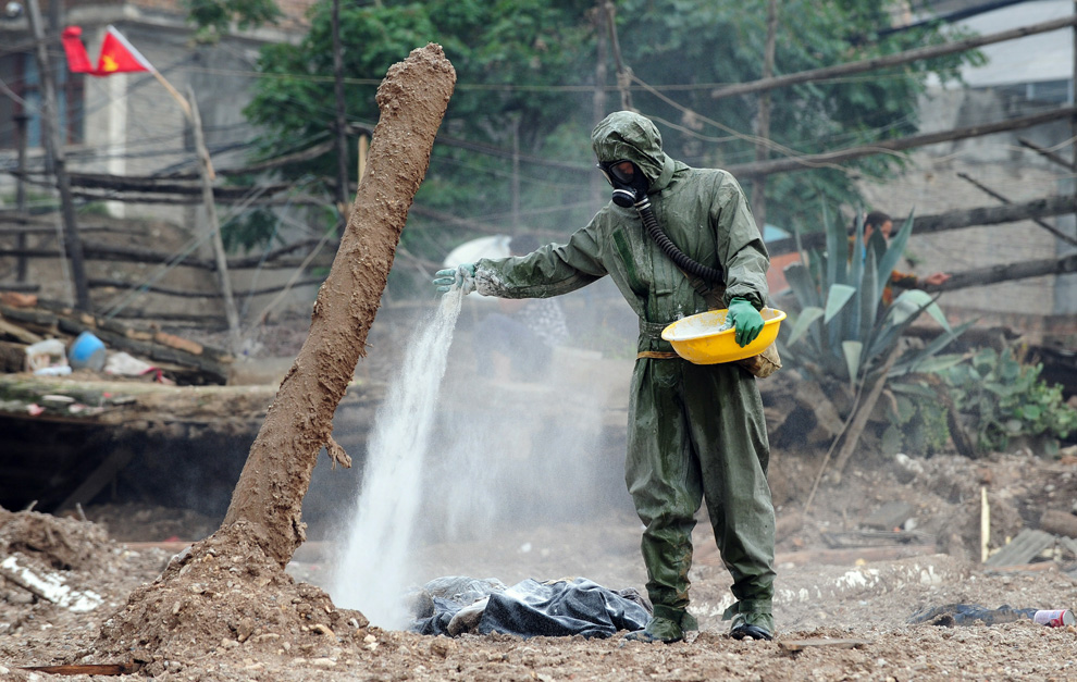
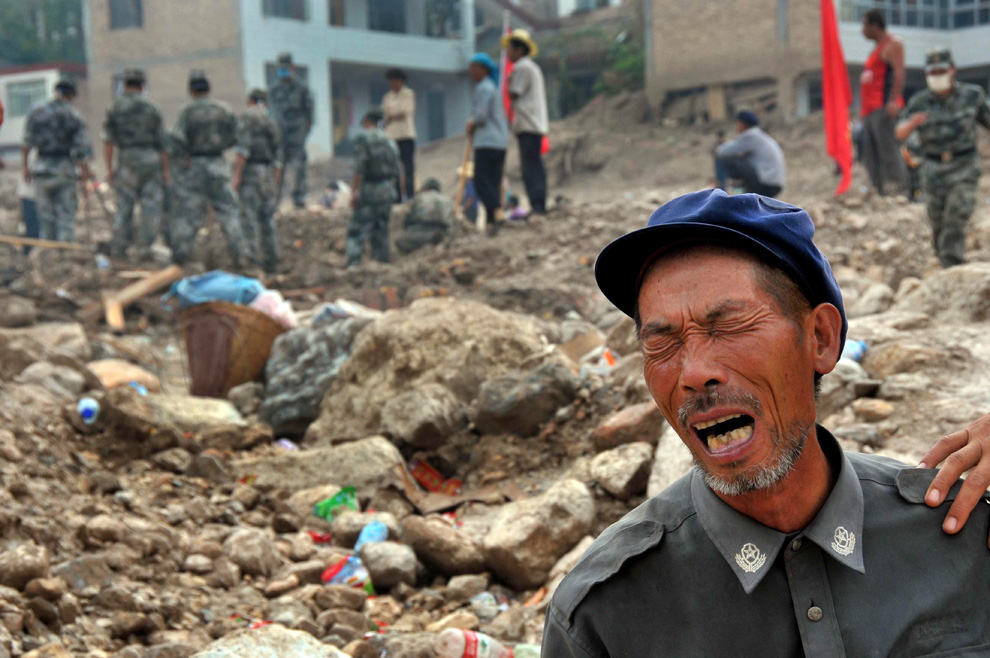
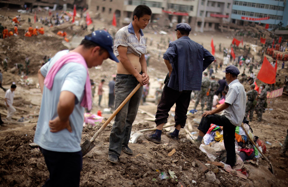
Residents take a break from their efforts to recover bodies after a mudslide swept into the town of Zhouqu in Gannan prefecture, northwestern China on Wednesday, Aug. 11, 2010. (AP Photo/Ng Han Guan) #
-
Τίτλος: Απ: Ηφαιστεια - τυφωνες και φυσικες καταστροφες
Αποστολή από: stelkon στις Αυγούστου 16, 2010, 13:30:59 μμ
-
Αναφέρομαι στο γεγονός ότι ο καθένας μας πρέπει πάντα να έχει υπόψη του ότι ο χώρος που διαθέτει το Σαιντ μας έχει κάποια χωρητικότητα, άρα με μέτρο πρέπει να την καλύπτουμε δεν νομίζω ότι είναι απαραίτητες τόσες φωτογραφίες από γεγονότα ουσιαστικά άσχετα με το περιεχόμενο του φόρουμ μας καθόσον κάλλιστα μπορούμε να παραθέτουμε τα λινγ όπου υπάρχουν οι σχετικές φωτογραφίες για όσους ενδιαφέρονται.
Συμπερασματικά ναι στην πληροφορία όχι στην κατασπατάληση του χώρου που διαθέτη το Σαιντ μας.. :)
-
Τίτλος: Απ: Ηφαιστεια - τυφωνες και φυσικες καταστροφες
Αποστολή από: administrator στις Αυγούστου 16, 2010, 20:16:17 μμ
-
Πληροφοριακά αναφερω οτι ολες οι φωτογραφίες ειναι ανεβασμένες σε αλλο site φιλοξενίας φωτογραφιών , αρα ΔΕΝ ΚΑΤΑΛΑΜΒΑΝΟΥΝ ΧΩΡΟ .
Εαν εχετε καταλαβει το site μας ΔΕΝ παρεχει την δυνατοτητα να ανεβασεις και φιλοξενήσεις σε αυτο καποια φωτογραφία !
Ευχαριστω για το ενδιαφερον , αλλα να ξερετε οτι εχει γνωση ο admin
-
Τίτλος: Απ: Ηφαιστεια - τυφωνες και φυσικες καταστροφες
Αποστολή από: Ivan στις Αυγούστου 17, 2010, 00:57:38 πμ
-
Αυτό είναι πολύ θετικό!!! και έτσι ο "ανταποκριτής και εμπριστής" ,thailandgr μπορεί να συνεχίσει το πολύ καλό του ρεπορτάζ!!!!
-
Τίτλος: Απ: Ηφαιστεια - τυφωνες και φυσικες καταστροφες
Αποστολή από: thailandgr στις Αυγούστου 19, 2010, 09:20:55 πμ
-
Κολπος του μεξικου .......
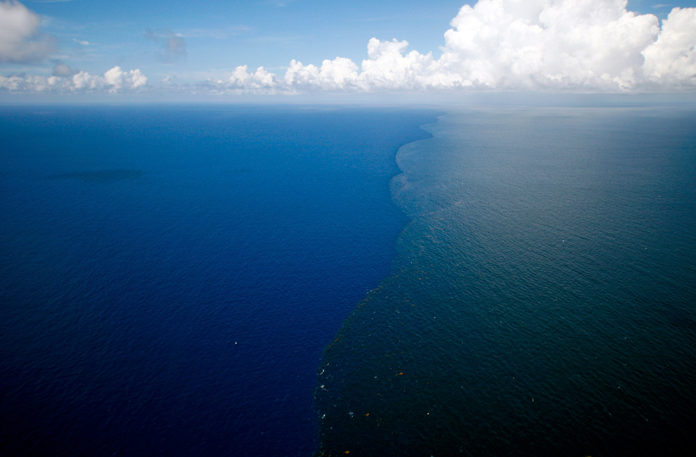
Από τις 20 Απρίλιου μεχρι και τις 15 Ιούλη 2010, μια γενικά αποδεκτή εκτίμηση ειναι οτι περίπου 5 εκατομμύρια βαρέλια (200 εκατομμύρια γαλόνια) αργού πετρελαίου διεφυγαν από το φρεατιο γεωτρησης στον θαλάσσιο πυθμένα από την Κόκκινη εξέδρα γεώτρησης πετρελαίου Horizon της ΒΡ.



-
Τίτλος: Απ: Ηφαιστεια - τυφωνες και φυσικες καταστροφες
Αποστολή από: thailandgr στις Αυγούστου 19, 2010, 09:21:29 πμ
-






Αποστολή από: stelkon στις Αυγούστου 16, 2010, 13:30:59 μμ
Tο «αυθεντικό» μέτρον άριστον μου φαίνεται κουτσό· το «λανθασμένο» παν μέτρον άριστον ;)μου φαίνεται πολύ πιο ρυθμικό.... :D :)stelkon σε τι αναφέρεσαι???
Αναφέρομαι στο γεγονός ότι ο καθένας μας πρέπει πάντα να έχει υπόψη του ότι ο χώρος που διαθέτει το Σαιντ μας έχει κάποια χωρητικότητα, άρα με μέτρο πρέπει να την καλύπτουμε δεν νομίζω ότι είναι απαραίτητες τόσες φωτογραφίες από γεγονότα ουσιαστικά άσχετα με το περιεχόμενο του φόρουμ μας καθόσον κάλλιστα μπορούμε να παραθέτουμε τα λινγ όπου υπάρχουν οι σχετικές φωτογραφίες για όσους ενδιαφέρονται.
Συμπερασματικά ναι στην πληροφορία όχι στην κατασπατάληση του χώρου που διαθέτη το Σαιντ μας.. :)
Αποστολή από: administrator στις Αυγούστου 16, 2010, 20:16:17 μμ
ότι ο χώρος που διαθέτει το Σαιντ μας έχει κάποια χωρητικότητα, άρα με μέτρο πρέπει να την καλύπτουμε ........
Συμπερασματικά ναι στην πληροφορία όχι στην κατασπατάληση του χώρου που διαθέτη το Σαιντ μας.. :)
Πληροφοριακά αναφερω οτι ολες οι φωτογραφίες ειναι ανεβασμένες σε αλλο site φιλοξενίας φωτογραφιών , αρα ΔΕΝ ΚΑΤΑΛΑΜΒΑΝΟΥΝ ΧΩΡΟ .
Εαν εχετε καταλαβει το site μας ΔΕΝ παρεχει την δυνατοτητα να ανεβασεις και φιλοξενήσεις σε αυτο καποια φωτογραφία !
Ευχαριστω για το ενδιαφερον , αλλα να ξερετε οτι εχει γνωση ο admin
Αποστολή από: Ivan στις Αυγούστου 17, 2010, 00:57:38 πμ
Αποστολή από: thailandgr στις Αυγούστου 19, 2010, 09:20:55 πμ
Από τις 20 Απρίλιου μεχρι και τις 15 Ιούλη 2010, μια γενικά αποδεκτή εκτίμηση ειναι οτι περίπου 5 εκατομμύρια βαρέλια (200 εκατομμύρια γαλόνια) αργού πετρελαίου διεφυγαν από το φρεατιο γεωτρησης στον θαλάσσιο πυθμένα από την Κόκκινη εξέδρα γεώτρησης πετρελαίου Horizon της ΒΡ.

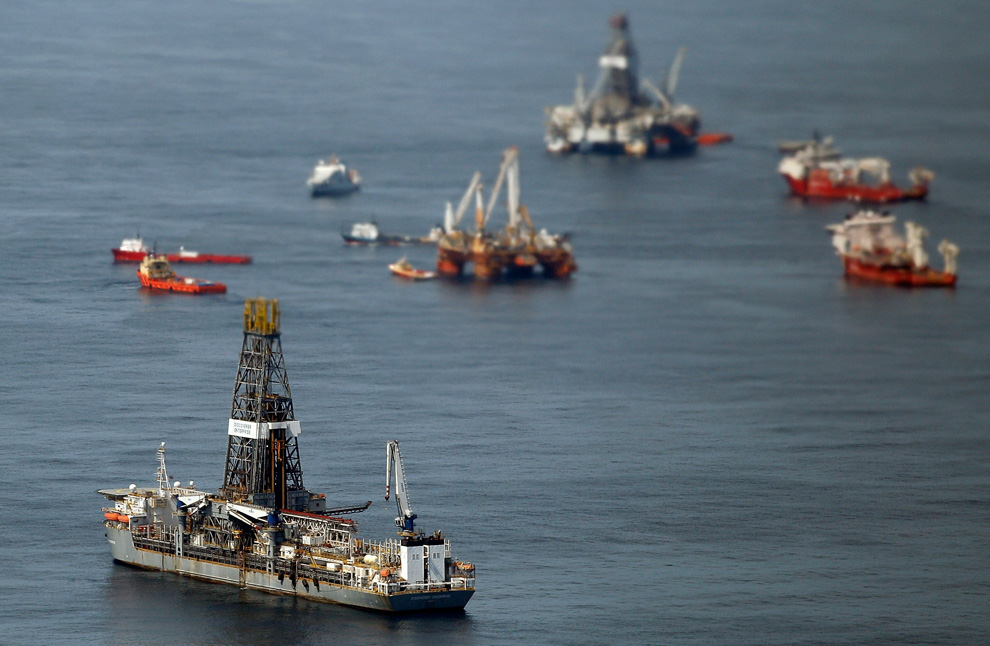
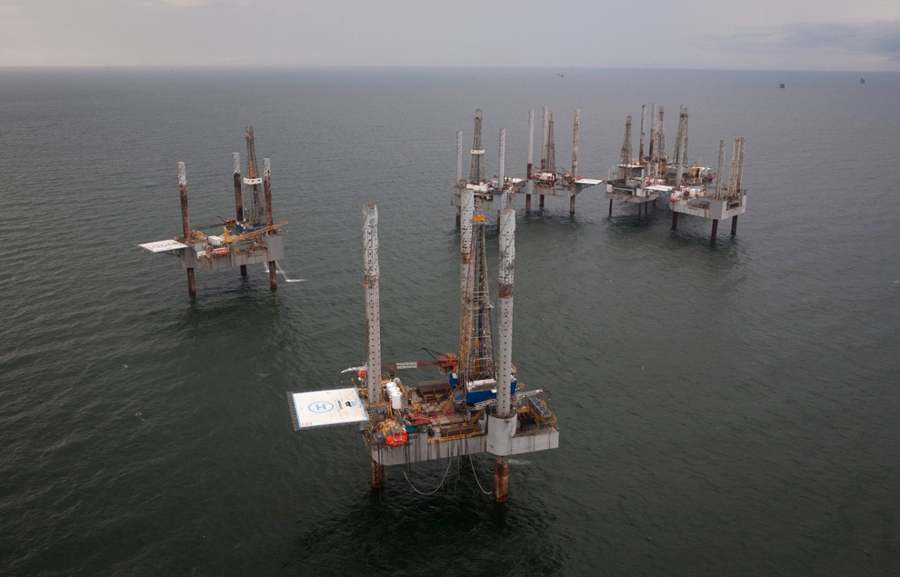
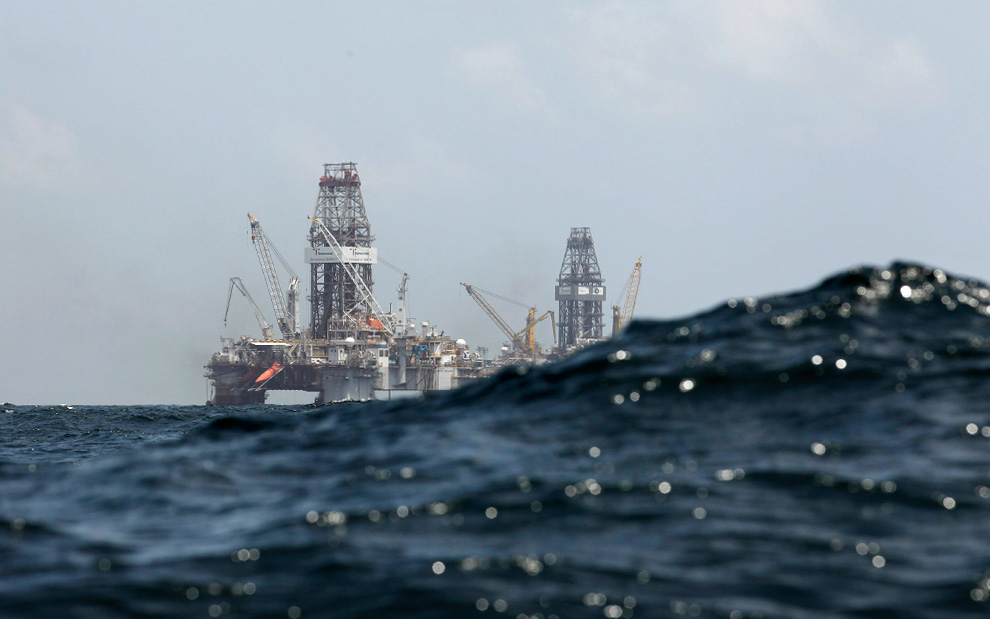
Waves partially obscure the Development Driller II at left, and the Development Driller III, which are drilling the relief wells, at the Deepwater Horizon oil spill site in the Gulf of Mexico off the Louisiana coast on Thursday, July 22, 2010. (AP Photo/Gerald Herbert)

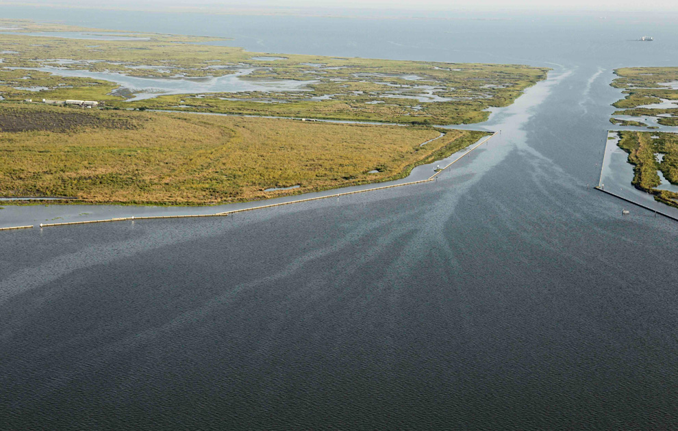
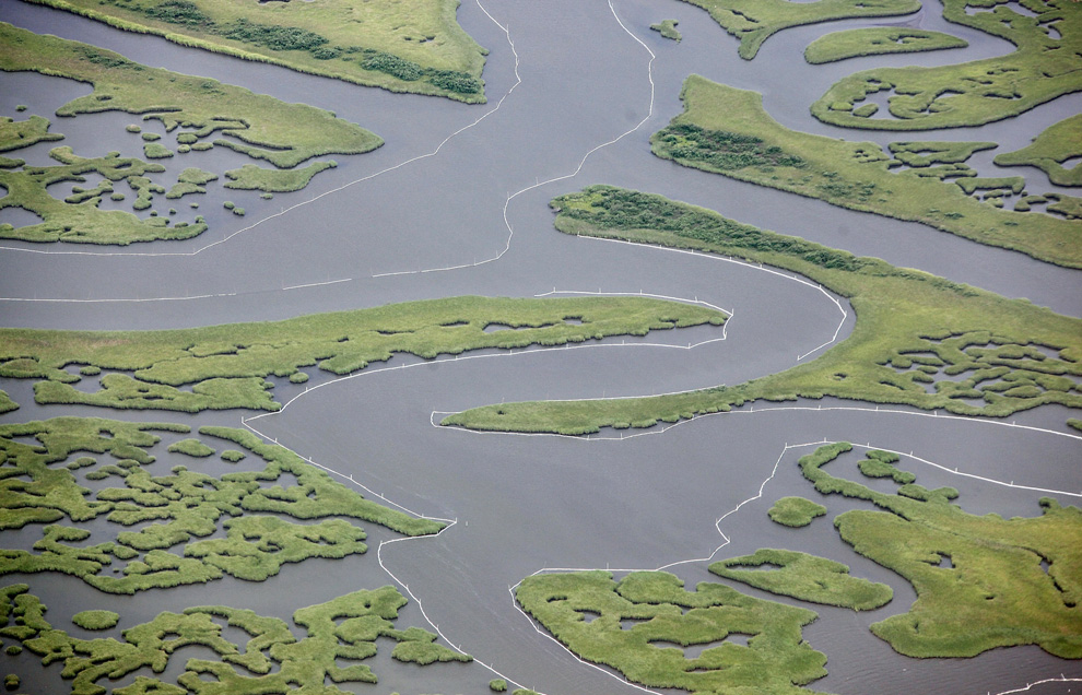
New marsh grass is seen in an area that had been impacted by the oil from the Deepwater Horizon oil spill near East Grand Terre Island on August 10, 2010. This bay that was the scene of some of the first startling images of oil-caked birds already has shoots of marsh grass and mangroves growing back. (AP Photo/Gerald Herbert) #

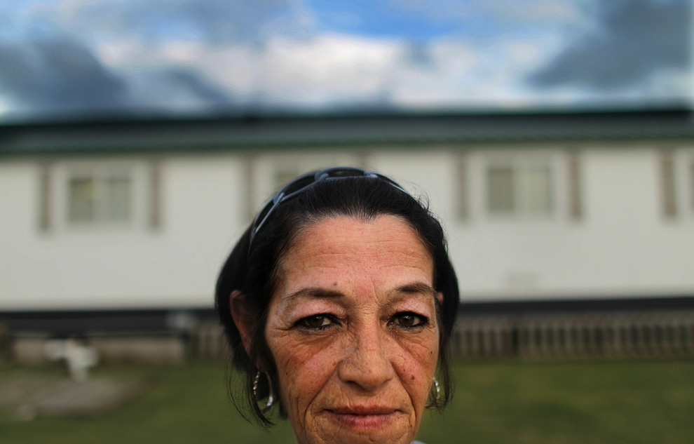
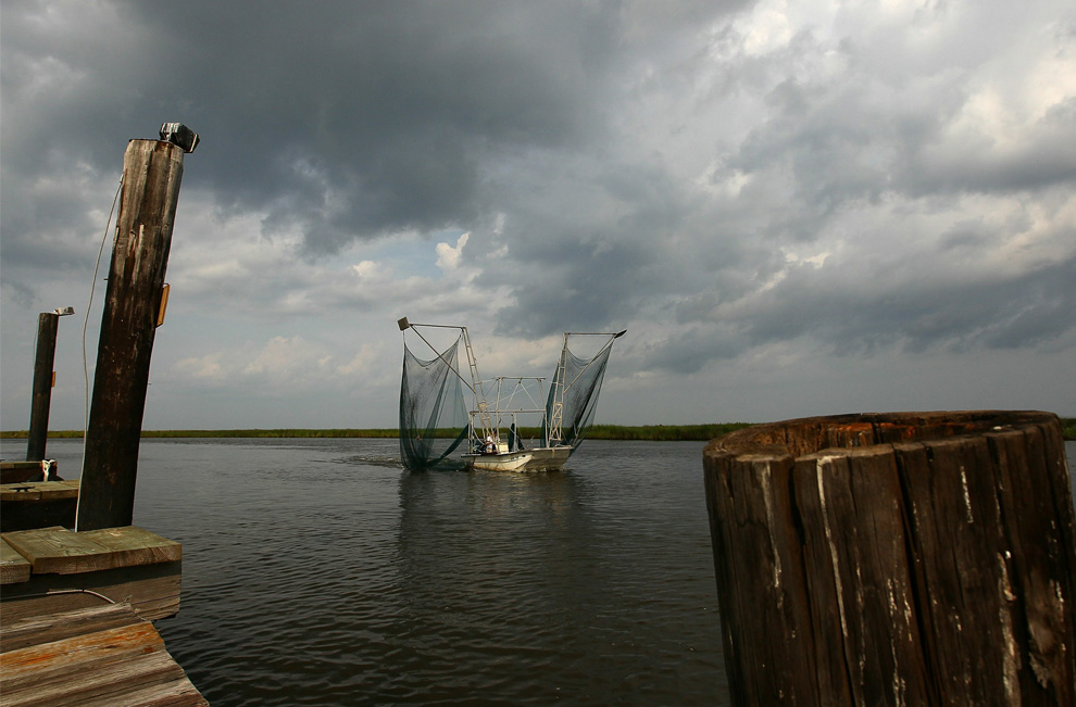
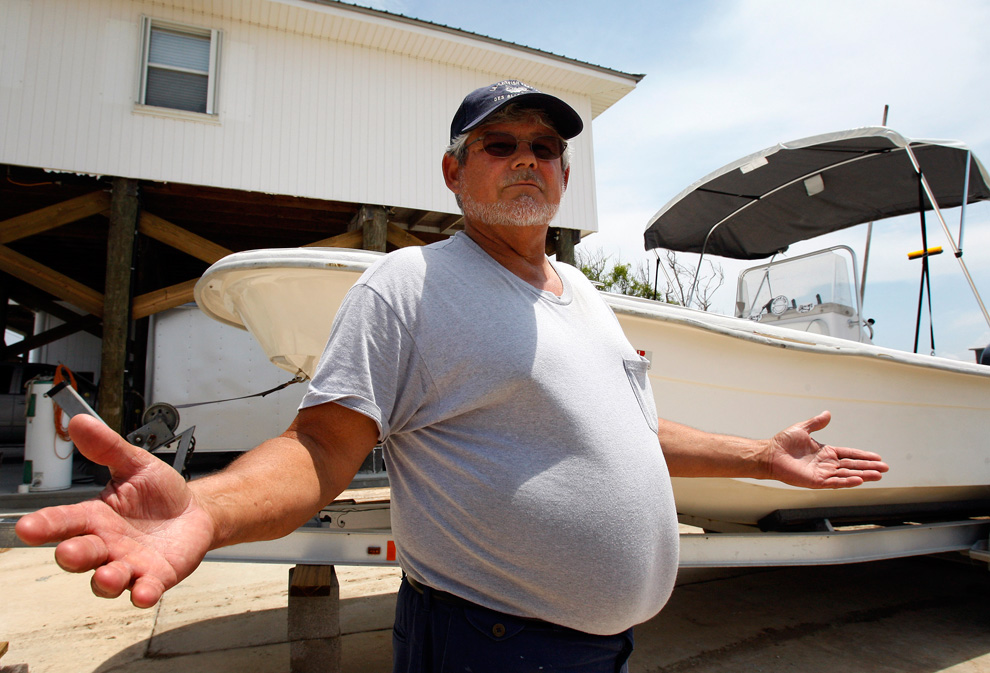
Commercial fisherman Harry Cheramie speaks in front of a boat he uses to shuttle to and from his shrimp boat, which his son and grandson are operating in the Vessels of Opportunity oil skimming program, in Grand Isle, Louisiana, Wednesday, Aug. 4, 2010. Despite word that BP PLC had successfully plugged the Deepwater Horizon well and that the amount of oil left in the Gulf of Mexico was far less than expected, Cheramie was skeptical that the worst had passed. (AP Photo/Patrick Semansky) #

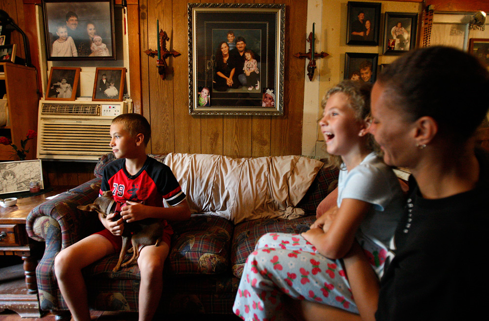
Austin Verdin, 11, left, sits in his family's living room with his sister Sabre, 5, and his mother Elana in Galliano, Louisiana on August 5, 2010. Austin and Sabre's father worked as a fisherman until local waters were closed because of the oil spill. He fell back on his commercial driver's license and took a job with a trucking firm, which keeps him away from home more often. (AP Photo/Patrick Semansky) #

Small oil droplets are visible trapped inside the shell of an immature blue crab collected near Grand Isle, Louisiana by researchers from the University of Southern Mississippi and Tulane University. Researchers wondering how badly the Gulf of Mexico will suffer from the oil spill are paying close attention to the blue crab. Photo provided by University of Southern Mississippi and Tulane University Gulf Coast Research Laboratory. (AP Photo/USM Gulf Coast Research Laboratory) #

Oceaneering supervisor Tim Weiss demonstrates controls for a remotely operated underwater vehicle, or ROV, as a screen displays a video of ROV operations at the Deepwater Horizon oil well leak site onboard the Ocean Intervention III vessel in Port Fourchon, Louisiana on Thursday, July 22, 2010. (AP Photo/Patrick Semansky) #
Αποστολή από: thailandgr στις Αυγούστου 19, 2010, 09:21:29 πμ

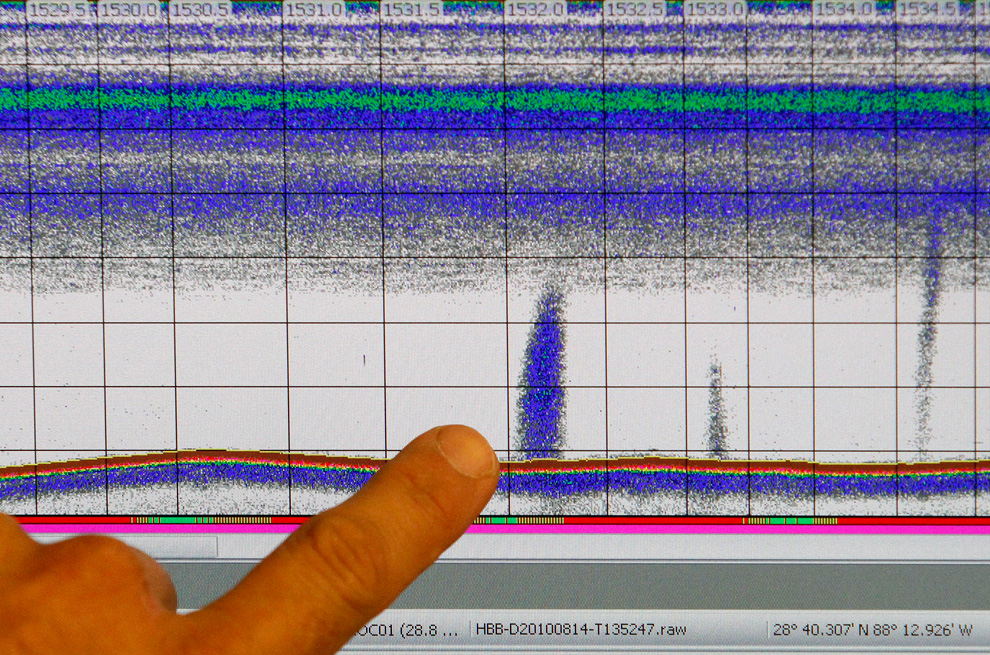
Research Fisheries Biologist Mike Jech points to an acoustic monitoring chart that shows possible areas of oil or gas seepage coming from the floor of the Gulf of Mexico while onboard the National Oceanic and Atmospheric Administration research vessel Henry B. Bigelow near the coast of Louisiana, Saturday, Aug. 14, 2010. The vessel is operating near the site of the Deepwater Horizon oil wellhead to help monitor oil and gas seepage on the seafloor as well as to collect subsurface water samples for analysis onshore. (AP Photo/Patrick Semansky) #

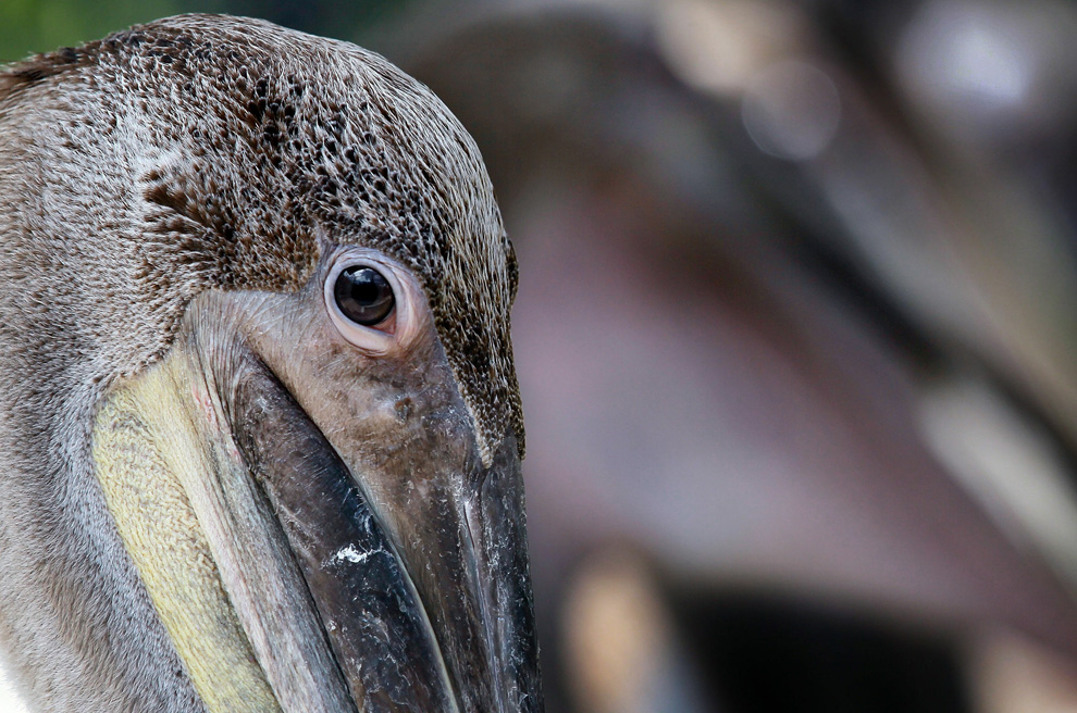
Brown Pelicans are seen at the Pelican Harbor Seabird Station as the center prepares to transfer the birds after they were rehabilitated from the oil spill in the Gulf of Mexico on August 4, 2010 in North Bay Village, Florida. The 45 birds that were brought to the center at the beginning of July were scheduled to be transferred back to the coast of Louisiana the following day to be released into the wild. (Joe Raedle/Getty Images) #

Research chemist Daryle Boyd holds a seafood sample from the Gulf of Mexico as tests are conducted on seafood at the NOAA facility in Seattle, on Thursday, Aug. 12, 2010. Seafood from the Gulf of Mexico is being put under the microscope like no other kind on the market, with fish, shrimp and other catches ground up to hunt for minute traces of oil. (AP Photo/Kevin P. Casey) #

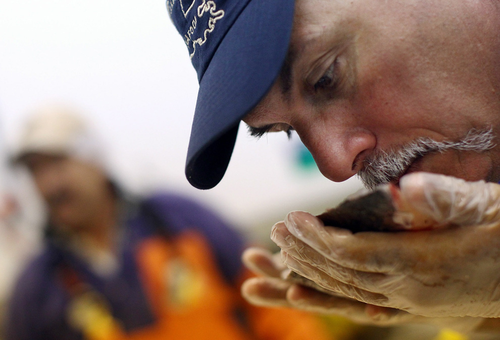
Gary Lopinto, a commercial seafood inspector for the Louisiana Department of Health and Hospitals, sniffs a fillet of drum fish for oil contamination at Inland Seafood August 17, 2010 in New Orleans, Louisiana. Seafood captured in Louisiana waters is randomly checked, both by sense of smell and chemical testing, on a regular basis following the massive oil spill into the Gulf of Mexico. (Win McNamee/Getty Images) #

Sunrise over the Deepwater Horizon site in the Gulf of Mexico on July 11, 2010. (© David Boudreaux) #

People attend the Rally for Economic Survival at the Cajundome on July 21, 2010 in Lafayette, Louisiana. Thousands attended the rally opposing the federal moratorium on deep water drilling which was organized by the Greater Lafayette Chamber of Commerce and the Louisiana Oil and Gas Association. (Mario Tama/Getty Images) #

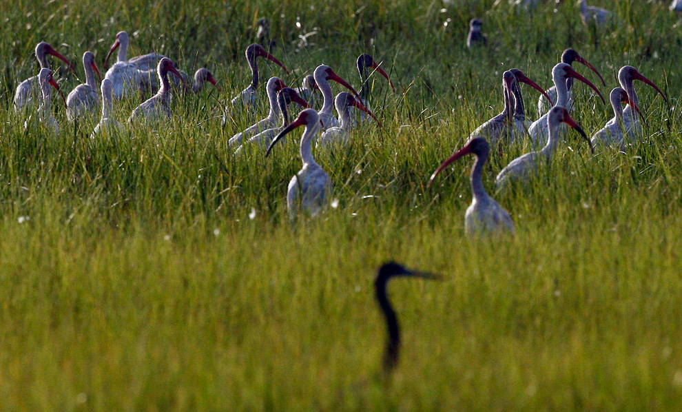
A flock of white ibis stands in marsh grass on Dry Bread Island in St. Bernard Parish, Louisiana on Wednesday, July 21, 2010. Days earlier, crews found about 130 dead birds and 15 live birds affected by oil from the Deepwater Horizon oil spill on in the eastern part of the parish behind the Chandeleur Islands. (AP Photo/Patrick Semansky) #

Michael Adkesson, right, associate veterinarian for the Chicago Zoological Society, oversees an American white pelican being anesthetized by Michael O'Neill and Denise Young, senior keepers/Veterinary Services, as they prepare the bird for a physical examination at Brookfield Zoo's Animal Hospital Wednesday, July 21, 2010, in Brookfield, Illinois. The bird, along with four other pelicans, was rescued from the Gulf Coast oil spill. They arrived at Brookfield Zoo on July 18 and following a 30-day quarantine period will be placed on permanent exhibit at the zoo's Formal Pool. (AP Photo/Chicago Zoological Society, Jim Schulz) #

Rhonda Murgatroyd, with Wildlife Response Services and Brian Bauer, BP's incident commander for Louisiana, watch as a gulls are released on Eugene Island, Louisiana on Tuesday, Aug. 10, 2010. The birds were once impacted by oil and cleaned at the Hammond Rehabilitation Center. (AP Photo/The Houma Daily Courier, Matt Stamey) #

U.S. President Barack Obama and his daughter Sasha swim at Alligator Point in Panama City Beach, Florida, August 14, 2010. Declaring Gulf Coast beaches "open for business," Obama visited Florida on Saturday and pledged to restore the economy and the environment of the region damaged by the BP Plc oil spill. Obama, on his fifth visit to the region since BP's deep-sea well in the Gulf of Mexico ruptured on April 20, held talks with local business owners to hear their concerns about the impact of the world's worst offshore oil spill. (REUTERS/Pete Souza/White House) #

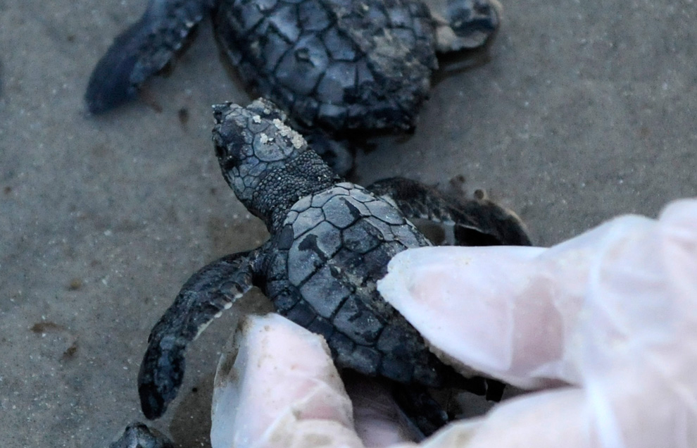
A volunteer holds a Kemp's Ridley's turtle hatchling before releasing it into the Gulf of Mexico on Monday, July 26, 2010 at Padre Island National Seashore, Texas. Hundreds of endangered baby sea turtles embarked on a new life in the Gulf of Mexico on Monday with federal biologists hoping that by the time the tiny critters get as far east as the BP spill, the toxic oil will largely be gone. (AP Photo/Pat Sullivan) #

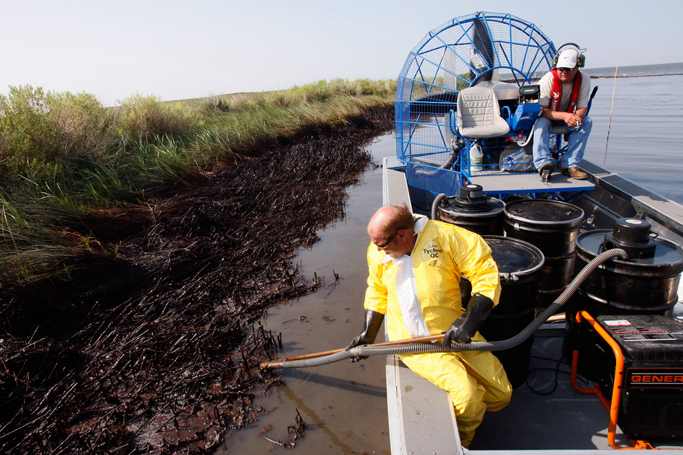
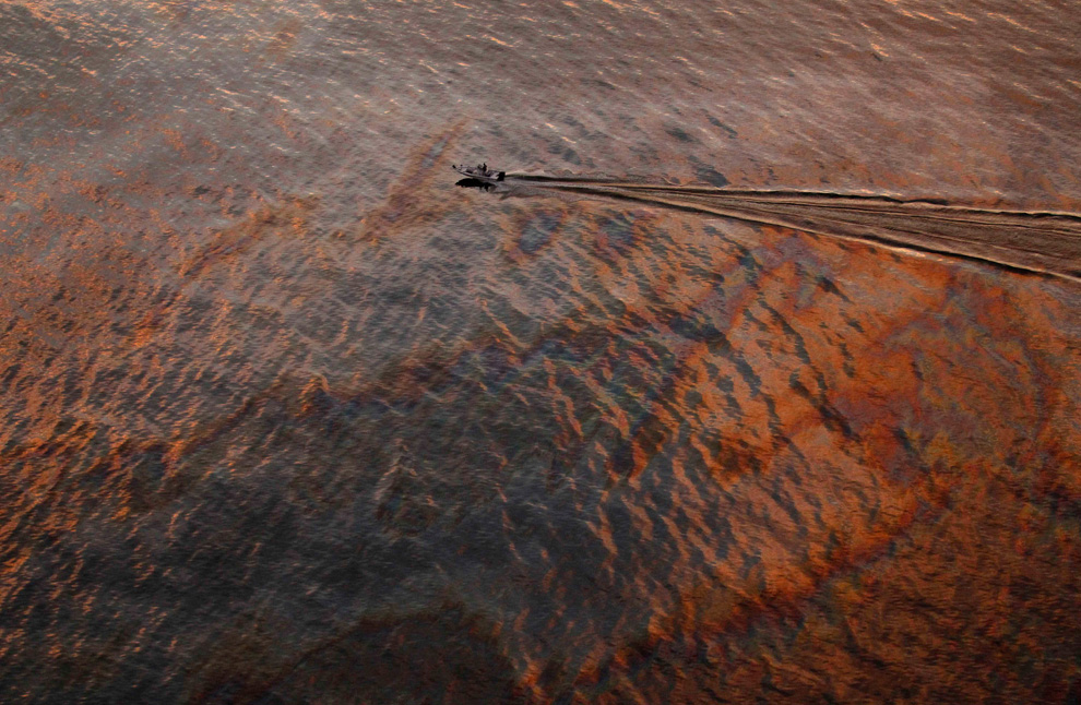
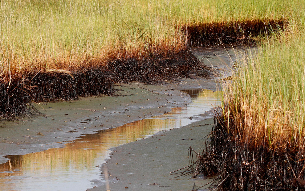
A ribbon of oil lines marsh grass at low tide in a cove in Barataria Bay on the coast of Louisiana, Saturday, July 31, 2010. As the National Oceanic and Atmospheric Administration reports that most surface oil in the Gulf of Mexico has degraded to a thin sheen and the incoming BP PLC CEO calls for a "scaleback" in cleanup efforts, local officials on the Louisiana coast say they are still finding new patches of heavy oil. (AP Photo/Patrick Semansky) #

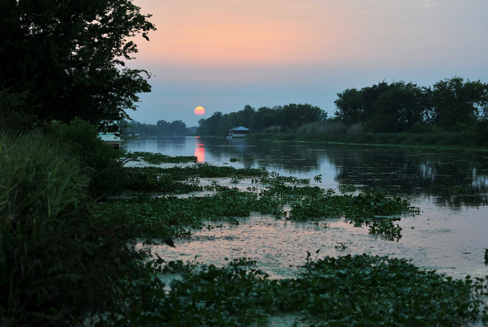
The sun sets over a bayou near Larose, Louisiana, on July 24, 2010, as tropical storm Bonnie roils towards land. (Alex Ogle/AFP/Getty Images) #
-
Τίτλος: Απ: Ηφαιστεια - τυφωνες και φυσικες καταστροφες
Αποστολή από: thailandgr στις Αυγούστου 30, 2010, 09:43:39 πμ
-
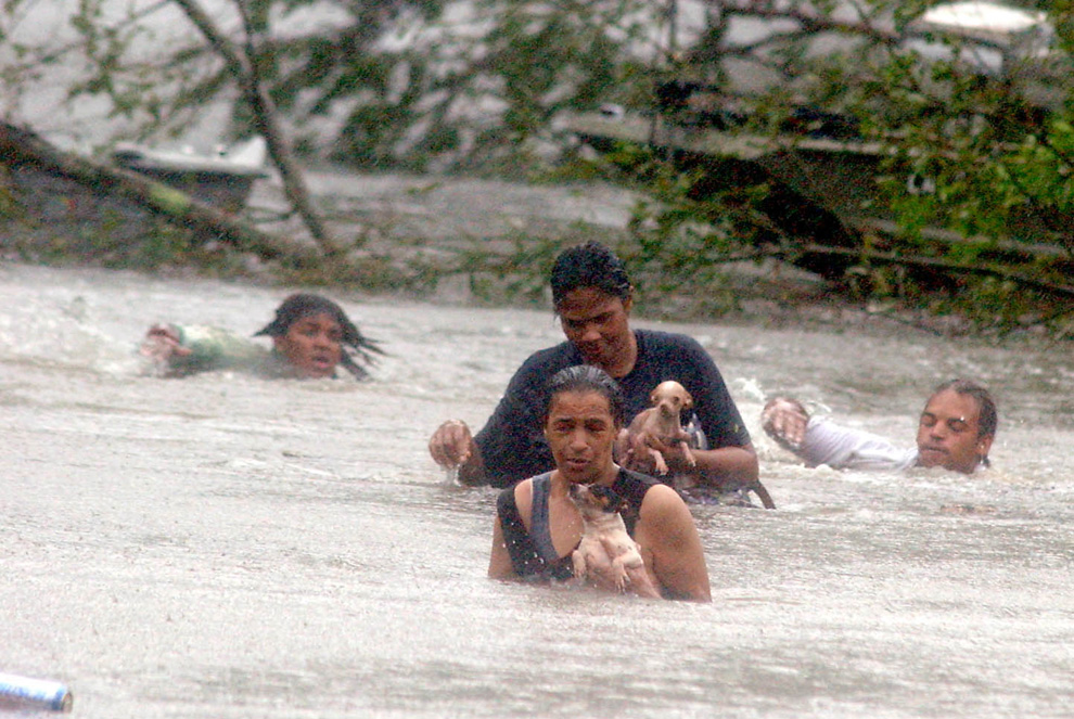
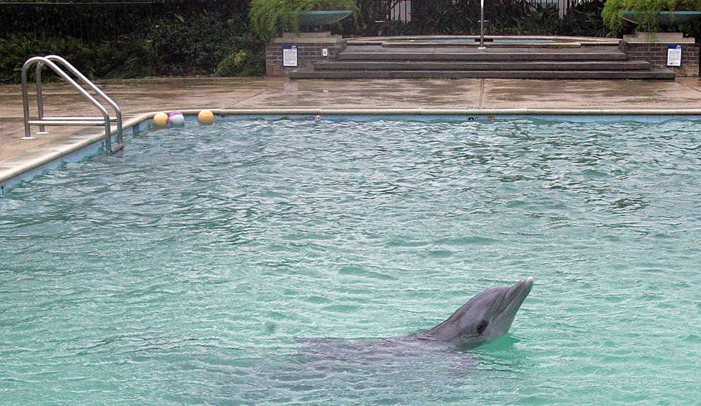
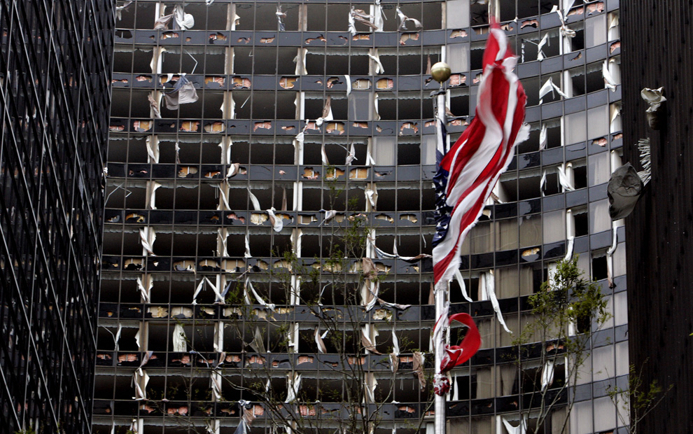
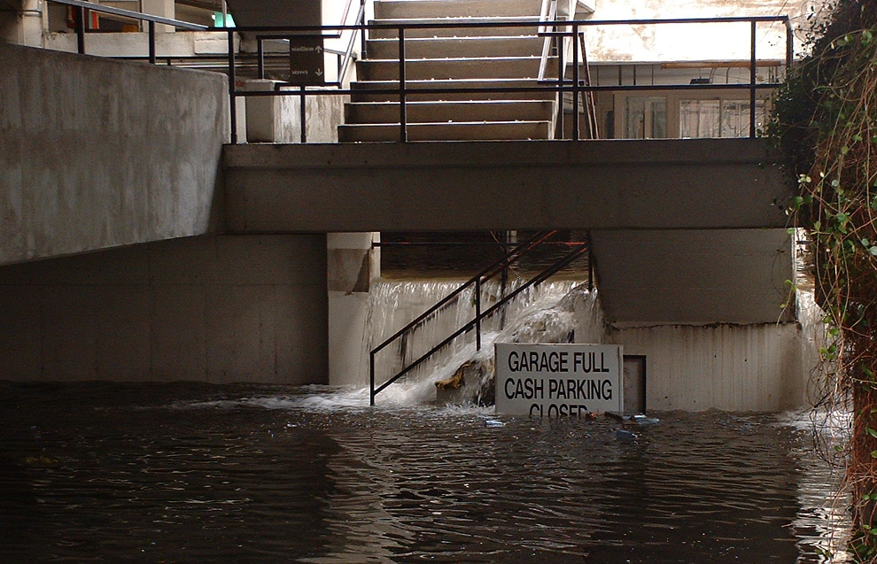
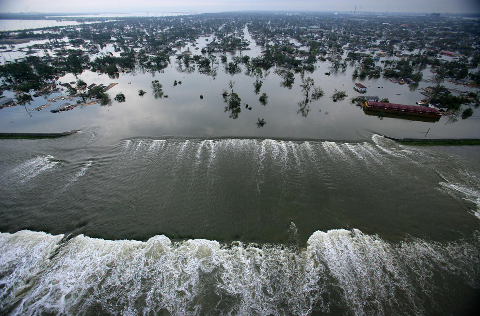
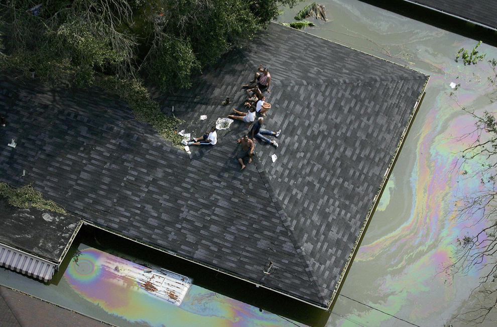
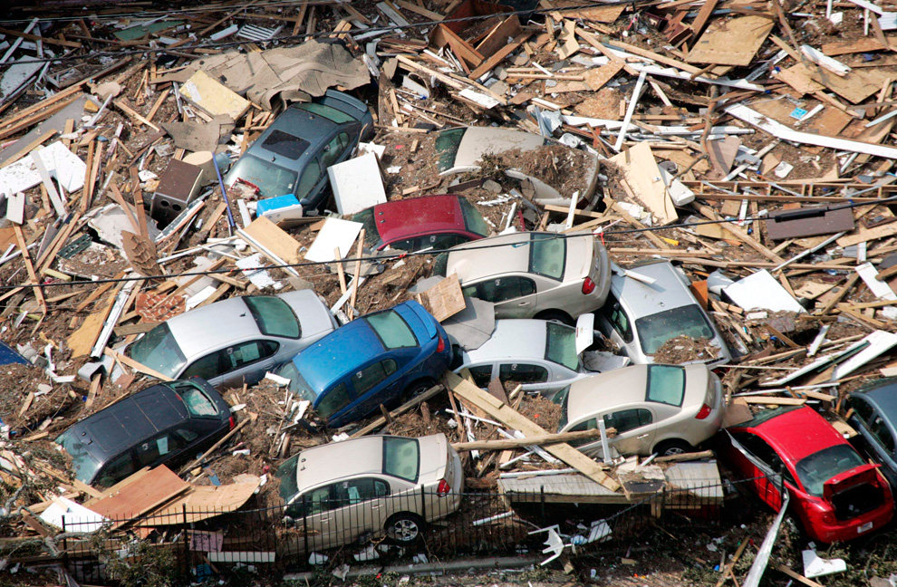
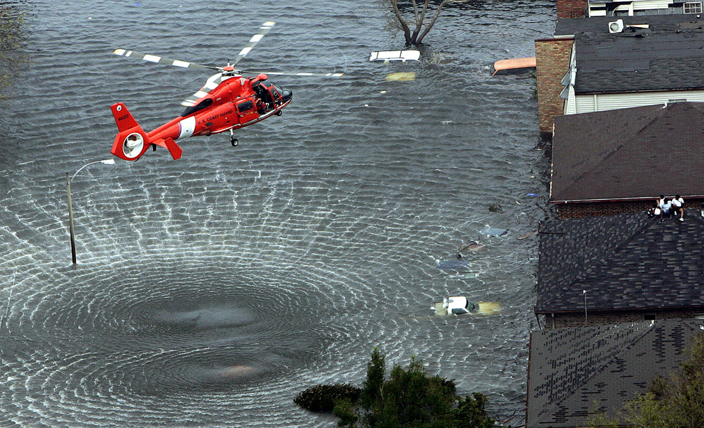
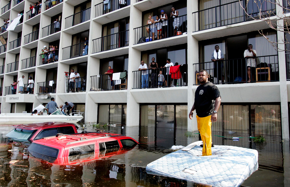
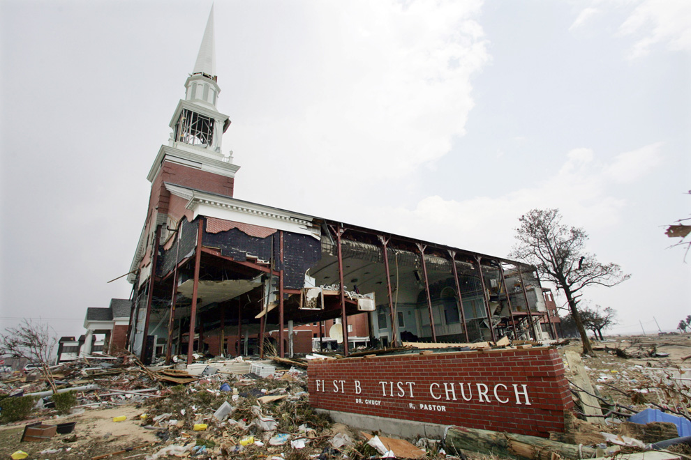
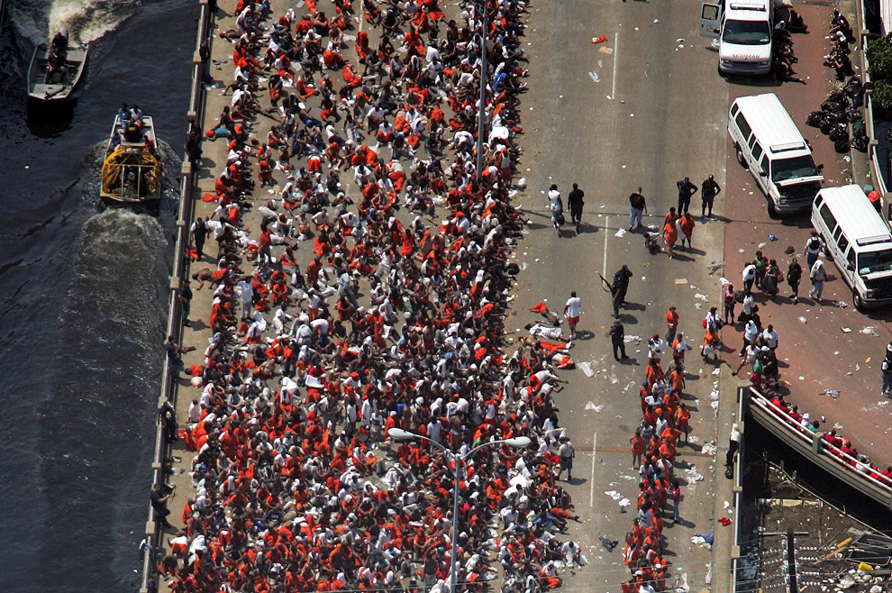
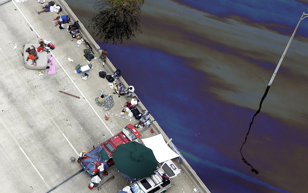
5 χρονια μετα τον τυφωνα ΚΑΤΡΙΝΑ 29 Αυγουστου 2010
-
Τίτλος: Απ: Ηφαιστεια - τυφωνες και φυσικες καταστροφες
Αποστολή από: thailandgr στις Αυγούστου 30, 2010, 09:45:24 πμ
-




-
Τίτλος: Απ: Ηφαιστεια - τυφωνες και φυσικες καταστροφες
Αποστολή από: Ivan στις Αυγούστου 30, 2010, 22:56:21 μμ
-
Ο τυφώνας Καρτίνα προκάλεσε μια κοσμοϊστορική καταστροφή και ομώς λίγο μετά, όταν σταμάτησαν τα ρεπορτάζ της "λαγνείας της καταστροφής και της δυστηχίας" ξεχάστηκε, πραγμά που επιβεβαίωνει για ακόμα μια φορά τον κανόνα . . .
οι κάθε είδους πληγέντες όμως...
-
Τίτλος: Απ: Ηφαιστεια - τυφωνες και φυσικες καταστροφες
Αποστολή από: Ivan στις Σεπτεμβρίου 11, 2010, 02:19:33 πμ
-
"όταν η φύση επιβάλλεται στον άνθρωπο" :
http://clopyandpaste.blogspot.com/2010/09/blog-post_9720.html
Πηγή: ClopYPastE.gr - ClopYandPastE.blogspot.com
-
Τίτλος: Απ: Ηφαιστεια - τυφωνες και φυσικες καταστροφες
Αποστολή από: rovespieros στις Σεπτεμβρίου 11, 2010, 09:09:07 πμ
-
Ηφαιστεια!!!!!!!!!!!!!!!!!!!!!!!
-
Τίτλος: Απ: Ηφαιστεια - τυφωνες και φυσικες καταστροφες
Αποστολή από: thailandgr στις Οκτωβρίου 07, 2010, 15:40:39 μμ
-
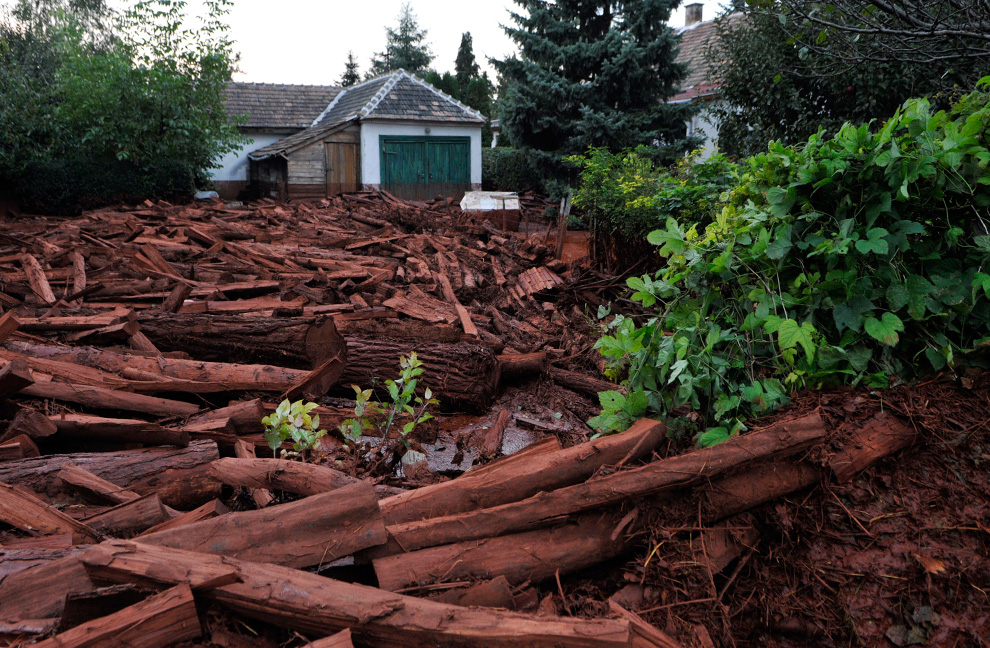
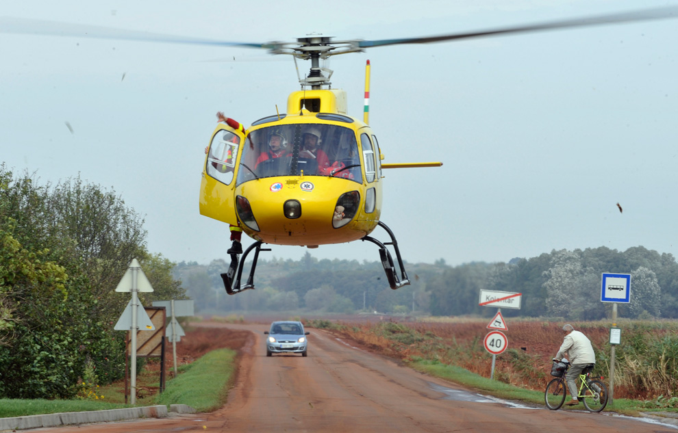
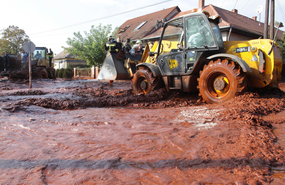
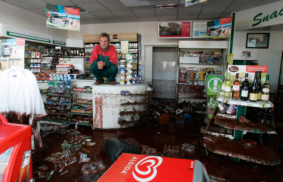
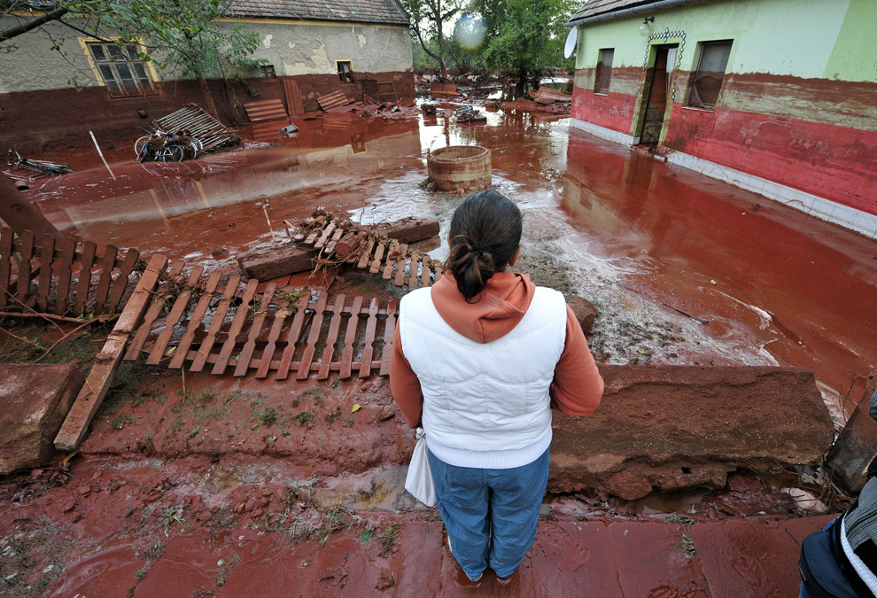
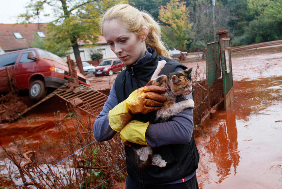
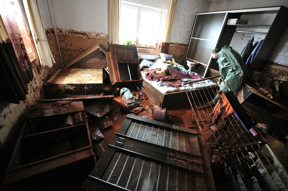
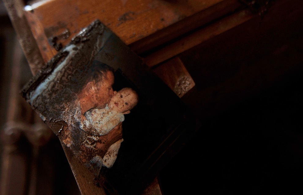
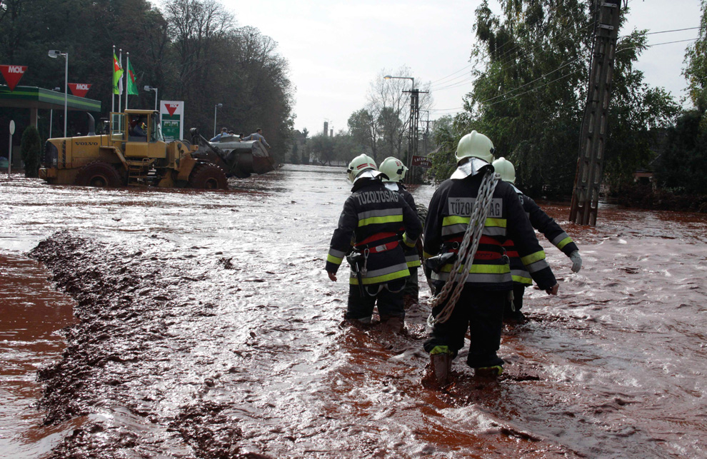
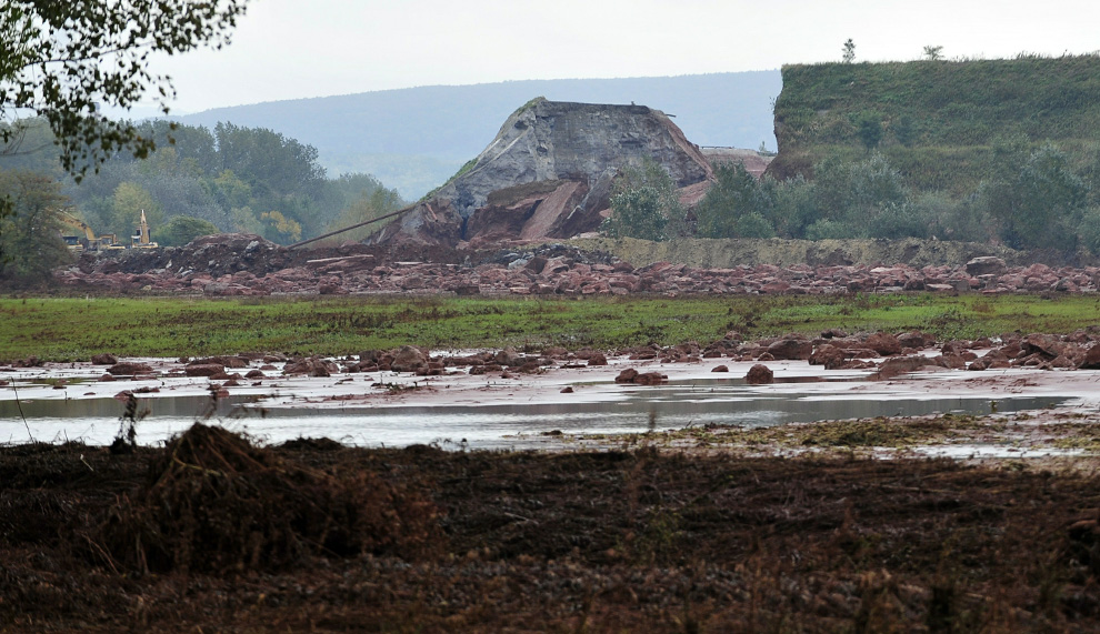
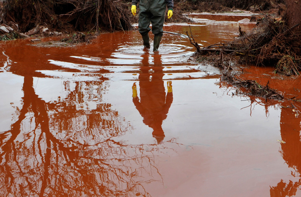
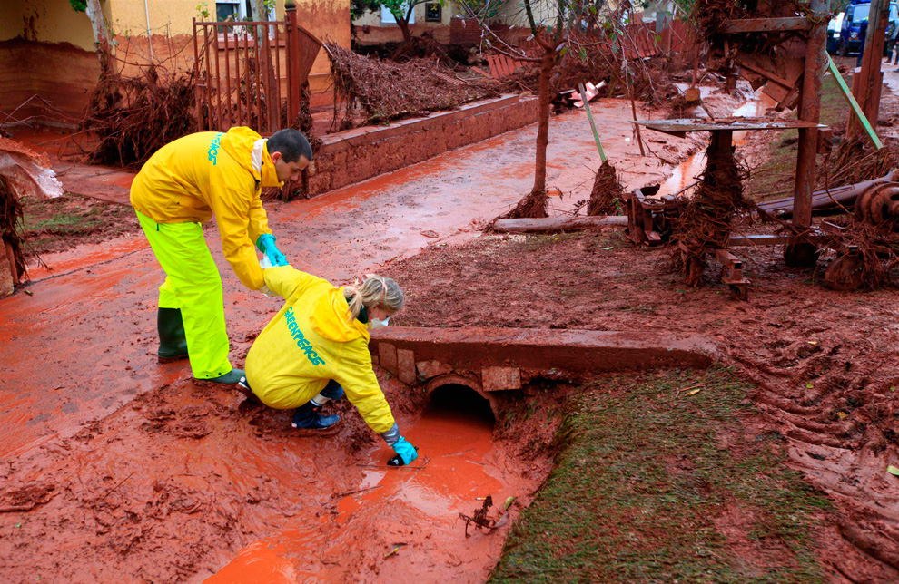
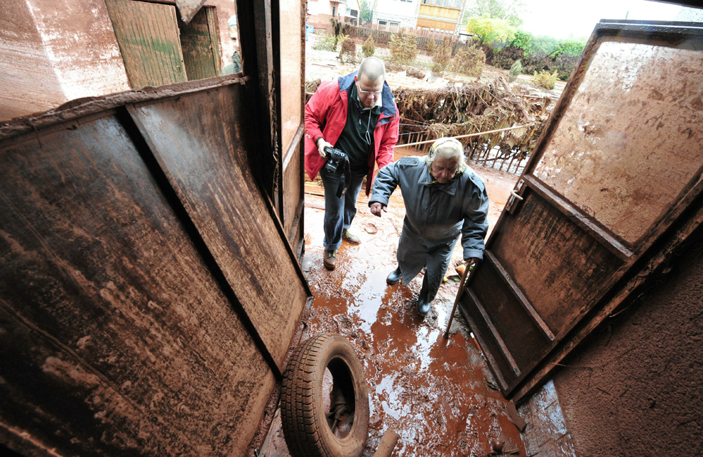
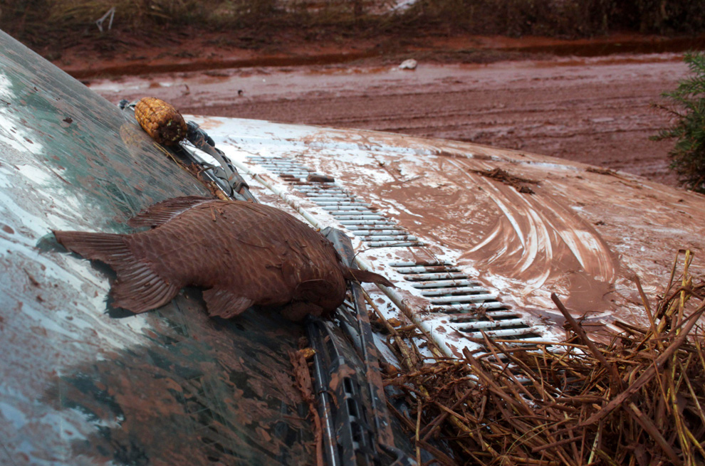
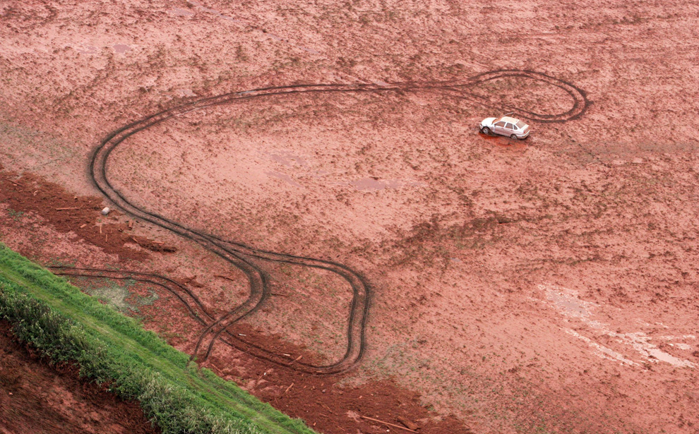
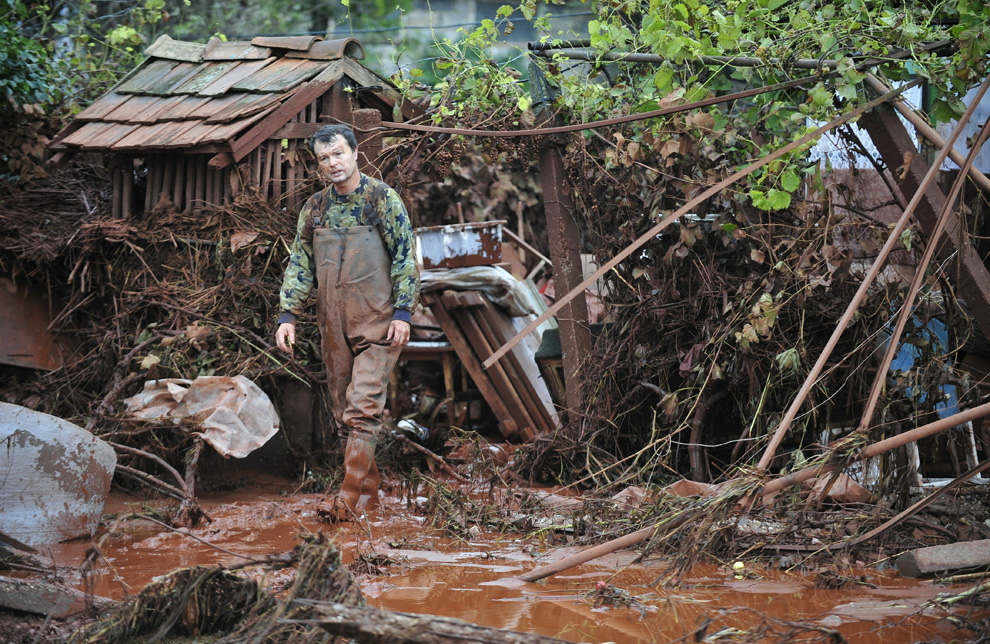
Μια πλημμύρα από τοξική λάσπη
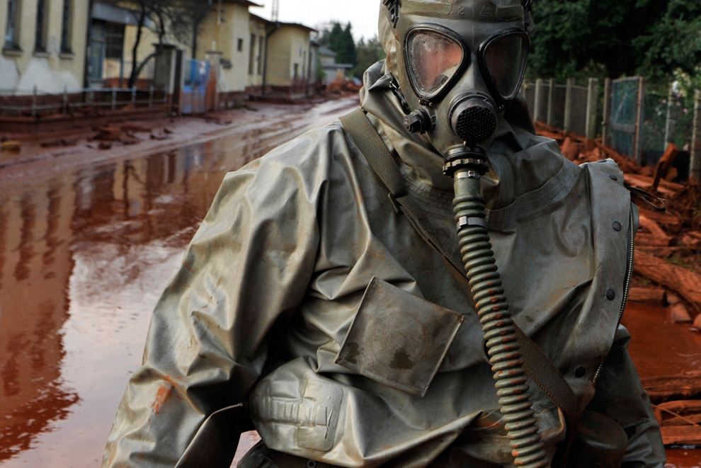
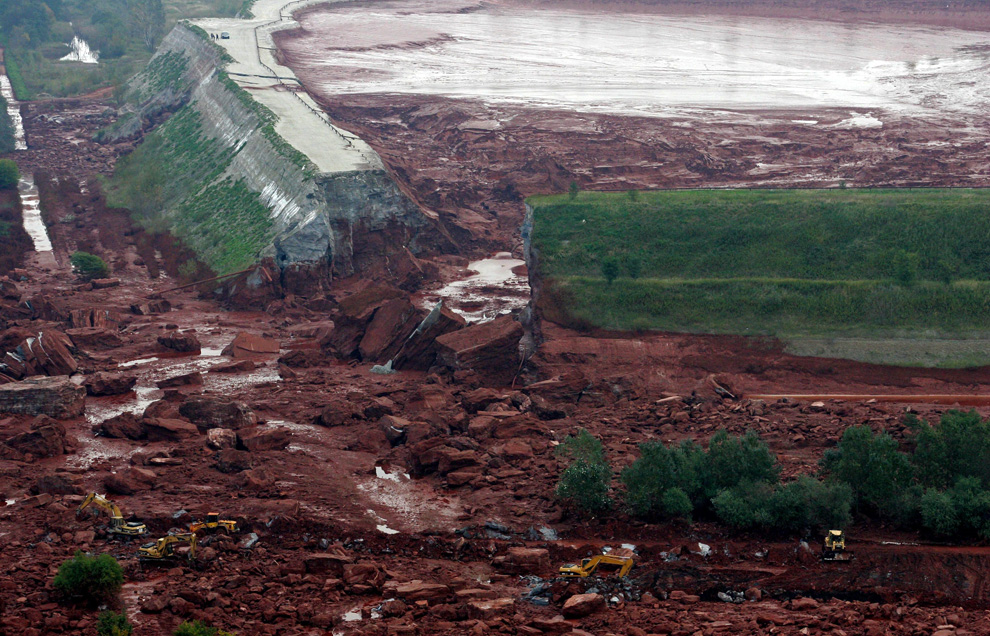
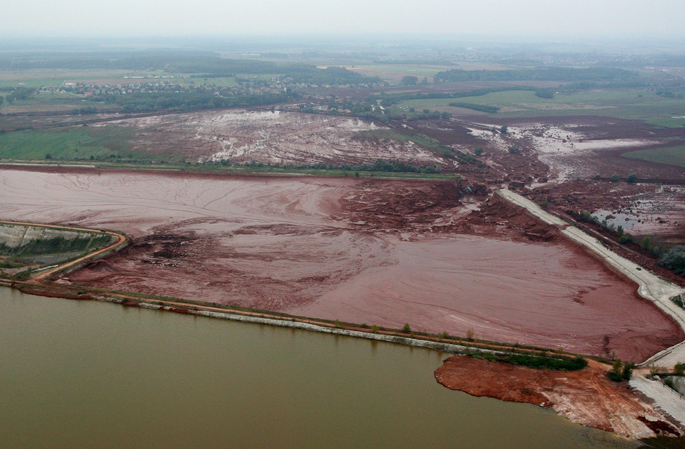
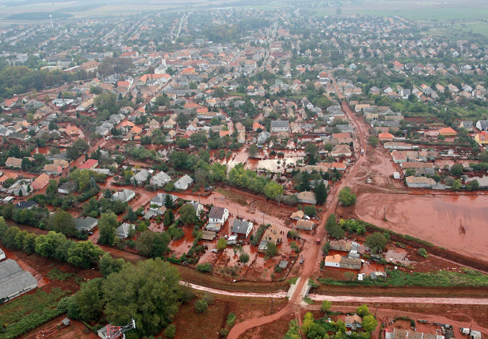
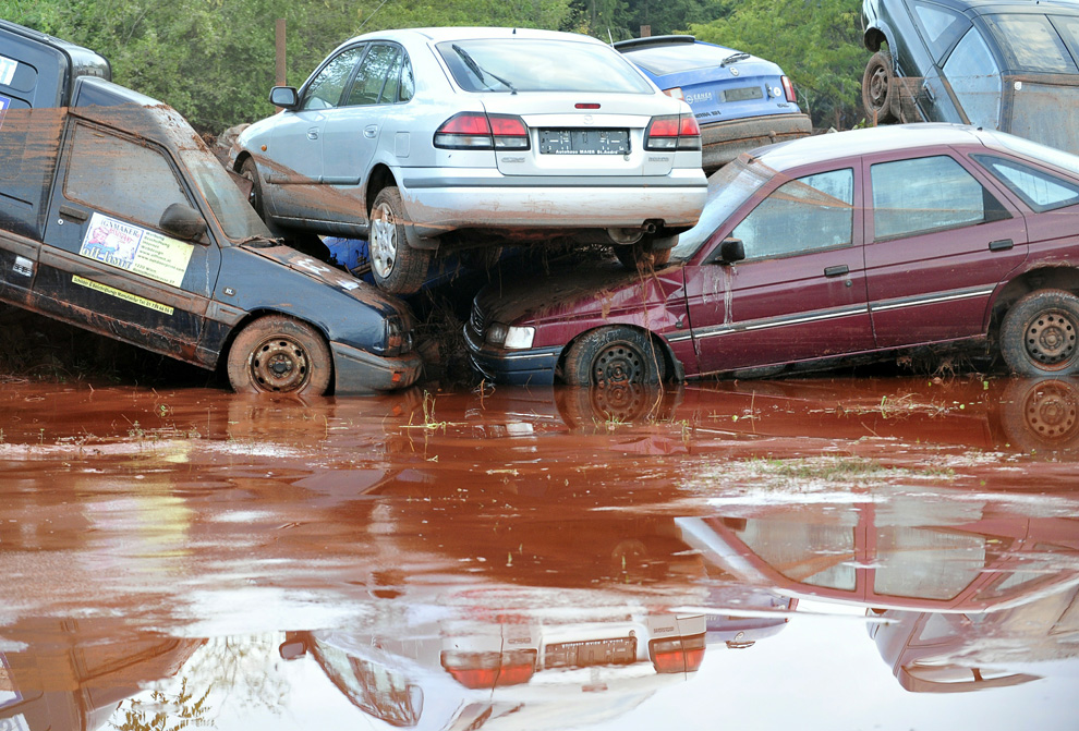
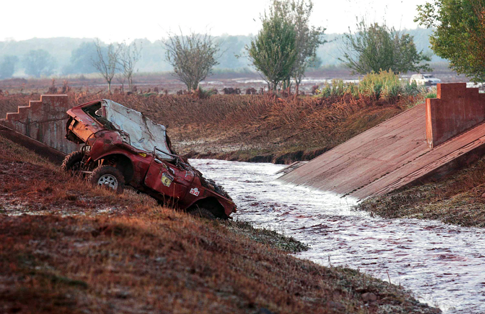
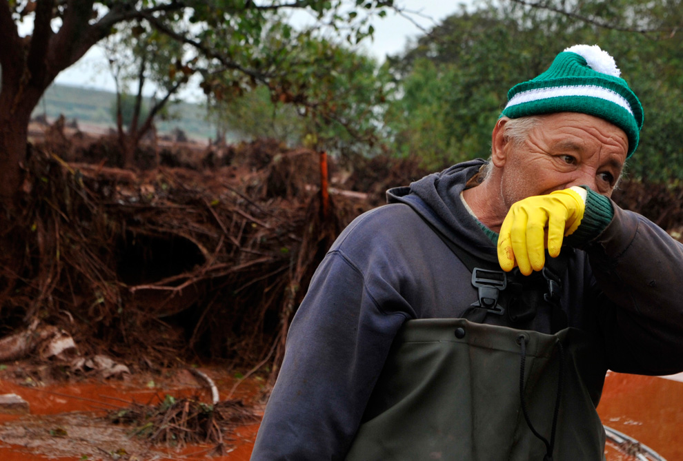
Την Δευτέρα, 4η Οκτωβρίου, μια μεγάλη δεξαμενή γεμάτη με τοξικη κόκκινη λάσπη στη δυτική Ουγγαρία εσπασε, απελευθερώνοντας περίπου 700.000 κυβικα μέτρα (185 εκατομμύρια γαλόνια) απο μια βρωμερη καυστικη λάσπη, απο την οποια σκοτώθηκαν πολλά ζώα, τουλάχιστον τέσσερα άτομα, και τραυματιστικαν πάνω από 120 καθως και πολλοι με χημικά εγκαύματα.
-
Τίτλος: Απ: Ηφαιστεια - τυφωνες και φυσικες ( και οχι μονο )κατα
Αποστολή από: Ivan στις Οκτωβρίου 07, 2010, 20:23:52 μμ
-
Προσπαθούσα να φανταστώ αυτή τη τεράστια τοξική δεξαμενή.... νομίζα οτι θα ταν κάτι χτισμένο. Ηταν μια χωμάτινη δεξαμένη λοιπόν και σκέφτομαι ολα αυτά τα τοξικά δεν περνούσαν στη γή, στον υδροφόρο ορίζοντα και τα ποτάμια?
-
Τίτλος: Απ: Ηφαιστεια - τυφωνες και φυσικες ( και οχι μονο )κατα
Αποστολή από: thailandgr στις Νοεμβρίου 12, 2010, 15:40:14 μμ
-
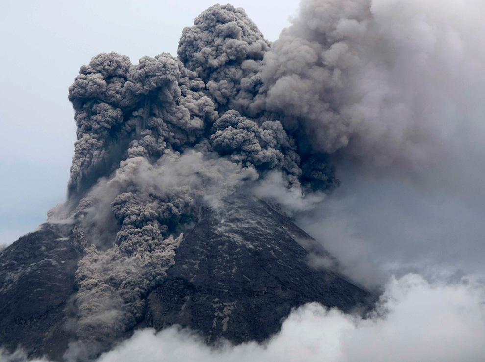
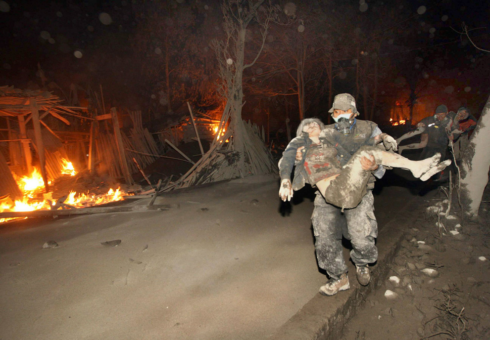
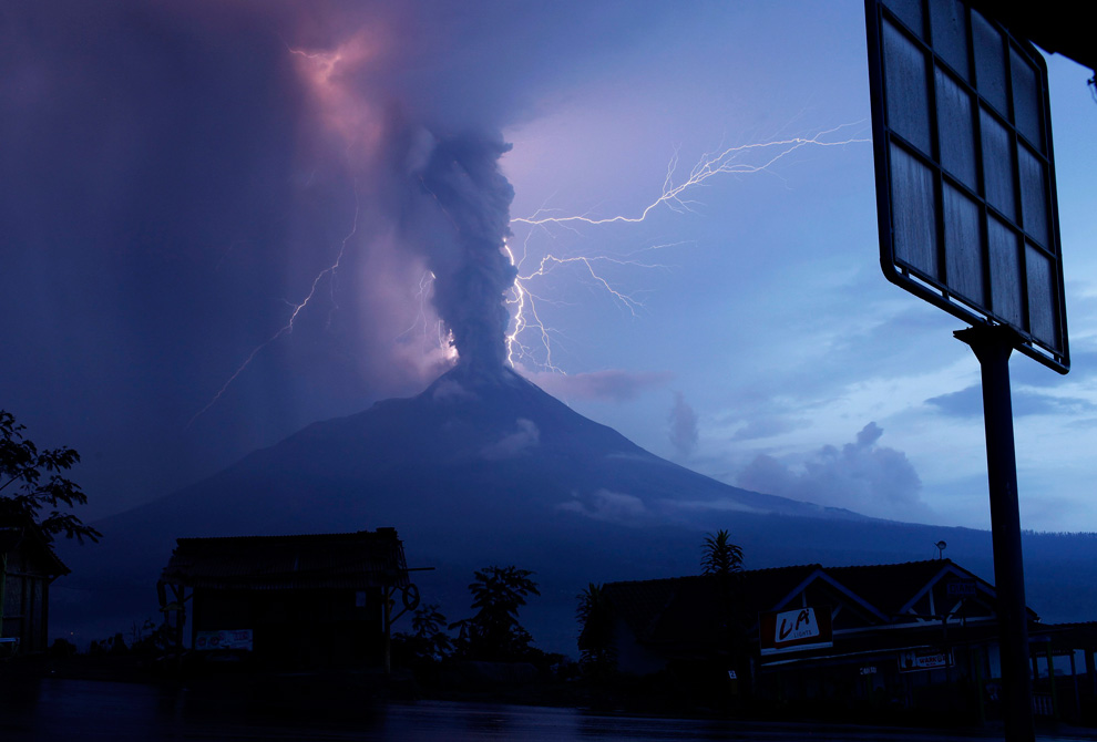
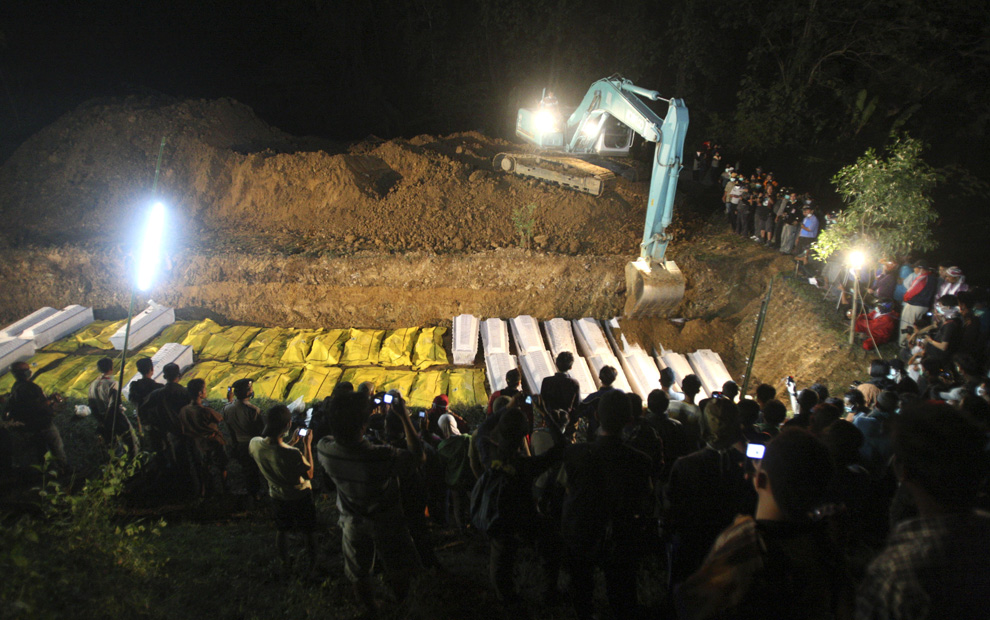
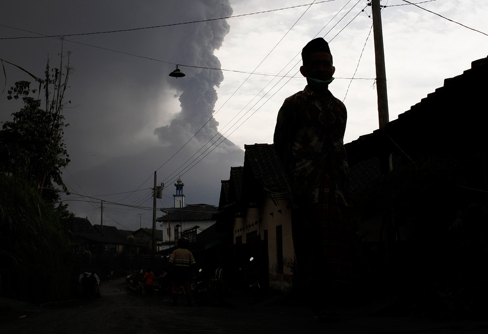
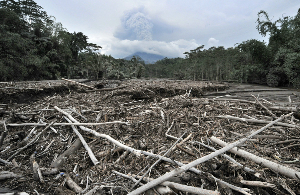
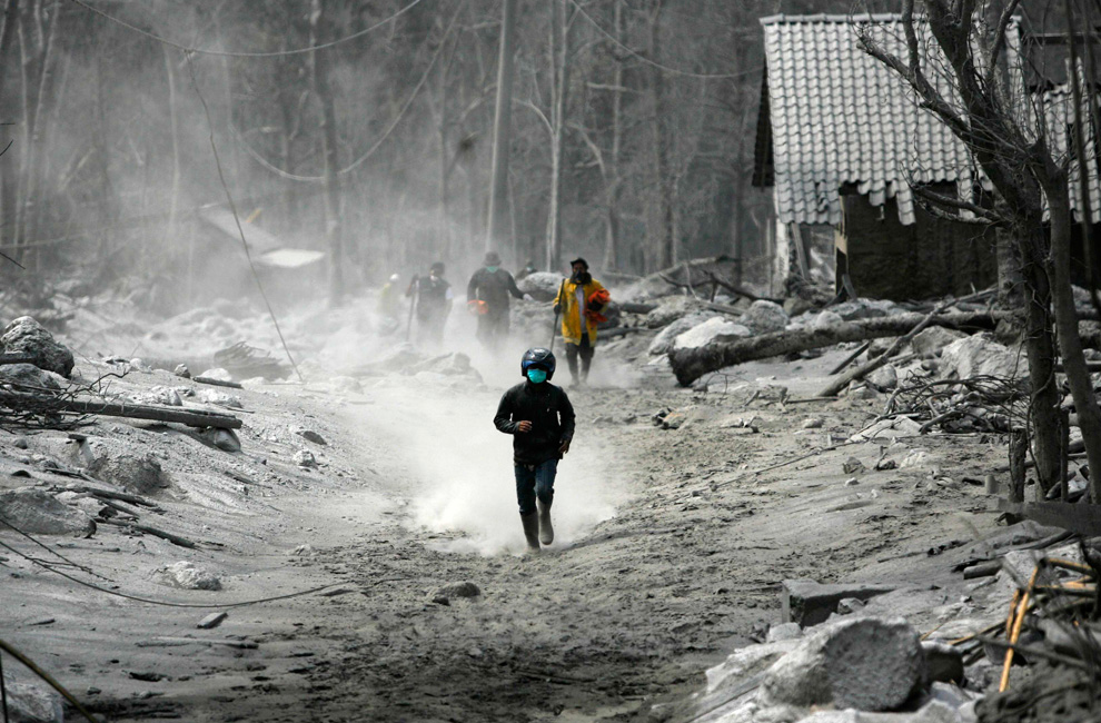
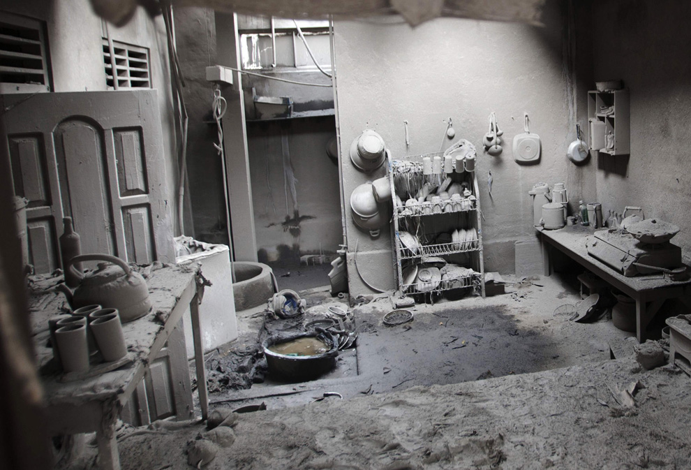
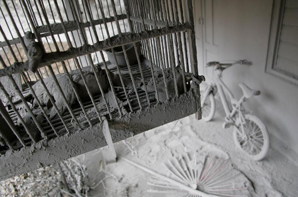
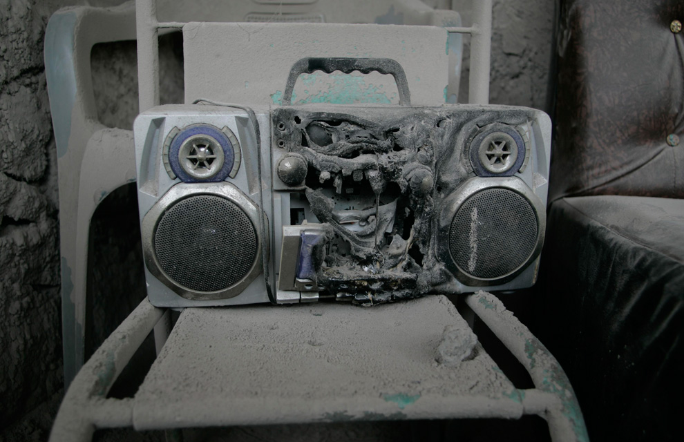
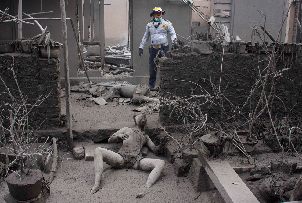
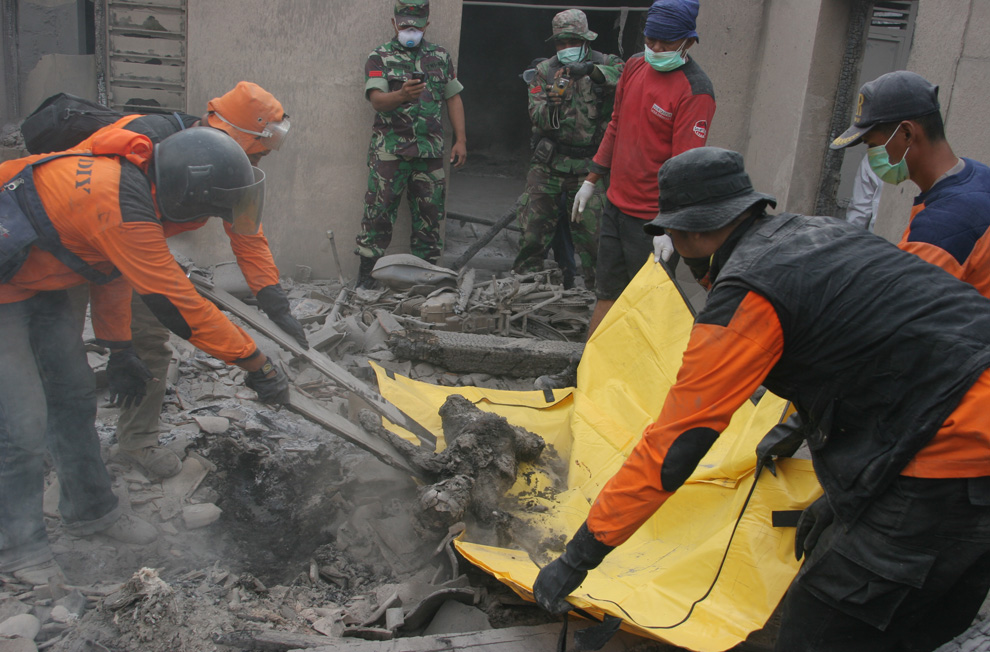
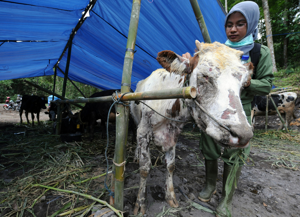
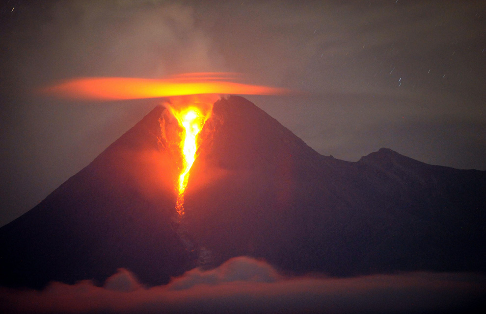
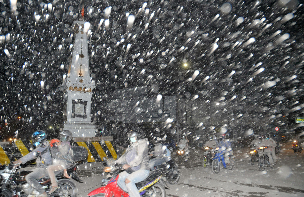
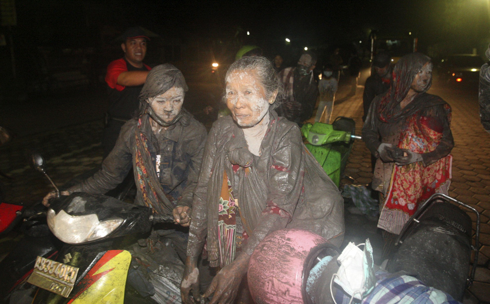
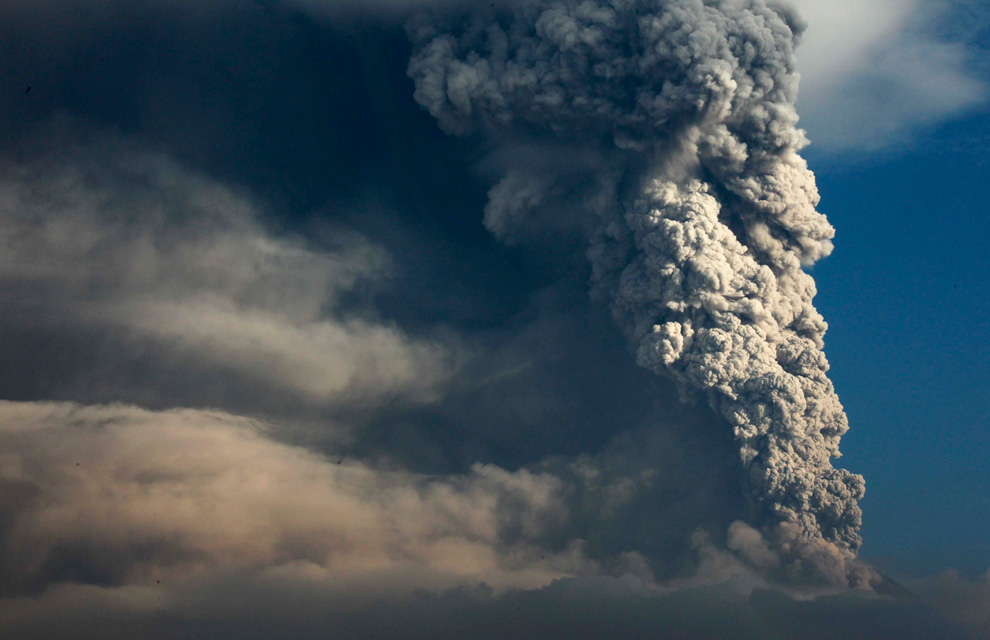
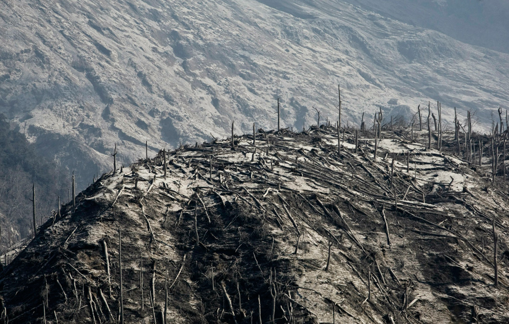
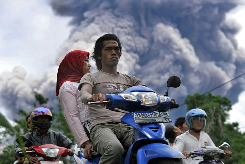
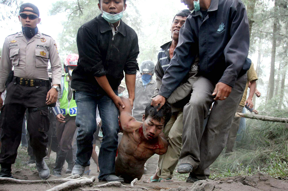
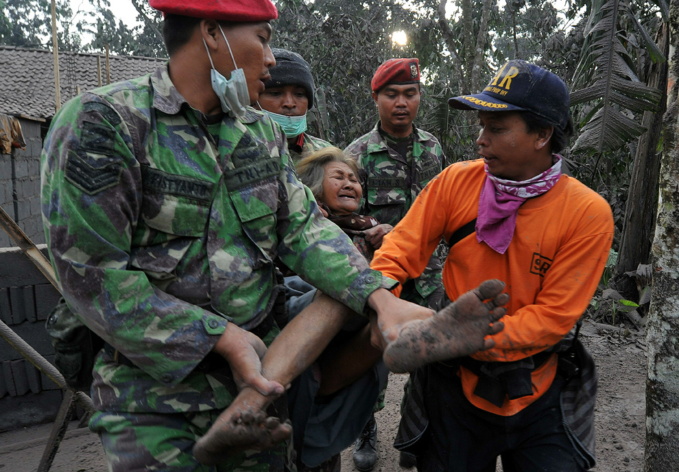
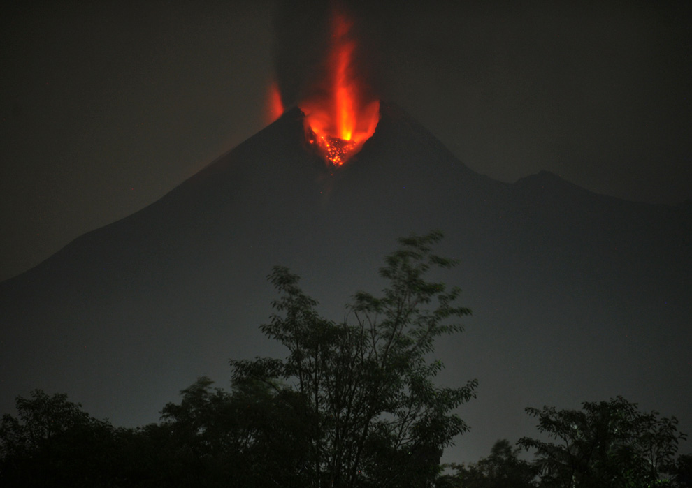
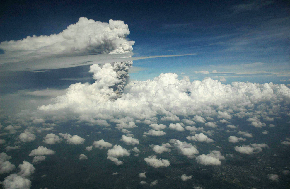
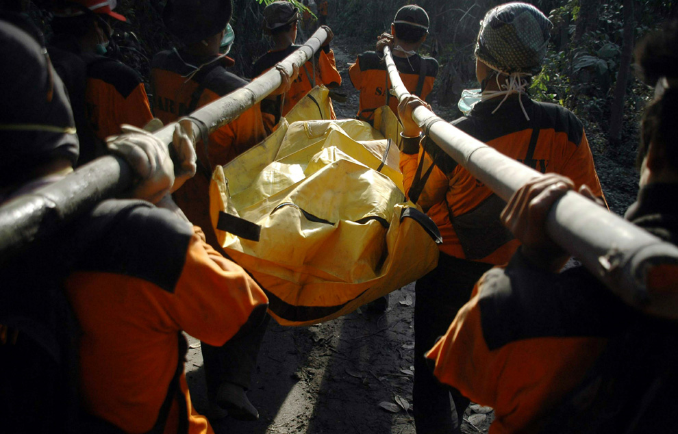
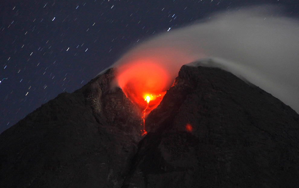
Από την αρχική εκρήξη του στις 25 Οκτωβρίου, το ηφαιστειο Merapi στην ινδονησια συνεχίζει να αποβάλλει θερμα αερία και στάχτη σε υψος 5.000 μέτρων στην ατμόσφαιρα, σπέρνει τον όλεθρο στα γύρω χωριά και αγροκτήματα, και διακόπτει τα αεροπορικά ταξίδια - και περισσότεροι από 140 άνθρωποι έχουν σκοτωθεί από τις εκρήξεις κατά τη διάρκεια των τελευταίων δύο εβδομάδων.
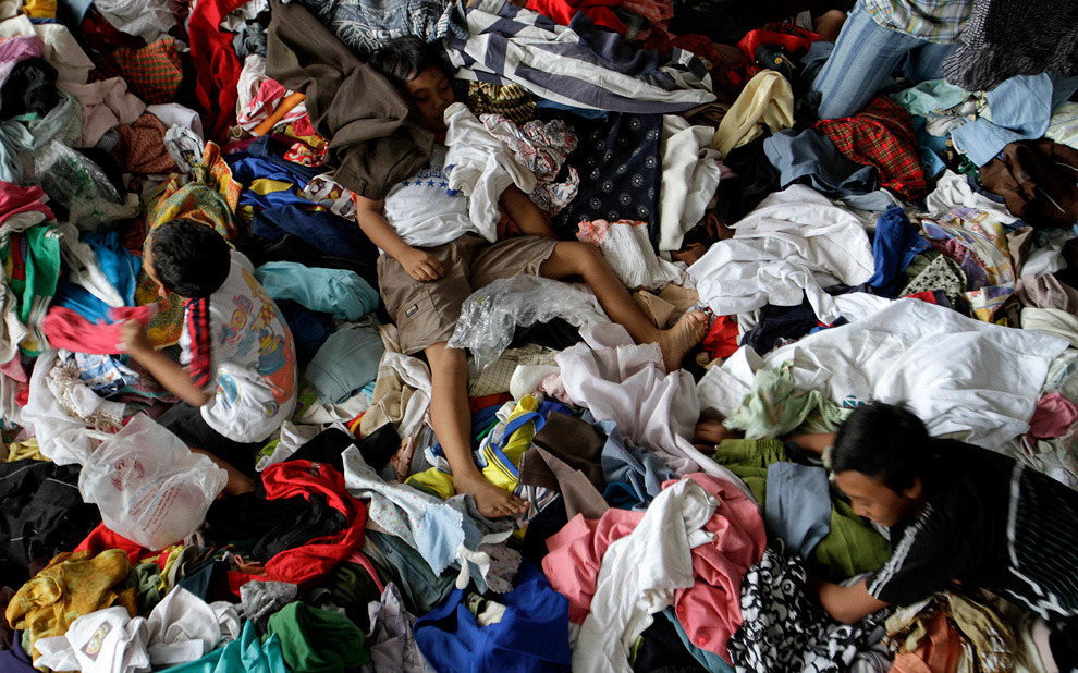
Εκατοντάδες χιλιάδες κάτοικοι εκτοπίστηκαν, πολλοί από αυτούς ζουν σε προσωρινά καταλύματα μέχρι η ινδονησιακή κυβέρνηση να μειώσει την υφιστάμενη 20 χιλιόμετρων «ζώνη ασφαλειας », και να τους επιτρέψει σε αυτους και τα ζώα τους να επιστρέψουν.

-
Τίτλος: Απ: Ηφαιστεια - τυφωνες και φυσικες ( και οχι μονο )κατα
Αποστολή από: thailandgr στις Φεβρουαρίου 24, 2011, 13:48:24 μμ
-
Ισχυρή σεισμική δόνηση έντασης 6,3 βαθμών της κλίμακας Ρίχτερ, εκδηλώθηκε την Τρίτη, στη δεύτερη μεγαλύτερη πόλη της Νέας Ζηλανδίας, την Κρίσττσερτς, για δεύτερη φορά μέσα σε πέντε μήνες.
Με εκατοντάδες εξακολουθούν να αγνοούνται, και 95 νεκρούς που έχουν ήδη επιβεβαιωθεί , οι διασώστες πασχιζουν για να βρουν επιζώντες στο δεύτερο βράδυ μετά απο ένα καταστροφικό σεισμό που έπληξε το Christchurch, τη δεύτερη μεγαλύτερη πόλη της Νέας Ζηλανδίας .
Κτίρια κατέρρευσαν στους δρόμους μετά το σεισμό των 6,3 R , και οι γεωλόγοι εξετάζουν το ενδεχόμενο να ειναι μετασεισμός σε ένα σεισμό 7,1 που δεν προκάλεσε θύματα, τον Σεπτέμβριο.
Ο Σεισμός της Τρίτης ήταν πιο καταστροφικος και θανάσιμος επειδή το επικεντρο ήταν μόνο έξι μίλια από το κέντρο της πόλης και το χτύπημα ηταν κατά τη διάρκεια μιας εργάσιμης ημέρας.
Η κυβέρνηση έχει κυρηξει μια εθνική κατάσταση έκτακτης ανάγκης.





-
Τίτλος: Απ: Ηφαιστεια - τυφωνες και φυσικες ( και οχι μονο )κατα
Αποστολή από: thailandgr στις Μαρτίου 12, 2011, 09:16:12 πμ
-
JAPAN 8.9 R


-
Τίτλος: Απ: Ηφαιστεια - τυφωνες και φυσικες ( και οχι μονο )κατα
Αποστολή από: thailandgr στις Μαρτίου 13, 2011, 11:12:24 πμ
-



-
Τίτλος: Απ: Ηφαιστεια - τυφωνες και φυσικες ( και οχι μονο )κατα
Αποστολή από: giannis στις Μαρτίου 14, 2011, 11:49:01 πμ
-
-
Τίτλος: Απ: Ηφαιστεια - τυφωνες και φυσικες ( και οχι μονο )κατα
Αποστολή από: thailandgr στις Μαρτίου 15, 2011, 22:17:55 μμ
-
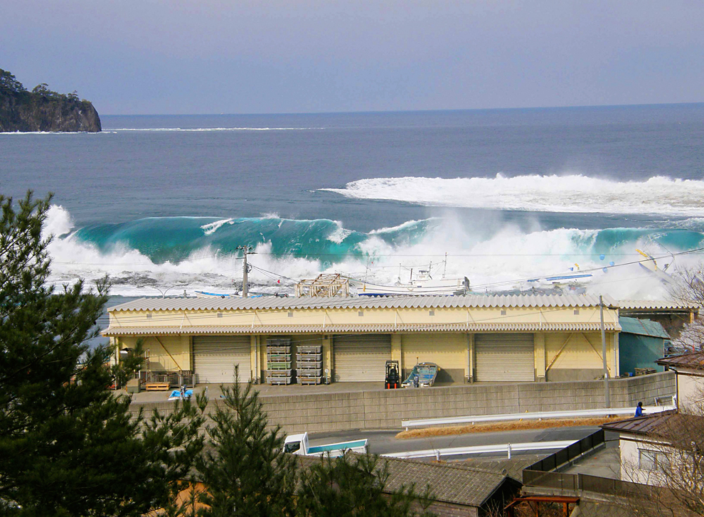
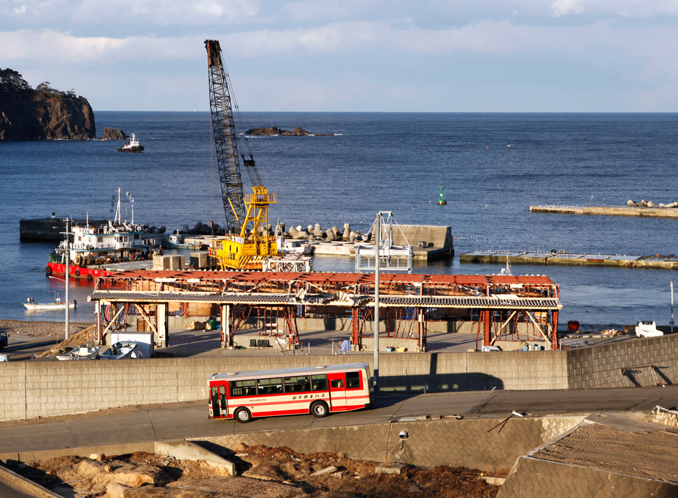
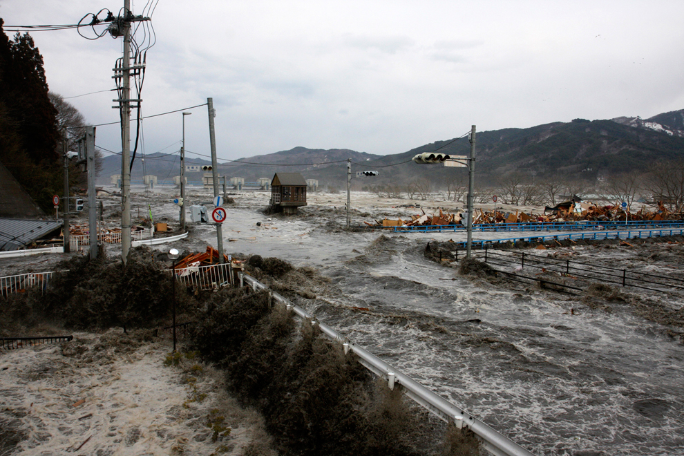
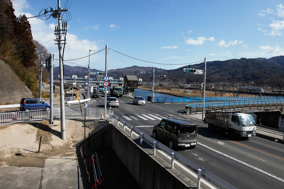
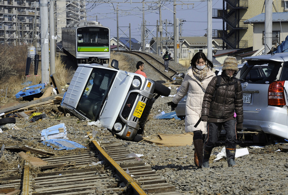
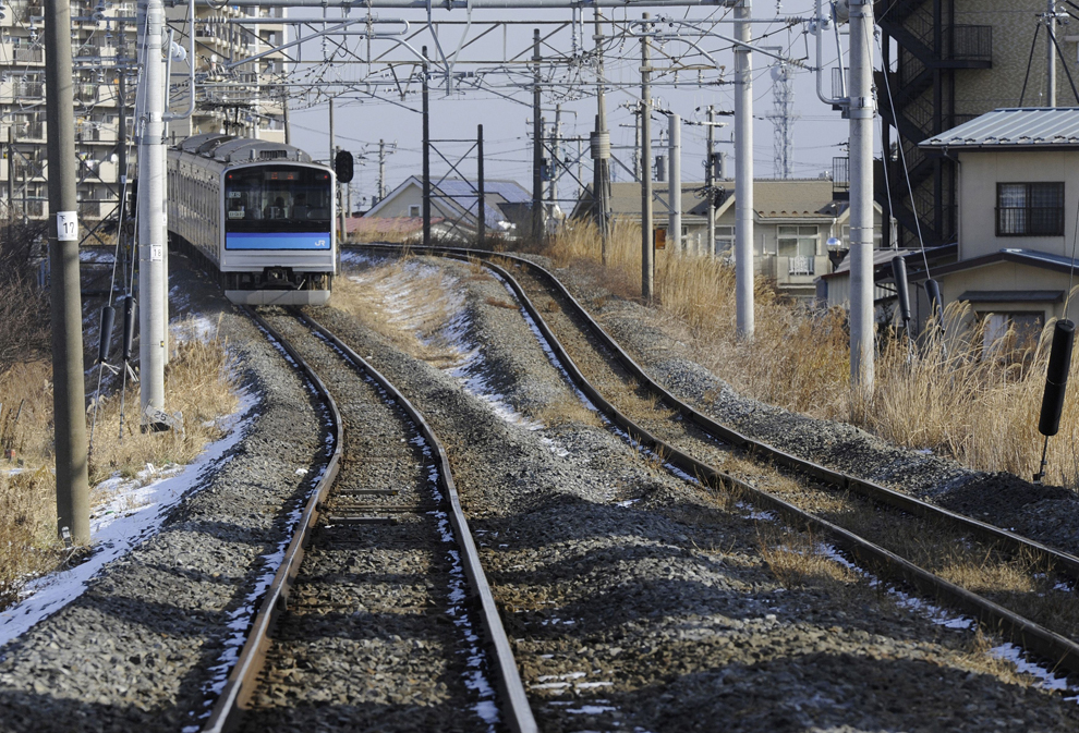
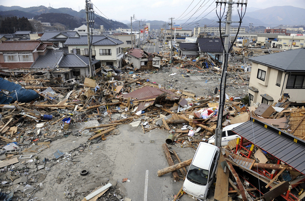
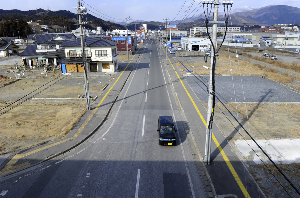
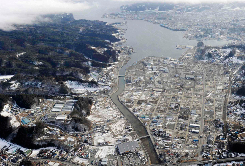
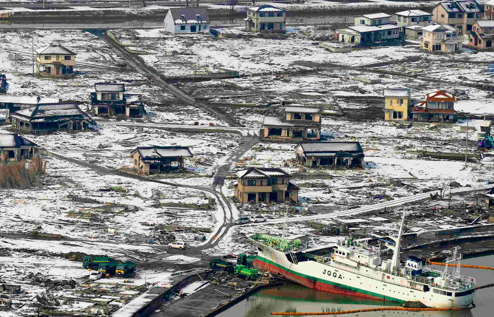
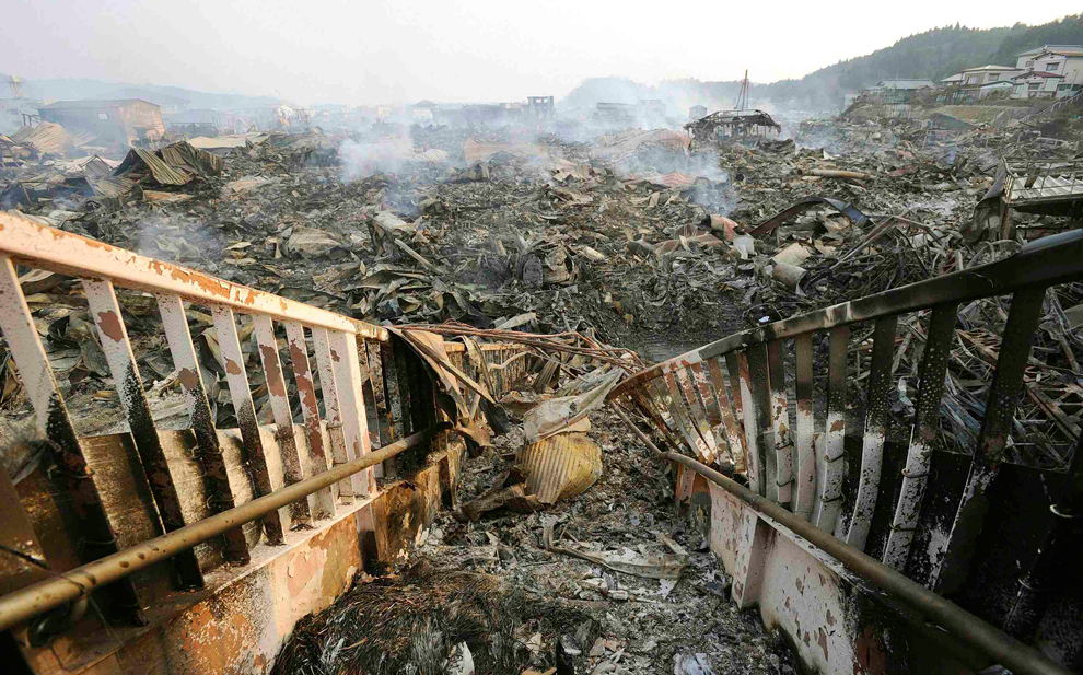
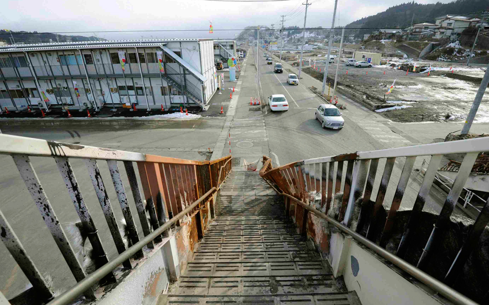
Πριν και μετα
Μετακινιστε την μεσαια μαυρη γραμμή
-
Τίτλος: Απ: Ηφαιστεια - τυφωνες και φυσικες ( και οχι μονο )κατα
Αποστολή από: giannis στις Μαρτίου 19, 2011, 10:39:54 πμ
-
(http://img251.imageshack.us/img251/9135/japanesetsunami1.jpg)
(http://img84.imageshack.us/img84/7657/japanesetsunami2.jpg)
(http://img198.imageshack.us/img198/7174/japanesetsunami3.jpg)
(http://img218.imageshack.us/img218/296/japanesetsunami4.jpg)
(http://img848.imageshack.us/img848/7484/japanesetsunami5.jpg)
(http://img692.imageshack.us/img692/749/japanesetsunami6.jpg)
(http://img204.imageshack.us/img204/1246/japanesetsunami7.jpg)
(http://img151.imageshack.us/img151/2954/japanesetsunami9.jpg)
(http://img155.imageshack.us/img155/2014/japanesetsunami10.jpg)
(http://img714.imageshack.us/img714/6867/japanesetsunami11.jpg)
(http://img818.imageshack.us/img818/5617/japanesetsunami12.jpg)
(http://img864.imageshack.us/img864/1730/japanesetsunami13.jpg)
(http://img402.imageshack.us/img402/7527/japanesetsunami15.jpg)
(http://img14.imageshack.us/img14/9847/japanesetsunami16.jpg)
(http://img88.imageshack.us/img88/8108/japanesetsunami17.jpg)
-
Τίτλος: Απ: Ηφαιστεια - τυφωνες και φυσικες ( και οχι μονο )κατα
Αποστολή από: thailandgr στις Μαρτίου 19, 2011, 13:35:10 μμ
-
Japan: Hopes fade for finding more survivors

-
Τίτλος: Απ: Ηφαιστεια - τυφωνες και φυσικες ( και οχι μονο )κατα
Αποστολή από: thailandgr στις Μαρτίου 19, 2011, 13:37:26 μμ
-
Japan: One week later




-
Τίτλος: Απ: Ηφαιστεια - τυφωνες και φυσικες ( και οχι μονο )κατα
Αποστολή από: thailandgr στις Ιουλίου 03, 2011, 20:29:18 μμ
-









-
Τίτλος: Απ: Ηφαιστεια - τυφωνες και φυσικες ( και οχι μονο )κατα
Αποστολή από: thailandgr στις Αυγούστου 31, 2011, 09:20:31 πμ
-
Hurricane Irene











-
Τίτλος: Απ: Ηφαιστεια - τυφωνες και φυσικες ( και οχι μονο )κατα
Αποστολή από: thailandgr στις Νοεμβρίου 28, 2011, 10:31:20 πμ
-
ΟΙ ΠΡΟΣΦΑΤΕΣ ΠΛΗΜΜΥΡΕΣ ΣΤΗΝ ΤΑΪΛΆΝΔΗ

-
Τίτλος: Απ: Ηφαιστεια - τυφωνες και φυσικες ( και οχι μονο )κατα
Αποστολή από: thailandgr στις Φεβρουαρίου 10, 2012, 17:12:44 μμ
-
Η Ευρωπη πάγωσε
Αποστολή από: thailandgr στις Αυγούστου 30, 2010, 09:43:39 πμ

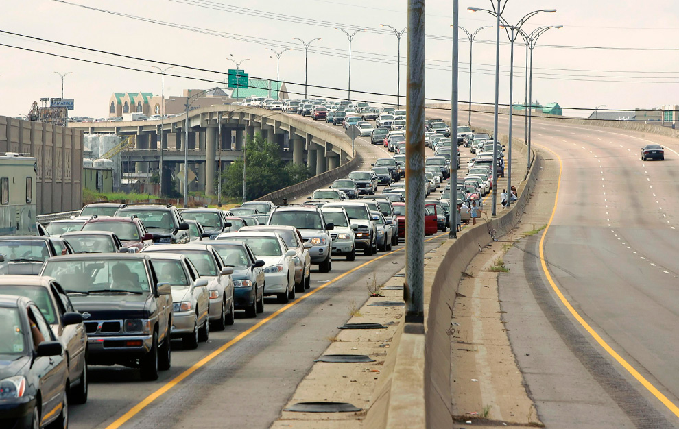
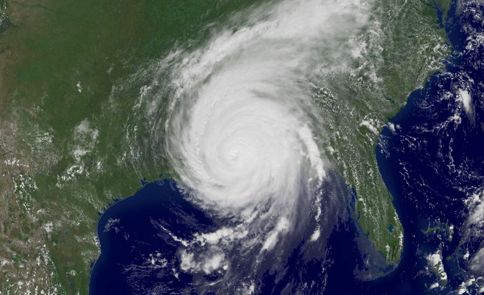
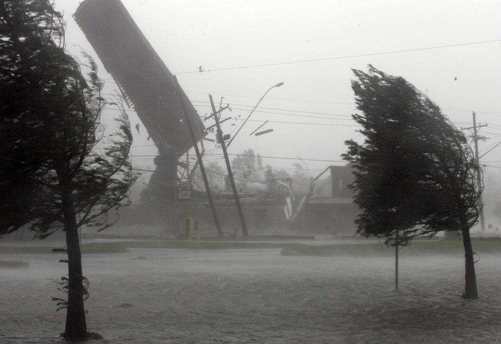
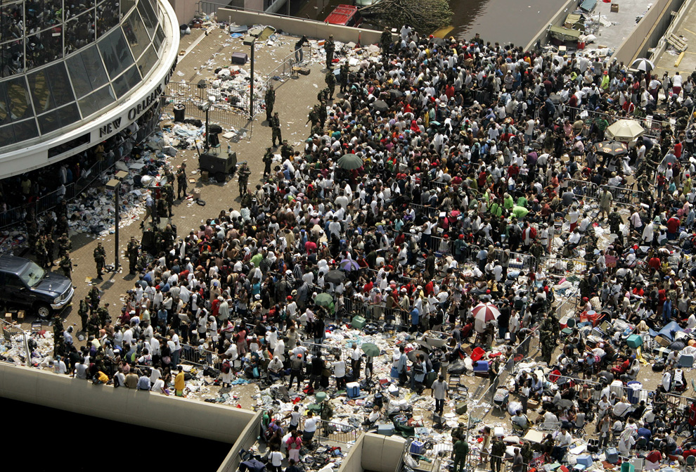
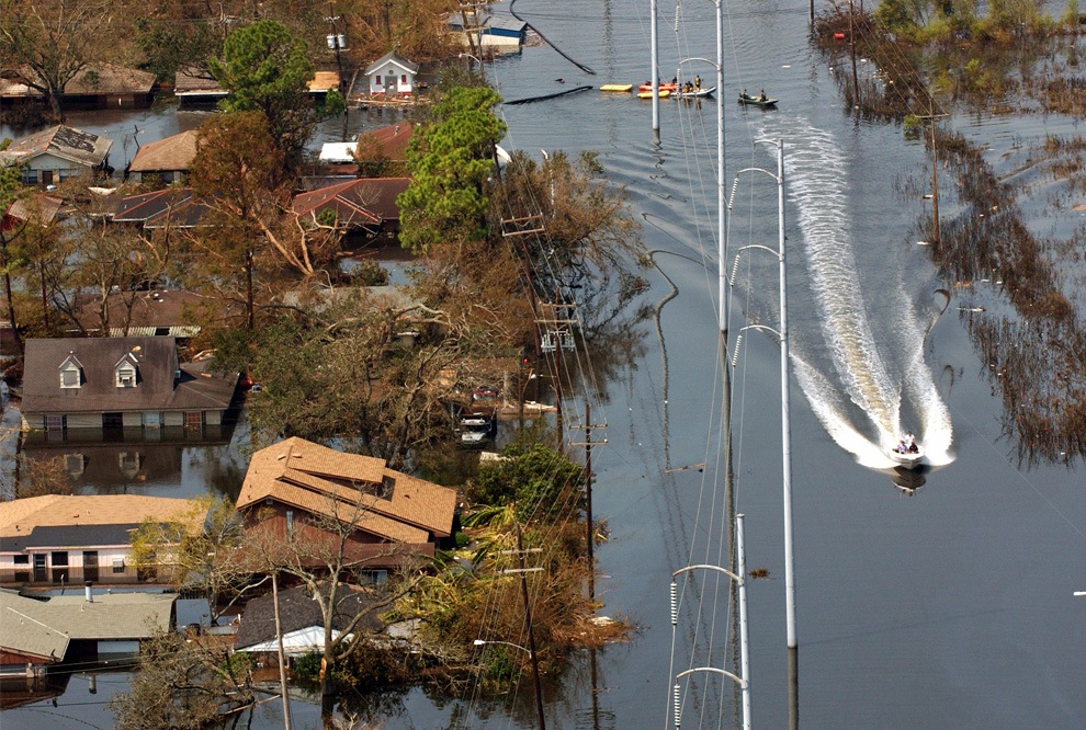
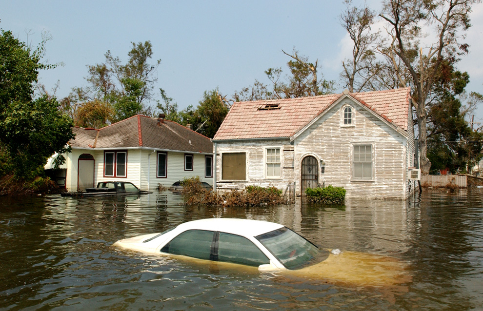
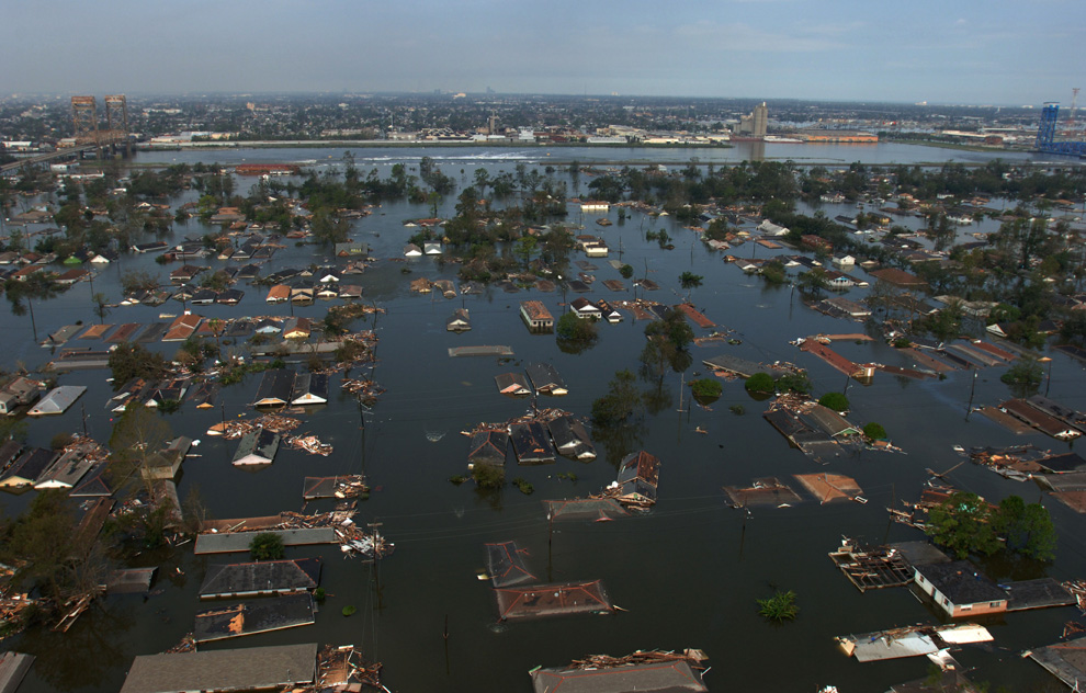
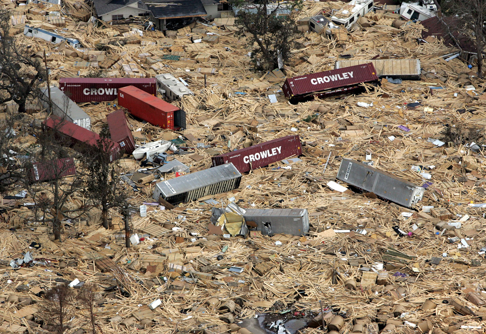
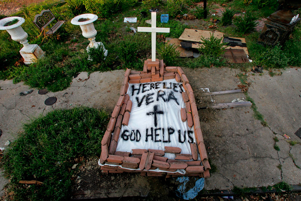
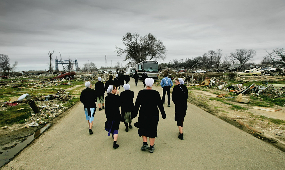
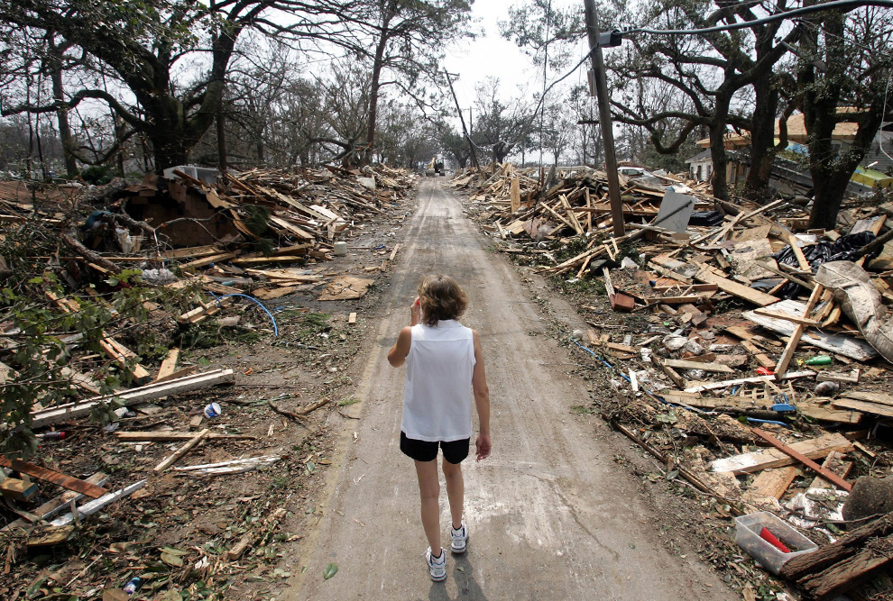
In this Aug. 31, 2005 picture, Rhonda Braden walks through the destruction in her childhood neighborhood in Long Beach, Mississippi after Hurricane Katrina ravaged the area. (AP Photo/Rob Carr)

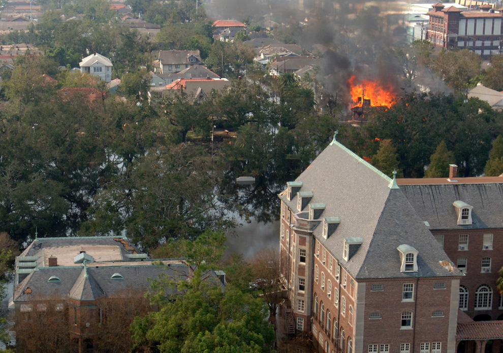
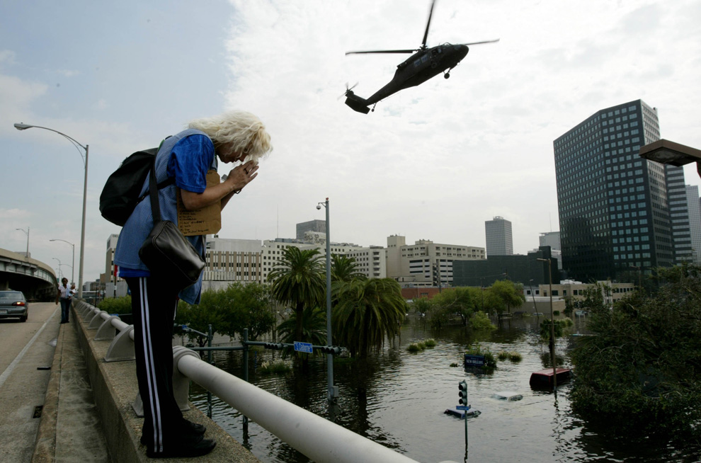
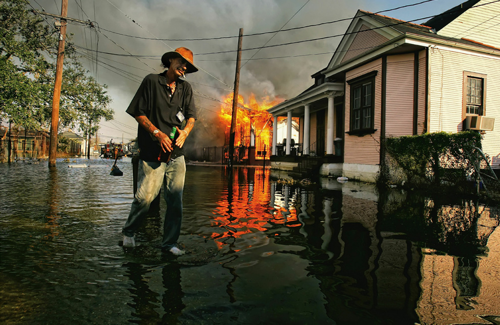
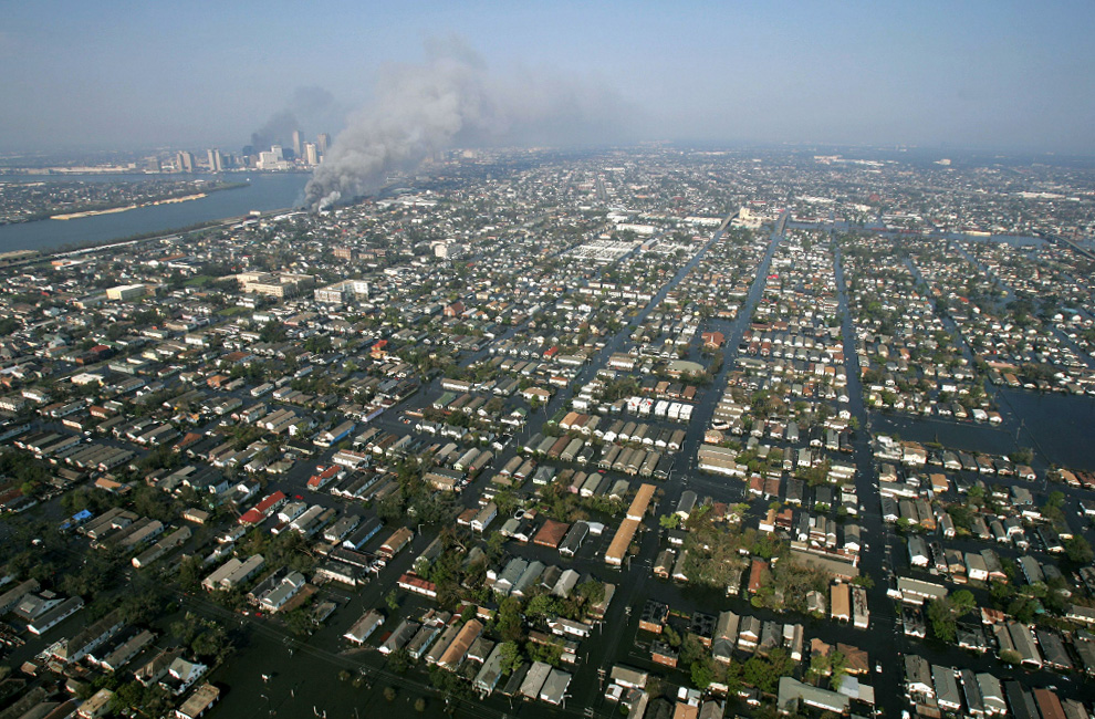
Smoke billows from a fire as another blaze (rear) rages in downtown New Orleans on September 2nd, 2005. Explosions rang out and fires blazed early Friday in southwestern New Orleans, as authorities battled to restore order after Hurricane Katrina battered the Gulf Coast. (DAVID J. PHILLIP/AFP/Getty Images) #

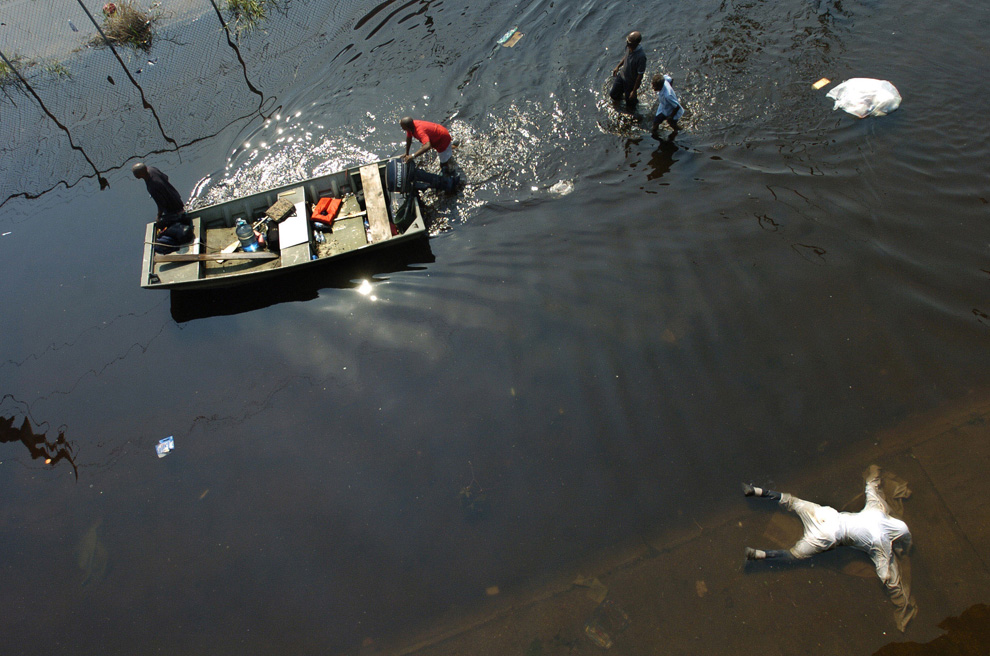
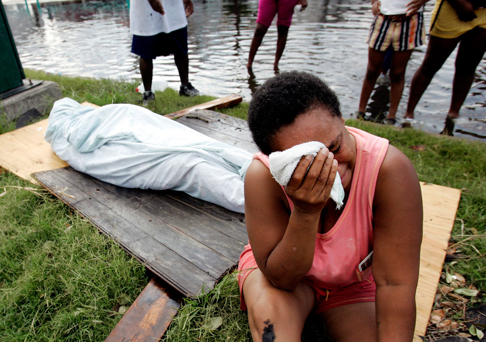
Evelyn Turner cries alongside the body of her common-law husband, Xavier Bowie, after he died in New Orleans on Tuesday, Aug. 30, 2005. Bowie and Turner had decided to ride out Hurricane Katrina when they could not find a way to leave the city. Bowie, who had lung cancer, died when he ran out of oxygen Tuesday afternoon. (AP Photo/Eric Gay) #
Αποστολή από: thailandgr στις Αυγούστου 30, 2010, 09:45:24 πμ

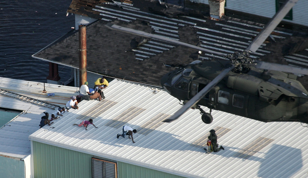
Leonard Thomas, 23, cries after a SWAT police team burst into the flooded home where he and his family were living in New Orleans on Sept. 5, 2005. Neighbors had reported that the family was squatting in the house in the wake of Hurricane Katrina but the authorities left after the family proved they were the owners. (AP Photo/Rick Bowmer) #

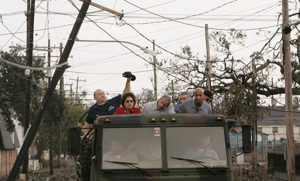
Vice Adm. Thad Allen, left, lifts a downed power line during a tour of the destruction caused by Hurricane Katrina in downtown New Orleans with President Bush, center, Louisiana Gov. Kathleen Blanco, second left, White House Chief of Staff Andrew Card, partially hidden, New Orleans Mayor Ray Nagin, second from right, and Lt. Gen. Russ Honore, right on Monday Sept. 12, 2005. (AP Photo/Susan Walsh) #

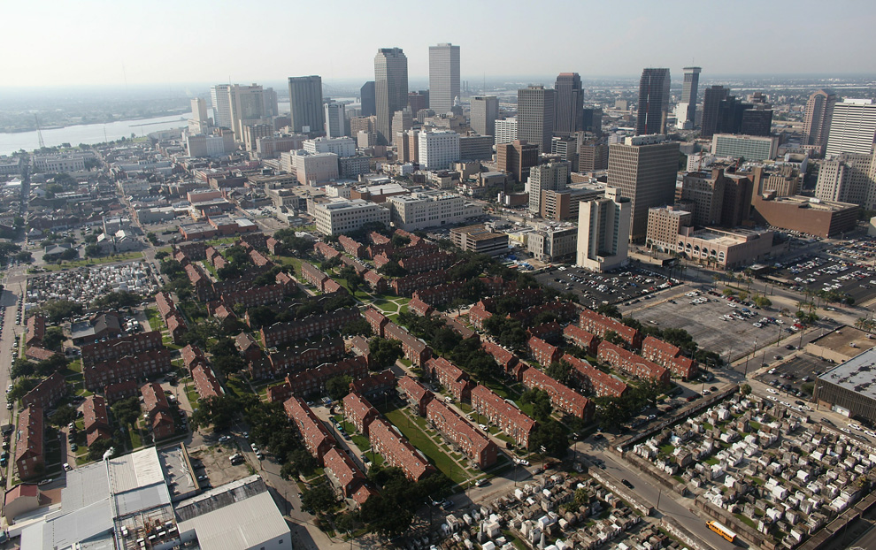
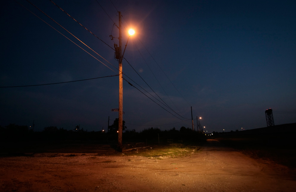
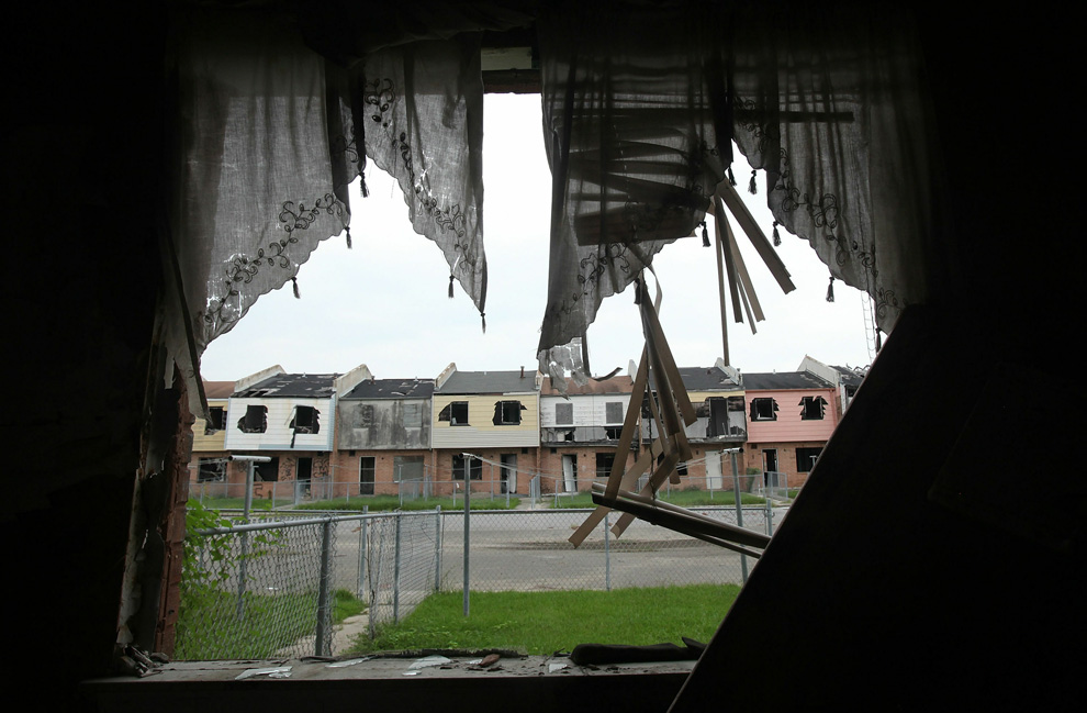
(2 of 2) Five years later, Robert Fontaine looks on at the scene where he fled a burning house fire in the aftermath of Hurricane Katrina, on August 23, 2010 in New Orleans, Louisiana. Fontaine said he stayed in the house to take care of dogs who were left behind. He was using candles due to a lack of electricity when one of the dogs knocked over a candle, causing the fire. Fontaine said, "My whole life, my whole world crashed. For everyone, not just for me." (Mario Tama/Getty Images) #

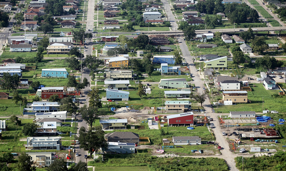
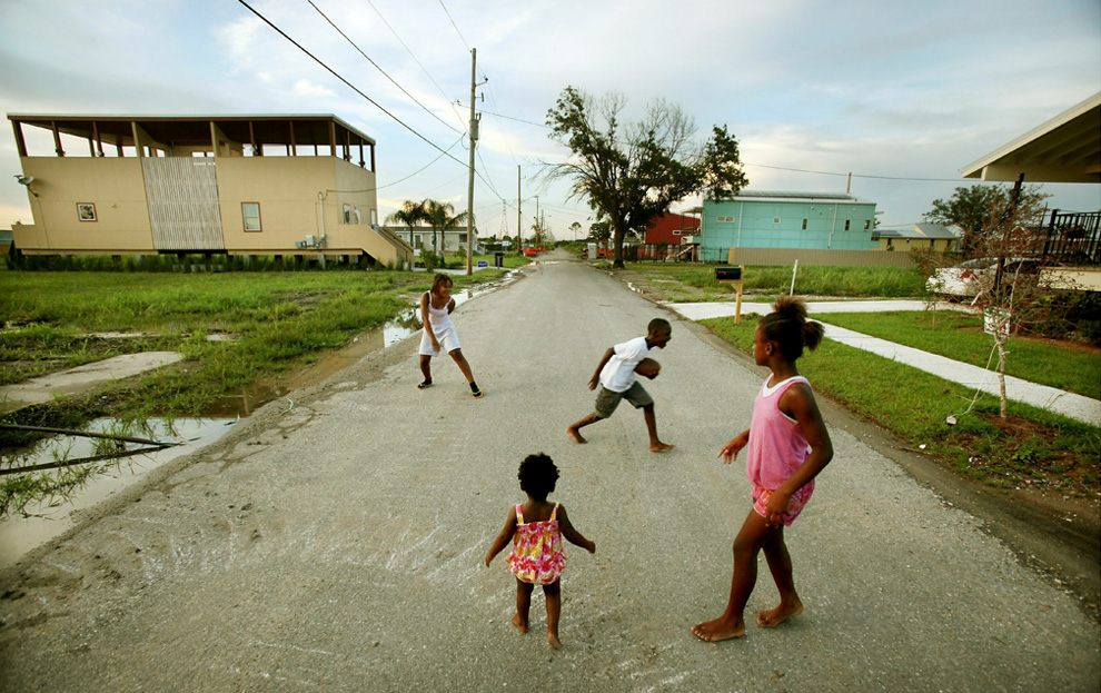
(2 of 2) Five years later, young residents play football near their home in a new development built by the Make it Right Foundation in the Lower Ninth Ward August 20, 2010 in New Orleans, Louisiana. The Make it Right Foundation is constructing homes for families who lost theirs in Hurricane Katrina's aftermath. (Mario Tama/Getty Images) #

Sara Montag, a volunteer from the group lowernine.org, cuts a board for renovation work on a house that was badly damaged during Hurricane Katrina, in the Lower Ninth Ward of New Orleans August 25, 2010. The group is renovating houses for residents to return to the neighborhood. (REUTERS/Lee Celano) #

Visitors tour the "Covering Katrina" exhibit at the Newseum in Washington, DC, August 26, 2010. On the fifth anniversary of the hurricane's landfall, the exhibit tells the story of the media's reporting of the storm and aftermath as water covered New Orleans and resulted in the deaths of more than 1,500 people in the region. (SAUL LOEB/AFP/Getty Images) #
Αποστολή από: Ivan στις Αυγούστου 30, 2010, 22:56:21 μμ
οι κάθε είδους πληγέντες όμως...
Αποστολή από: Ivan στις Σεπτεμβρίου 11, 2010, 02:19:33 πμ
http://clopyandpaste.blogspot.com/2010/09/blog-post_9720.html
Πηγή: ClopYPastE.gr - ClopYandPastE.blogspot.com
Αποστολή από: rovespieros στις Σεπτεμβρίου 11, 2010, 09:09:07 πμ
Αποστολή από: thailandgr στις Οκτωβρίου 07, 2010, 15:40:39 μμ
Την Δευτέρα, 4η Οκτωβρίου, μια μεγάλη δεξαμενή γεμάτη με τοξικη κόκκινη λάσπη στη δυτική Ουγγαρία εσπασε, απελευθερώνοντας περίπου 700.000 κυβικα μέτρα (185 εκατομμύρια γαλόνια) απο μια βρωμερη καυστικη λάσπη, απο την οποια σκοτώθηκαν πολλά ζώα, τουλάχιστον τέσσερα άτομα, και τραυματιστικαν πάνω από 120 καθως και πολλοι με χημικά εγκαύματα.
Αποστολή από: Ivan στις Οκτωβρίου 07, 2010, 20:23:52 μμ
Αποστολή από: thailandgr στις Νοεμβρίου 12, 2010, 15:40:14 μμ
Εκατοντάδες χιλιάδες κάτοικοι εκτοπίστηκαν, πολλοί από αυτούς ζουν σε προσωρινά καταλύματα μέχρι η ινδονησιακή κυβέρνηση να μειώσει την υφιστάμενη 20 χιλιόμετρων «ζώνη ασφαλειας », και να τους επιτρέψει σε αυτους και τα ζώα τους να επιστρέψουν.

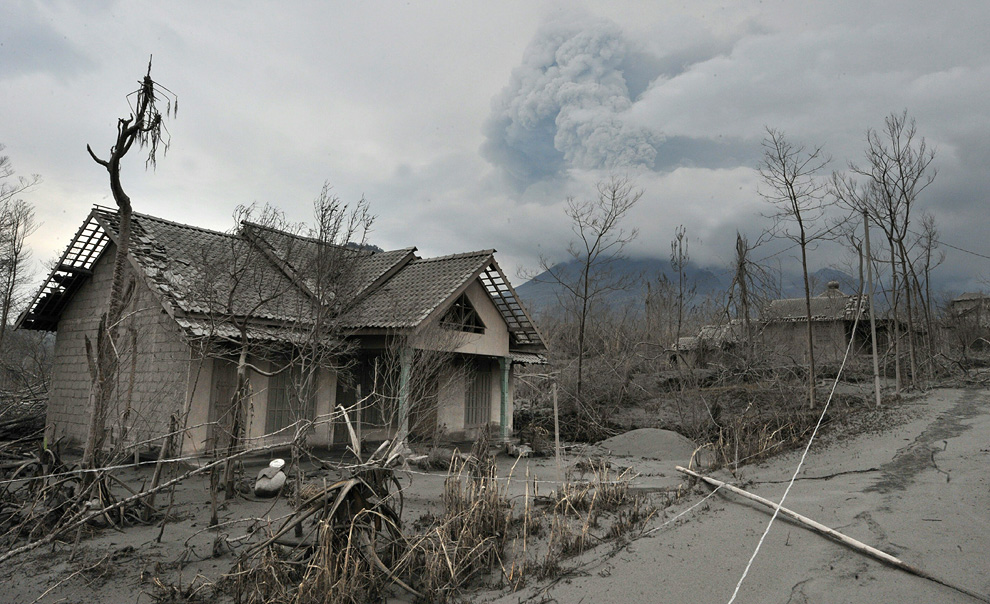
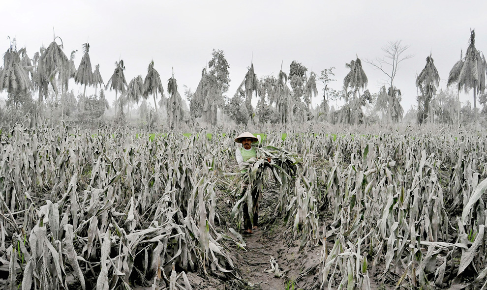
A farmer stands in a rice field as volcanic material from Mount Merapi erupts, in Klaten, Central Java on November 4, 2010 near Yogyakarta, Indonesia. Over 70,000 people have now been evacuated with the danger zone being extended to over 15km as the volcano continues to spew ash and volcanic material. (Ulet Ifansasti/Getty Images)

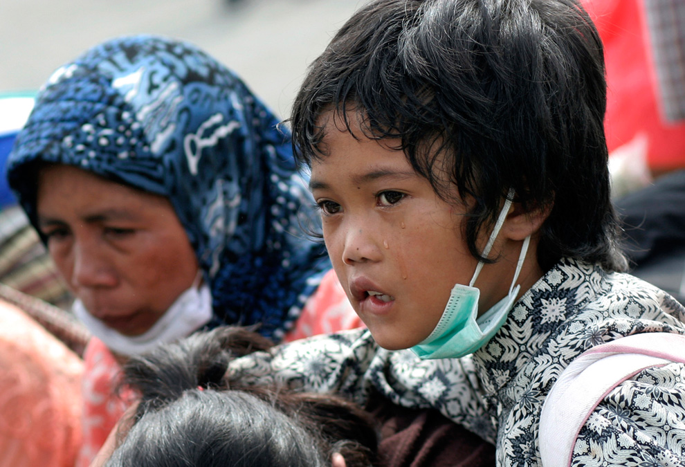
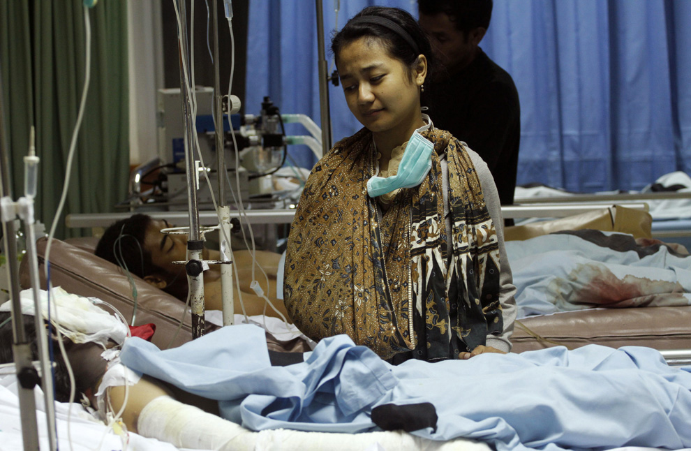
Survivor Sri Sucirathaasri, 18, stands beside her injured sister Prisca in a hospital in Yogyakarta, Indonesia on Nov. 5, 2010. The hospital at the foot of Indonesia's most volatile volcano is struggling to cope with victims brought in after the mountain's most powerful eruption in a century. (AP Photo/Achmad Ibrahim) #
Αποστολή από: thailandgr στις Φεβρουαρίου 24, 2011, 13:48:24 μμ
Με εκατοντάδες εξακολουθούν να αγνοούνται, και 95 νεκρούς που έχουν ήδη επιβεβαιωθεί , οι διασώστες πασχιζουν για να βρουν επιζώντες στο δεύτερο βράδυ μετά απο ένα καταστροφικό σεισμό που έπληξε το Christchurch, τη δεύτερη μεγαλύτερη πόλη της Νέας Ζηλανδίας .
Κτίρια κατέρρευσαν στους δρόμους μετά το σεισμό των 6,3 R , και οι γεωλόγοι εξετάζουν το ενδεχόμενο να ειναι μετασεισμός σε ένα σεισμό 7,1 που δεν προκάλεσε θύματα, τον Σεπτέμβριο.
Ο Σεισμός της Τρίτης ήταν πιο καταστροφικος και θανάσιμος επειδή το επικεντρο ήταν μόνο έξι μίλια από το κέντρο της πόλης και το χτύπημα ηταν κατά τη διάρκεια μιας εργάσιμης ημέρας.
Η κυβέρνηση έχει κυρηξει μια εθνική κατάσταση έκτακτης ανάγκης.

The 6.3 magnitude earthquake struck in the early afternoon Tuesday in Christchurch, prompting New Zealanders to flee into the streets as others rushed to the collapsed buildings in attempts to rescue those trapped in the rubble. (Iain McGregor/Christchurch Press/Reuters)

Workers and police converge on the rubble of the CTV building in Christchurch Tuesday to seek victims. The building had housed the King's Education School; the quake struck in the middle of the school day. As many as 23 Japanese students at the language school were believed to be trapped, according to the Associated Press. (Carys Monteath/Christchurch Press/Reuters) #

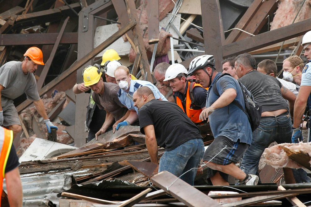
Rescuers search for survivors in a collapsed building along Manchester Street minutes after the quake struck. This scene was repeated in pockets of destruction throughout Christchurch. By Wednesday, about 120 people around the city had been pulled alive from the rubble. Hundreds remained missing. (Martin Hunter/Getty Images) #

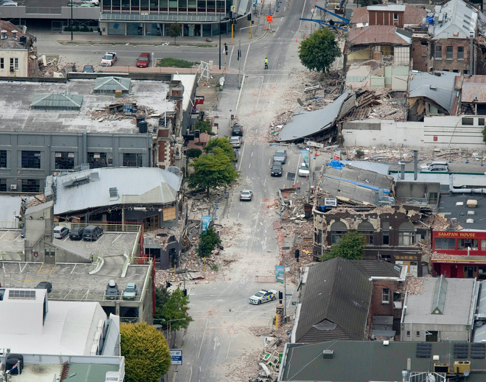
Buildings crumbled into the streets after the 6.3 magnitude earthquake, which geologists consider an aftershock to a 7.1 earthquake that caused no casualties in September. Tuesday’s temblor was more devastating and deadly because it was centered only six miles from the city's center and hit during the middle of a workday. (Martin Hunter/Getty Images) #

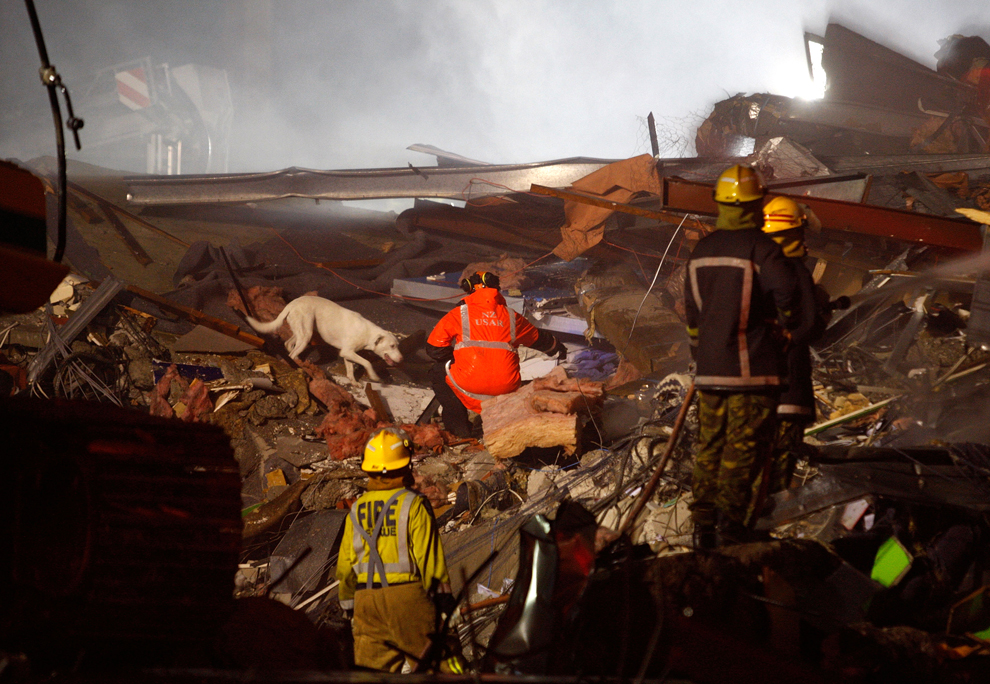
In a video image from New Zealand's TVNZ, men carry a wounded man after he is pulled from the rubble. “They are trapped in cars, crushed under rubble and, where they are clearly deceased, our focus unfortunately at this time has turned to the living,” the city’s police superintendent, Russell Gibson, told Radio New Zealand Wednesday. “We are getting texts and tapping sounds from some of these buildings, and that’s where our focus is at the moment.” (TVNZ via Associated Press Television News) #

Rescuers pull a woman from the rubble Tuesday in Christchurch. Around the city, New Zealand's second largest, some victims emerged unscathed from the rubble, while emergency workers had to amputate the limbs of others to free them, the city’s police superintendent, Russell Gibson, told Radio New Zealand. (Iain McGregor/Christchurch Press/Reuters) #

Collapsed and severely damaged buildings fill the center of Christchurch Tuesday. Mayor Bob Parker declared a state of emergency and ordered the evacuation of the center. “I think we need to prepare ourselves in this city for a death toll that could be significant. It’s not going to be good news, and we need to steel ourselves to understand that,” he said. (Mark Mitchell/AFP/Getty Images) #

Emergency teams comb the rumble for survivors of the collapsed CTV building, which housed the King's Education School in Christchurch. Parts of the city of 350,000 people lay in ruins after Tuesday's quake; the confirmed death toll Wednesday was 75, but officials said it was sure to climb. (AP Photo/New Zealand Herald, Brett Phibbs) #
Αποστολή από: thailandgr στις Μαρτίου 12, 2011, 09:16:12 πμ

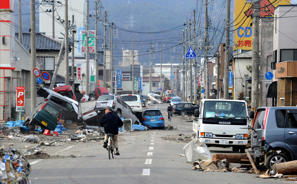
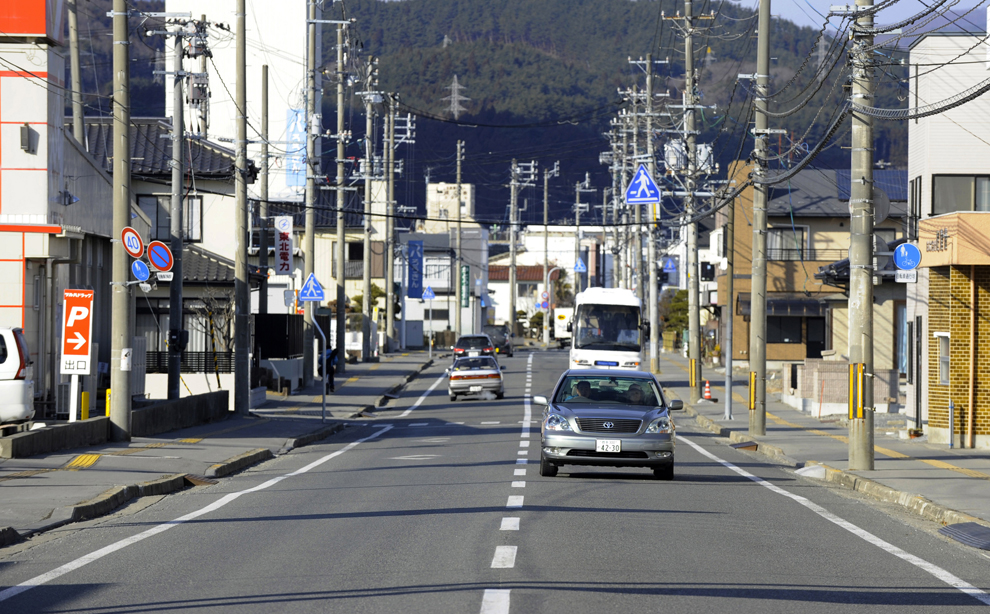
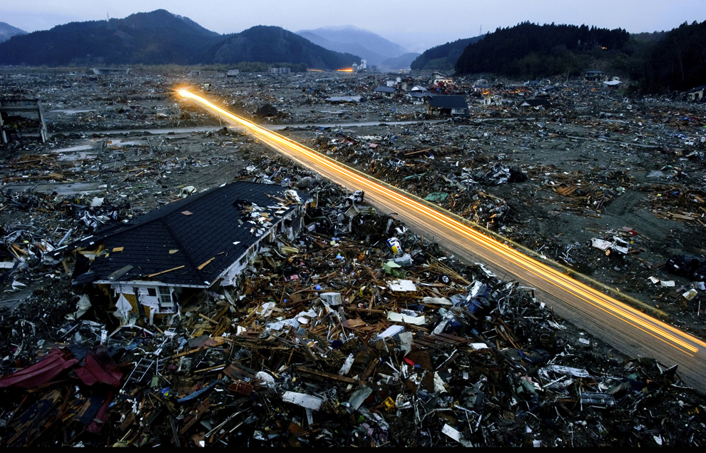
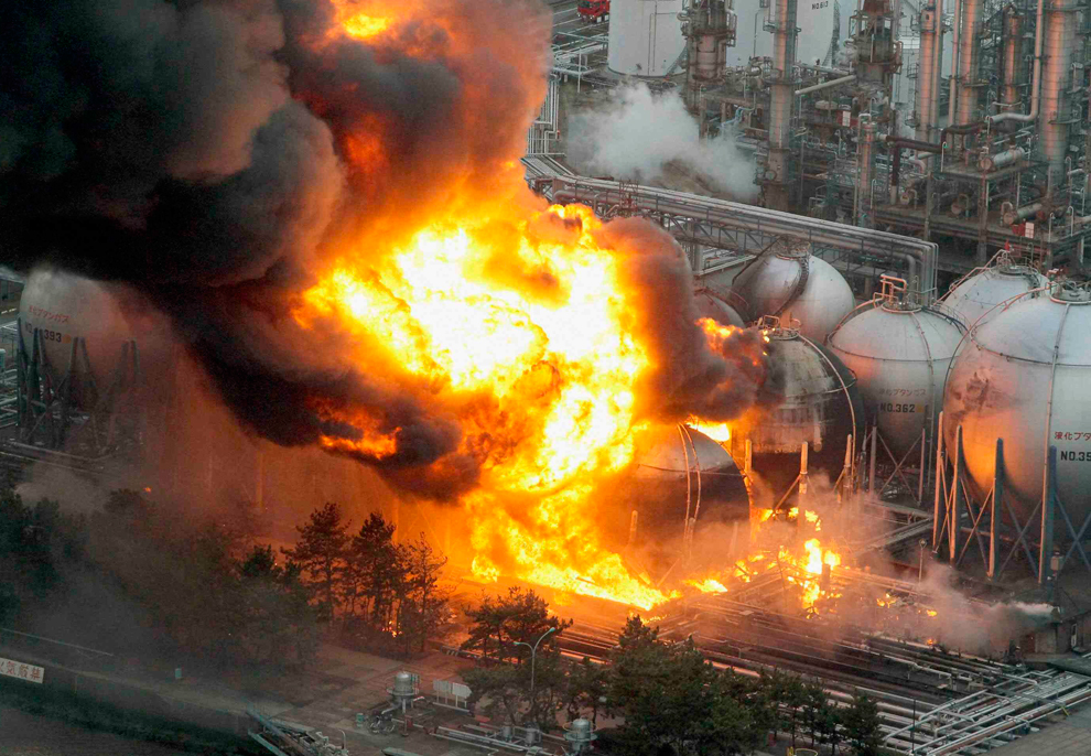
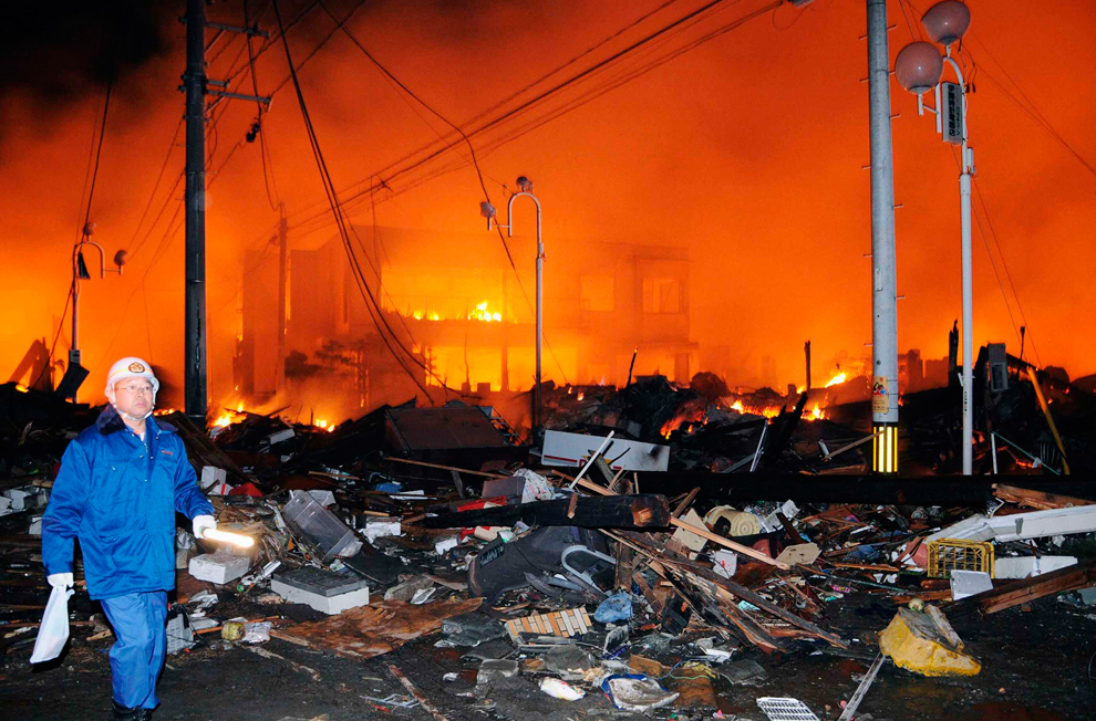
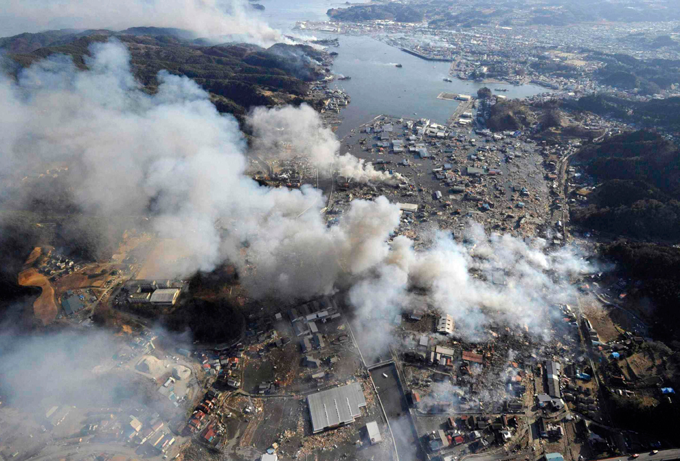
Houses swallowed by tsunami waves burn in Natori, Miyagi Prefecture (state) after Japan was struck by a strong earthquake off its northeastern coast Friday, March 11. (Kyodo News/Associated Press)

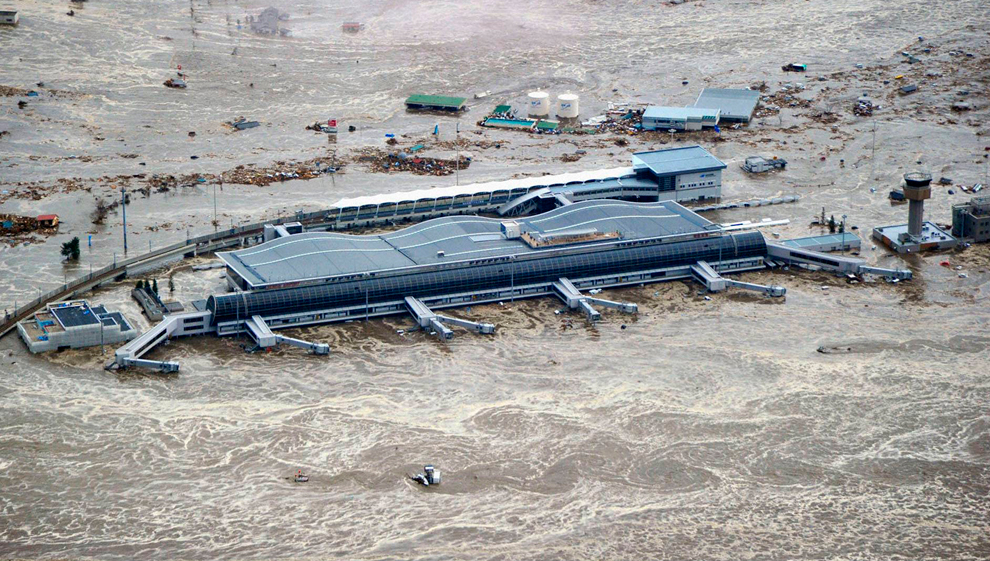
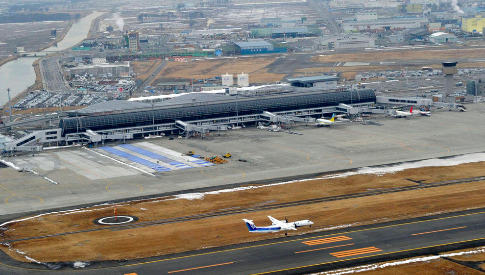
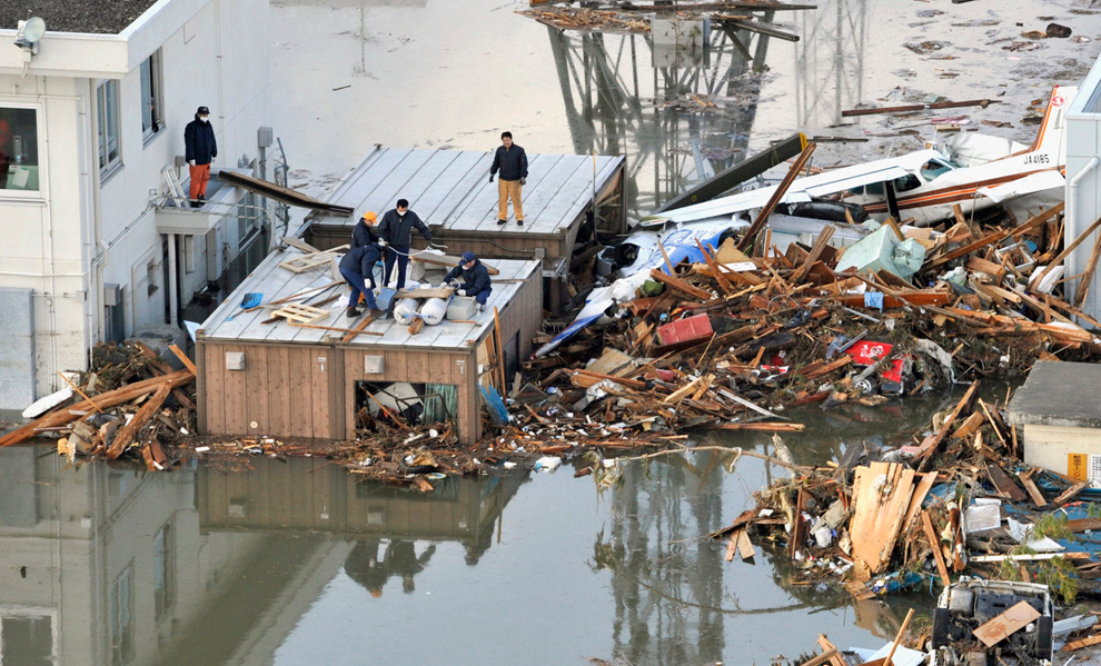
A tsumani triggered by a powerful earthquake makes its way to sweep part of Sendai airport in northern Japan on Friday March 11, 2011. The magnitude 8.9 earthquake slammed Japan's eastern coast Friday, unleashing a 13-foot (4-meter) tsunami that swept boats, cars, buildings and tons of debris miles inland. (Kyodo News/Associated Press) #

Evacuees stand around Shinjuku Central Park in Tokyo Japan March 11, 2011. A massive 8.9 magnitude quake hit northeast Japan on Friday, causing many injuries, fires and a ten-metre (33-ft) tsunami along parts of the country's coastline. A tsunami warning has been issued for the entire Pacific basin except for the mainland United States and Canada following a huge earthquake that hit Japan on Friday, the Pacific (Reuters) #

Houses are swept by a tsunami in Natori City in northeastern Japan March 11, 2011. A massive 8.9 magnitude quake hit northeast Japan on Friday, causing many injuries, fires and a ten-metre (33-ft) tsunami along parts of the country's coastline. There were several strong aftershocks and a warning of a 10-metre tsunami following the quake, which also caused buildings to shake violently in the capital Tokyo. (Reuters) #

Seismologists pose for the media as they display a seismographic graph showing the magnitude of the earthquake in Japan, on a monitor at the British Geological Survey office in Edinburgh, Scotland March 11, 2011. The biggest earthquake on record to hit Japan struck the northeast coast on Friday, triggering a 10-metre tsunami that swept away everything in its path, including houses, ships, cars and farm buildings. (David Moir/Reuters) #

An energy map provided by the National Oceanic and Atmospheric Administration (NOAA) shows the intensity of the tsunami caused by the magnitude 8.9 earthquake which struck Japan on March 11, 2011. A tsunami warning has been issued for the entire Pacific basin except mainland United States and Canada following a huge earthquake that hit Japan on Friday, the U.S. Pacific Tsunami Warning Center said. The warning includes Hawaii and extends from Mexico down to South American countries on the Pacific, the center said. (NOAA/Tsunami Warning Center/)#

This National Oceanic and Atmospheric Administration (NOAA) Global bathymetry map image released on March 11, 2011 shows features of the ocean floor depth (or bathymetry) from a NOAA ETOPO-1 dataset. The image shows the entire Western Pacific basin. Notice how abruptly the Japanese islands rise out of the ocean. Other coastal Asian areas have much more gradual slopes. The islands and mountain ranges throughout the ocean, visible in this imagery, also affect the tsunami travel time and speed. In the open ocean, tsunamis can travel at speeds up to 500 mph (800 kph). This momentum is what creates such a destructive force as the wave moves inland. Tsunami waves rolled thousands of miles across the Pacific Ocean after a massive earthquake off Japan and washed ashore in Hawaii early March 11, 2011, but the tourist hotspot appeared to escape major damage. As sirens blared and Hawaiian authorities rapidly evacuated low-lying areas, the Pacific Tsunami Warning Center reported wave changes at Waianae Harbor at around 3:24 a.m. (NOAA/handout)#

An oncoming tsunami strikes the coast in Natori City, Miyagi Prefecture, northeastern Japan March 11, 2011. The biggest earthquake to hit Japan in 140 years struck the northeast coast on Friday, triggering a 10-metre tsunami that swept away everything in its path, including houses, cars and farm buildings on fire. (Reuters) #

Japan's Prime Minister Naoto Kan (center) reacts he he feels an earthquake as he attends a committee meeting in the upper house of parliament in Tokyo March 11. A massive 8.8 magnitude quake hit the northeast coast of Japan on Friday, shaking buildings in the capital Tokyo, causing "many injuries", at least one fire and triggering a four-metre (13-ft) tsunami, NHK television and witnesses reported. (Toro Hanai/Reuters) #

Rescue workers hurry to a building following reports of injuries in Tokyo's financial district after an earthquake hit off the coast of northern Japan. There were several strong aftershocks and a warning of a 10-metre tsunami following the quake, which also caused buildings to shake violently in the capital Tokyo. (Kim Kyung-Hoon/Reuters) #

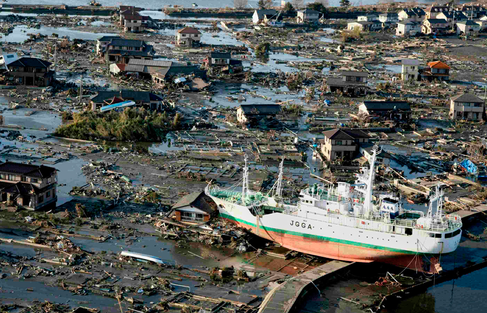
An aerial shot shows vehicles ready for shipping being carried by a tsunami tidal wave at Hitachinaka city in Ibaraki prefecture on March 11, 2011. A massive 8.8-magnitude earthquake shook Japan, unleashing a powerful tsunami that sent ships crashing into the shore and carried cars through the streets of coastal towns. (AFP/Getty Images) #

Evacuees wait in an evacuation area following an earthquake in Tokyo, Japan, on Friday, March 11, 2011. Japan was struck by its strongest earthquake on record, an 8.9-magnitude temblor that shook buildings across Tokyo and unleashed a seven-meter-high tsunami that killed hundreds as it engulfed towns on the northern coast. (Haruyoshi Yamaguchi/Bloomberg) #

Police place roadside flares along the highway on March 11 in Honolulu, Hawaii. An earthquake measuring 8.9 on the Richter scale has hit the northeast coast of Japan causing tsunami alerts throughout the Pacific Ocean. Thousands along the coast are evacuating their homes in Hawaii as the state prepares for tsunami waves. (Lucy Pemoni/Getty Images) #

Puipui Faletoi, of Moiliili, Oahu, background center, rests in his vehicle with his sons Daniel, left, and Fletcher Faletoi in the parking lot of Manoa District Park in Oahu, Hawaii. The site is a volunteer staging area which could turn into a Red Cross shelter if a tsunami arrives. The Faletoi family plan to take shelter here. (Rebecca Breyer/Associated Press)#

This National Oceanic and Atmospheric Administration (NOAA) image released on March 11, 2011 shows model runs from the Center for Tsunami Research at the NOAA Pacific Marine Environmental Laboratory showing the expected wave heights of the tsunami as it travels across the Pacific basin. The largest wave heights are expected near the earthquake epicenter off Japan. The wave will decrease in height as it travels across the deep Pacific but grow taller as it nears coastal areas. In general, as the energy of the wave decreases with distance, the near shore heights will also decrease (e.g., coastal Hawaii will not expect heights of that encountered in coastal Japan). Tsunami waves rolled thousands of miles across the Pacific Ocean after a massive earthquake off Japan and washed ashore in Hawaii early March 11. (NOAA) #
Αποστολή από: thailandgr στις Μαρτίου 13, 2011, 11:12:24 πμ

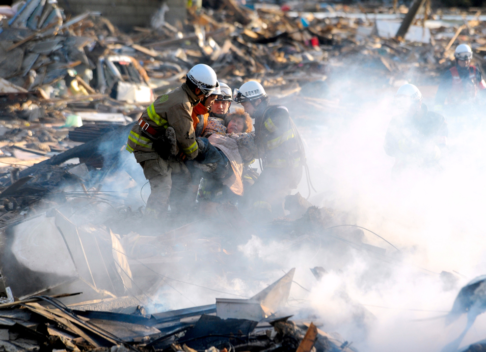
A resident is rescued from debris in Natori, Miyagi, northern Japan March 12 after one of the country's strongest earthquakes ever recorded hit its eastern coast March 11. (Asahi Shimbun, Noboru Tomura/Associated Press)

People build a raft on the roof of a building struck by a tsunami and earthquake at Sendai Airport in northeastern Japan March 12. Japan confronted devastation along its northeastern coast on Saturday, with fires raging and parts of some cities under water after a massive earthquake and tsunami. (Kyodo/Reuters) #

An official in protective gear talks to a woman who is from the evacuation area near the Fukushima Daini nuclear plant in Koriyama March 13. Japanese Chief Cabinet Secretary Yukio Edano confirmed on Saturday there has been an explosion and radiation leakage at Tokyo Electric Power Co's (TEPCO) Fukushima Daiichi nuclear power plant. (Kim Kyung-Hoon/Reuters) #

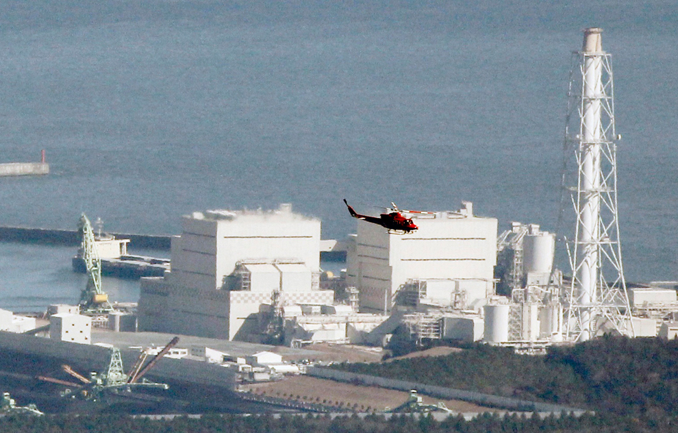
A helicopter flies past Japan's Fukushima Daiichi No.1 Nuclear reactor March 12. An explosion blew the roof off the unstable reactor north of Tokyo on Saturday, Japanese media said, raising fears of a disastrous meltdown at a nuclear plant damaged in the massive earthquake that hit Japan. (Kim Kyung-Hoon/Reuters) #

A man who was trapped by a tsunami is rescued by a Japan Self-Defense Force soldier in Kesennuma City in Miyagi Prefecture in northeastern Japan March 12. Japan confronted devastation along its northeastern coast on Saturday, with fires raging and parts of some cities under water after a massive earthquake and tsunami. (Kyodo/Reuters) #

Cargo containers are strewn about in Sendai Japan March 12. Japan launched a massive military rescue operation Saturday after a giant, earthquake-fed tsunami killed hundreds of people and turned the northeastern coast into a swampy wasteland, while authorities braced for a possible meltdown at a nuclear reactor. (Itsuo Inouye/Asociated Press) #

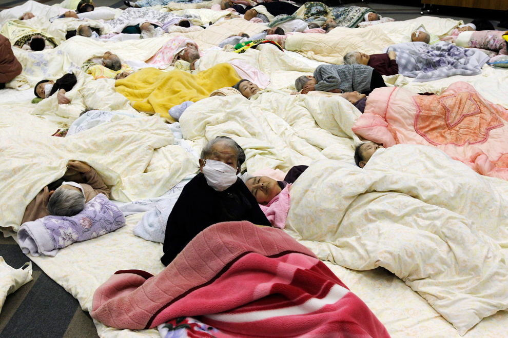
People evacuated from a nursing home located in the evacuation area around the Fukushima Daini nuclear plant, rest at a temporary shelter in Koriyama, March 13. Japanese Chief Cabinet Secretary Yukio Edano confirmed on Saturday there has been an explosion and radiation leakage at Tokyo Electric Power Co's (TEPCO) Fukushima Daiichi nuclear power plant. (Kim Kyung-Hoon/Reuters) #
Αποστολή από: giannis στις Μαρτίου 14, 2011, 11:49:01 πμ
Αποστολή από: thailandgr στις Μαρτίου 15, 2011, 22:17:55 μμ
Μετακινιστε την μεσαια μαυρη γραμμή
Αποστολή από: giannis στις Μαρτίου 19, 2011, 10:39:54 πμ
(http://img84.imageshack.us/img84/7657/japanesetsunami2.jpg)
(http://img198.imageshack.us/img198/7174/japanesetsunami3.jpg)
(http://img218.imageshack.us/img218/296/japanesetsunami4.jpg)
(http://img848.imageshack.us/img848/7484/japanesetsunami5.jpg)
(http://img692.imageshack.us/img692/749/japanesetsunami6.jpg)
(http://img204.imageshack.us/img204/1246/japanesetsunami7.jpg)
(http://img151.imageshack.us/img151/2954/japanesetsunami9.jpg)
(http://img155.imageshack.us/img155/2014/japanesetsunami10.jpg)
(http://img714.imageshack.us/img714/6867/japanesetsunami11.jpg)
(http://img818.imageshack.us/img818/5617/japanesetsunami12.jpg)
(http://img864.imageshack.us/img864/1730/japanesetsunami13.jpg)
(http://img402.imageshack.us/img402/7527/japanesetsunami15.jpg)
(http://img14.imageshack.us/img14/9847/japanesetsunami16.jpg)
(http://img88.imageshack.us/img88/8108/japanesetsunami17.jpg)
Αποστολή από: thailandgr στις Μαρτίου 19, 2011, 13:35:10 μμ

Sixty-six-year-old Yoshikatsu Hiratsuka cries in front of his collapsed house with his son still missing, possibly buried in the rubble, at Onagawa town in Miyagi prefecture on March 17. The official number of dead and missing after a devastating earthquake and tsunami that flattened Japan's northeast coast is approaching 15,000, police said. (Yomiuri Shimbun/AFP/Getty Images)

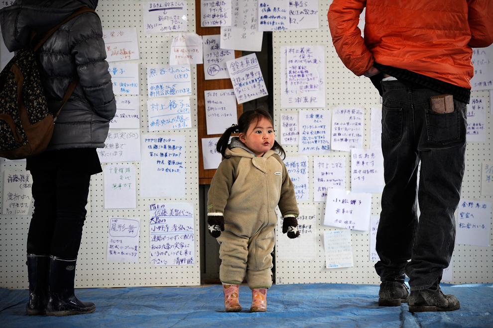
Survivors check a message board at a shelter for earthquake victims in Kesennuma on March 17. Half a million evacuees struggled to stay warm as rescuers said their efforts to help the devastated population were at risk, almost a week after the 9.0 magnitude quake and massive tsunami hit. (Philippe Lopez/AFP/Getty Images) #

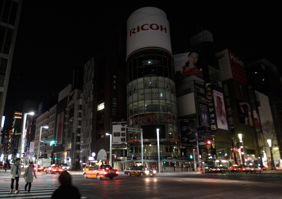
A couple cross a large intersection in front of blacked out light displays in Tokyo's Ginza district March 17. In the famous shopping mecca - and elsewhere in the nation's capital - public apprehension over a brewing nuclear disaster is draining the streets and stores of the crowds that normally define this dynamic, densely packed city. (Gregory Bull/AP) #
Αποστολή από: thailandgr στις Μαρτίου 19, 2011, 13:37:26 μμ

Momoko Onodera prays at an evacuation center as she talks about her husband who died in the tsunami on March 18 in Kesennuma, Japan. A potential humanitarian crisis looms as nearly half a million people who have been displaced by the disaster continue to suffer a shortage of food and fuel as freezing weather conditions set in. (Paula Bronstein/Getty Images)

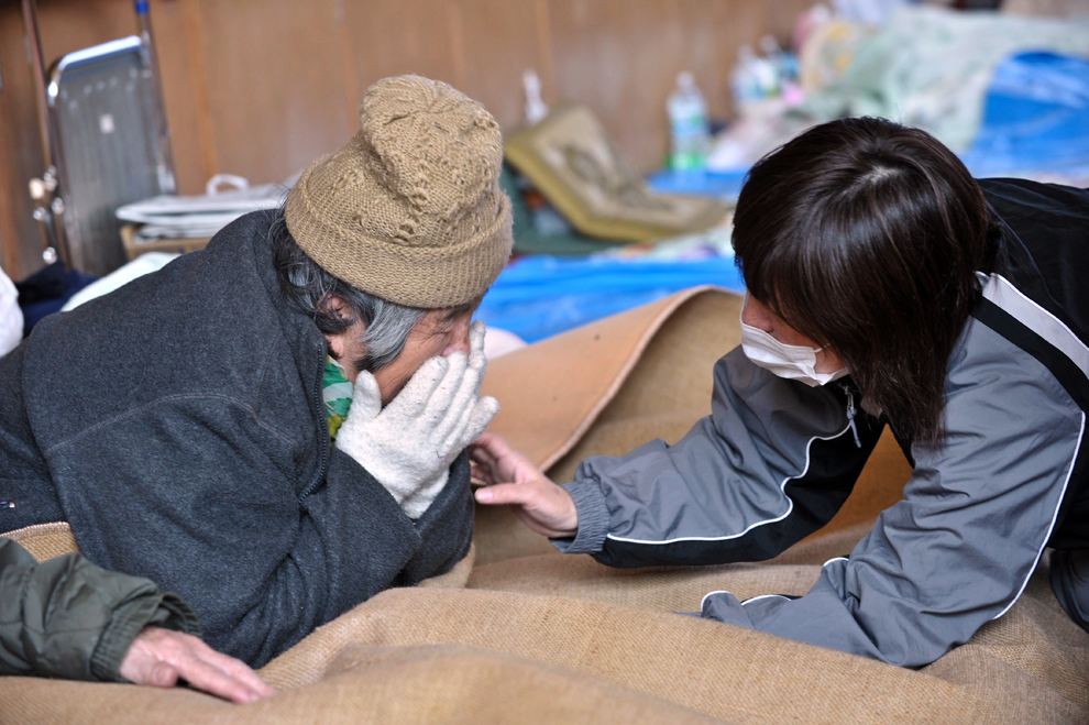
An elderly woman and a relative are reunited at a center for displaced persons in the devastated town of Otsuchi, Iwate prefecture on March 18 one week after a massive 9.0 magnitude earthquake and tsunami hit the northestern coast of Japan's main island of Honshu. (Nicholas Kamm/AFP/Getty Images) #

A two-month old baby evacuated along with his parents from the town of Okuma, Fubata district in Fukushima prefecture where the TEPCO Fukushima Daiichi nuclear power plant, is given a bath by a volunteer, Junko Sakamoto in Koriyama city in Fukushima prefecture on March 18. (Go Takayama/AFP/Getty Images) #

People queue to buy gasoline at a destroyed village in Ofunato, Iwate Prefecture March 18. The shutdown of a fifth of Japan's nuclear power capacity and nearly a third of its refining capacity following last week's killer quake and tsunami has resulted in a fuel shortage in the country. (Lee Jae-Won/Reuters) #

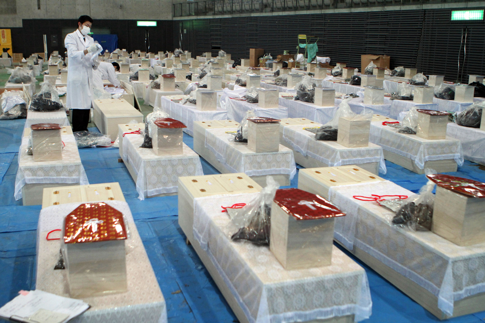
Dozens of coffins are pictured on the floor of a hall in the town of Rifu in Miyagi prefecture on March 18. The official number of dead and missing after the devastating earthquake and tsunami that flattened Japan's northeast coast a week ago has topped 16,600, with 6,405 confirmed dead. (JIJI PRESS/AFP/Getty Images) #

Lights are turned off during rolling blackouts in Misato City, Saitama Prefecture on March 18. Tokyo Electric Power Co has announced rolling blackouts after its power generation was cut due to damage to its Fukushima Daiichi power plant, where it is struggling to prevent reactor meltdowns. (Reuters/Kyodo) #

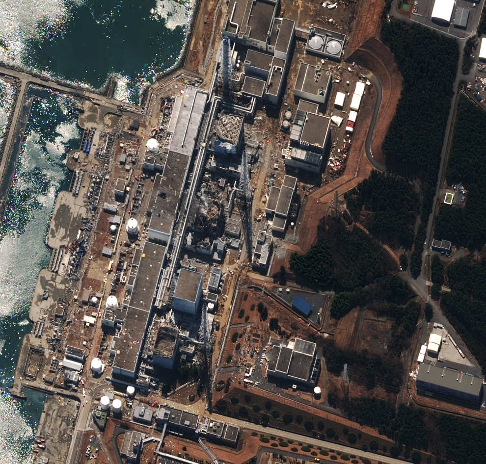
A satellite image shows damage to the reactors at the Fukushima Dai-Ichi nuclear power plant at the town of Okuma in Futaba district in Fukushima. Teams of Japanese workers and troops on March 18 battled to prevent meltdown at the quake-hit nuclear plant as alarm over the disaster grew with more foreign governments advising their citizens to flee. (DigitalGlobe/AFP/Getty Images) #
Αποστολή από: thailandgr στις Ιουλίου 03, 2011, 20:29:18 μμ
Wildfire threatens nuclear facility
Η πυρκαγιά στο Las Conchas στο Νέο Μεξικό εχει εξαπλωθεί επικίνδυνα κοντά στο Los Alamos National Laboratory αυτή την εβδομάδα, προκαλώντας την εκκένωση της πόλης και την παύση της λειτουργίας του εργαστηρίου, το οποίο είναι η έδρα για την αμερικανική στρατιωτική έρευνα.
Το εργαστήριο δημιουργήθηκε κατά τη διάρκεια του Β 'Παγκοσμίου Πολέμου για την ανάπτυξη της πρώτης ατομικής βόμβας για το Manhattan Project και αποθηκες με εξαιρετικά ευαίσθητα υλικά.
Ως προληπτικό μέτρο, οι επιστήμονες εχουν την παρακολούθηση της ραδιενέργειας στον αέρα.
Η φωτιά είναι η μεγαλύτερη πυρκαγιά στην ιστορία της πολιτείας, που καλύπτει πάνω από 100.000 στρέμματα

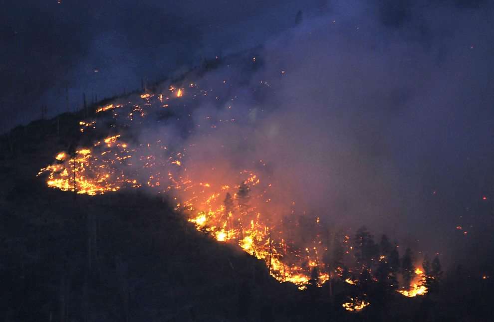
A vicious wildfire burns near the Los Alamos Laboratory in Los Alamos, N.M., on June 28, 2011. The Las Conchas fire spread through the mountains above the northern New Mexico town, driving thousands of people from their homes as officials at the government nuclear laboratory tried to dispel concerns about the safety of sensitive materials. (Jae C. Hong/Associated Press)

Ella Gaffney, 7, and her mother. Jenni, listen to Los Alamos Police Chief Wayne Thorpy give details about the Las Conchas fire. They were in the Red Cross evacuation center set up at the Santa Claran Hotel in Espanola, N.M., on June 28, 2011. (Eddie Moore/Albuquerque Journal via Associated Press) #

New Mexico National Guard member Pia Romero holds a map of the Las Conchas fire during a news conference in Los Alamos, N.M., on June 29, 2011. The wildfire 12 miles southwest of Los Alamos was 3 percent contained after burning across nearly 61,000 acres or 95 square miles. (Jae C. Hong/Associated Press) #

A NASA image taken by a crew member aboard the International Space Station, flying at an altitude of approximately 235 statute miles on June 27, 2011, shows the Las Conchas fire in the Jemez Mountains of the Santa Fe National Forest in north-central New Mexico. The fire is just southwest of Los Alamos National Laboratories. (NASA/Associated Press) #

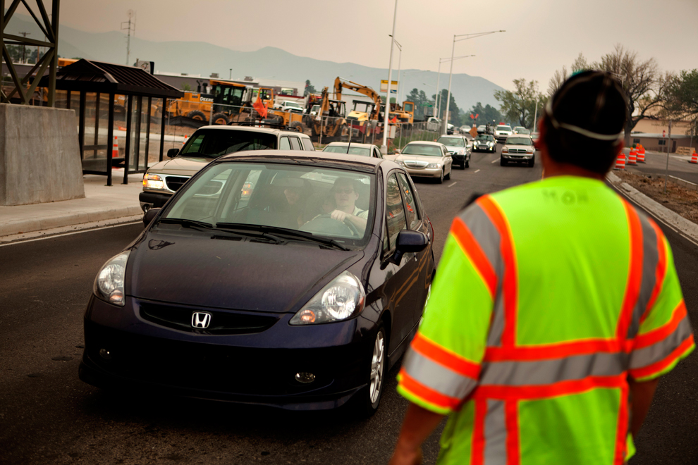
Carissa Pittman consoles her daughter, Emily, 15, while her husband, Pete, in the car, and son, Allen, 21, prepare to leave Los Alamos, N.M., because of the wildfire on June 27, 2011. Thousands of residents calmly fled Monday from the mesa-top town that's home to the Los Alamos nuclear laboratory, ahead of an approaching wildfire. (Jane Phillips/The New Mexican via Associated Press) #

Flames from the Las Conchas fire burn in Los Alamos, N.M. in the Jemez Mountains on the morning of June 28, 2011. Fire managers said it was a "make or break day" for ensuring flames from the wildfire don't race into the northern New Mexico town that is home to a government nuclear laboratory that stores sensitive materials. (Eddie Moor/Albuquerque Journal via Associated Press) #

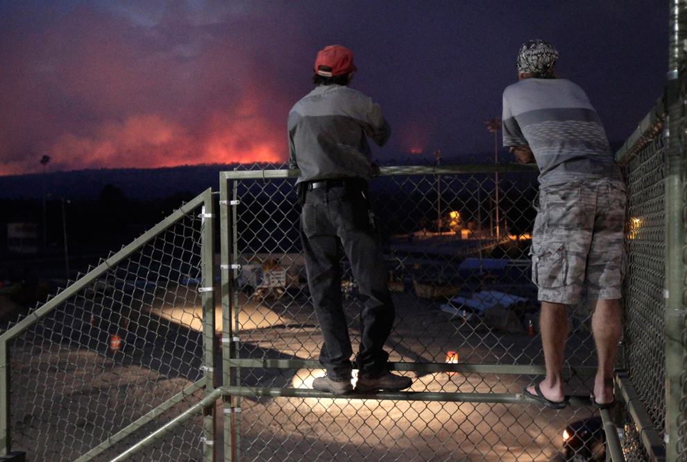
Los Alamos residents Ross Van Lyssel, left, and Steve Bowers watch flames from the Las Conchas fire in Los Alamos, N.M., on June 28, 2011. The vicious wildfire spread through the mountains above the northern New Mexico town, driving thousands of people from their homes as officials at the government nuclear laboratory tried to dispel concerns about the safety of sensitive materials. (Jae C. Hong/Associated Press) #

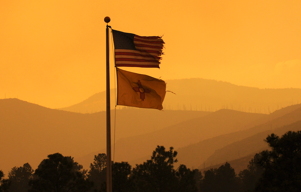
Wind battered flags located at a fire station at Diamond and Range roads in Los Alamos, N.M., flap in the breeze on June 27, 2011, after the fast-moving wildfire broke out in New Mexico and forced officials at the Los Alamos National Laboratory to close the site as residents nearby evacuated their homes. (Pat Vasquez-Cunningham/The Albuquerque Journal via Associated Press) #

A firefighter walks through heavy smoke from the Las Conchas fire near Los Alamos, N.M., on June 29, 2011. As crews fight to keep the wildfire from reaching the country's premier nuclear-weapons laboratory and the surrounding community, scientists are busy sampling the air for chemicals and radiological materials. (Jae C. Hong/Associated Press) #

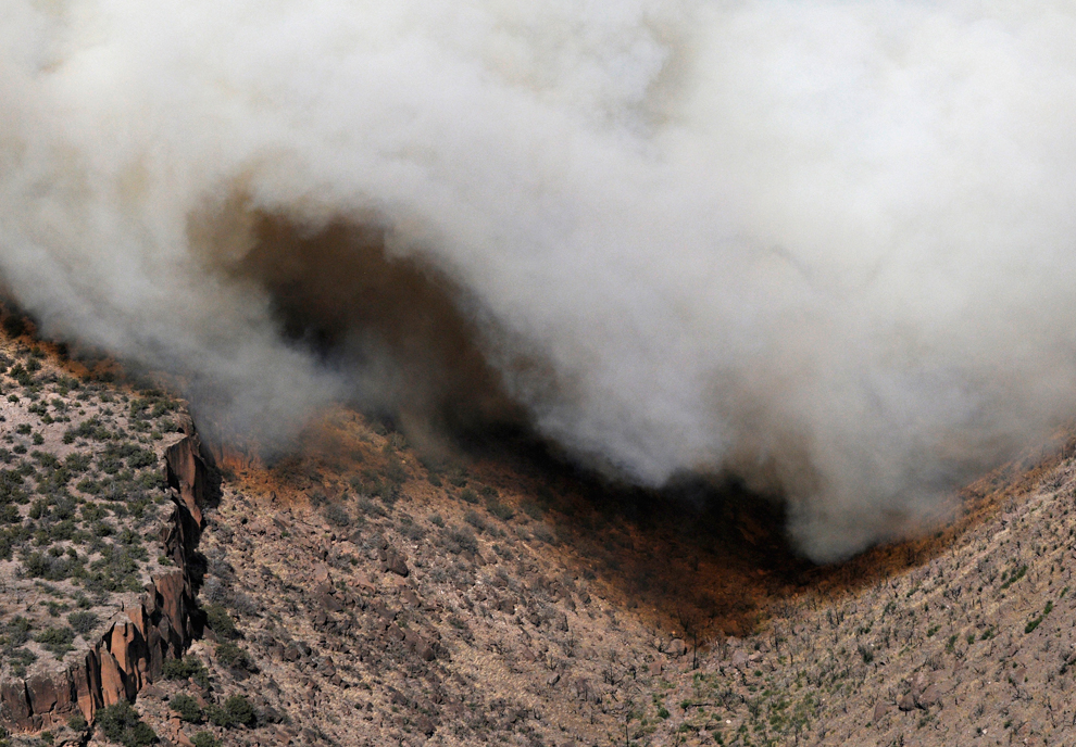
A wave of smoke billows and fills a canyon as the Las Conchas, N.M. fire creeps into the canyon. The wildfire threatening the nation’s premier nuclear weapons laboratory and a community in northern New Mexico was poised Thursday to become the largest fire in state history. (Morgan Petroski/Albuquerque Journal via Associated Press) #

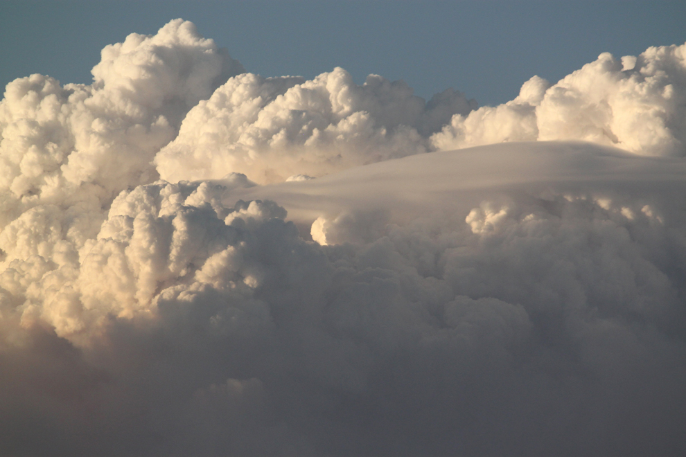
The top of a plume of smoke from the Las Conchas wildfire in the Jemez Mountains billows in the clouds, as seen from miles away in Rio Rancho, N.M., on June 26, 2011. Fire officials say the Las Conchas fire charred more than 3,500 acres since starting Sunday afternoon. Voluntary evacuations were issued for Los Alamos and White Rock. (Susan Montoya Bryan/Associated Press) #

Fire trucks patrol the western area of Los Alamos, N.M., a day after an evacuation order was issued because of the encroaching Las Conchas wildfire on June 28, 2011. New Mexico fire managers scrambled on Tuesday to reinforce crews battling a third day against an out-of-control blaze at the edge of one of the nation's top nuclear weapons production centers. (Craig Fritz/Reuters) #

The Morrison family, Dee, top left, Taylor, 4, right, Bob, and Jeni, center, pack up their belongings following a mandatory evacuation ordered for Los Alamos, N.M., as the rapidly growing Las Conchas wildfire approaches on June 27, 2011. The blaze, which began Sunday, had already destroyed 30 structures south of Los Alamos and forced the closure of the Los Alamos Nuclear Laboratory. (Craig Fritz/Associated Press) #

Gary Thayer takes out a cooler of food as he prepares to leave following the mandatory evacuation of Los Alamos, N.M., on June 27, 2011. Thousands of residents calmly fled the town that's home to the Los Alamos nuclear laboratory as the rapidly growing wildfire approached, sending up towering plumes of smoke, raining down ash and charring the fringes of the sprawling lab's property. (Craig Fritz/Associated Press) #

The Las Conchas Fire burns through a canyon on June 29, 2011 in Los Alamos, N,M. The government sent a plane equipped with radiation monitors over the Los Alamos nuclear laboratory as a 110-square-mile wildfire burned at its doorstep, putting thousands of scientific experiments on hold for days. (Morgan Petroski/The Albuquerque Journal via Associated Press) #

Threatened by the Las Conchas wildfire, residents wind their way by car along Diamond Drive following an evacuation order for Los Alamos, N.M., on June 27, 2011. Thousands of residents calmly fled the town that's home to the Los Alamos nuclear laboratory as a rapidly growing wildfire approached, sending up towering plumes of smoke, raining down ash, and charring the fringes of the sprawling lab's property. (Craig Fritz/Associated Press) #

Felina Trujillo, from Los Alamos, left, and her daughter Jenna Trujillo, 15, who both evacuated Las Alamos on Sunday, look for groceries in the donated food at the Food Depot in Sante Fe, N.M. on June 29, 2011. The Food Depot is making direct donation to evacuees. (Luis Sánchez Saturno/The New Mexican via Associated Press) #

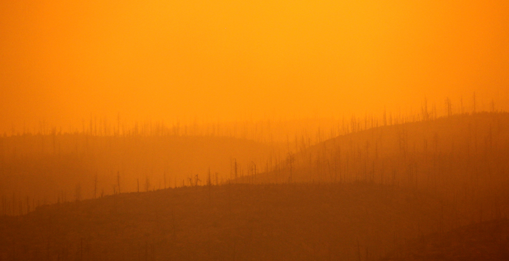
The sun filters through thick smoke from a wildfire burning near Los Alamos, N.M., on June 27, 2011. Thousands of residents calmly fled the town that's home to the Los Alamos nuclear laboratory as a rapidly growing wildfire approached, sending up towering plumes of smoke, raining down ash and charring the fringes of the sprawling lab's property. The blaze, which began Sunday, had destroyed 30 structures south of Los Alamos and forced the closure of the lab. (Susan Montoya Bryan/Associated Press) #

Alex Lopez plays baseball with his sister Sugey while smoke generated by the Las Conchas fire covers the sky in Espanola, N.M. on June 29, 2011. As crews fight to keep the wildfire from reaching the country's premier nuclear-weapons laboratory and the surrounding community, scientists are busy sampling the air for chemicals and radiological materials. (Jae C. Hong/Associated Press) #

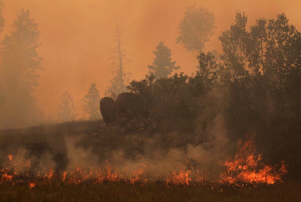
The Las Conchas fire burns trees and grass near Los Alamos, N.M., on June 29, 2011. As crews fight to keep the wildfire from reaching the country's premier nuclear-weapons laboratory and the surrounding community, scientists are busy sampling the air for chemicals and radiological materials. (Jae C. Hong/Associated Press)#

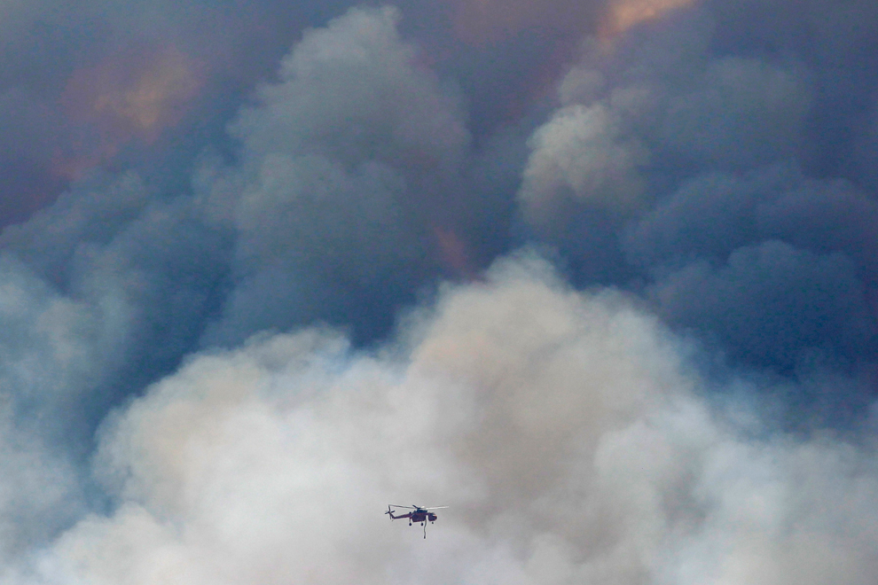
A helicopter flies through the smoke from the Las Conchas fire in Los Alamos, N.M. on June 29, 2011. As crews fight to keep the wildfire from reaching the country's premier nuclear-weapons laboratory and the surrounding community, scientists are busy sampling the air for chemicals and radiological materials. (Jae C. Hong/Associated Press) #

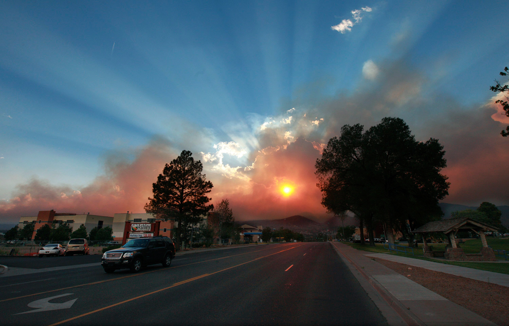
The sun shines through smoke from the Las Conchas wildfire near the Los Alamos National Laboratory., on June 29, 2011. Thousands of residents calmly fled the town that's home to the Los Alamos nuclear laboratory as the rapidly growing wildfire approached, sending up towering plumes of smoke, raining down ash, and charring the fringes of the sprawling lab's property. The blaze, which began Sunday, had already destroyed 30 structures south of Los Alamos and forced the closure of the lab. (Eric Draper/Reuters) #
Αποστολή από: thailandgr στις Αυγούστου 31, 2011, 09:20:31 πμ

Billy Stinson comforts his daughter Erin Stinson as they sit on the steps where their cottage once stood on August 28, 2011 in Nags Head, N.C. The cottage, built in 1903 and destroyed by Hurricane Irene, was one of the first vacation cottages built on Albemarle Sound in Nags Head. Stinson has owned the home, which is listed in the National Register of Historic Places, since 1963. "We were pretending, just for a moment, that the cottage was still behind us and we were just sitting there watching the sunset," said Erin afterward. (Scott Olson/Getty Images)

A resident rides a horse through a flooded neighborhood after the passing of Hurricane Irene in Nagua, Dominican Republic on August 23, 2011. Hundreds were displaced by flooding in the Dominican Republic, forced to take refuge in churches, schools or relatives' homes. Electricity also was cut in some areas. (Roberto Guzman/AP) #

A surfer passes the broken end of the Bogue Inlet Fishing Pier in Emerald Isle, N.C. on August 28, 2011. Hurricane Irene spent 12 hours scouring the coast, killed at least five people, brought pockets of flooding that required rescues along the sounds, and left nearly a half-million customers without power. (John Rottet/The News & Observer/AP) #

Steve Egbert of Des Moines, Iowa reads from his journal at a shelter set up in Portland, Maine as Hurricane Irene made its way into the state on August 28, 2011. Egbert had been camping in western Maine for a week and was trying to get home, when both his bus and plane reservations were cancelled. (Pat Wellenbach/AP) #

Susie and over 75 other pets are checked into the Red Cross center at Indian River High School to ride out Hurricane Irene in Dagsboro, Del. on August 27, 2011. (Suchat Pederson/The News Journal/AP)#
-
Τίτλος: Απ: Ηφαιστεια - τυφωνες και φυσικες ( και οχι μονο )κατα
Αποστολή από: thailandgr στις Οκτωβρίου 02, 2011, 11:29:05 πμ
-
Το νερό είναι απαραίτητο για τη ζωή, αλλά σε μέρη όπως η Ινδία, το Πακιστάν, η Κίνα και η Ταϊλάνδη για άλλη μια φορά προκάλεσε δυστυχία. Ο τυφωνας Nesat χτύπησε τις Φιλιππίνες στις αρχές της εβδομάδας στο δρόμο προς νότια Κίνα. Στο Πακιστάν, πάνω από 5 εκατομμύρια άνθρωποι έχουν έχουν πληγεί από τις πρόσφατες πλημμύρες, σύμφωνα με το πρακτορείο Oxfam. Το Πακιστάν αγωνίζεται ακόμα να ορθοποδήσει από τις καταστροφικές βροχές των μουσώνων, του 2010.(36 photos total)
Αποστολή από: thailandgr στις Οκτωβρίου 02, 2011, 11:29:05 πμ

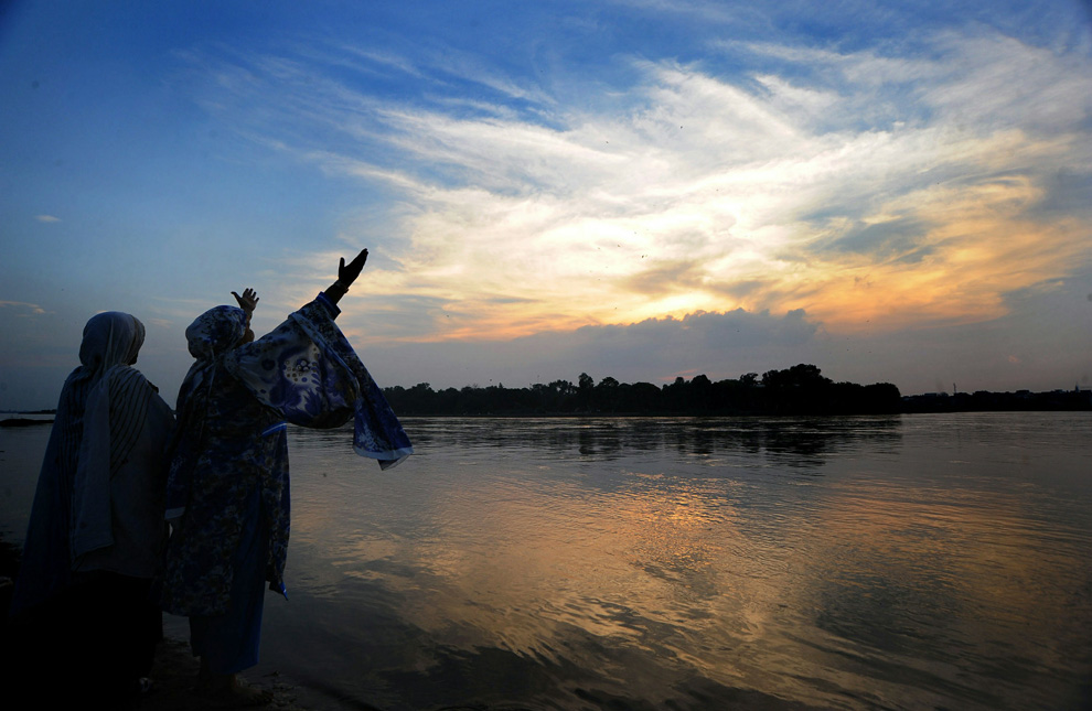
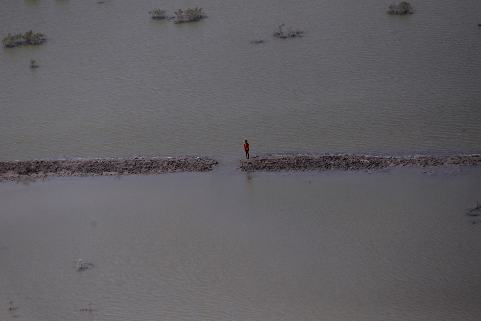
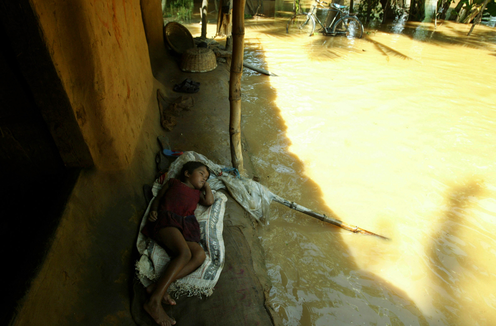
A village boy sits on the banks of the swelling Daya River, near Pipli village, about 25 kilometers from the eastern Indian city of Bhubaneshwar Sept. 9. The flood situation in Orissa state worsened with the release of more water downstream from Hirakud dam, according to a news agency. A high alert has been sounded in 11 districts of the state. (Biswaranjan Rout/Associated Press)

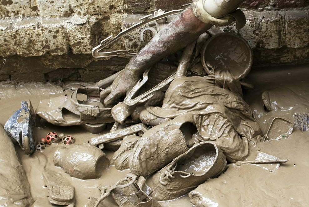
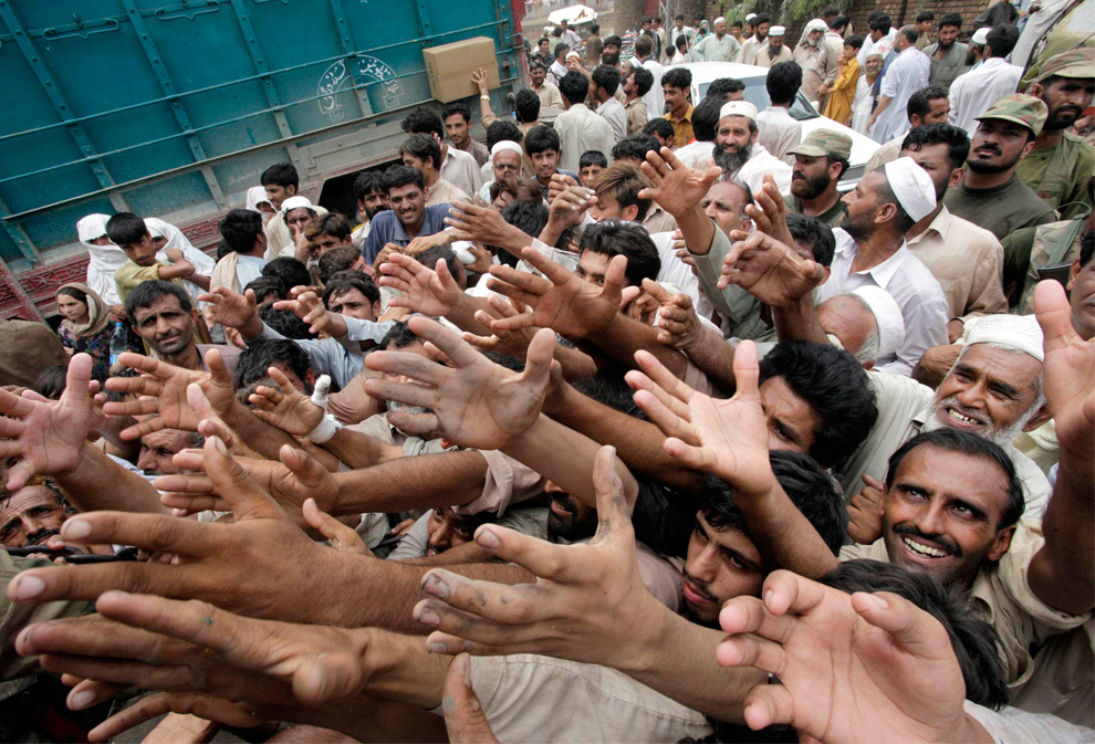
A displaced Pakistani man gestures to Pakistani army officers as they deliver rice and sugar to flood victims, in Badin District, in Pakistan's Sindh province Sept. 24. In Pakistan's Sindh province alone, the floods have killed over 220 people, damaged or destroyed some 665,000 homes and displaced more than 1.8 million people, according to the United Nations. Neighboring Baluchistan province has also been affected. (Muhammed Muheisen/Associated Press) #

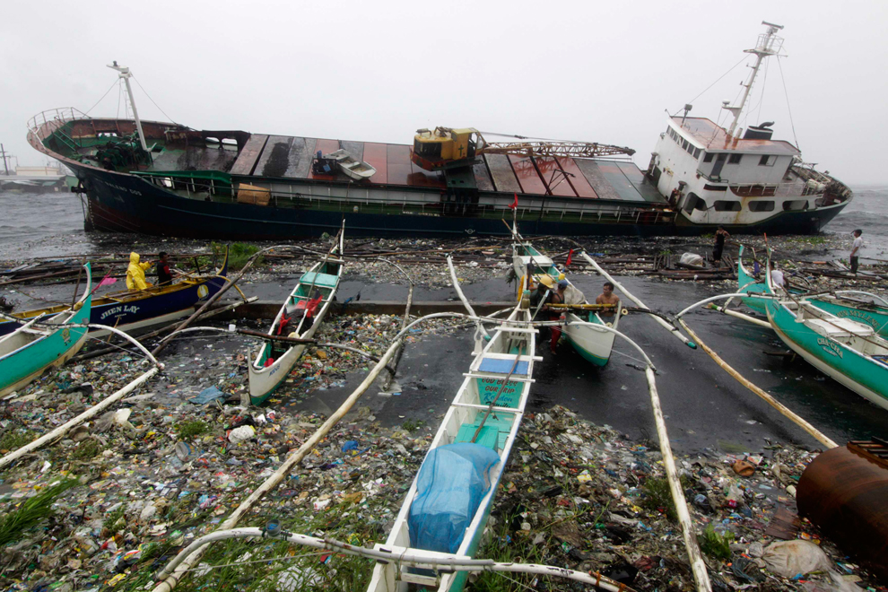
Residents carry a pig down a flooded street during typhoon Nesat in San Mateo, Rizal, east of Manila on Sept. 27. Typhoon Nesat brought the Philippine capital to a near standstill with its vast rain band also flooding remote farms and vicious winds tearing roofs off buildings in coastal towns. (Noel Celis/AFP/Getty Images) #

Surging waves hit against the breakwater in Udono in a port town of Kiho, Mie Prefecture, central Japan, Sept. 21. A powerful typhoon was bearing down on Japan's tsunami-ravaged northeastern coast approaching a nuclear power plant crippled in that disaster and prompting calls for the evacuation of more than a million people. ( #

A resident carries his son while crossing on waist deep floodwaters brought by Typhoon Nesat, locally known as Pedring, that hit the Tanza town of Malabon city, north of Manila Sept. 27. Typhoon Nesat crossed the Philippines main island leaving behind at least 7 dead after it lashed crop-growing provinces and brought the capital to a near standstill as it flooded roads and villages and cut power supplies. (Reuters) #

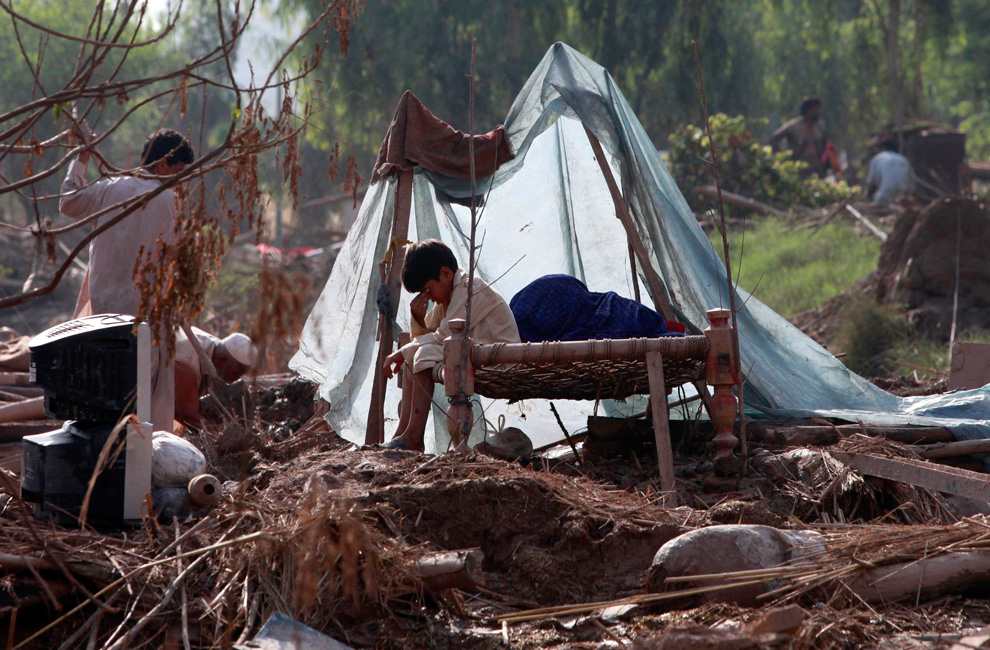
Family members, displaced by floods, use a tarp to escape a monsoon downpour while taking shelter at a make-shift camp for flood victims in the Badin district in Pakistan's Sindh province Sept. 14. Floods this year have destroyed or damaged 1.2 million houses and flooded 4.5 million acres since late last month, according to officials and Western aid groups. More than 300,000 people have been made homeless and about 200 have been killed. (Akhtar Soomro/Reuters) #

Rescuers and volunteers search for the body of the fourth fatality in Baguio, northern Philippines on Aug. 29 after an avalanche of rubbish at the city dump at the height of Typhoon Nanmadol. Super-typhoon Nanmadol left at least 16 people dead after hitting the Philippines, and the toll is expected to rise as hopes of finding those missing fade, the civil defense chief said. (AFP/AFP/Getty Images) #

Vehicles are piled on top of one another on muddy ground after Typhoon Talas caused flash flooding in the town of Nachikatsuura, Wakayama prefecture, in western Japan on Sept. 5. Typhoon Talas cut across western Japan late on September 3, leaving at least 31 people dead and 50 missing after heavy rains and fierce winds. (Jiji Press/AFP/Getty Images) #

A boy looks from the balcony of his home Sept. 19 after flood waters swamped Guangan, southwest China's Sichuan province, as unprecedented rains over the past week have swamped parts of northern, central and southwest China. Heavy rains and floods across China have left 57 people dead, dozens of others missing and hundreds injured, while more than a million residents have been evacuated from their homes, the government said. (AFP/Getty Images) #

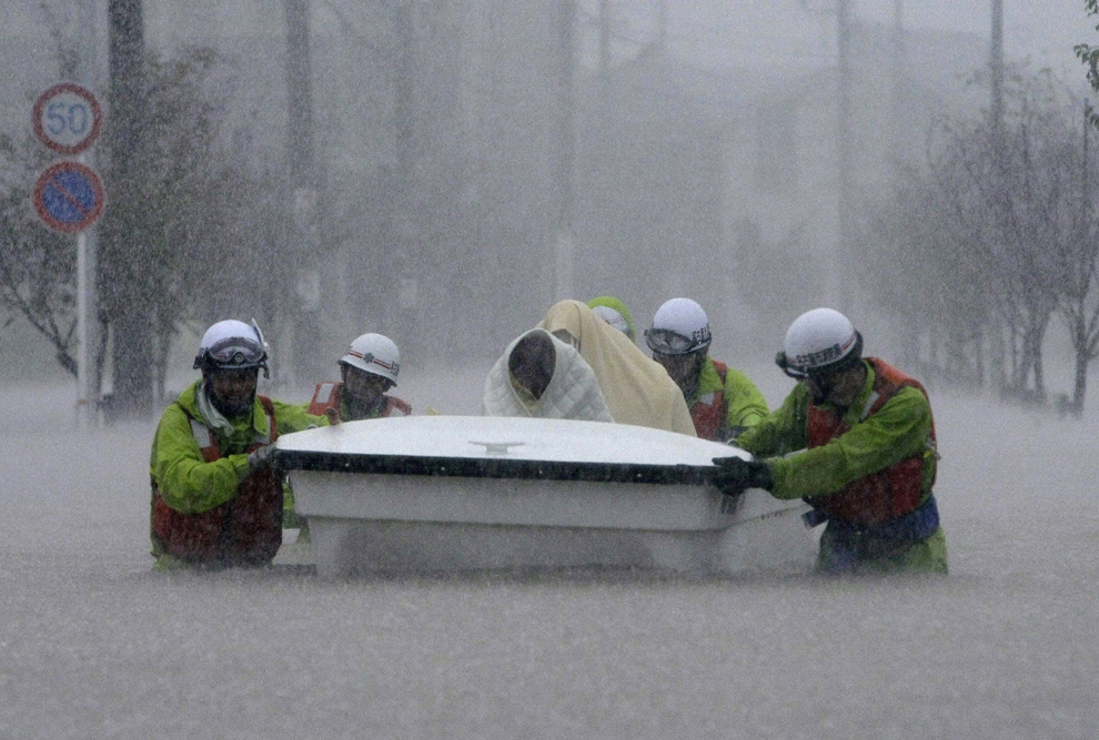
Rescue workers transport evacuees in a boat through floodwaters in Nagoya, Aichi prefecture, in central Japan on Sept. 20. Hundreds of thousands of people in Japan were warned to leave their homes as an approaching typhoon brought heavy rain and fears of landslides and flash flooding. (Jiji Press/AFP/Getty Images) #

A paramedic gives treatment to a Pakistani flood affected child at a hospital in Tando Allahyar in flood-hit Sindh province on Sept. 26. Some 2 million Pakistanis have fallen ill from diseases since monsoon rains left the southern region under several feet of water, the country's disaster authority said. More than 350 people have been killed and over eight million people have been affected this year by floods that officials say are worse in parts of Sindh province than last year, when the country saw its worst ever disaster. (Rizwan Tabassum/AFP/Getty Images) #

Displaced Pakistanis wash their belongings in a flooded field in Mirpur Khas in Pakistan's Sindh province, after fleeing their flood-hit homes Sept. 23. In Pakistan's Sindh province alone, the floods have killed over 220 people, damaged or destroyed some 665,000 homes and displaced more than 1.8 million people, according to the United Nations. Neighboring Baluchistan province has also been affected. (Muhammed Muheisen/Associated Press) #

Residents are evacuated from a flood zone Sept. 19 in Guang'an, China's Sichuan province. Heavy rains that have unleashed flooding across southwest China and left at least 14 people dead will continue to pound the region in the coming days, the country's meteorological agency said. (Associated Press) #

Policemen and residents run as waves from a tidal bore surge past a barrier on the banks of Qiantang River in Haining, Zhejiang province Aug. 31. As Typhoon Nanmadol approaches eastern China, the tides and waves in Qiantang River recorded its highest level in 10 years, local media reported. (China Daily/Reuters) #

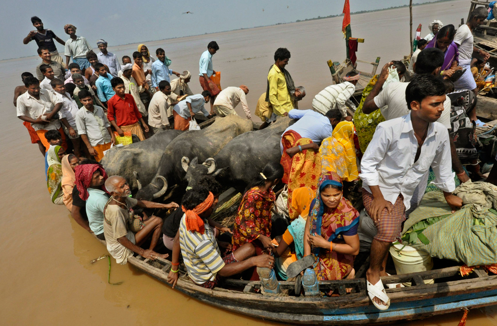
Indian villagers with their cattle cross flood waters on a boat at Kasimpurchak near Danapur Diara in Patna, India, Sept. 27. Monsoon rains destroyed mud huts and flooded wide swaths of northern and eastern India in recent days, leaving hundreds of thousands marooned by raging waters, officials said. (Aftab Alam Siddiqui/Associated Press) #

Unidentified teens walk through the high water and waves at the Mandeville, La. lakefront of Lake Pontchartrain from Tropical Storm Lee, on Sept. 4. The vast, soggy storm system spent hours during the weekend hovering in the northernmost Gulf of Mexico. Its slow crawl to the north gave more time for its drenching rain bands to pelt a wide swath of vulnerable coastline, raising the flood threat. (Ted Jackson/Associated Press/The Times-Picayune) #

Tom Harris hugs James Aaron after Aaron tears up when he saw the flood damage to his home in the Flats area of Plains, Pa. Sept. 10. The water lines went a few feet up his roof, tearing down parts of his ceiling, and both his front and rear porch have separated from the home. Tens of thousands of evacuated residents are being allowed to return home Saturday as rivers swollen by the remnants of Tropical Storm Lee recede. (Aimee Dilger/Associated Press) #

Cecil Flemming tries to maneuver his wheelchair through the waters on the Mandeville, La. lakefront of Lake Pontchartrain after waters crashed over the seawall from Tropical Storm Lee Sept. 4. The vast, soggy storm system spent hours during the weekend hovering in the northernmost Gulf of Mexico. Its slow crawl to the north gave more time for its drenching rain bands to pelt a wide swath of vulnerable coastline, raising the flood threat. (Ted Jackson/Associated Press/The Times-Picayune) #

Pakistani men sit on the rubble of a house, surrounded by floods water in Badin district near Hyderabad, Pakistan Sept. 18. The floods caused by heavy rains have killed more than 200 people, made about 200,000 people homeless and left 4.2 million acres of agriculture land inundated with water, authorities said. (Shakil Adil/Associated Press) #

A displaced Pakistani boy, lies on a bed under a mosquito net, while he and others take refuge on a roadside after fleeing their homes in Tando Allah Yar Sept. 20. Flood victims camped out near inundated fields and crowded hospitals on Monday as authorities and international aid groups struggled to respond to Pakistan's second major bout of flooding in just over a year. (Muhammed Muheisen/Associated Press) #

A flood effected farmer dry chilies crop to earn his living in Hyderabad, Pakistan on Sept. 23. In Pakistan's Sindh province alone, the floods have killed over 200 people, damaged or destroyed some 665,000 homes and displaced more than 1.8 million people, according to the United Nations. Neighboring Baluchistan province has also been affected. (Pervez Masih/Associated Press) #

A displaced Pakistani boy stands on a narrow path surrounded by flood water in Badin District, in Pakistan's Sindh province Sept. 24. In Pakistan's Sindh province alone, the floods have killed over 220 people, damaged or destroyed some 665,000 homes and displaced more than 1.8 million people, according to the United Nations. Neighboring Baluchistan province has also been affected. (Muhammed Muheisen/Associated Press) #

A resident carries a gas tank as he evacuates his house amid rising flood waters in San Mateo, Rizal, east of Manila Sept. 27. Typhoon Nesat, locally known as Pedring, pounded the Philippines' main island lashing crop-growing provinces and bringing the capital to a near standstill as it disrupted power supplies and closed financial markets, government offices, transport and schools. (Cheryl Ravelo/Reuters) #

A girl, displaced by floods, carries pots as she walks on the trunk of a tree floating in the water near her home in the Badin district of Pakistan's Sindh province Sept. 23. The latest floods, triggered by monsoon rains, have killed more than 230 people, destroyed or damaged 1.2 million houses and flooded 4.5 million acres since late last month, officials and Western aid groups say. More than 300,000 people have been moved to shelters. Some 800,000 families hit by last year's floods are still homeless. Aid groups have warned of a growing risk of fatal diseases. (Akhtar Soomro/Reuters) #

Residents living beside a swollen river walk through floods in Navotas, north of Manila, Philippines Sept. 27 as Typhoon Nesat hits the country. Massive flooding hit the Philippine capital as typhoon winds and rains isolated the historic old city where residents waded in waist-deep waters, dodging tree branches and debris. (Aaron Favila/Associated Press) #

Fishermen stand at the scene of a cargo ship washed ashore at the sea port in Navotas city, north of Manila Sept. 27 after Typhoon Nesat, locally known as Pedring, hit the capital, Manila. Typhoon Nesat pounded the Philippines' main island lashing crop-growing provinces and bringing the capital to a near standstill as it disrupted power supplies and closed financial markets, government offices, transport and schools. At least one person, a 22 month-old boy, died in the storm, and four people were reported missing. (Romeo Ranoco/Reuters) #

A Indian girl sleeps at her mud hut surrounded by flood waters at Pahanga village Sept. 25 in Orissa's Jajpur district, India. Monsoon rains have collapsed mud huts and flooded wide swaths of north and east India in recent days, leaving hundreds of thousands of people marooned by the raging waters, officials said. (Biswaranjan Rout/Associated Press) #
Αποστολή από: thailandgr στις Νοεμβρίου 28, 2011, 10:31:20 πμ

A Thai child carries a gas tank through floods in Rangsit district on the outskirts of Bangkok on October 21. Children make up around a quarter of the nearly 800 deaths the United Nations has tallied since July across Thailand, Cambodia, Vietnam, Laos and the Philippines, which have been ravaged by some of the worst flooding in decades. Drownings are a huge unreported epidemic in Southeast Asia, killing an estimated 240,000 children up to 17 years old each year - mostly because the majority of kids in the region simply never learn to swim. (Aaron Favila/AP) #
Αποστολή από: thailandgr στις Φεβρουαρίου 10, 2012, 17:12:44 μμ

A woman looks out a bus in Bucharest on February 2, 2012. (Vadim Ghirda/Associated Press)

Snow paints a scene in Rubi, Spain on February 2, 2012. (Manu Fernandez/Associated Press)

Skiers approach Wendelstein church near Bayrischzell, Germany on January 31, 2012. (Lukas Barth/dapd/Associated Press)
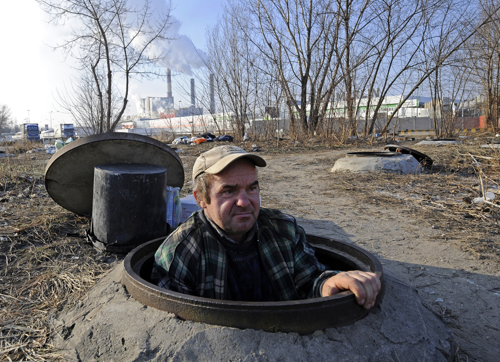
A homeless man emerges from Warsaw's underground heating duct where he lives on February 2, 2012. (Janek Skarzynski/AFP/Getty Images)

Homeless men gather in Warsaw's underground heating duct on February 2, 2012. (Janek Skarzynski/AFP/Getty Images)

A homeless woman, Anna Svrcinova, sits in an abandoned factory that served her as a shelter during a cold night in Prague on February 2, 2012. (Petr David Josek/Associated Press)

Homeless people eat a hot meal and drink hot tea in one of newly opened tent shelters in Lviv, Ukraine on February 1, 2012. (Yuriy Dyachyshyn/AFP/Getty Images)

Homeless people eat a free dinner provided by the Russian Orthodox church in Moscow on February 1, 2012. (Alexander Zemlianichenko/Associated Press)
A homeless man drinks tea in a shelter in Donetsk, Ukraine on February 2, 2012. (Alexander Khudoteply/AFP/Getty Images)
A woman rests in a shelter for adults and the elderly in Belgrade on February 1, 2012. (Marko Drobnjakovic/Associated Press)
People carry food supplies in a remote village cut off by road due to high snowfall near Sokolac, Bosnia on February 1, 2012. Rescue helicopters are airlifting supplies and evacuating dozens of people from snow-covered villages in Bosnia as the death toll from Eastern Europe's severe cold spell has risen to 79. (Radul Radovanovic/Associated Press)

Emin Hotovic, 55, carries a 25-kilo sack of flour and some groceries to his remote village of Hotani, Bosnia on February 2, 2012. (Amel Emric/Associated Press)

A woman carries firewood in Bucharest on January 31, 2012. (Bogdan Cristel/Reuters)

A man braves the bitter cold as he makes his way to exercise in a park in Moscow on February 1, 2012. Temperatures in Moscow fell to -21 degrees Celsius. (Mikhail Metzel/Associated Press)

People walk on frozen Black Sea waters next to an ice-covered dam in Constanta, Romania on February 1, 2012. (Daniel Mihailescu/AFP/Getty Images)
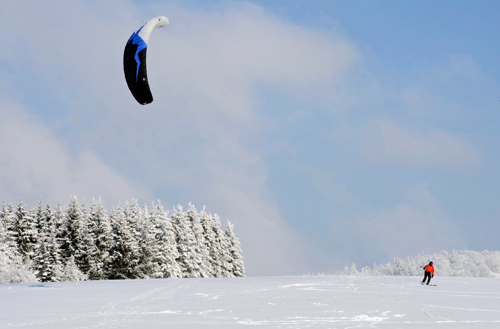
A snow kiter makes his way on the Schauinsland mountain near Freiburg, Germany on February 1, 2012. (Winfried Rothermel/dapd/Associated Press)

Television technicians move their equipment from the field as the Italian Serie A soccer match between Parma and Juventus is cancelled due to weather at the Tardini stadium in Parma on January 31, 2012. (Alessandro Garofalo/Reuters)

Ducks take off from a pond in Minsk, Belarus on February 1, 2012. (Sergei Grits/Associated Press)

Deer run in a snow-covered field near the village of Mileikovo, Belarus on January 31, 2012. (Sergei Grits/Associated Press)

A cow looks out of its stable in Davos, Switzerland on February 2, 2012. (Arno Balzarini/Keystone/Associated Press)
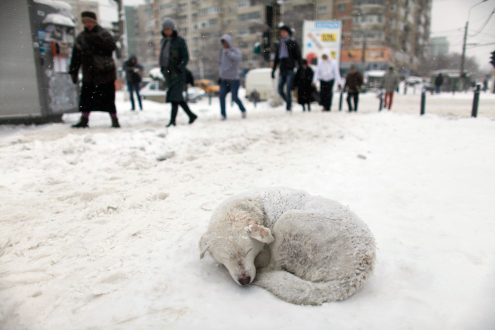
A stray dog sleeps in the snow in Bucharest on January 26, 2012. (Radu Sigheti/Reuters)

A pug dog strolls on a street in Gelsenkirchen, Germany on February 2, 2012. (Martin Meissner/Associated Press)

A seagull rests in Istanbul on February 1, 2012. Heavy snow and cold weather paralyzed life in Istanbul and closed several roads in eastern Turkey. (Associated Press)

A man rides a horse in the village of Vrapce, Serbia on February 1, 2012. (Sasa Djordjevic/AFP/Getty Images)

A horse-drawn sleigh makes its way on a snowy road in Klosters Monbiel, Switzerland on February 2, 2012. (Arno Balzarini/Keystone/Associated Press)

A man walks his dog along the banks of the Neris river in Vilnius, Lithuania on January 31, 2012, as morning temperatures plummeted to -23 Celsius. (Mindaugas Kulbis/Associated Press)

A pedestrian walks past a frosted window in Pristina on February 1, 2012. (Visar Kryeziu/Associated Press)

A man walks through blowing snow in Roncesvalles, Spain on February 2, 2012. (Alvaro Barrientos/Associated Press)

Boys play on a frozen pond in Prague on January 31, 2012. (David W Cerny/Reuters)

Young men enjoy hockey as the sun sets over a frozen dam in Brno, Czech Republic on February 1, 2012. Temperatures in the Czech Republic plummeted to lows of minus 30 Celsius. (Petr David Josek/Associated Press)

A heating plant obscures the sun in Minsk, Belarus on February 1, 2012 as temperatures of minus 21 Celsius hit the Belarusian capital. (Sergei Grits/Associated Press)

A passenger boat sails at sunrise in the Black Sea port of Sevastopol, Ukraine on February 1, 2012. (Andrew Lubimov/Associated Press)
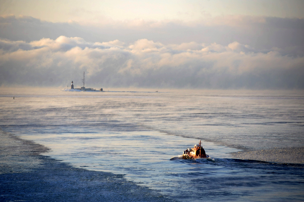
A small cutter makes its way to the Harmaja lighthouse off the coast of Helsinki on Feburary 1, 2012. (Martti Kainulainen/AFP/Getty Images)

Icicles hang on the branches of a bush on the banks of the River Elbe in Dresden, Germany on February 2, 2012. (Norbert Millauer/dapd/Associated Press)

Reed sprouts are covered with ice at Lake Zwischenahner Meer in Bad Zwischenahn, Germany on January 31, 2012. (David Hecker/dapd/Associated Press)

Frost decorates a window on February 1, 2012 in Godewaersvelde, France. (Philippe Huguen/AFP/Getty Images)

An Orthodox Christian cathedral stands amid a winter landscape in Kiev on January 30, 2012. (Efrem Lukatsky/Associated Press)
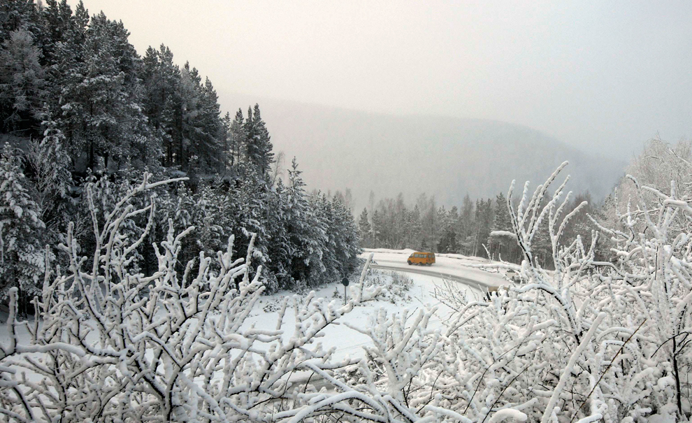
A van drives along a road near the village of Sliznevo as temperatures fell to minus 34 Celsius outside Russia's Siberian city of Krasnoyarsk on January 30, 2012. (Ilya Naymushin/Reuters)

People walk through the snow in Istanbul on February 1, 2012. (Associated Press)
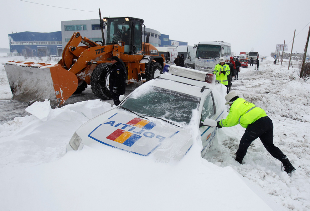
A policeman tries to open the frozen door of his car stuck in a snow drift during a blizzard in Afumati, Romania on January 26, 2012. (Bogdan Cristel/Reuters)

A man walks in the center of Kiev where temperatures dropped to minus 20 Celsius on February 1, 2012. (Sergei Supinsky/AFP/Getty Images)
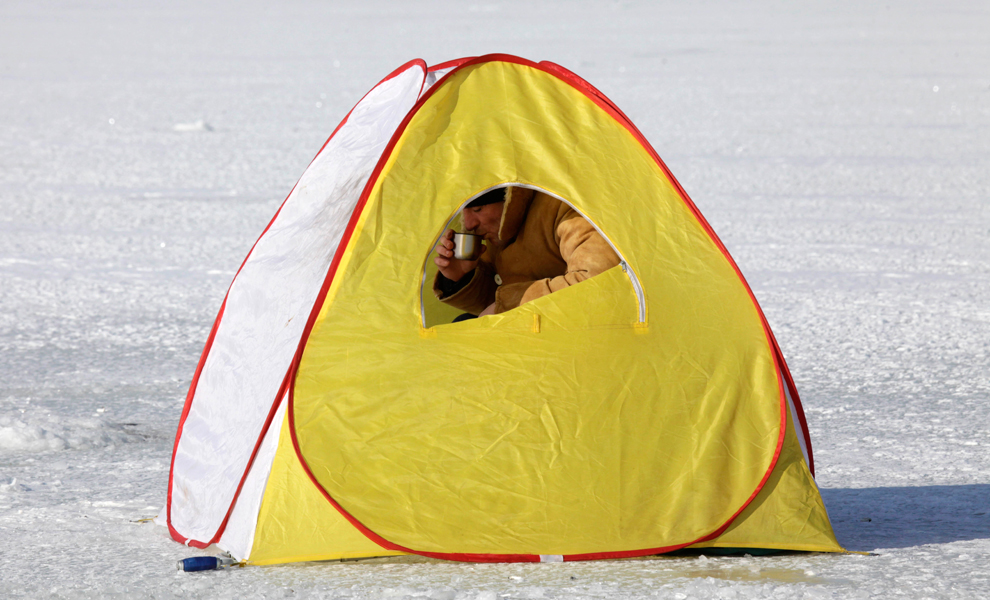
A Ukrainian angler, in a tent for protection from the wind and cold, fishes through an ice hole on the Dnipro River outside Cherkasy, Ukraine on February 1, 2012. (Efrem Lukatsky/Associated Press)

A snowman decorates a car on February 1, 2012 in Nice, France. (Valery Hache/AFP/Getty Images)

A man braves minus 20 Celsius temperatures in Kiev on February 2, 2012. (Sergei Chuzavkov/Associated Press)
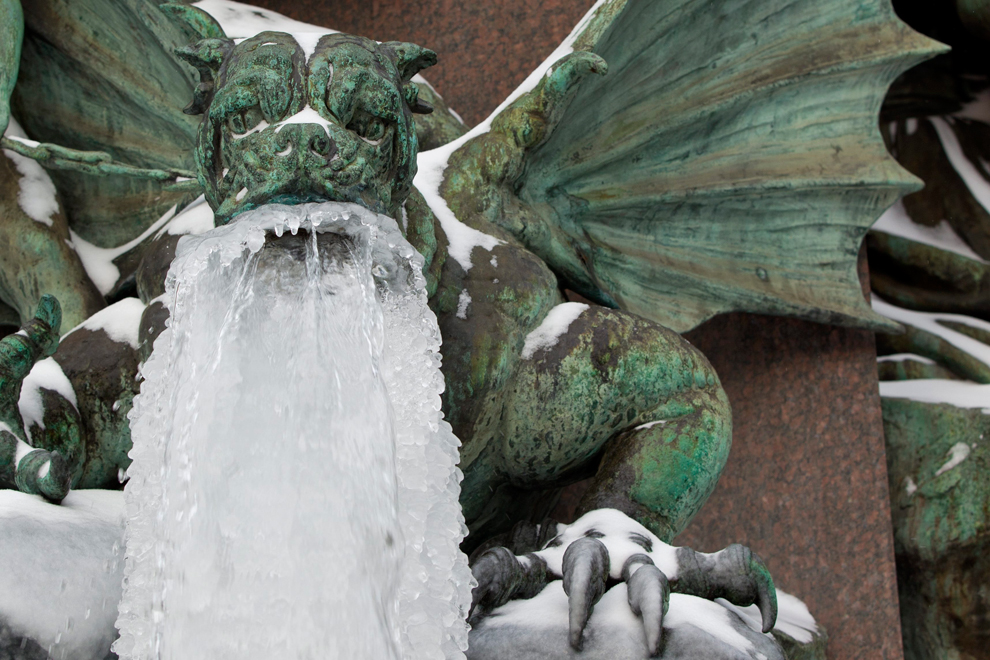
An gargoyle grows an icy beard in a fountain in Zurich on February 2, 2012. (Alessandro Della Bella/Keystone/Associated Press)
-
Τίτλος: Απ: Ηφαιστεια - τυφωνες και φυσικες ( και οχι μονο )κατα
Αποστολή από: thailandgr στις Μαρτίου 11, 2012, 17:30:19 μμ
-
Japan tsunami pictures: before and after
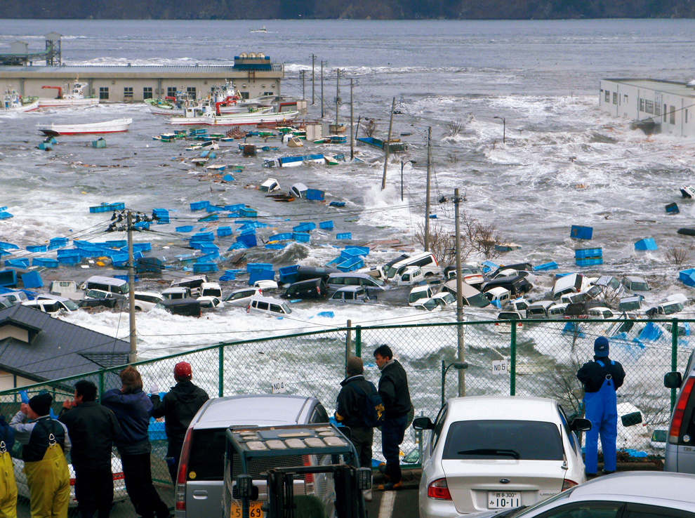
This pair of photographs shows the same location in a fishing port in Miyako, Iwate Prefecture, Japan on March 11, 2011 and February 17, 2012. The second photograph shows a wave crashing into the port during the tsunami. [ Click image to see the area one year ago ] (Miyako City Office/Handout/Reuters) and (Toru Hanai/Reuters) #
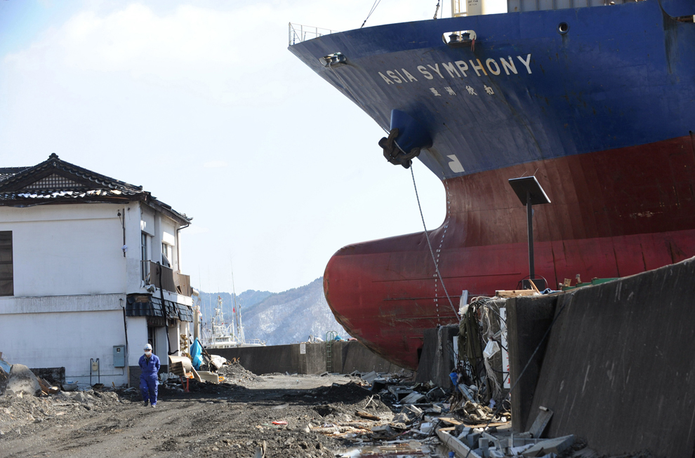
This pair of pictures shows the area where the ship Asia Symphony ran aground after the March 11 tsunami in Kamaishi, Iwate Prefecture, Japan on March 18, 2011 and January 16, 2012. [ Click image to see the area one year ago ] (Roslan Rahman/AFP/Getty Images) and (Toru Yamanaka/AFP/Getty Images) #
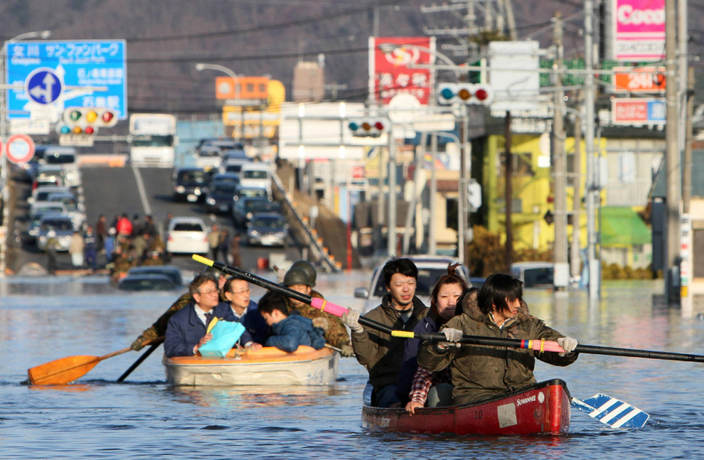
This pair of pictures shows the city of Ishinomaki in Miyagi prefecture, Japan on January 13, 2012 and people evacuating with small boats down the same road flooded by the tsunami on March 12, 2011. [ Click image to see the area one year ago ] (Jiji Press/AFP/Getty Images) and (Toru Yamanaka/AFP/Getty Images) #
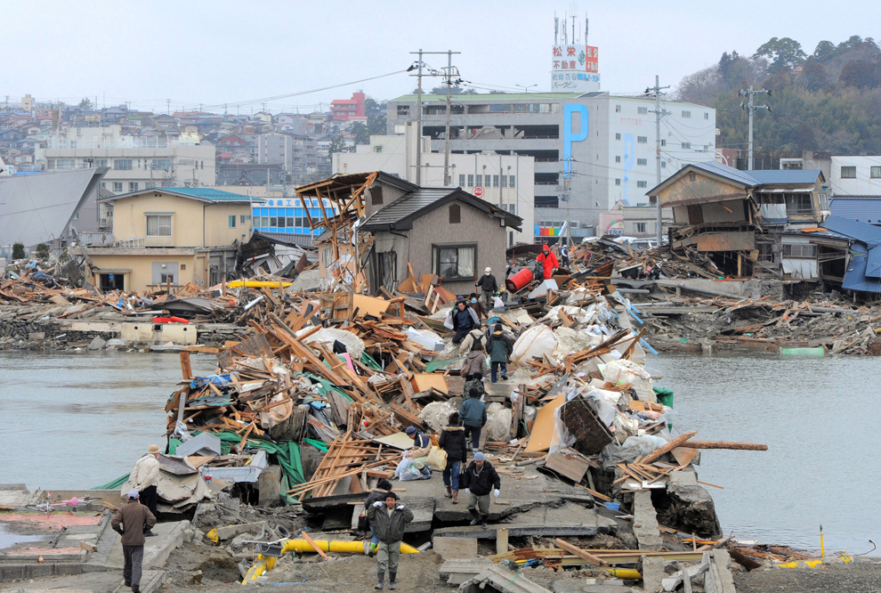
This pair of pictures shows a bridge in the city of Ishinomaki in Miyagi prefecture, Japan as it looked on January 13, 2012 and as it looked covered with debris from the tsunami on March 15, 2011. [ Click image to see the area one year ago ] (Kim Jae-Hwan/AFP/Getty Images) and (Toru Yamanaka/AFP/Getty Images) #
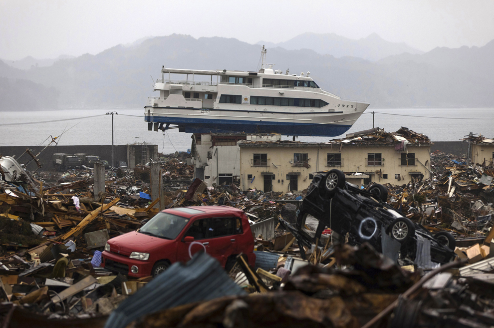
This pair of pictures shows a tourist home in Otsuchi, Iwate prefecture, Japan on January 16, 2012 and the same building with a sightseeing boat washed onto it on April 16, 2011. [ Click image to see the area one year ago ] (Yasuyoshi Chiba/AFP/Getty Images) and (Toru Yamanaka/AFP/Getty Images) #
Yuko Sugimoto listens as her son Raito talks about his friend who passed away during a visit to the Ishinomaki Mizuho No.2 kindergarten in Ishinomaki, Japan on February 22, 2012. Sugimoto was pictured last year (see photo number one), wrapped in a blanket in front of a pile of debris as she looked for her son Raito who was missing. He had found refuge from the tsunami on the roof of the kindergarten. (Yuriko Nakao/Reuters)
Children and teachers from Ishinomaki Mizuho No.2 kindergarten take shelter on the roof of their school during the tsunami in this photo taken by head teacher Hiroaki Tsuda with his mobile phone on March 11, 2011. Yuko Sugimoto's son Raito was among the children that survived the disaster as they scrambled onto the rooftop and stayed through the night until the Coast Guard rescued them the following morning. (Ishinomaki Mizuho Kindergarten head Hiroaki Tsuda/Reuters/Handout)
Yuko Sugimoto and her son Raito pray on February 22, 2012 at the site where their pet dog was buried in the yard of their house in Ishinomaki, Miyagi Prefecture, Japan after the 3011 earthquake and tsunami. (Yuriko Nakao/Reuters)
-
Τίτλος: Το πέρασμά του τυφώνα Bopha απο τις Φιλιππίνες
Αποστολή από: thailandgr στις Δεκεμβρίου 09, 2012, 14:38:48 μμ
-
Το πέρασμά του τυφώνα Bopha απο τις Φιλιππίνες
Ο τυφώνας Bopha , ένας απίστευτα ισχυρός τυφώνας, έχει σκοτώσει εκατοντάδες, προκάλεσε κατολισθήσεις και πλημμύρες και άφησε ανυπολόγιστη καταστροφή στο πέρασμά του στις Φιλιππίνες.
Ο αριθμός των νεκρών ανέρχεται σε πάνω από 500 - ολόκληρες οικογένειες ξεκληρίστηκαν - πολλοί εξακολουθούν να αγνοούνται.
Τουλάχιστον 200 από τα θύματα έχασαν τη ζωή τους στην Κοιλάδα Κομποστέλα .
Ένα λασπωμένο σκουπιδότοπο που κατέρρευσαν σπίτια και τα δέντρα κόπηκαν από άγριους ανέμους.
300.000 έμειναν άστεγοι με μεγάλη ανάγκη για νερό, τροφή και καταλύματα

Typhoon Bopha is shown moving toward the Philippines from the International Space Station, Dec. 2, 2012. The typhoon slammed into the Davao region of the Philippines early Dec. 4, killing hundreds and forcing more than 50,000 to flee from inundated villages. (NASA/Associated Press)
Banana trees destroyed by Typhoon Bopha at a plantation in Compostela town, Compostela Valley province, on the southern island of Mindanao, Dec. 4, 2012. Typhoon Bopha killed 43 people in one hard-hit Philippine town Dec. 4, local television station ABS-CBN reported from the scene. (Karlos Manlupig/AFP/Getty Images)#
An elderly woman is assisted by a soldier of the 71st Infantry Battalion, 1001st Infantry Brigade of the Philippine Army at a flooded area in Compostela Valley, southern Philippines. The death toll from Typhoon Bhopa climbed to more than 100 people, Dec. 5, while scores of others remain missing in the worst-hit areas of the southern Philippines. (The Philippine Army/Associated Press) #
A boy waits in a temporary shelter after Typhoon Bopha made landfall in Compostela Valley in southeastern Philippines, Dec. 4, 2012. Typhoon Bopha (local name Pablo), one of the strongest typhoons to hit the Philippines this year, barreled across the country's south, killing at least 40 people and forcing more than 50,000 to flee from inundated villages. (Karlos Manlupig/Associated Press)#
Residents walk among the debris littered on a road after flashfloods brought by Typhoon Bopha in Compostela Valley in southern Philippines, Dec. 5, 2012. Blocked roads and severed communications in the southern Philippines frustrated rescuers as teams searched for hundreds of people missing after the strongest typhoon this year killed at least 283 people. (Erik De Castro/Reuters)#
Residents try to identify bodies of relatives, victims of flash floods in New Bataan town, Compostela Valley province, Dec. 5, 2012, a day after Typhoon Bopha hit the province. At least 274 people have been killed and hundreds remain missing in the Philippines from the deadliest typhoon to hit the country this year, the civil defense chief said. (Ted Aljibe/AFP/Getty Images)#
Relatives grieve as they view bodies recovered from floods in New Bataan, Compostela Valley province, southern Philippines, Dec. 5, 2012. The death toll from Typhoon Bhopa climbed, while scores of others remain missing in the worst-hit areas of the southern Philippines. (Karlos Manlupig/Associated Press)#
Survivors are loaded onto a flat bed truck to be taken to a hospital in the aftermath of Typhoon Bopha in New Bataan, Compostela Valley in the southern Philippines, Dec. 5, 2012. The death toll from a typhoon that ravaged the Philippines jumped to 274 Dec. 5 with hundreds more missing, as rescuers battled to reach areas cut off by floods and mudslides. (Karlos Manlupig/AFP/Getty Images)#
Residents try to rebuild their house destroyed by Typhoon Bopha in Compostela Valley, southern Philippines, Dec. 5, 2012. Blocked roads and severed communications in the southern Philippines frustrated rescuers as teams searched for hundreds of people missing after the strongest typhoon this year killed at least 283 people. (Erik De Castro/Reuters)#
Residents wash their clothes amid the devastation left by Typhoon Bopha, in the village of Andap, New Bataan township, Compostela Valley in southern Philippines, Dec. 5, 2012. Typhoon Bopha, one of the strongest typhoons to hit the Philippines this year, barreled across the country's south, killing scores of people while triggering landslides, flooding and cutting off power in two entire provinces. (Bullit Marquez/Associated Press)#
A girl sits on top of boulders washed to the road by flash floods at the height of Typhoon Bopha in the village of Andap, New Bataan town, Compostela Valley province, Dec. 5, 2012, a day after the powerful Typhoon hit the province. At least 274 people have been killed and hundreds remain missing in the Philippines from the deadliest typhoon to hit the country this year, the civil defense chief said. (Ted Aljibe/AFP/Getty Images)#
Children retrieve their books and other belongings from their damaged home, Dec. 5, 2012, a day after powerful Typhoon Bopha hit Montevista township, in the Compostela Valley in southern Philippines. Typhoon Bopha (local name Pablo), one of the strongest typhoons to hit the Philippines this year. (Bullit Marquez/Associated Press)#
The devastation brought about by powerful Typhoon Bopha at Montevista township, Compostela Valley in southern Philippines, Dec. 5, 2012. Typhoon Bopha, one of the strongest typhoons to hit the Philippines this year, killed scores of peopl while triggering landslides, flooding and cutting off power in two entire provinces. (Bullit Marquez/Associated Press)#
Residents examine their house, damaged by a devastating typhoon, Dec. 6, 2012, in New Bataan township, Compostela Valley in the southern Philippines. The powerful typhoon that washed away emergency shelters, a military camp and possibly entire families in the southern Philippines has killed hundreds of people with nearly 400 missing, authorities said. (Bullit Marquez/Associated Press)#
A woman dries her laundry next to her family's makeshift tent in Montevista town in Compostela Valley in southern Philippines, Dec. 6, 2012. The numbers of dead and missing vary, but the head of the national disaster agency said 332 people were killed and 379 were missing after Typhoon Bopha triggered landslides and floods along the coast and in farming and mining towns inland in the southern Mindanao region. (Erik De Castro/Reuters)#
An aerial view of damaged houses caused by flash floods in Compostela Valley province, southern Philippines, Dec. 6, 2012. Rescue workers searched through thick mud, broken homes and fallen trees for survivors, two days after Typhoon Bopha swept the southern Philippines. (Philippine Army 10th Infantry Division/Reuters)#
Rescuers evacuate a child who survived flooding with her pregnant mother as they cross a river in New Bataan town, Compostela Valley, southern Philippines, Dec. 6, 2012. Rescuers found the six-month pregnant woman on the other side of a river, stranded with her one-year-old son after escaping floods that swamped their house. (Erik De Castro/Reuters)#
-
Τίτλος: Απ: Ηφαιστεια - τυφωνες και φυσικες ( και οχι μονο )κατα
Αποστολή από: thailandgr στις Νοεμβρίου 09, 2013, 10:05:35 πμ
-
Το πέρασμά του τυφώνα Haiyan απο τις Φιλιππίνες

A Filipino resident stands on a roof of a home with a backdrop of a cloudy financial district in Manila, Philippines, Nov. 8. The most powerful cyclone in three decades battered the Philippines, killing at least three people and displacing over 718,000, disaster relief officials said. Typhoon Haiyan was packing maximum sustained winds of 235 kilometres per hour (kph) and gusts of up to 275 kph as it made five landfalls over the eastern and central provinces of Eastern Samar, Leyte, Cebu and Iloilo, the national weather bureau said. (Francis R. Malasig/EPA) 
A handout satelite image shows Typhoon Haiyan striking the Philippines, Nov. 8. The Philippine disaster relief agency says at least three people have been killed and more than half a million displaced as Typhoon Haiyan pummels the archipelago. Haiyan, packing maximum winds of 235 kilometres per hour (kph) and gusts of up to 275 kph, made landfall at five locations, according to the weather bureau. (National Oceanic and Atmosphere Adminstration/EPA) #
A house is engulfed by the storm surge brought about by powerful typhoon Haiyan that hit Legazpi city, Albay province on Nov. 8, about 520 kilometers (325 miles) south of Manila, Philippines. Typhoon Haiyan, one of the most powerful typhoons ever recorded slammed into the Philippines, setting off landslides, knocking out power in one entire province and cutting communications in the country's central region of island provinces. (Nelson Salting/Associated Press) #
A resident walks past high waves pounding the sea wall amidst strong winds as Typhoon Haiyan hit the city of Legaspi, Albay province, south of Manila on Nov. 8. One of the most intense typhoons on record whipped the Philippines on Nov. 8, killing three people and terrifying millions as monster winds tore roofs off buildings and giant waves washed away flimsy homes. (Charism Sayat/AFP/Getty Images) #
A Filipino woman uses a plastic sheet during a downpour brought by Typhoon Haiyan in Manila, Philippines, on Nov. 8. The most powerful cyclone in three decades battered the Philippines killing at least one, forcing hundreds of thousands to flee their homes, and cutting power and communication. (Dennis M. Sabagan/EPA) #
A mother takes refuge with her children as Typhoon Haiyan hits Cebu city, central Philippines on Nov. 8. Typhoon Haiyan, the strongest typhoon in the world this year and possibly the most powerful ever to hit land battered the central Philippines, forced millions of people to flee to safer ground, cut power lines and blew apart houses. Haiyan, a category-5 super typhoon, bore down on the northern tip of Cebu Province, a popular tourist destination with the country's second-largest city, after lashing the islands of Leyte and Samar with 275 kph (170 mph) wind gusts and 5-6 meter (15-19 ft) waves. (Zander Casas/Reuters) #
A fisherman secures his outrigger in a river near Manila bay on Nov. 8. Super Typhoon Haiyan smashed into coastal communities on the central Philippine island of Samar, about 600 kilometres (370 miles) southeast of Manila, before dawn with maximum sustained winds of about 315 kilometres (195 miles) an hour. (Jay Directo/AFP/Getty Images) #
A farmer inspects his cornfields that was damage by the passing of Super Typhoon Haiyan into coastal communities on the central island of Cebu on Nov. 8. One of the most intense typhoons on record whipped the Philippines, killing three people and terrifying millions as monster winds tore roofs off buildings and giant waves washed away flimsy homes. (STR/AFP/Getty Images) #
-
Τίτλος: Απ: Ηφαιστεια - τυφωνες και φυσικες ( και οχι μονο )κατα
Αποστολή από: thailandgr στις Νοεμβρίου 17, 2013, 20:26:22 μμ
-

A man wearing a t-shirt displaying the message 'never give up' walks over debris with other survivors as they pass through an area devastaed by Typhoon Haiyan on Nov. 12 in Leyte, Philippines. Four days after the typhoon devastated the region many have nothing left, they are without food or power and most lost their homes. (Dondi Tawatao/Getty Images) #
Residents walk past damaged houses in Tacloban city, Leyte province, central Philippines on Nov. 10. The city remains littered with debris from damaged homes as many complain of shortages of food and water and no electricity since Typhoon Haiyan slammed into their province. (Bullit Marquez/Associated Press) #
Newborn baby Bea Joy is held as mother Emily Ortega, 21, rests after giving birth at an improvised clinic at Tacloban airport in Tacloban city, Leyte province in central Philippines on Nov. 10. Bea Joy was named after her grandmother Beatrice, who was missing following the onslaught of Typhoon Haiyan. Ortega was in an evacuation center when the storm surge hit and flooded the city. She had to swim to survive before finding safety at the airport. (Bullit Marquez/Associated Press) #

A woman looks out a bus in Bucharest on February 2, 2012. (Vadim Ghirda/Associated Press)

Snow paints a scene in Rubi, Spain on February 2, 2012. (Manu Fernandez/Associated Press)

Skiers approach Wendelstein church near Bayrischzell, Germany on January 31, 2012. (Lukas Barth/dapd/Associated Press)

A homeless man emerges from Warsaw's underground heating duct where he lives on February 2, 2012. (Janek Skarzynski/AFP/Getty Images)

Homeless men gather in Warsaw's underground heating duct on February 2, 2012. (Janek Skarzynski/AFP/Getty Images)

A homeless woman, Anna Svrcinova, sits in an abandoned factory that served her as a shelter during a cold night in Prague on February 2, 2012. (Petr David Josek/Associated Press)

Homeless people eat a hot meal and drink hot tea in one of newly opened tent shelters in Lviv, Ukraine on February 1, 2012. (Yuriy Dyachyshyn/AFP/Getty Images)

Homeless people eat a free dinner provided by the Russian Orthodox church in Moscow on February 1, 2012. (Alexander Zemlianichenko/Associated Press)

A homeless man drinks tea in a shelter in Donetsk, Ukraine on February 2, 2012. (Alexander Khudoteply/AFP/Getty Images)

A woman rests in a shelter for adults and the elderly in Belgrade on February 1, 2012. (Marko Drobnjakovic/Associated Press)

People carry food supplies in a remote village cut off by road due to high snowfall near Sokolac, Bosnia on February 1, 2012. Rescue helicopters are airlifting supplies and evacuating dozens of people from snow-covered villages in Bosnia as the death toll from Eastern Europe's severe cold spell has risen to 79. (Radul Radovanovic/Associated Press)

Emin Hotovic, 55, carries a 25-kilo sack of flour and some groceries to his remote village of Hotani, Bosnia on February 2, 2012. (Amel Emric/Associated Press)

A woman carries firewood in Bucharest on January 31, 2012. (Bogdan Cristel/Reuters)

A man braves the bitter cold as he makes his way to exercise in a park in Moscow on February 1, 2012. Temperatures in Moscow fell to -21 degrees Celsius. (Mikhail Metzel/Associated Press)

People walk on frozen Black Sea waters next to an ice-covered dam in Constanta, Romania on February 1, 2012. (Daniel Mihailescu/AFP/Getty Images)

A snow kiter makes his way on the Schauinsland mountain near Freiburg, Germany on February 1, 2012. (Winfried Rothermel/dapd/Associated Press)

Television technicians move their equipment from the field as the Italian Serie A soccer match between Parma and Juventus is cancelled due to weather at the Tardini stadium in Parma on January 31, 2012. (Alessandro Garofalo/Reuters)

Ducks take off from a pond in Minsk, Belarus on February 1, 2012. (Sergei Grits/Associated Press)

Deer run in a snow-covered field near the village of Mileikovo, Belarus on January 31, 2012. (Sergei Grits/Associated Press)

A cow looks out of its stable in Davos, Switzerland on February 2, 2012. (Arno Balzarini/Keystone/Associated Press)

A stray dog sleeps in the snow in Bucharest on January 26, 2012. (Radu Sigheti/Reuters)

A pug dog strolls on a street in Gelsenkirchen, Germany on February 2, 2012. (Martin Meissner/Associated Press)

A seagull rests in Istanbul on February 1, 2012. Heavy snow and cold weather paralyzed life in Istanbul and closed several roads in eastern Turkey. (Associated Press)

A man rides a horse in the village of Vrapce, Serbia on February 1, 2012. (Sasa Djordjevic/AFP/Getty Images)

A horse-drawn sleigh makes its way on a snowy road in Klosters Monbiel, Switzerland on February 2, 2012. (Arno Balzarini/Keystone/Associated Press)

A man walks his dog along the banks of the Neris river in Vilnius, Lithuania on January 31, 2012, as morning temperatures plummeted to -23 Celsius. (Mindaugas Kulbis/Associated Press)

A pedestrian walks past a frosted window in Pristina on February 1, 2012. (Visar Kryeziu/Associated Press)

A man walks through blowing snow in Roncesvalles, Spain on February 2, 2012. (Alvaro Barrientos/Associated Press)

Boys play on a frozen pond in Prague on January 31, 2012. (David W Cerny/Reuters)

Young men enjoy hockey as the sun sets over a frozen dam in Brno, Czech Republic on February 1, 2012. Temperatures in the Czech Republic plummeted to lows of minus 30 Celsius. (Petr David Josek/Associated Press)

A heating plant obscures the sun in Minsk, Belarus on February 1, 2012 as temperatures of minus 21 Celsius hit the Belarusian capital. (Sergei Grits/Associated Press)

A passenger boat sails at sunrise in the Black Sea port of Sevastopol, Ukraine on February 1, 2012. (Andrew Lubimov/Associated Press)

A small cutter makes its way to the Harmaja lighthouse off the coast of Helsinki on Feburary 1, 2012. (Martti Kainulainen/AFP/Getty Images)

Icicles hang on the branches of a bush on the banks of the River Elbe in Dresden, Germany on February 2, 2012. (Norbert Millauer/dapd/Associated Press)

Reed sprouts are covered with ice at Lake Zwischenahner Meer in Bad Zwischenahn, Germany on January 31, 2012. (David Hecker/dapd/Associated Press)

Frost decorates a window on February 1, 2012 in Godewaersvelde, France. (Philippe Huguen/AFP/Getty Images)

An Orthodox Christian cathedral stands amid a winter landscape in Kiev on January 30, 2012. (Efrem Lukatsky/Associated Press)

A van drives along a road near the village of Sliznevo as temperatures fell to minus 34 Celsius outside Russia's Siberian city of Krasnoyarsk on January 30, 2012. (Ilya Naymushin/Reuters)

People walk through the snow in Istanbul on February 1, 2012. (Associated Press)

A policeman tries to open the frozen door of his car stuck in a snow drift during a blizzard in Afumati, Romania on January 26, 2012. (Bogdan Cristel/Reuters)

A man walks in the center of Kiev where temperatures dropped to minus 20 Celsius on February 1, 2012. (Sergei Supinsky/AFP/Getty Images)

A Ukrainian angler, in a tent for protection from the wind and cold, fishes through an ice hole on the Dnipro River outside Cherkasy, Ukraine on February 1, 2012. (Efrem Lukatsky/Associated Press)

A snowman decorates a car on February 1, 2012 in Nice, France. (Valery Hache/AFP/Getty Images)

A man braves minus 20 Celsius temperatures in Kiev on February 2, 2012. (Sergei Chuzavkov/Associated Press)

An gargoyle grows an icy beard in a fountain in Zurich on February 2, 2012. (Alessandro Della Bella/Keystone/Associated Press)
Αποστολή από: thailandgr στις Μαρτίου 11, 2012, 17:30:19 μμ
Japan tsunami pictures: before and after

This pair of photographs shows the same location in a fishing port in Miyako, Iwate Prefecture, Japan on March 11, 2011 and February 17, 2012. The second photograph shows a wave crashing into the port during the tsunami. [ Click image to see the area one year ago ] (Miyako City Office/Handout/Reuters) and (Toru Hanai/Reuters) #

This pair of pictures shows the area where the ship Asia Symphony ran aground after the March 11 tsunami in Kamaishi, Iwate Prefecture, Japan on March 18, 2011 and January 16, 2012. [ Click image to see the area one year ago ] (Roslan Rahman/AFP/Getty Images) and (Toru Yamanaka/AFP/Getty Images) #

This pair of pictures shows the city of Ishinomaki in Miyagi prefecture, Japan on January 13, 2012 and people evacuating with small boats down the same road flooded by the tsunami on March 12, 2011. [ Click image to see the area one year ago ] (Jiji Press/AFP/Getty Images) and (Toru Yamanaka/AFP/Getty Images) #

This pair of pictures shows a bridge in the city of Ishinomaki in Miyagi prefecture, Japan as it looked on January 13, 2012 and as it looked covered with debris from the tsunami on March 15, 2011. [ Click image to see the area one year ago ] (Kim Jae-Hwan/AFP/Getty Images) and (Toru Yamanaka/AFP/Getty Images) #

This pair of pictures shows a tourist home in Otsuchi, Iwate prefecture, Japan on January 16, 2012 and the same building with a sightseeing boat washed onto it on April 16, 2011. [ Click image to see the area one year ago ] (Yasuyoshi Chiba/AFP/Getty Images) and (Toru Yamanaka/AFP/Getty Images) #
Yuko Sugimoto listens as her son Raito talks about his friend who passed away during a visit to the Ishinomaki Mizuho No.2 kindergarten in Ishinomaki, Japan on February 22, 2012. Sugimoto was pictured last year (see photo number one), wrapped in a blanket in front of a pile of debris as she looked for her son Raito who was missing. He had found refuge from the tsunami on the roof of the kindergarten. (Yuriko Nakao/Reuters)
Children and teachers from Ishinomaki Mizuho No.2 kindergarten take shelter on the roof of their school during the tsunami in this photo taken by head teacher Hiroaki Tsuda with his mobile phone on March 11, 2011. Yuko Sugimoto's son Raito was among the children that survived the disaster as they scrambled onto the rooftop and stayed through the night until the Coast Guard rescued them the following morning. (Ishinomaki Mizuho Kindergarten head Hiroaki Tsuda/Reuters/Handout)
Yuko Sugimoto and her son Raito pray on February 22, 2012 at the site where their pet dog was buried in the yard of their house in Ishinomaki, Miyagi Prefecture, Japan after the 3011 earthquake and tsunami. (Yuriko Nakao/Reuters)
Αποστολή από: thailandgr στις Δεκεμβρίου 09, 2012, 14:38:48 μμ
Ο τυφώνας Bopha , ένας απίστευτα ισχυρός τυφώνας, έχει σκοτώσει εκατοντάδες, προκάλεσε κατολισθήσεις και πλημμύρες και άφησε ανυπολόγιστη καταστροφή στο πέρασμά του στις Φιλιππίνες.
Ο αριθμός των νεκρών ανέρχεται σε πάνω από 500 - ολόκληρες οικογένειες ξεκληρίστηκαν - πολλοί εξακολουθούν να αγνοούνται.
Τουλάχιστον 200 από τα θύματα έχασαν τη ζωή τους στην Κοιλάδα Κομποστέλα .
Ένα λασπωμένο σκουπιδότοπο που κατέρρευσαν σπίτια και τα δέντρα κόπηκαν από άγριους ανέμους.
300.000 έμειναν άστεγοι με μεγάλη ανάγκη για νερό, τροφή και καταλύματα

Typhoon Bopha is shown moving toward the Philippines from the International Space Station, Dec. 2, 2012. The typhoon slammed into the Davao region of the Philippines early Dec. 4, killing hundreds and forcing more than 50,000 to flee from inundated villages. (NASA/Associated Press)

Banana trees destroyed by Typhoon Bopha at a plantation in Compostela town, Compostela Valley province, on the southern island of Mindanao, Dec. 4, 2012. Typhoon Bopha killed 43 people in one hard-hit Philippine town Dec. 4, local television station ABS-CBN reported from the scene. (Karlos Manlupig/AFP/Getty Images)#

An elderly woman is assisted by a soldier of the 71st Infantry Battalion, 1001st Infantry Brigade of the Philippine Army at a flooded area in Compostela Valley, southern Philippines. The death toll from Typhoon Bhopa climbed to more than 100 people, Dec. 5, while scores of others remain missing in the worst-hit areas of the southern Philippines. (The Philippine Army/Associated Press) #

A boy waits in a temporary shelter after Typhoon Bopha made landfall in Compostela Valley in southeastern Philippines, Dec. 4, 2012. Typhoon Bopha (local name Pablo), one of the strongest typhoons to hit the Philippines this year, barreled across the country's south, killing at least 40 people and forcing more than 50,000 to flee from inundated villages. (Karlos Manlupig/Associated Press)#

Residents walk among the debris littered on a road after flashfloods brought by Typhoon Bopha in Compostela Valley in southern Philippines, Dec. 5, 2012. Blocked roads and severed communications in the southern Philippines frustrated rescuers as teams searched for hundreds of people missing after the strongest typhoon this year killed at least 283 people. (Erik De Castro/Reuters)#

Residents try to identify bodies of relatives, victims of flash floods in New Bataan town, Compostela Valley province, Dec. 5, 2012, a day after Typhoon Bopha hit the province. At least 274 people have been killed and hundreds remain missing in the Philippines from the deadliest typhoon to hit the country this year, the civil defense chief said. (Ted Aljibe/AFP/Getty Images)#

Relatives grieve as they view bodies recovered from floods in New Bataan, Compostela Valley province, southern Philippines, Dec. 5, 2012. The death toll from Typhoon Bhopa climbed, while scores of others remain missing in the worst-hit areas of the southern Philippines. (Karlos Manlupig/Associated Press)#

Survivors are loaded onto a flat bed truck to be taken to a hospital in the aftermath of Typhoon Bopha in New Bataan, Compostela Valley in the southern Philippines, Dec. 5, 2012. The death toll from a typhoon that ravaged the Philippines jumped to 274 Dec. 5 with hundreds more missing, as rescuers battled to reach areas cut off by floods and mudslides. (Karlos Manlupig/AFP/Getty Images)#

Residents try to rebuild their house destroyed by Typhoon Bopha in Compostela Valley, southern Philippines, Dec. 5, 2012. Blocked roads and severed communications in the southern Philippines frustrated rescuers as teams searched for hundreds of people missing after the strongest typhoon this year killed at least 283 people. (Erik De Castro/Reuters)#

Residents wash their clothes amid the devastation left by Typhoon Bopha, in the village of Andap, New Bataan township, Compostela Valley in southern Philippines, Dec. 5, 2012. Typhoon Bopha, one of the strongest typhoons to hit the Philippines this year, barreled across the country's south, killing scores of people while triggering landslides, flooding and cutting off power in two entire provinces. (Bullit Marquez/Associated Press)#

A girl sits on top of boulders washed to the road by flash floods at the height of Typhoon Bopha in the village of Andap, New Bataan town, Compostela Valley province, Dec. 5, 2012, a day after the powerful Typhoon hit the province. At least 274 people have been killed and hundreds remain missing in the Philippines from the deadliest typhoon to hit the country this year, the civil defense chief said. (Ted Aljibe/AFP/Getty Images)#

Children retrieve their books and other belongings from their damaged home, Dec. 5, 2012, a day after powerful Typhoon Bopha hit Montevista township, in the Compostela Valley in southern Philippines. Typhoon Bopha (local name Pablo), one of the strongest typhoons to hit the Philippines this year. (Bullit Marquez/Associated Press)#

The devastation brought about by powerful Typhoon Bopha at Montevista township, Compostela Valley in southern Philippines, Dec. 5, 2012. Typhoon Bopha, one of the strongest typhoons to hit the Philippines this year, killed scores of peopl while triggering landslides, flooding and cutting off power in two entire provinces. (Bullit Marquez/Associated Press)#

Residents examine their house, damaged by a devastating typhoon, Dec. 6, 2012, in New Bataan township, Compostela Valley in the southern Philippines. The powerful typhoon that washed away emergency shelters, a military camp and possibly entire families in the southern Philippines has killed hundreds of people with nearly 400 missing, authorities said. (Bullit Marquez/Associated Press)#

A woman dries her laundry next to her family's makeshift tent in Montevista town in Compostela Valley in southern Philippines, Dec. 6, 2012. The numbers of dead and missing vary, but the head of the national disaster agency said 332 people were killed and 379 were missing after Typhoon Bopha triggered landslides and floods along the coast and in farming and mining towns inland in the southern Mindanao region. (Erik De Castro/Reuters)#

An aerial view of damaged houses caused by flash floods in Compostela Valley province, southern Philippines, Dec. 6, 2012. Rescue workers searched through thick mud, broken homes and fallen trees for survivors, two days after Typhoon Bopha swept the southern Philippines. (Philippine Army 10th Infantry Division/Reuters)#

Rescuers evacuate a child who survived flooding with her pregnant mother as they cross a river in New Bataan town, Compostela Valley, southern Philippines, Dec. 6, 2012. Rescuers found the six-month pregnant woman on the other side of a river, stranded with her one-year-old son after escaping floods that swamped their house. (Erik De Castro/Reuters)#
Αποστολή από: thailandgr στις Νοεμβρίου 09, 2013, 10:05:35 πμ

A Filipino resident stands on a roof of a home with a backdrop of a cloudy financial district in Manila, Philippines, Nov. 8. The most powerful cyclone in three decades battered the Philippines, killing at least three people and displacing over 718,000, disaster relief officials said. Typhoon Haiyan was packing maximum sustained winds of 235 kilometres per hour (kph) and gusts of up to 275 kph as it made five landfalls over the eastern and central provinces of Eastern Samar, Leyte, Cebu and Iloilo, the national weather bureau said. (Francis R. Malasig/EPA)

A handout satelite image shows Typhoon Haiyan striking the Philippines, Nov. 8. The Philippine disaster relief agency says at least three people have been killed and more than half a million displaced as Typhoon Haiyan pummels the archipelago. Haiyan, packing maximum winds of 235 kilometres per hour (kph) and gusts of up to 275 kph, made landfall at five locations, according to the weather bureau. (National Oceanic and Atmosphere Adminstration/EPA) #

A house is engulfed by the storm surge brought about by powerful typhoon Haiyan that hit Legazpi city, Albay province on Nov. 8, about 520 kilometers (325 miles) south of Manila, Philippines. Typhoon Haiyan, one of the most powerful typhoons ever recorded slammed into the Philippines, setting off landslides, knocking out power in one entire province and cutting communications in the country's central region of island provinces. (Nelson Salting/Associated Press) #

A resident walks past high waves pounding the sea wall amidst strong winds as Typhoon Haiyan hit the city of Legaspi, Albay province, south of Manila on Nov. 8. One of the most intense typhoons on record whipped the Philippines on Nov. 8, killing three people and terrifying millions as monster winds tore roofs off buildings and giant waves washed away flimsy homes. (Charism Sayat/AFP/Getty Images) #

A Filipino woman uses a plastic sheet during a downpour brought by Typhoon Haiyan in Manila, Philippines, on Nov. 8. The most powerful cyclone in three decades battered the Philippines killing at least one, forcing hundreds of thousands to flee their homes, and cutting power and communication. (Dennis M. Sabagan/EPA) #

A mother takes refuge with her children as Typhoon Haiyan hits Cebu city, central Philippines on Nov. 8. Typhoon Haiyan, the strongest typhoon in the world this year and possibly the most powerful ever to hit land battered the central Philippines, forced millions of people to flee to safer ground, cut power lines and blew apart houses. Haiyan, a category-5 super typhoon, bore down on the northern tip of Cebu Province, a popular tourist destination with the country's second-largest city, after lashing the islands of Leyte and Samar with 275 kph (170 mph) wind gusts and 5-6 meter (15-19 ft) waves. (Zander Casas/Reuters) #

A fisherman secures his outrigger in a river near Manila bay on Nov. 8. Super Typhoon Haiyan smashed into coastal communities on the central Philippine island of Samar, about 600 kilometres (370 miles) southeast of Manila, before dawn with maximum sustained winds of about 315 kilometres (195 miles) an hour. (Jay Directo/AFP/Getty Images) #

A farmer inspects his cornfields that was damage by the passing of Super Typhoon Haiyan into coastal communities on the central island of Cebu on Nov. 8. One of the most intense typhoons on record whipped the Philippines, killing three people and terrifying millions as monster winds tore roofs off buildings and giant waves washed away flimsy homes. (STR/AFP/Getty Images) #
Αποστολή από: thailandgr στις Νοεμβρίου 17, 2013, 20:26:22 μμ

A man wearing a t-shirt displaying the message 'never give up' walks over debris with other survivors as they pass through an area devastaed by Typhoon Haiyan on Nov. 12 in Leyte, Philippines. Four days after the typhoon devastated the region many have nothing left, they are without food or power and most lost their homes. (Dondi Tawatao/Getty Images) #

Residents walk past damaged houses in Tacloban city, Leyte province, central Philippines on Nov. 10. The city remains littered with debris from damaged homes as many complain of shortages of food and water and no electricity since Typhoon Haiyan slammed into their province. (Bullit Marquez/Associated Press) #

Newborn baby Bea Joy is held as mother Emily Ortega, 21, rests after giving birth at an improvised clinic at Tacloban airport in Tacloban city, Leyte province in central Philippines on Nov. 10. Bea Joy was named after her grandmother Beatrice, who was missing following the onslaught of Typhoon Haiyan. Ortega was in an evacuation center when the storm surge hit and flooded the city. She had to swim to survive before finding safety at the airport. (Bullit Marquez/Associated Press) #
